Archiv - Nach Datum
Archiv - Nach Aktivität
-
Andere Tour (3)
- Kayaking (3)
-
Fahrradtour (110)
- Fahrradtour Straße (85)
- Fahrradtour gemischt (25)
-
Fahrzeugtour (9)
- Autotour (9)
-
Fußtour (1887)
- Bergtour (1116)
- Jogging (1)
- Spaziergang (59)
- Wanderung (711)
-
Skitour (116)
- Langlauf (47)
- Tourenskilauf (69)
Gesammelte Listen
-
Utvalgte topper og turmål i Bergen
(348/349)
 99%
99% -
Alle topper i Bergen
(391/398)
98%
-
Voss ≥ 100m pf.
(96/98)
97%
-
Opptur Hordaland
(144/159)
90%
-
Stasjoner på Bergensbanen
(33/40)
82%
-
Ulvik ≥ 100m pf.
(28/38)
73%
-
Hordaland ≥ 100m pf.
(622/863)
72%
-
Mjølfjell PF > 100m
(21/31)
67%
-
Jondal ≥ 100m pf.
(15/23)
65%
-
Dagsturhyttene i Vestland
(36/61)
59%
-
Sunnhordland PF >= 100m
(105/186)
56%
-
Hordaland: Hardanger PF>=100m
(194/359)
54%
-
DNT-hytter i Hordaland
(23/45)
51%
-
Kvinnherad ≥ 100m pf.
(40/79)
50%
-
Eidfjord ≥ 100m pf.
(13/42)
30%
-
Sogndal ≥ 100m pf.
(23/81)
28%
-
Gulen ≥ 100m pf.
(15/54)
27%
-
Vik i Sogn ≥ 100m pf.
(10/46)
21%
-
Sogn - Sør for Sognefjorden PF>=100m
(31/159)
19%
-
DNT-hytter i Sogn og Fjordane
(8/47)
17%

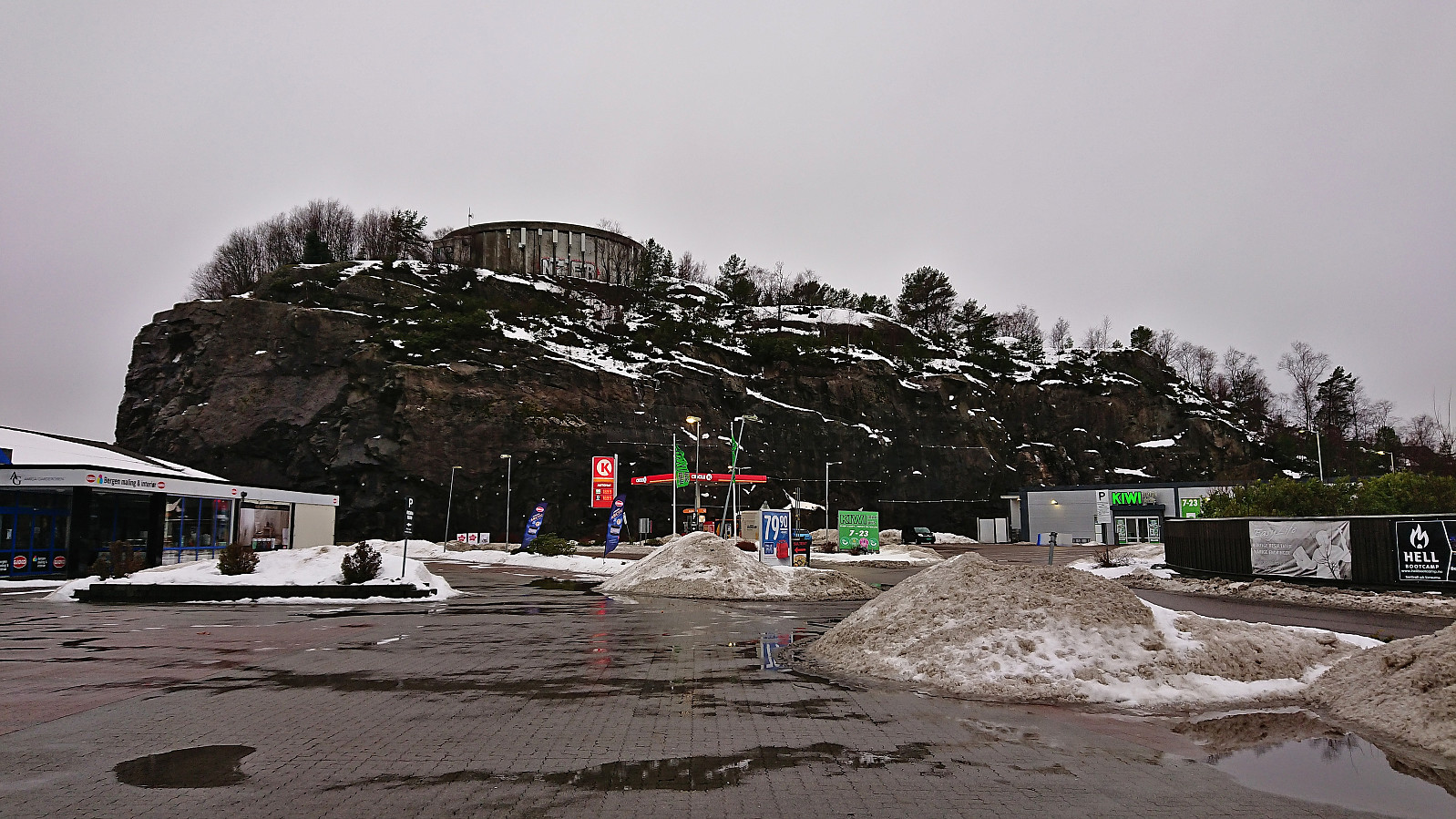
Four trig markers west and south of Flesland
- Datum:
- 03.02.2024
- Tourcharakter:
- Wanderung
- Tourlänge:
- 3:19h
- Entfernung:
- 14,8km
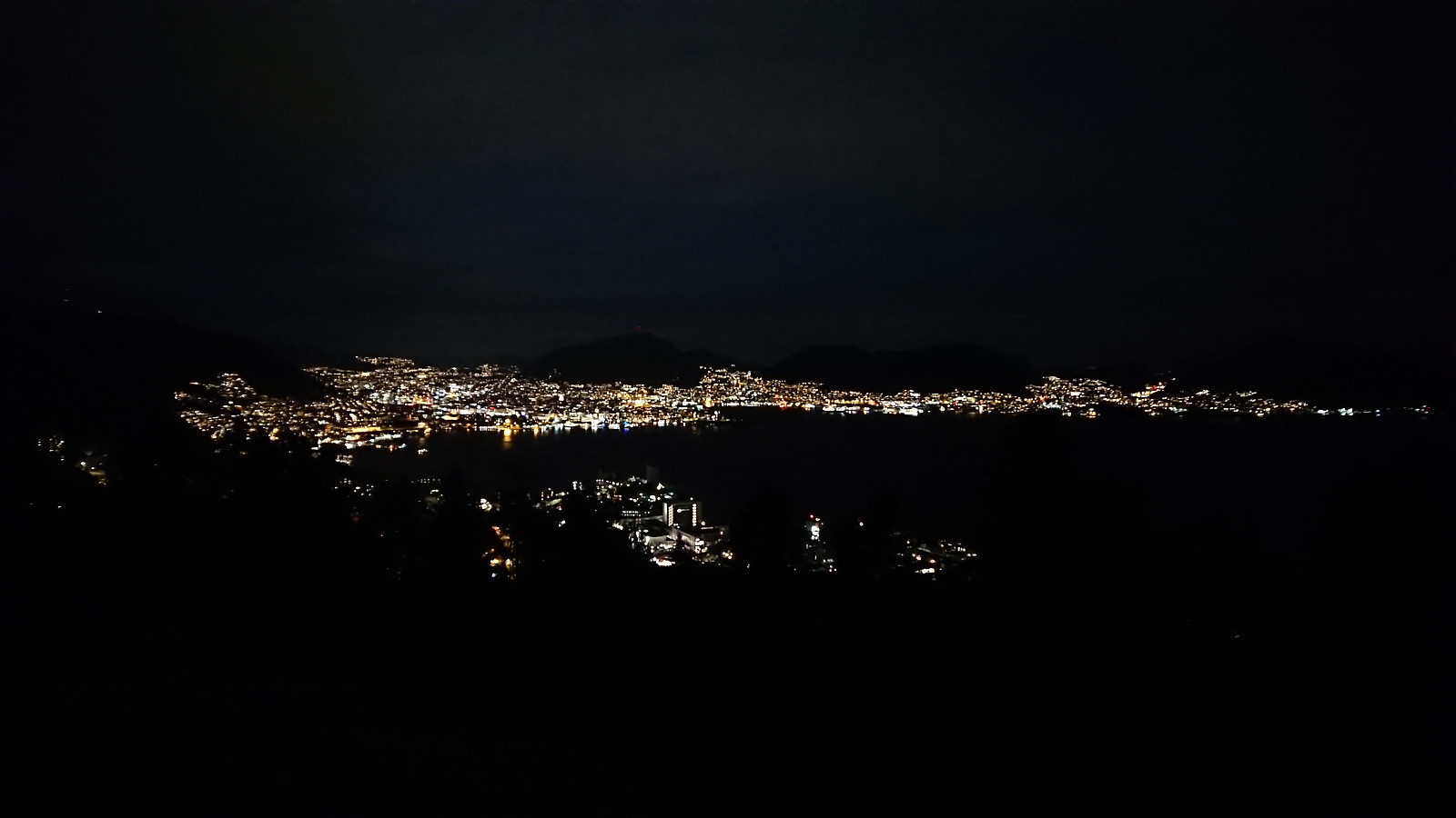
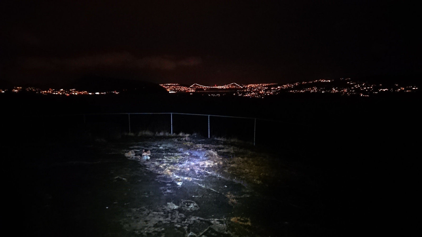
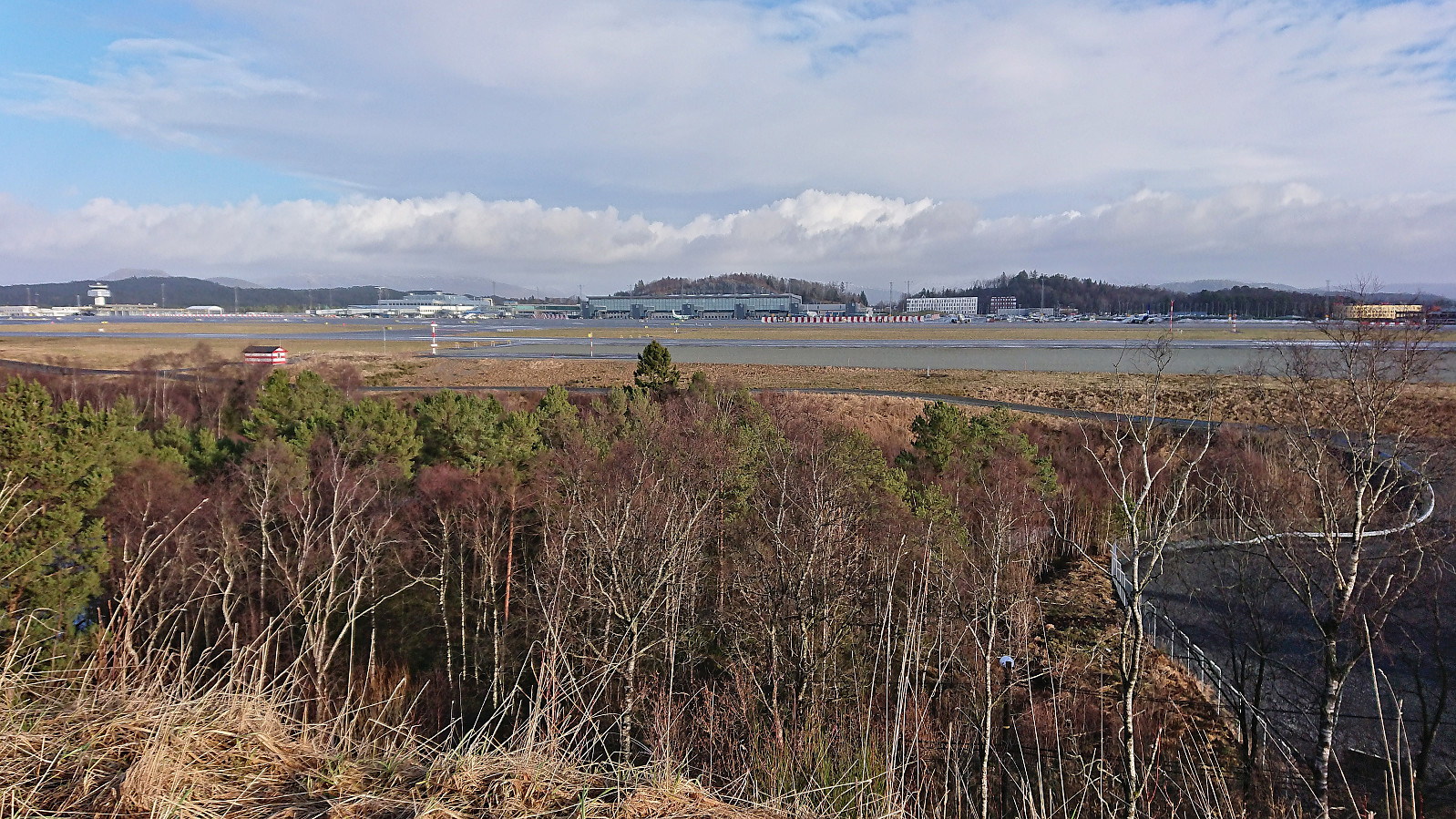 This Saturday I used the Søyler (fastmerker) i Bergen list as inspiration to visit some new areas in Bergen. Started by taking Bybanen to Flesland and finding my way to Sletten søyle . Note that to get to the trig marker I had to step over two fences and the final stretch was quite wet and contained lots of fallen trees.
Next, I headed to Espeland søyle via Lønningshavn. Also this trig marker could be easily visited from the southeast. There were even traces of an old road just east of the small hill containing the trig marker.
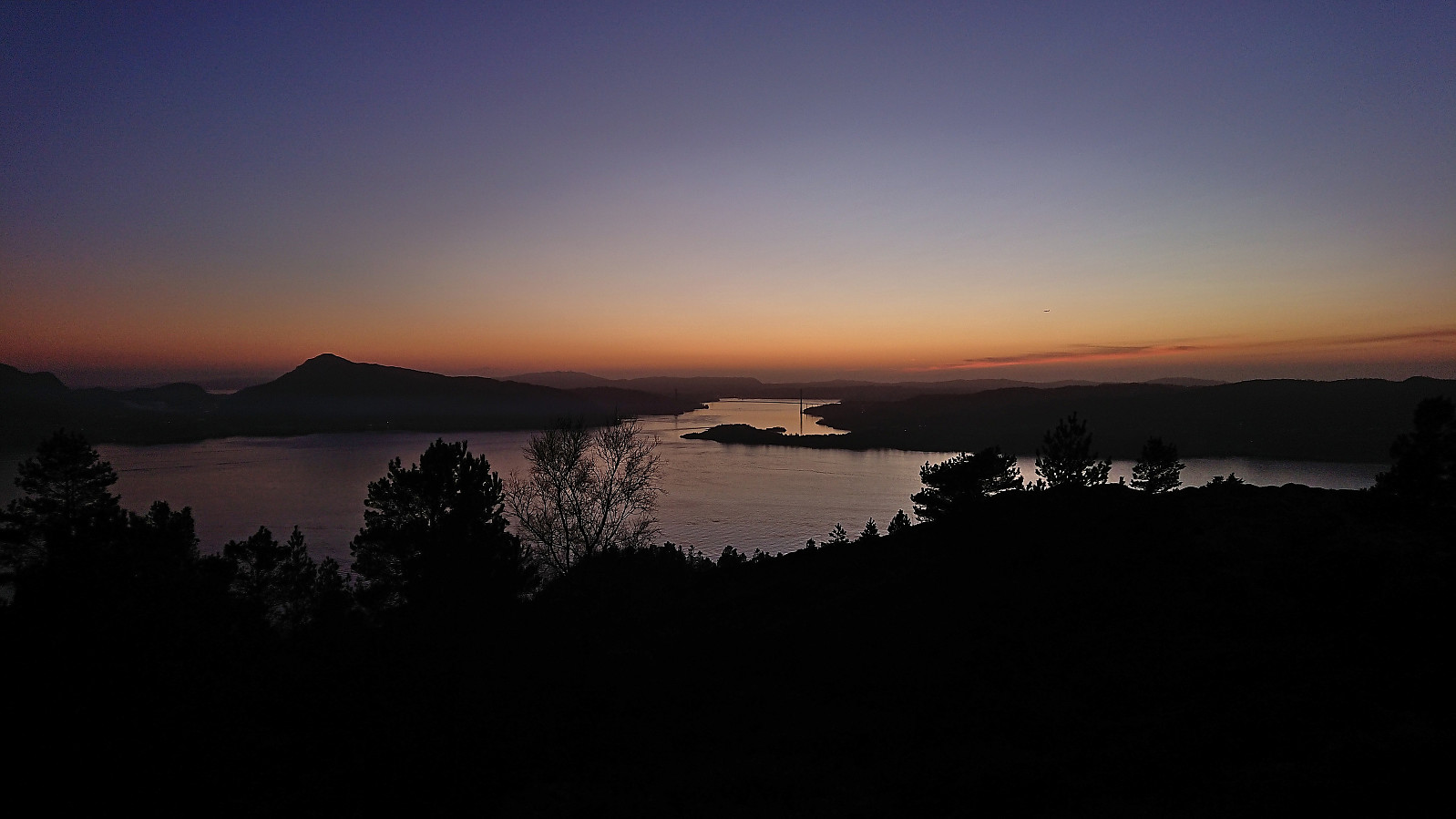
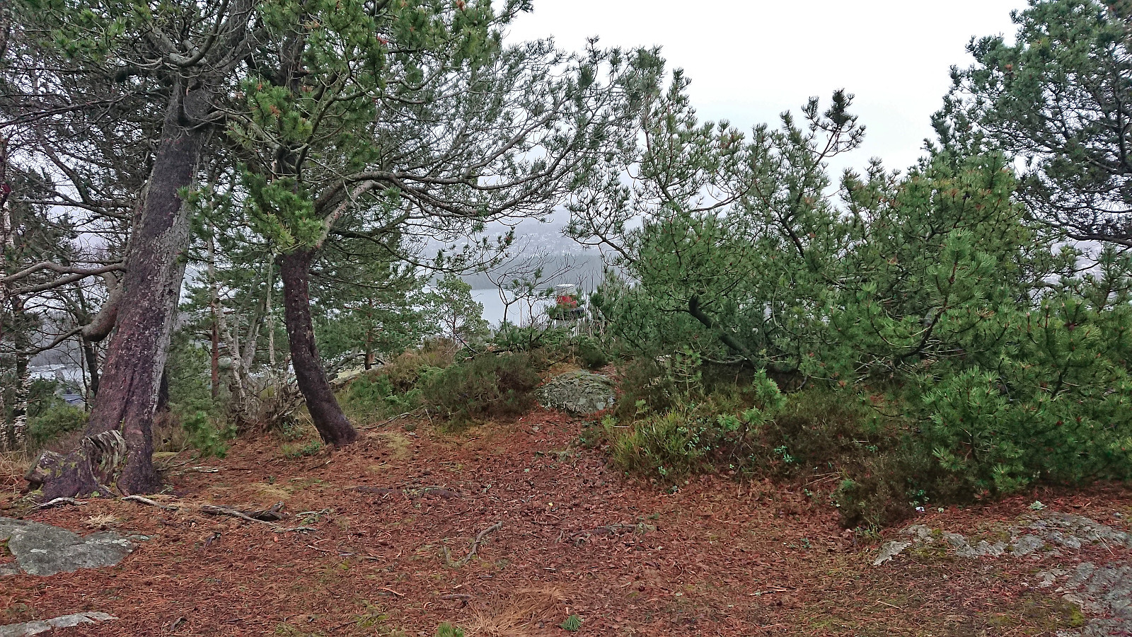
I returned to the road and continued east to Kletten søyle . Thanks to an open gate west of Kletten, this trig marker did not present any real challenges either and the small hill also provided the best views of the day.
The final planned trig marker visit was Håvardstun søyle , but on the way there I also made a quick stop at Moahagen (73.5 m, 32V 294034 6689309). >>>
This Saturday I used the Søyler (fastmerker) i Bergen list as inspiration to visit some new areas in Bergen. Started by taking Bybanen to Flesland and finding my way to Sletten søyle . Note that to get to the trig marker I had to step over two fences and the final stretch was quite wet and contained lots of fallen trees.
Next, I headed to Espeland søyle via Lønningshavn. Also this trig marker could be easily visited from the southeast. There were even traces of an old road just east of the small hill containing the trig marker.
I returned to the road and continued east to Kletten søyle . Thanks to an open gate west of Kletten, this trig marker did not present any real challenges either and the small hill also provided the best views of the day.
The final planned trig marker visit was Håvardstun søyle , but on the way there I also made a quick stop at Moahagen (73.5 m, 32V 294034 6689309). >>>
Across Hellen festning
- Datum:
- 01.02.2024
- Tourcharakter:
- Wanderung
- Tourlänge:
- 0:36h
- Entfernung:
- 3,2km
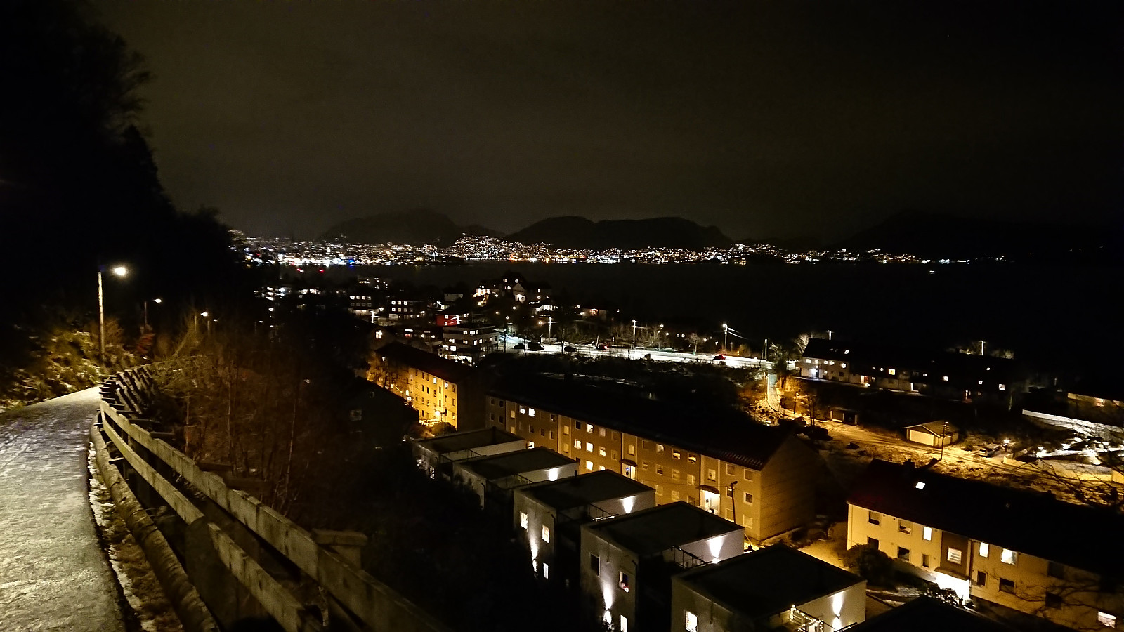 Short local evening hike.
Ørneberget and Hellen festning
- Datum:
- 30.01.2024
- Tourcharakter:
- Bergtour
- Tourlänge:
- 0:54h
- Entfernung:
- 4,1km
 Short local hike just after sunset.
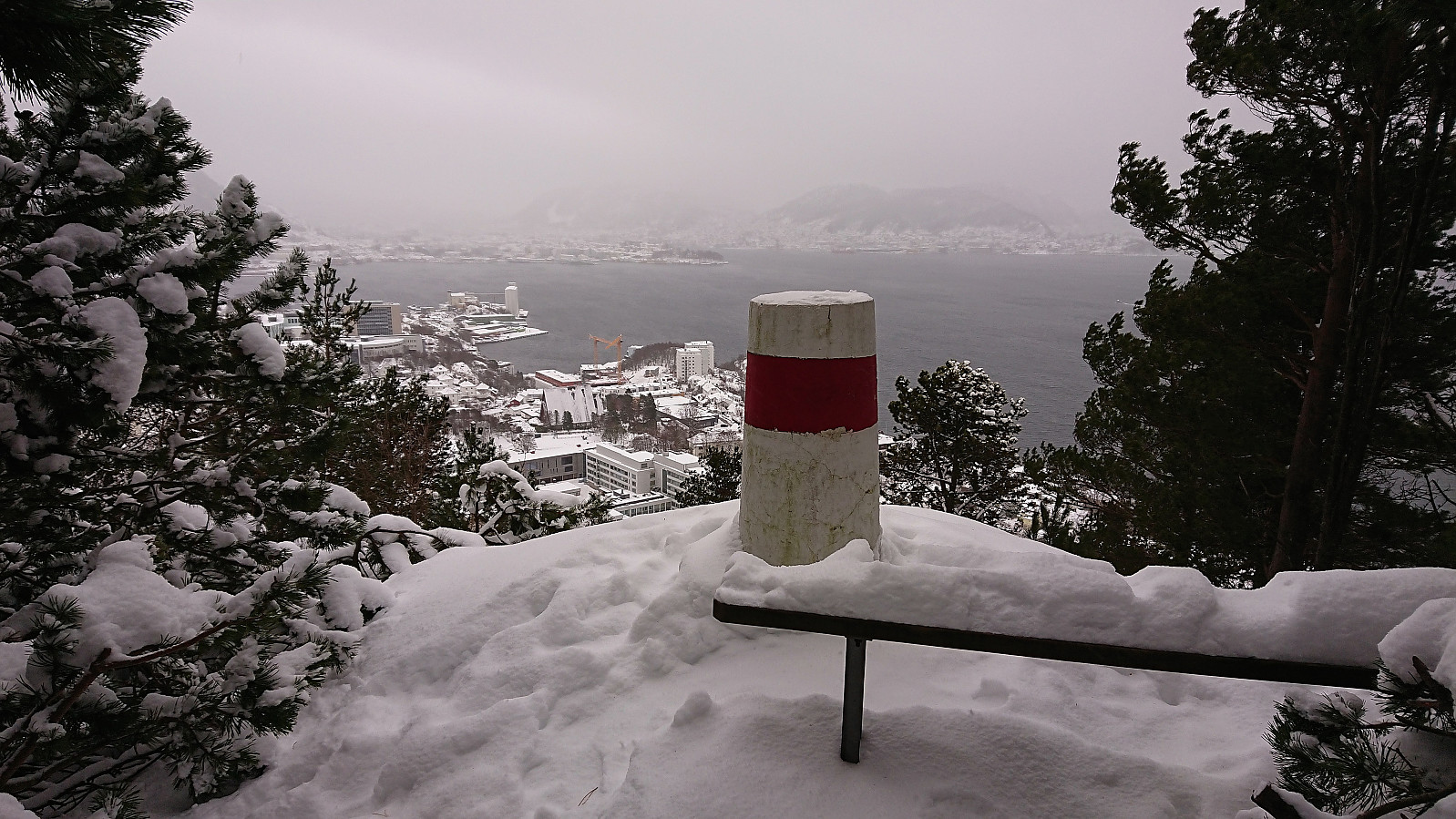
Bjørnåsen and Fuglen
- Datum:
- 28.01.2024
- Tourcharakter:
- Bergtour
- Tourlänge:
- 1:37h
- Entfernung:
- 7,5km
 In the report from my visit of Bjørnåsen in 2021 I had commented that the trail seemed to continue towards a slightly lower hill to the north called Fuglen and that perhaps this had to be explored one day. With Fuglen recently having been added as its own PB-element, that day had arrived. This time I arrived on foot via the cycling and walking path from the bus stop at Kalandseidet.
I first followed the same trail as last time to Bjørnåsen and from there continued north in the direction of Fuglen. While there was a weak trail, and even some trail markers, I quickly lost the trail and was left finding my own way. The terrain however did not present any challenges and the highest point of Fuglen was easily reached.
As expected, Fuglen provided the same limited views as Bjørnåsen and I did not stay long before descending off-trail to reconnect with the >>>
In the report from my visit of Bjørnåsen in 2021 I had commented that the trail seemed to continue towards a slightly lower hill to the north called Fuglen and that perhaps this had to be explored one day. With Fuglen recently having been added as its own PB-element, that day had arrived. This time I arrived on foot via the cycling and walking path from the bus stop at Kalandseidet.
I first followed the same trail as last time to Bjørnåsen and from there continued north in the direction of Fuglen. While there was a weak trail, and even some trail markers, I quickly lost the trail and was left finding my own way. The terrain however did not present any challenges and the highest point of Fuglen was easily reached.
As expected, Fuglen provided the same limited views as Bjørnåsen and I did not stay long before descending off-trail to reconnect with the >>>
Bønes søyle
- Datum:
- 27.01.2024
- Tourcharakter:
- Wanderung
- Tourlänge:
- 0:47h
- Entfernung:
- 4,0km
 Yet another gray weekend and yet another short Saturday hike. This time to the trig marker at Bønes . I started by taking the bus to "Bønes senter" and from there completed the short walk to today's target. The trig marker was located on a small hill next to several houses but could be easily accessed from the northwest via a small playground. There was even a weak path which helped reduce the feeling of trespassing. Given that the visit of the trig marker had taken less than five minutes, I extended the hike by walking along the roads to Oasen before taking the bus home.
Hellen festning and Furukammen
- Datum:
- 26.01.2024
- Tourcharakter:
- Wanderung
- Tourlänge:
- 1:05h
- Entfernung:
- 5,0km
 Short local evening hike.
Ørneberget and Furukammen
- Datum:
- 25.01.2024
- Tourcharakter:
- Bergtour
- Tourlänge:
- 0:59h
- Entfernung:
- 4,5km
 Short local evening hike.
Across Hellen festning
- Datum:
- 23.01.2024
- Tourcharakter:
- Wanderung
- Tourlänge:
- 0:36h
- Entfernung:
- 3,2km
 Short local evening hike before it started raining again.
Alvehaugen and Høyde ved Janaflaten
- Datum:
- 21.01.2024
- Tourcharakter:
- Bergtour
- Tourlänge:
- 0:36h
- Entfernung:
- 2,2km
 On a gray Sunday where the rain showers did their best to melt the recent snow and make all surfaces slippery, I once again turned to the Alle topper i Bergen list and decided on two minor hills just east of Sotrabroen.
First up was Alvehaugen which could be spotted immediately after getting off the bus. Getting to the summit however required a bit more work but could be fairly easily done via a short off-trail ascent from the north.
I descended the same way and headed the short distance south to Høyde ved Janaflaten . Here the ascent was easier than expected as most of the trees shown covering the summit in previous trip reports had been removed and it was now simply a matter of walking up to the highest point. While the removal of the trees had resulted in better views, it was still a rather uninteresting small hill.
The short hike was then concluded >>>
On a gray Sunday where the rain showers did their best to melt the recent snow and make all surfaces slippery, I once again turned to the Alle topper i Bergen list and decided on two minor hills just east of Sotrabroen.
First up was Alvehaugen which could be spotted immediately after getting off the bus. Getting to the summit however required a bit more work but could be fairly easily done via a short off-trail ascent from the north.
I descended the same way and headed the short distance south to Høyde ved Janaflaten . Here the ascent was easier than expected as most of the trees shown covering the summit in previous trip reports had been removed and it was now simply a matter of walking up to the highest point. While the removal of the trees had resulted in better views, it was still a rather uninteresting small hill.
The short hike was then concluded >>>
Hellen festning and Furukammen
- Datum:
- 20.01.2024
- Tourcharakter:
- Wanderung
- Tourlänge:
- 1:57h
- Entfernung:
- 5,1km
 Short local Saturday hike where the snow showers gradually turned into rain showers.
