Archiv - Nach Datum
Archiv - Nach Aktivität
-
Andere Tour (3)
- Kayaking (3)
-
Fahrradtour (110)
- Fahrradtour Straße (85)
- Fahrradtour gemischt (25)
-
Fahrzeugtour (9)
- Autotour (9)
-
Fußtour (1887)
- Bergtour (1116)
- Jogging (1)
- Spaziergang (59)
- Wanderung (711)
-
Skitour (116)
- Langlauf (47)
- Tourenskilauf (69)
Gesammelte Listen
-
Utvalgte topper og turmål i Bergen
(348/349)
 99%
99% -
Alle topper i Bergen
(391/398)
98%
-
Voss ≥ 100m pf.
(96/98)
97%
-
Opptur Hordaland
(144/159)
90%
-
Stasjoner på Bergensbanen
(33/40)
82%
-
Ulvik ≥ 100m pf.
(28/38)
73%
-
Hordaland ≥ 100m pf.
(622/863)
72%
-
Mjølfjell PF > 100m
(21/31)
67%
-
Jondal ≥ 100m pf.
(15/23)
65%
-
Dagsturhyttene i Vestland
(36/61)
59%
-
Sunnhordland PF >= 100m
(105/186)
56%
-
Hordaland: Hardanger PF>=100m
(194/359)
54%
-
DNT-hytter i Hordaland
(23/45)
51%
-
Kvinnherad ≥ 100m pf.
(40/79)
50%
-
Eidfjord ≥ 100m pf.
(13/42)
30%
-
Sogndal ≥ 100m pf.
(23/81)
28%
-
Gulen ≥ 100m pf.
(15/54)
27%
-
Vik i Sogn ≥ 100m pf.
(10/46)
21%
-
Sogn - Sør for Sognefjorden PF>=100m
(31/159)
19%
-
DNT-hytter i Sogn og Fjordane
(8/47)
17%

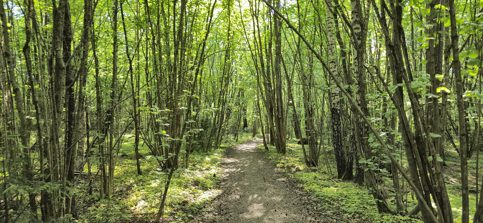
Ørneberget and Furukammen
- Datum:
- 31.05.2024
- Tourcharakter:
- Bergtour
- Tourlänge:
- 0:54h
- Entfernung:
- 4,0km
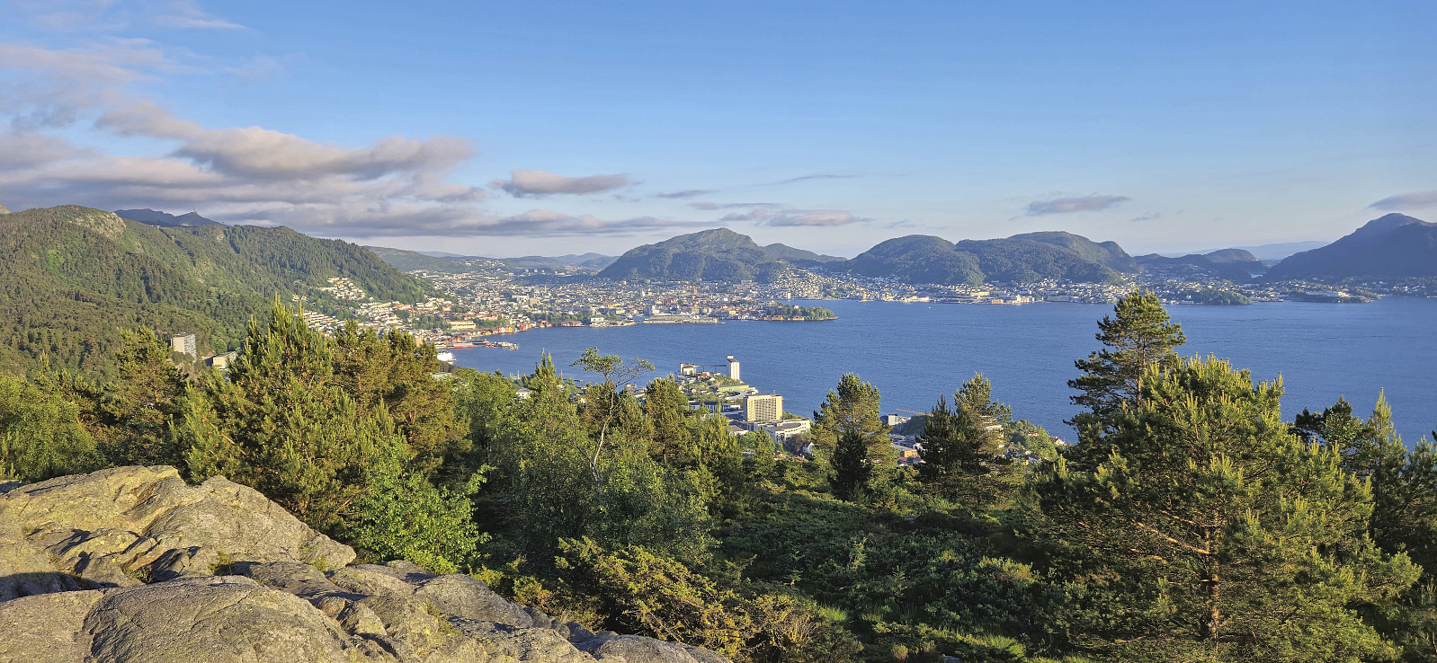 Short local evening hike.
Across Hellen festning
- Datum:
- 29.05.2024
- Tourcharakter:
- Wanderung
- Tourlänge:
- 0:38h
- Entfernung:
- 3,1km
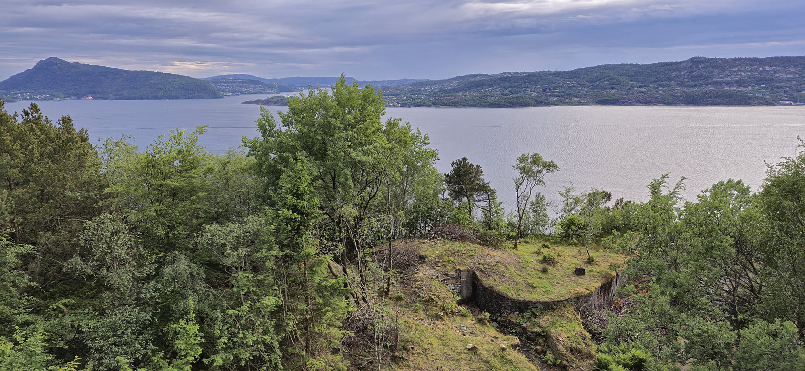 Short local evening hike.
Brushytten from Torget
- Datum:
- 26.05.2024
- Tourcharakter:
- Wanderung
- Tourlänge:
- 3:38h
- Entfernung:
- 9,9km
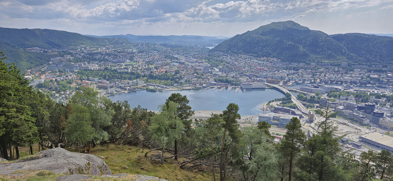 I had initially planned to simply take the bus to Torget and follow Fjellveien home, but when I happened to meet lots of family members on my dad's side at Skansen I quickly decided to join them on their hike to Brushytten and Fløyen instead before finally taking the bus home from Bryggen.
Cycling: Svartavassrinden
- Datum:
- 25.05.2024
- Tourcharakter:
- Fahrradtour gemischt
- Tourlänge:
- 5:26h
- Entfernung:
- 66,4km
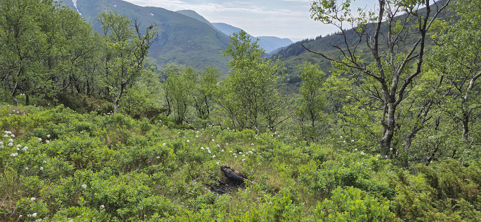 Due to a weather forecast with potential rain showers in the afternoon, I opted for a cycling trip to visit Svartavassrinden . I had passed by this minor peak several times but never been to the summit. After 33 km on the bike, I left it at the end of the gravel road and completed the final short off-trail distance to the summit on foot. I returned the same way for a late lunch break back at the end of the gravel road. The trip was then concluded by cycling the same route to Lønborg, where I made it home just before it started raining.
Syverstadbråten and Hvalstrand
- Datum:
- 23.05.2024
- Tourcharakter:
- Wanderung
- Tourlänge:
- 1:19h
- Entfernung:
- 5,1km
 At the end of the first day of a conference at Holmen Fjordhotell there was a long break before dinner which of course had to be used for a short hike. Another colleague of mine had the same idea and together we made a short walk via Syverstadbråten and Hvalstrand . Syverstadbråten had lots of nice paths in between the trees but the summit itself was more of a summit area and did not provide any views. There were however a couple of old ski jumping hills nearby that made it a bit more interesting.
Skaugumsåsen and Djupdalsåsen
- Datum:
- 22.05.2024
- Tourcharakter:
- Bergtour
- Tourlänge:
- 3:58h
- Entfernung:
- 11,1km
 When attending a two-day conference at Holmen Fjordhotell outside Oslo we had to arrive the day before (to catch the morning session on the first day). Upon arriving we quickly decided to take advantage of the excellent weather for some afternoon hiking. After buying some food nearby we took a bus to Solgården, followed the road up to Semsvannet utfartsparkering and from there continued on the marked trail to Skaugumsåsen .
The steep ascent from the south bordered on scrambling, and the dry sand did not make it any easier, but by being extra careful it did not take long before the terrain flattened out and we could start enjoying the excellent views. There were several vantage points to choose from and we stopped for a very late lunch break at one of them.
As returning our ascent route was not very tempting, and I had not yet visited the highest point, >>>
When attending a two-day conference at Holmen Fjordhotell outside Oslo we had to arrive the day before (to catch the morning session on the first day). Upon arriving we quickly decided to take advantage of the excellent weather for some afternoon hiking. After buying some food nearby we took a bus to Solgården, followed the road up to Semsvannet utfartsparkering and from there continued on the marked trail to Skaugumsåsen .
The steep ascent from the south bordered on scrambling, and the dry sand did not make it any easier, but by being extra careful it did not take long before the terrain flattened out and we could start enjoying the excellent views. There were several vantage points to choose from and we stopped for a very late lunch break at one of them.
As returning our ascent route was not very tempting, and I had not yet visited the highest point, >>>
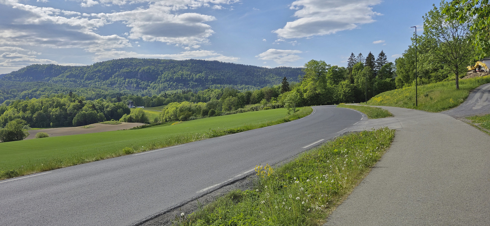
Ørneberget, Rognåsen and Håmanen
- Datum:
- 21.05.2024
- Tourcharakter:
- Bergtour
- Tourlänge:
- 1:59h
- Entfernung:
- 7,0km
 Local evening hike after work.
Påskåsen
- Datum:
- 20.05.2024
- Tourcharakter:
- Bergtour
- Tourlänge:
- 2:01h
- Entfernung:
- 5,0km
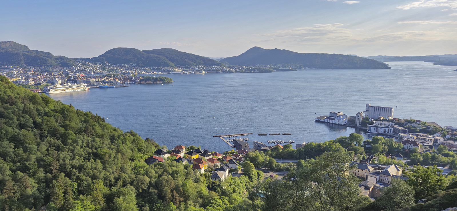
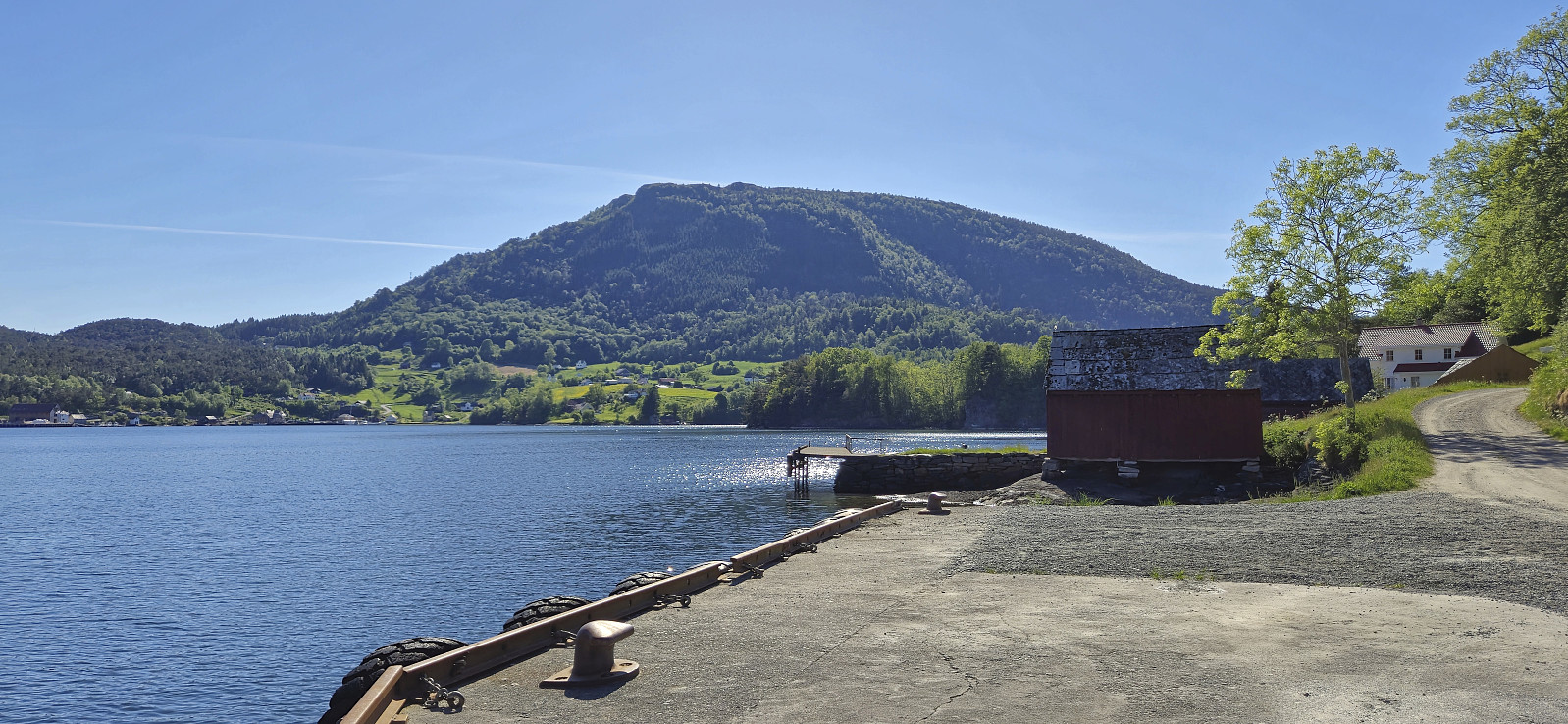 The last day of a long weekend was spent visiting Påskåsen . I started by taking the boat from Strandkaiterminalen in Bergen to Leirvik. Here there was another boat waiting for the final leg to Fjelbergøy. I was the only passenger disembarking, roughly two hours after leaving Bergen. By following the road north I soon arrived at a tractor road that took me up to the unmarked trailhead. (PB indicates a parking lot at the end of this road, but there is only room for one car and I do not think the area is really meant for parking.)
Thanks to previous trip reports I here left the tractor road and continued on an unmarked trail heading south/southwest. The trail later turned towards the summit and could be easily followed all the way to the highest point. Limited views from the top, except for an opening >>>
The last day of a long weekend was spent visiting Påskåsen . I started by taking the boat from Strandkaiterminalen in Bergen to Leirvik. Here there was another boat waiting for the final leg to Fjelbergøy. I was the only passenger disembarking, roughly two hours after leaving Bergen. By following the road north I soon arrived at a tractor road that took me up to the unmarked trailhead. (PB indicates a parking lot at the end of this road, but there is only room for one car and I do not think the area is really meant for parking.)
Thanks to previous trip reports I here left the tractor road and continued on an unmarked trail heading south/southwest. The trail later turned towards the summit and could be easily followed all the way to the highest point. Limited views from the top, except for an opening >>>
