Archiv - Nach Datum
Archiv - Nach Aktivität
-
Andere Tour (3)
- Kayaking (3)
-
Fahrradtour (111)
- Fahrradtour Straße (86)
- Fahrradtour gemischt (25)
-
Fahrzeugtour (9)
- Autotour (9)
-
Fußtour (1897)
- Bergtour (1120)
- Jogging (1)
- Spaziergang (60)
- Wanderung (716)
-
Skitour (116)
- Langlauf (47)
- Tourenskilauf (69)
Gesammelte Listen
-
Utvalgte topper og turmål i Bergen
(349/351)
 99%
99% -
Alle topper i Bergen
(393/400)
98%
-
Voss ≥ 100m pf.
(96/98)
97%
-
Opptur Hordaland
(144/159)
90%
-
Stasjoner på Bergensbanen
(33/40)
82%
-
Ulvik ≥ 100m pf.
(30/38)
78%
-
Hordaland ≥ 100m pf.
(624/863)
72%
-
Mjølfjell PF > 100m
(21/31)
67%
-
Jondal ≥ 100m pf.
(15/23)
65%
-
Dagsturhyttene i Vestland
(36/61)
59%
-
Sunnhordland PF >= 100m
(105/186)
56%
-
Hordaland: Hardanger PF>=100m
(196/359)
54%
-
DNT-hytter i Hordaland
(23/45)
51%
-
Kvinnherad ≥ 100m pf.
(40/79)
50%
-
Eidfjord ≥ 100m pf.
(13/42)
30%
-
Sogndal ≥ 100m pf.
(23/81)
28%
-
Gulen ≥ 100m pf.
(15/54)
27%
-
Vik i Sogn ≥ 100m pf.
(10/46)
21%
-
Sogn - Sør for Sognefjorden PF>=100m
(31/159)
19%
-
DNT-hytter i Sogn og Fjordane
(8/47)
17%

Storås and Klauv from Våge
- Datum:
- 30.04.2023
- Tourcharakter:
- Bergtour
- Tourlänge:
- 5:10h
- Entfernung:
- 22,1km
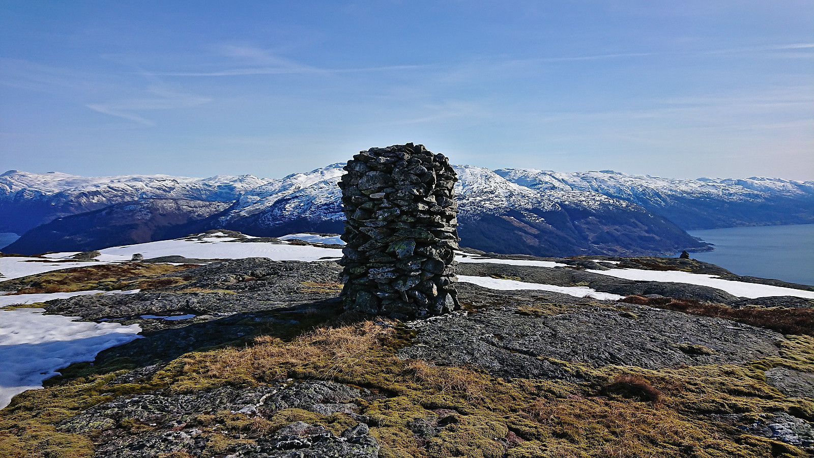
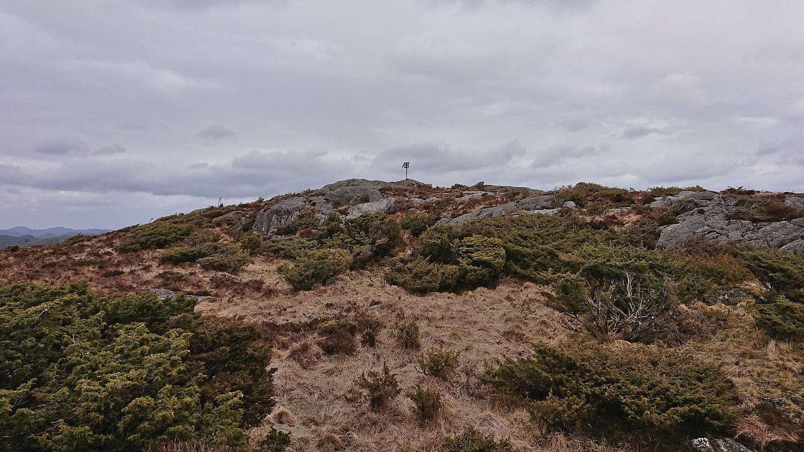 I have to admit that peak bagging via public transportation has its added challenges, especially when the distance to the trailhead from the nearest bus stop is almost 9.5 km. But in the case of Storås in Sveio , that distance could thankfully be easily covered by following a side road with limited traffic.
The trip started by taking the express bus from Bergen to Sveio and getting off at the stop with the interesting name "Søre Våge sør". I immediately left the main road heading south to Haugesund, and instead turned east on a smaller single-lane road. Soon I even left Sveio, entering Haugesund and Rogaland, and would not reenter Sveio until almost an hour later. On my way I also passed by the trailhead for the highest summit in Haugesund called Klauv , which I planned to ascend on my way back (if time permitted).
I have to admit that peak bagging via public transportation has its added challenges, especially when the distance to the trailhead from the nearest bus stop is almost 9.5 km. But in the case of Storås in Sveio , that distance could thankfully be easily covered by following a side road with limited traffic.
The trip started by taking the express bus from Bergen to Sveio and getting off at the stop with the interesting name "Søre Våge sør". I immediately left the main road heading south to Haugesund, and instead turned east on a smaller single-lane road. Soon I even left Sveio, entering Haugesund and Rogaland, and would not reenter Sveio until almost an hour later. On my way I also passed by the trailhead for the highest summit in Haugesund called Klauv , which I planned to ascend on my way back (if time permitted).
Skinstø søyle and Ranten
- Datum:
- 29.04.2023
- Tourcharakter:
- Wanderung
- Tourlänge:
- 1:04h
- Entfernung:
- 5,0km
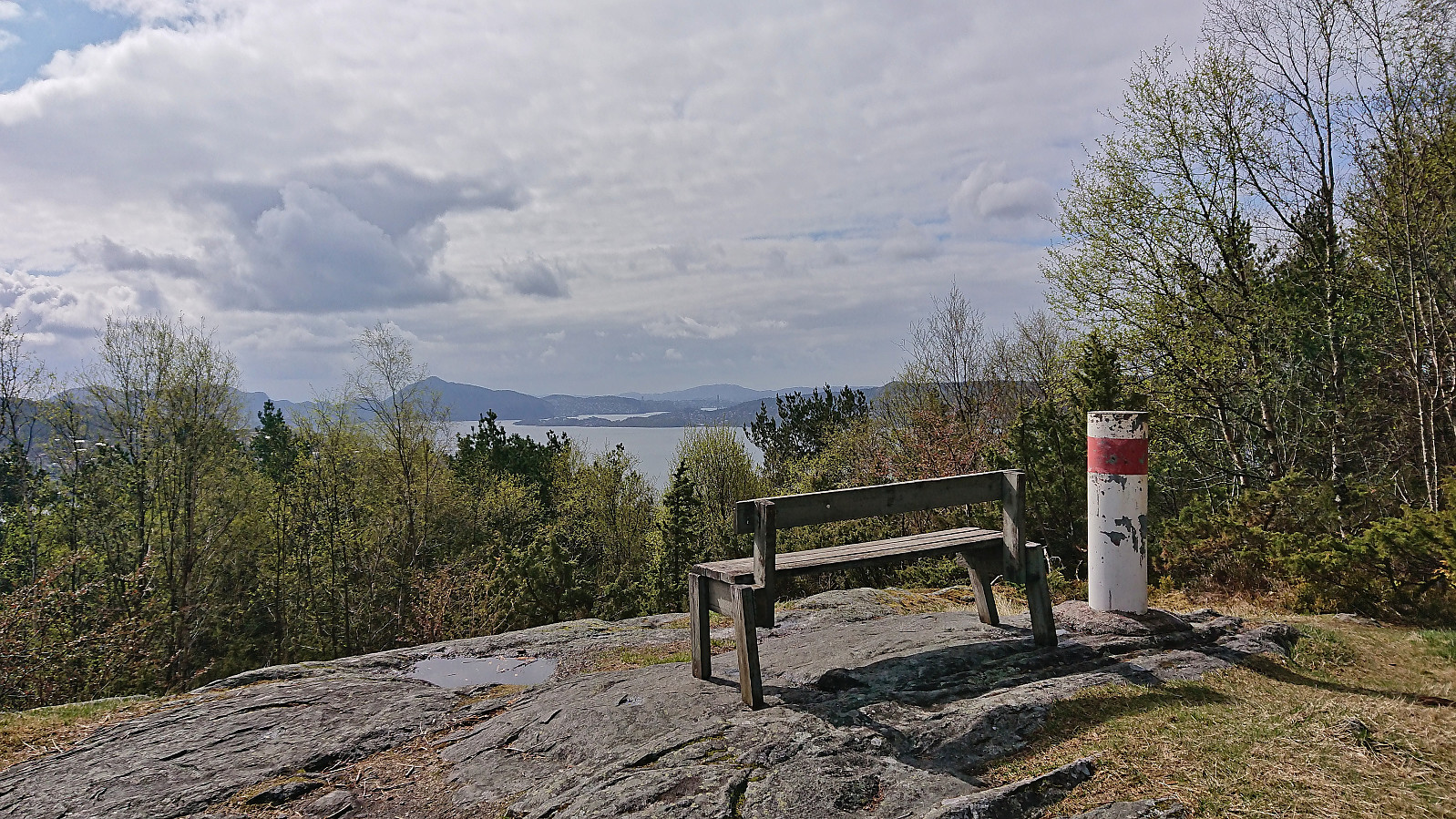 Exploring Haukedalen in Åsane with short visits of both Skinstø søyle and Ranten . Both easily accessible by trails and both provided nice views.
Across Hellen festning
- Datum:
- 25.04.2023
- Tourcharakter:
- Wanderung
- Tourlänge:
- 0:34h
- Entfernung:
- 3,1km
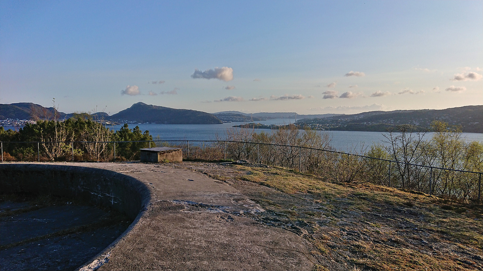 Short local evening hike.
Across Hellen festning
- Datum:
- 24.04.2023
- Tourcharakter:
- Wanderung
- Tourlänge:
- 0:35h
- Entfernung:
- 3,1km
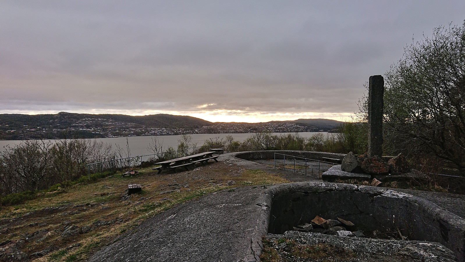 Short local evening hike.
Klevanuten and Rjoandeggi
- Datum:
- 22.04.2023
- Tourcharakter:
- Tourenskilauf
- Tourlänge:
- 5:24h
- Entfernung:
- 17,3km
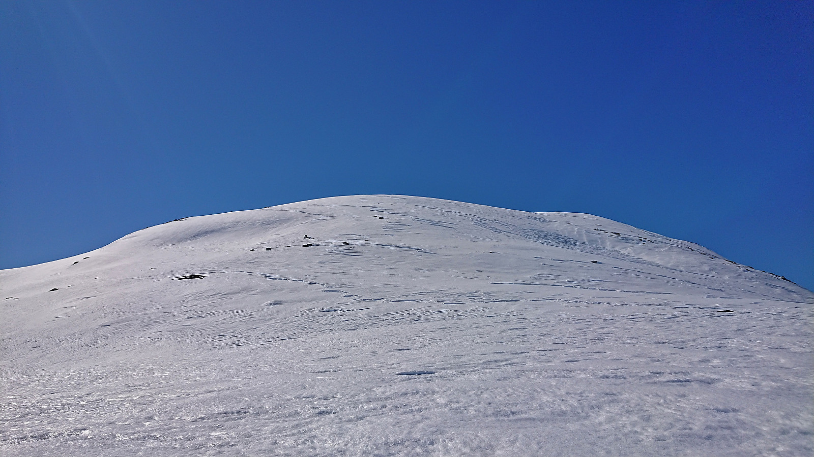 On a perfect Saturday for skiing, I took the train to Ljosandbotn and followed the marked route up Ljosanddalen to Borgarebuvotni, making a minor detour to visit Appelsintreet . From Borgarebuvotni I continued north before ascending Klevanuten from the northeast. After a short break at the summit I descended into Klevaskaret and ascended to the northern end of Rjoandeggi which I then proceeded to follow south to the highest point . Sunshine and no wind made for an excellent location for my late lunch break.
I continued south along the ridge to Søre Rjoandeggi . Overall straightforward, however there were lots of rocks and even larger areas without any snow that had to be properly navigated. After another extended break, all that remained was the very nice descent to the train station. Even though I had tried to take it slow, and include lots of breaks, I still >>>
On a perfect Saturday for skiing, I took the train to Ljosandbotn and followed the marked route up Ljosanddalen to Borgarebuvotni, making a minor detour to visit Appelsintreet . From Borgarebuvotni I continued north before ascending Klevanuten from the northeast. After a short break at the summit I descended into Klevaskaret and ascended to the northern end of Rjoandeggi which I then proceeded to follow south to the highest point . Sunshine and no wind made for an excellent location for my late lunch break.
I continued south along the ridge to Søre Rjoandeggi . Overall straightforward, however there were lots of rocks and even larger areas without any snow that had to be properly navigated. After another extended break, all that remained was the very nice descent to the train station. Even though I had tried to take it slow, and include lots of breaks, I still >>>
Fyllingsdalstunnelen - the world's longest cycling tunnel!
- Datum:
- 21.04.2023
- Tourcharakter:
- Fahrradtour Straße
- Tourlänge:
- 2:57h
- Entfernung:
- 32,9km
 Started the weekend early to join my dad in trying out the new Fyllingsdalstunnelen, the world's longest cycling tunnel, which opened less than a week ago. It provides a 3 km shortcut to Fyllingsdalen underneath Løvstakken. We also tried the other new related cycling paths alongside Store Lungegårdsvannet and the new (much shorter) cycling tunnel at Kronstad/Årstad, and included a short trip around Orrtuvatnet before returning more or less the same way.
Hellemyrstien
- Datum:
- 20.04.2023
- Tourcharakter:
- Wanderung
- Tourlänge:
- 1:01h
- Entfernung:
- 5,0km
 Short local evening hike.
Across Hellen festning
- Datum:
- 19.04.2023
- Tourcharakter:
- Wanderung
- Tourlänge:
- 0:50h
- Entfernung:
- 3,8km
 Short local evening hike just before sunset.
Gråfjellet from Lussand
- Datum:
- 18.04.2023
- Tourcharakter:
- Bergtour
- Tourlänge:
- 4:25h
- Entfernung:
- 9,3km
 After spending two days at a conference at Voss, most of my colleagues returned to Bergen shortly after the late lunch. I however decided to take advantage of the excellent weather and instead return to Bergen via a detour including an ascent of Gråfjellet in Granvin . When talking about my plans during the breaks at the conference I had managed to spike the interest of one of my colleagues, and after changing into our hiking gear we hopped on the bus to Lussand and were ready to start our hike shortly after 15:00.
We started by walking southeast along the old main road south of Bjørgatunnelen before following the winding Fossdalsvegen, a steep private gravel road, up to the river coming down from Veslevatnet. Here we left the road behind, which towards the end had been covered by snow, and continued off-trail towards >>>
After spending two days at a conference at Voss, most of my colleagues returned to Bergen shortly after the late lunch. I however decided to take advantage of the excellent weather and instead return to Bergen via a detour including an ascent of Gråfjellet in Granvin . When talking about my plans during the breaks at the conference I had managed to spike the interest of one of my colleagues, and after changing into our hiking gear we hopped on the bus to Lussand and were ready to start our hike shortly after 15:00.
We started by walking southeast along the old main road south of Bjørgatunnelen before following the winding Fossdalsvegen, a steep private gravel road, up to the river coming down from Veslevatnet. Here we left the road behind, which towards the end had been covered by snow, and continued off-trail towards >>>
Bordalsgjelet from Voss train station
- Datum:
- 17.04.2023
- Tourcharakter:
- Wanderung
- Tourlänge:
- 1:20h
- Entfernung:
- 5,6km
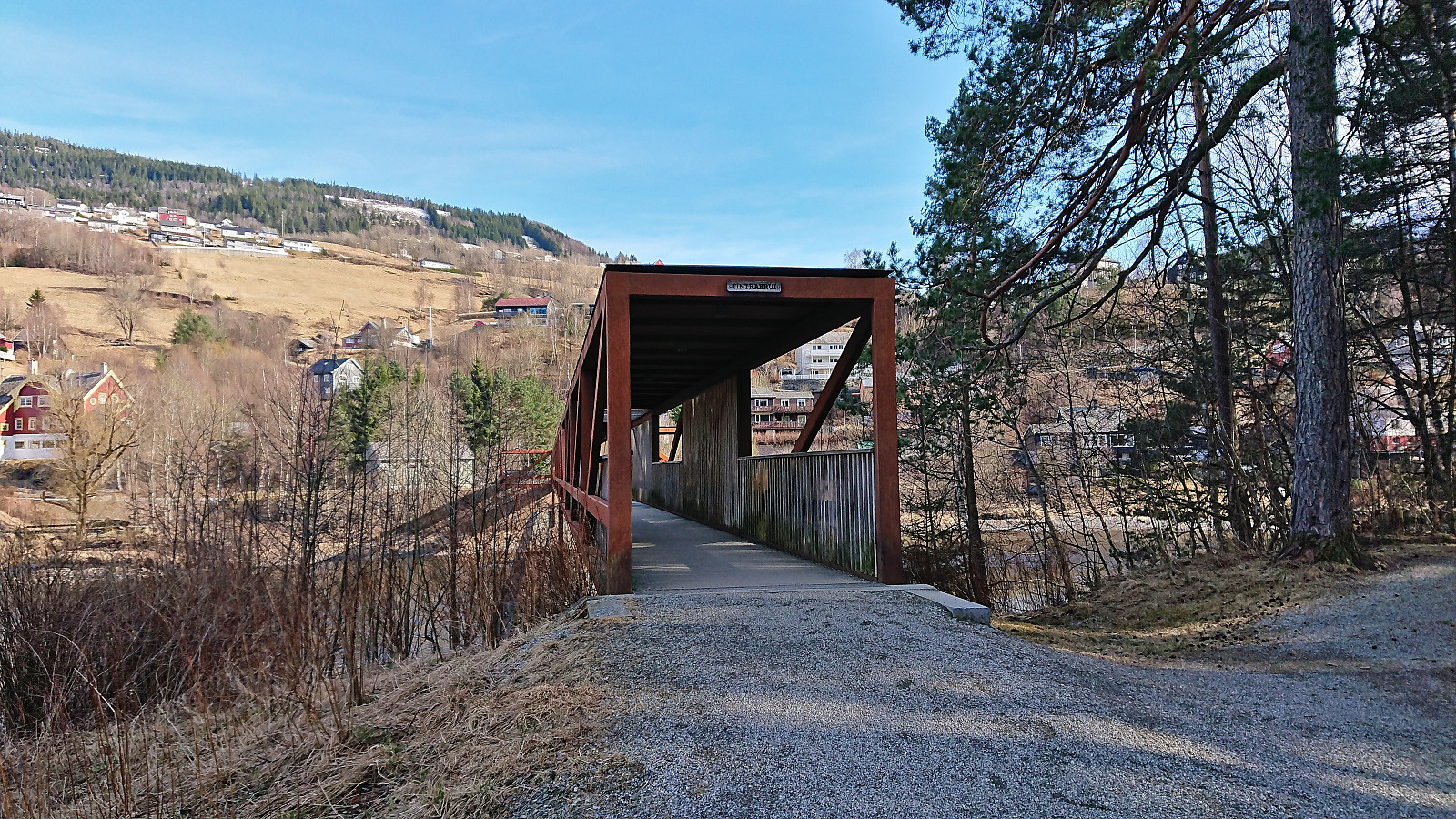 When spending two days at a conference at Voss, I took advantage of an extended break before the evening's dinner for a visit of Bordalsgjelet . The route to Bordalsgjelet is marked with signs all the way from Tintrabrui , however I somehow missed the first sign and ended up with an alternative route via Gjernesvegen. More or less the same distance, but more traffic and no sidewalk until the road turns north, hence I would recommend using my return route in both directions.
Before crossing the bridge across Bordalselvi, I followed a sign to a viewpoint northwest of the bridge that provided a nice view across what I guess one can call the end of Bordalsgjelet. I then continued to the parking lot and from there followed the trail into Bordalsgjelet. Note that while this trail has safety railing, it is still closed during the winter, >>>
When spending two days at a conference at Voss, I took advantage of an extended break before the evening's dinner for a visit of Bordalsgjelet . The route to Bordalsgjelet is marked with signs all the way from Tintrabrui , however I somehow missed the first sign and ended up with an alternative route via Gjernesvegen. More or less the same distance, but more traffic and no sidewalk until the road turns north, hence I would recommend using my return route in both directions.
Before crossing the bridge across Bordalselvi, I followed a sign to a viewpoint northwest of the bridge that provided a nice view across what I guess one can call the end of Bordalsgjelet. I then continued to the parking lot and from there followed the trail into Bordalsgjelet. Note that while this trail has safety railing, it is still closed during the winter, >>>
