Archiv - Nach Datum
Archiv - Nach Aktivität
-
Andere Tour (3)
- Kayaking (3)
-
Fahrradtour (108)
- Fahrradtour Straße (83)
- Fahrradtour gemischt (25)
-
Fahrzeugtour (9)
- Autotour (9)
-
Fußtour (1836)
- Bergtour (1088)
- Jogging (1)
- Spaziergang (55)
- Wanderung (692)
-
Skitour (112)
- Langlauf (46)
- Tourenskilauf (66)
Gesammelte Listen
- Utvalgte topper og turmål i Bergen
- Alle topper i Bergen
- Voss ≥ 100m pf.
- Opptur Hordaland
- Stasjoner på Bergensbanen
- Ulvik ≥ 100m pf.
- Hordaland ≥ 100m pf.
- Mjølfjell PF > 100m
- Jondal ≥ 100m pf.
- Sunnhordland PF >= 100m
- Dagsturhyttene i Vestland
- Hordaland: Hardanger PF>=100m
- DNT-hytter i Hordaland
- Kvinnherad ≥ 100m pf.
- Sogndal ≥ 100m pf.
- Vik i Sogn ≥ 100m pf.
- Gulen ≥ 100m pf.
- DNT-hytter i Sogn og Fjordane
- Eidfjord ≥ 100m pf.
- Sogn - Sør for Sognefjorden PF>=100m
Olav Nygards bu and Nåmdalsfjellet
- Datum:
- 02.03.2023
- Tourcharakter:
- Tourenskilauf
- Tourlänge:
- 3:15h
- Entfernung:
- 8,6km
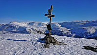 Given the near perfect weather, I took one day of "vinterferie" to go skiing. I convinced my dad to join and together we drove to Modalen and Øvre Helland. Here we left the paved road and continued along a good-quality gravel road up to Steinavatnet p-plass . After a very short climb of only a couple of meters, and less than 150 meters of skiing, we arrived at the ice-covered Steinavatnet, which provided very easy access to Olav Nygards bu .
We then turned west and headed for the ridge to Nåmdalsfjellet . Lots of traces of earlier skiers, however there did not seem to be a fixed summit route. The direction was in any case obvious and there were no steep areas to avoid. It therefore did not take long before we arrived at the summit where we could enjoy the views to the surrounding mountains.
After spending the whole trip in the warm >>>
Bergenhus søyle
- Datum:
- 01.03.2023
- Tourcharakter:
- Spaziergang
- Tourlänge:
- 0:34h
- Entfernung:
- 2,8km
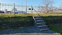 Short detour on the way home from work to pass by the trig marker at Bergenhus festning.
Across Hellen festning
- Datum:
- 28.02.2023
- Tourcharakter:
- Wanderung
- Tourlänge:
- 0:28h
- Entfernung:
- 2,3km
Hegreneset søyle
- Datum:
- 27.02.2023
- Tourcharakter:
- Spaziergang
- Tourlänge:
- 0:30h
- Entfernung:
- 2,6km
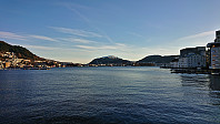 Short detour on the way home from work for a quick visit of the trig marker at Hegreneset.
Five summits west of Vinningsleitet
- Datum:
- 25.02.2023
- Tourcharakter:
- Tourenskilauf
- Tourlänge:
- 9:28h
- Entfernung:
- 24,3km
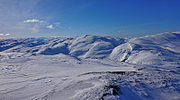 When Fjellsamleren (Endre Myrdal Olsen) suggested a skiing trip to the five summits east of Vinningsleitet, I of course quickly said yes. (Bonus tip: see this external trip report for a similar skiing trip.) He picked me up early Saturday morning for the drive to Vinningsleitet. We arrived at the small parking lot around 10:00 and were ready to start skiing shortly after. First up was Nonhaugen , which was easily accessed by ascending directly from the parking lot, except for a short descent into the valley between Nonhaugen and Ørnahaugen , and it did not take long before we were standing at the summit.
Throughout the trip there would be a strong and cold wind from north/northeast. It was however mainly coming at us from the side and overall did not present much of an issue. The snow conditions were on the other hand more heavily affected, thus the condition varied greatly, from packed >>>
Hellen festning and Furukammen
- Datum:
- 19.02.2023
- Tourcharakter:
- Wanderung
- Tourlänge:
- 1:57h
- Entfernung:
- 4,7km
 Short local hike exploring Hellen festning with my youngest nephew.
Lilandshaugen
- Datum:
- 18.02.2023
- Tourcharakter:
- Wanderung
- Tourlänge:
- 0:39h
- Entfernung:
- 2,6km
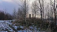 My initial plan for the Saturday afternoon had been to travel to Eikelandsosen for a visit of Vetlavardhytto , but due to the recently "improved" bus connection between Bergen and Gjermundshamn (where the earlier direct bus line had been replaced by a three (or thirty-three) minutes transfer at Osøyro), I ended up missing the bus from Osøyro to Eikelandsosen by less than two minutes and quickly had to come up with a plan B. Two minutes later I was therefore on the first bus back to Lagunen. Here I switched to the tram to Flesland and after this long detour I was finally ready for the short walk to the top of Lilandshaugen . Interestingly, Lilandshaugen has to be the Bergen summit with the largest sign, i.e. the infamous "BERGEN?" sign welcoming visitors as they exit the main terminal at Flesland. >>>
Across Hellen festning
- Datum:
- 14.02.2023
- Tourcharakter:
- Wanderung
- Tourlänge:
- 0:37h
- Entfernung:
- 3,2km
Nordskogfjellet and Golfståvo
- Datum:
- 12.02.2023
- Tourcharakter:
- Bergtour
- Tourlänge:
- 3:51h
- Entfernung:
- 16,8km
 For the second Sunday in a row I returned to Sveio, this time to ascend Nordskogfjellet with an added bonus of also visiting Golfståvo . I started by taking the express bus from Bergen and getting off at the stop "Sveio gravplass". From there I followed the roads north to Nordskog and Skardhaugtjørna where I left the paved road and headed off-trail in the direction of the summit. More traffic than expected for a Sunday morning (or rather mid-day I guess), but even though there were no sidewalks this was generally not an issue.
Less than 100m after leaving the road, I came across a rough tractor road that led me up to the trig marker at the unnamed hill around 650m south of the highest point at Nordskogfjellet. Excellent views from this location (now added as its own PB-element). Next, I turned north and made my own way towards the highest >>>
Bergen Travpark and Gjesthaugen
- Datum:
- 11.02.2023
- Tourcharakter:
- Bergtour
- Tourlänge:
- 0:52h
- Entfernung:
- 3,9km
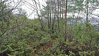 Short hike on a gray Saturday where the main goal was to visit yet another minor summit on the Alle topper i Bergen list, namely Gjesthaugen . While in the area I also took the opportunity to pass by both Bergen Camping Park and Bergen Travpark. The summit of Gjesthaugen was easy to reach via a narrow trail from the southeast, although the trail was a bit weak at times (indicated by my unplanned use of an alternative trail for part of the descent) and one definitely had to pay attention in order to not miss the unmarked trailhead. After descending from Gjesthaugen, I concluded the hike by following the paved hiking path to Breistein, from where I took the bus back home.


