Archiv - Nach Datum
Archiv - Nach Aktivität
-
Andere Tour (3)
- Kayaking (3)
-
Fahrradtour (111)
- Fahrradtour Straße (86)
- Fahrradtour gemischt (25)
-
Fahrzeugtour (9)
- Autotour (9)
-
Fußtour (1897)
- Bergtour (1120)
- Jogging (1)
- Spaziergang (60)
- Wanderung (716)
-
Skitour (116)
- Langlauf (47)
- Tourenskilauf (69)
Gesammelte Listen
-
Utvalgte topper og turmål i Bergen
(349/351)
 99%
99% -
Alle topper i Bergen
(393/400)
98%
-
Voss ≥ 100m pf.
(96/98)
97%
-
Opptur Hordaland
(144/159)
90%
-
Stasjoner på Bergensbanen
(33/40)
82%
-
Ulvik ≥ 100m pf.
(30/38)
78%
-
Hordaland ≥ 100m pf.
(624/863)
72%
-
Mjølfjell PF > 100m
(21/31)
67%
-
Jondal ≥ 100m pf.
(15/23)
65%
-
Dagsturhyttene i Vestland
(36/61)
59%
-
Sunnhordland PF >= 100m
(105/186)
56%
-
Hordaland: Hardanger PF>=100m
(196/359)
54%
-
DNT-hytter i Hordaland
(23/45)
51%
-
Kvinnherad ≥ 100m pf.
(40/79)
50%
-
Eidfjord ≥ 100m pf.
(13/42)
30%
-
Sogndal ≥ 100m pf.
(23/81)
28%
-
Gulen ≥ 100m pf.
(15/54)
27%
-
Vik i Sogn ≥ 100m pf.
(10/46)
21%
-
Sogn - Sør for Sognefjorden PF>=100m
(31/159)
19%
-
DNT-hytter i Sogn og Fjordane
(8/47)
17%

Furefjellet from Åreiddalen/Finnåsvatnet
- Datum:
- 21.07.2021
- Tourcharakter:
- Bergtour
- Tourlänge:
- 0:41h
- Entfernung:
- 2,0km
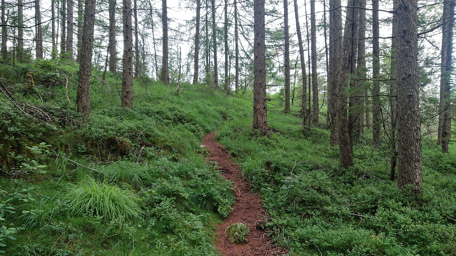
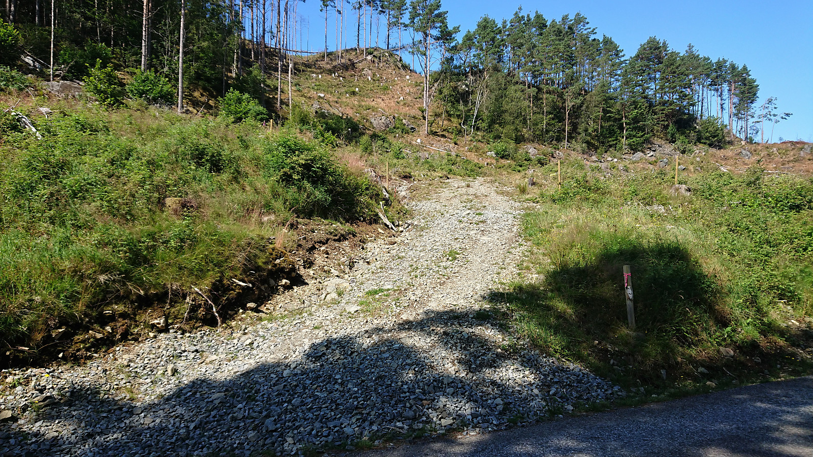 After descending from Siggjo (see separate trip report here ), I cycled about 300 meters north to the unmarked trailhead for Furefjellet . Here I again left the bike behind and continued on foot along a rough tractor road, i.e. bringing the bike was clearly not an option.
After twice crossing an electric fence set up to keep the cows from wandering off, I easily located the marked trail for Furefjellet where it departed from the tractor road. The trail was marked with the now familiar wooden sticks tipped with red paint and also the pink ribbons. In fact, the markers had been there all the way from when the first crossing of the electric fence.
While the low vegetation was partially hiding the trail at times, it was overall easy to follow and made it straightforward to reach the summit. The summit itself was not marked, although I did discover >>>
After descending from Siggjo (see separate trip report here ), I cycled about 300 meters north to the unmarked trailhead for Furefjellet . Here I again left the bike behind and continued on foot along a rough tractor road, i.e. bringing the bike was clearly not an option.
After twice crossing an electric fence set up to keep the cows from wandering off, I easily located the marked trail for Furefjellet where it departed from the tractor road. The trail was marked with the now familiar wooden sticks tipped with red paint and also the pink ribbons. In fact, the markers had been there all the way from when the first crossing of the electric fence.
While the low vegetation was partially hiding the trail at times, it was overall easy to follow and made it straightforward to reach the summit. The summit itself was not marked, although I did discover >>>
Siggjo from Åreiddalen/Finnåsvatnet
- Datum:
- 21.07.2021
- Tourcharakter:
- Bergtour
- Tourlänge:
- 2:15h
- Entfernung:
- 5,8km
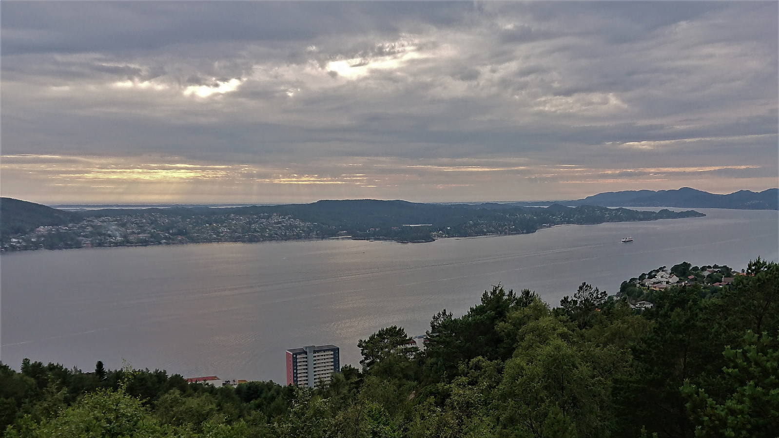
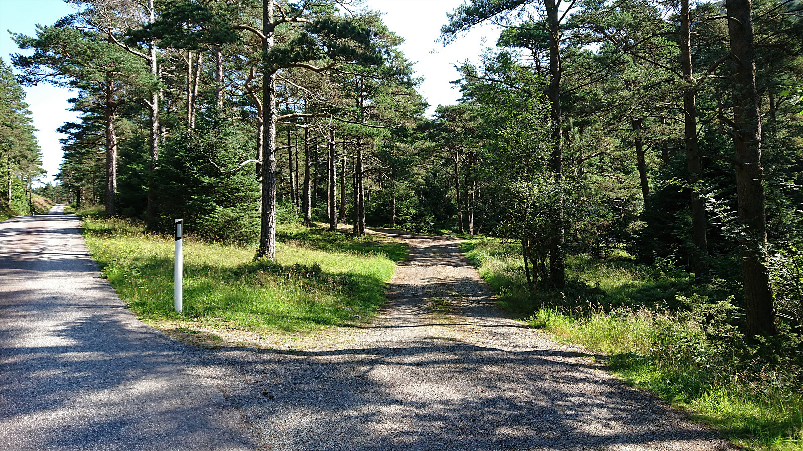 After cycling from Rubbestadneset to the unmarked trailhead for Siggjo in the valley between Siggjo and Furefjellet , I left the bike behind and continued towards the summit on foot following a trail marked with wooden sticks tipped with red paint. (At the start the trail was also marked with pink ribbons, but these soon departed from the main trail, and the one indicated on the map, and I continued following the wooden sticks.)
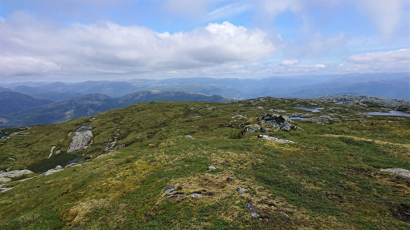
The trail was easy to follow as it winded its way up to the summit, which was therefore reached without any difficulties. Especially the last part was very nice, i.e. when getting above the tree line with the views greatly improving. As expected, the panoramic view from the summit was spectacular with unobstructed views in all directions. After a short break, and lots of pictures, I descended along the same route.
After cycling from Rubbestadneset to the unmarked trailhead for Siggjo in the valley between Siggjo and Furefjellet , I left the bike behind and continued towards the summit on foot following a trail marked with wooden sticks tipped with red paint. (At the start the trail was also marked with pink ribbons, but these soon departed from the main trail, and the one indicated on the map, and I continued following the wooden sticks.)
The trail was easy to follow as it winded its way up to the summit, which was therefore reached without any difficulties. Especially the last part was very nice, i.e. when getting above the tree line with the views greatly improving. As expected, the panoramic view from the summit was spectacular with unobstructed views in all directions. After a short break, and lots of pictures, I descended along the same route.
Cycling: Siggjo, Furefjellet and Vardafjell
- Datum:
- 21.07.2021
- Tourcharakter:
- Fahrradtour Straße
- Tourlänge:
- 7:18h
- Entfernung:
- 42,5km
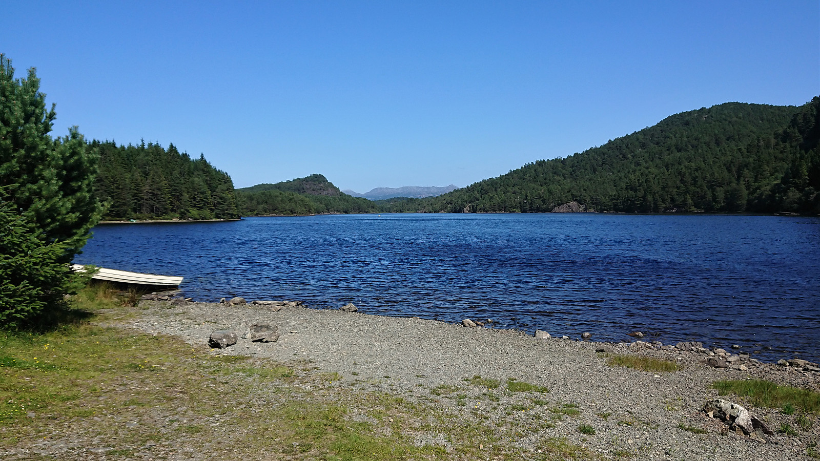 I started by cycling to Strandkaiterminalen, from where I took the high-speed ferry to Rubbestadneset. Here I started the GPS tracking and headed south along the roads to the trailhead for Siggjo , generally on either separate cycling/walking paths or on roads with limited traffic. It should however be mentioned that while the area was overall well-suited for cycling, the signs for cyclists leave a lot to be desired, as basically there were none. I therefore struggled a bit when getting to the highway south of Rubbestadneset and trying to figure out how where the cycling path continued.
After reaching the valley between Siggjo and Furefjellet called Åreiddalen, I easily located the unmarked trailhead for Siggjo and continued from there on foot. See the separate trip report here . Upon returning to my bike, I cycled >>>
I started by cycling to Strandkaiterminalen, from where I took the high-speed ferry to Rubbestadneset. Here I started the GPS tracking and headed south along the roads to the trailhead for Siggjo , generally on either separate cycling/walking paths or on roads with limited traffic. It should however be mentioned that while the area was overall well-suited for cycling, the signs for cyclists leave a lot to be desired, as basically there were none. I therefore struggled a bit when getting to the highway south of Rubbestadneset and trying to figure out how where the cycling path continued.
After reaching the valley between Siggjo and Furefjellet called Åreiddalen, I easily located the unmarked trailhead for Siggjo and continued from there on foot. See the separate trip report here . Upon returning to my bike, I cycled >>>
Båtevassfjellet from Einestranda
- Datum:
- 19.07.2021
- Tourcharakter:
- Bergtour
- Tourlänge:
- 4:55h
- Entfernung:
- 14,5km
 I started by taking the bus (or rather buses, four in total) to Einestranda. Here I managed to get off one stop too early. I think I can be excused by the fact that this particular stop, while having its own bus stop sign, does not appear in the list of bus stops at skyss.no. In any case, it was only a short 250 meters walk to the correct stop.
Next, the unmarked trailhead for Båtevassfjellet was easily located just before crossing the river at Einestranda. The trail itself however was marked, and the first trail marker could be spotted from the trailhead. After a short detour following some trail markers on the north/west side of the river, I retraced my steps and crossed the river via a concrete bridge, and quickly picked up the trail markers on the other side. From there on the trail was overall easy to >>>
I started by taking the bus (or rather buses, four in total) to Einestranda. Here I managed to get off one stop too early. I think I can be excused by the fact that this particular stop, while having its own bus stop sign, does not appear in the list of bus stops at skyss.no. In any case, it was only a short 250 meters walk to the correct stop.
Next, the unmarked trailhead for Båtevassfjellet was easily located just before crossing the river at Einestranda. The trail itself however was marked, and the first trail marker could be spotted from the trailhead. After a short detour following some trail markers on the north/west side of the river, I retraced my steps and crossed the river via a concrete bridge, and quickly picked up the trail markers on the other side. From there on the trail was overall easy to >>>
Cycling: Myrdalsvatnet and Preståsen
- Datum:
- 18.07.2021
- Tourcharakter:
- Fahrradtour gemischt
- Tourlänge:
- 3:10h
- Entfernung:
- 43,4km
 When the rain showers finally stopped, or so I thought, I cycled towards Myrdalsvatnet for a visit of Preståsen . It however started raining again as I was approaching Nesttun, but thankfully it was only light rain and soon stopped completely. The summit of Preståsen was easily reached on foot via an unmarked trail starting from the gravel road northeast of Myrdalsvatnet. Next to no views from the summit nor the trail though. I even briefly followed the trail south beyond the summit to check if there were any better views there, but this was not the case as far as I could tell. I therefore returned to my bike at the gravel road and followed it north before returning south to Myrdalsvatnet and the ride home.
Across Hellen festning
- Datum:
- 17.07.2021
- Tourcharakter:
- Wanderung
- Tourlänge:
- 0:38h
- Entfernung:
- 3,2km
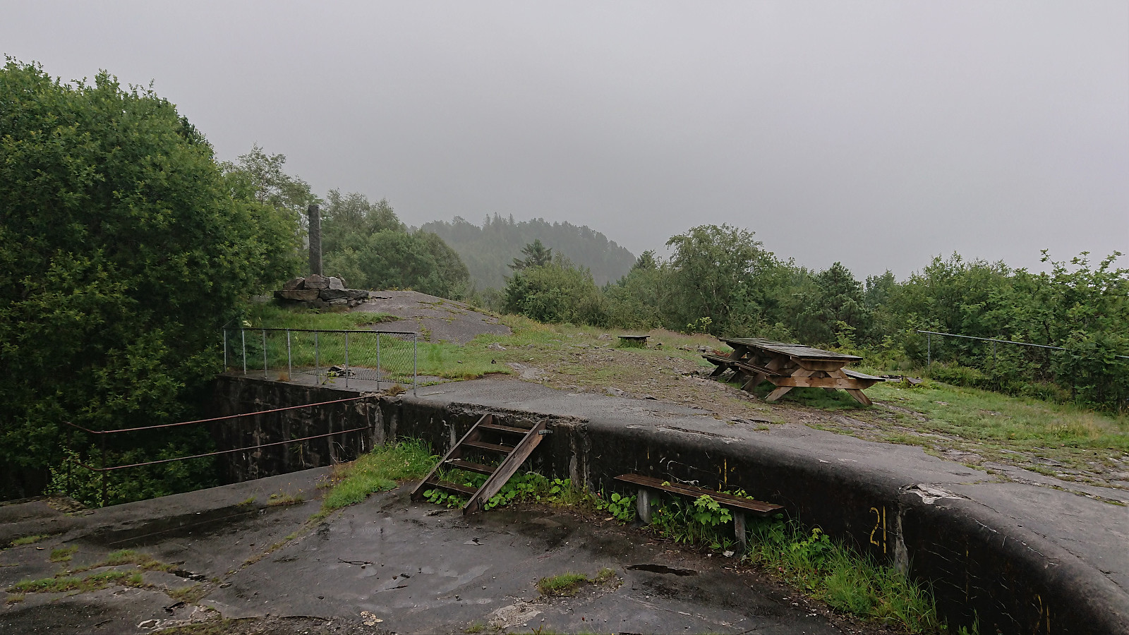 Short local hike on a gray and wet Saturday.
Vestrefjellet and Snjonipa roundtrip from Tyssebotn
- Datum:
- 16.07.2021
- Tourcharakter:
- Bergtour
- Tourlänge:
- 8:22h
- Entfernung:
- 24,5km
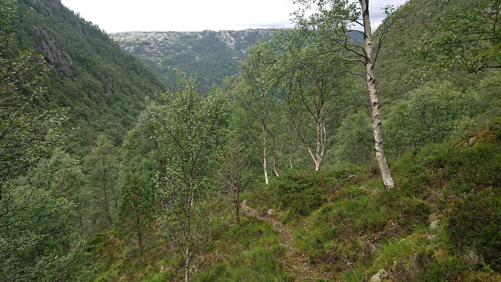 I started by taking the first bus to Tyssebotn on a Friday morning, where I was the only passenger on both the bus and the ferry from Breistein to Valestrand. From Tyssebotn, I walked along the road to the trailhead for Gammersvik south of Kleiveland. I proceeded to follow this unmarked but easy to follow trail to Vaultjørna. After a quick visit to Vaulelvbrua to check that both it and the trail on the other side was there and of ok quality (as it would be quite important when later returning along that route), I backtracked about 100 meters to a trail/deer track I had noticed just after crossing the small stream north of Vaultjørna.
By following this track, I easily ascended the initial steep section on my way northeast towards Vestrefjellet . The track however soon more or less disappeared, and I was left making >>>
I started by taking the first bus to Tyssebotn on a Friday morning, where I was the only passenger on both the bus and the ferry from Breistein to Valestrand. From Tyssebotn, I walked along the road to the trailhead for Gammersvik south of Kleiveland. I proceeded to follow this unmarked but easy to follow trail to Vaultjørna. After a quick visit to Vaulelvbrua to check that both it and the trail on the other side was there and of ok quality (as it would be quite important when later returning along that route), I backtracked about 100 meters to a trail/deer track I had noticed just after crossing the small stream north of Vaultjørna.
By following this track, I easily ascended the initial steep section on my way northeast towards Vestrefjellet . The track however soon more or less disappeared, and I was left making >>>
Hellen festning and Furukammen
- Datum:
- 15.07.2021
- Tourcharakter:
- Wanderung
- Tourlänge:
- 1:23h
- Entfernung:
- 4,5km
 Short local afternoon hike.
Cycling: Kvernafossen
- Datum:
- 14.07.2021
- Tourcharakter:
- Fahrradtour gemischt
- Tourlänge:
- 4:19h
- Entfernung:
- 54,9km
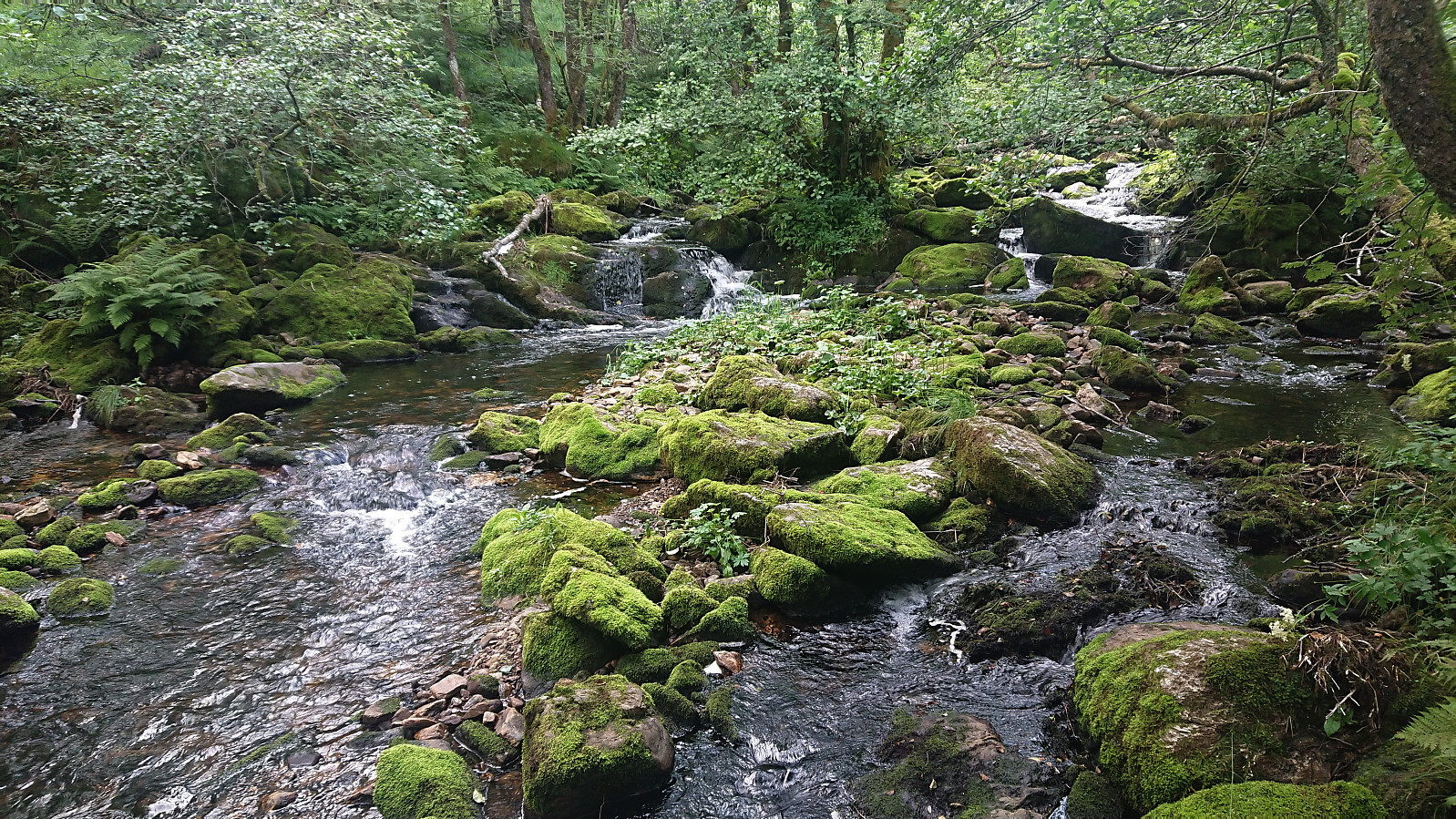 Cycling trip with the objective of exploring a possible trail to Nedstaheia, a small hill southeast of Haukheia in Arna. The unmarked trailhead south of the summit was easily located, and after leaving my bike behind, I continued on foot along the river/waterfall called Kvernafossen . The trail was partially hidden by the low vegetation, but easy to follow. Shortly I reached the tractor road south of Krokavatnet. Here I turned right and started searching for the trail to Nedstaheia. I think I found it in the end, but it was pretty much completely hidden by the tall grasses. After a short attempt at following the hidden trail, I therefore gave up and decided to rather return on a future hike, ideally not wearing shorts as today, especially given that I was also planning on including a visit to Haukheia. Back on >>>
Munkebotn, Hellemyrstien and Furukammen
- Datum:
- 13.07.2021
- Tourcharakter:
- Wanderung
- Tourlänge:
- 1:53h
- Entfernung:
- 10,1km
 Local evening hike.
