Archiv - Nach Datum
Archiv - Nach Aktivität
-
Andere Tour (3)
- Kayaking (3)
-
Fahrradtour (111)
- Fahrradtour Straße (86)
- Fahrradtour gemischt (25)
-
Fahrzeugtour (9)
- Autotour (9)
-
Fußtour (1897)
- Bergtour (1120)
- Jogging (1)
- Spaziergang (60)
- Wanderung (716)
-
Skitour (116)
- Langlauf (47)
- Tourenskilauf (69)
Gesammelte Listen
-
Utvalgte topper og turmål i Bergen
(349/351)
 99%
99% -
Alle topper i Bergen
(393/400)
98%
-
Voss ≥ 100m pf.
(96/98)
97%
-
Opptur Hordaland
(144/159)
90%
-
Stasjoner på Bergensbanen
(33/40)
82%
-
Ulvik ≥ 100m pf.
(30/38)
78%
-
Hordaland ≥ 100m pf.
(624/863)
72%
-
Mjølfjell PF > 100m
(21/31)
67%
-
Jondal ≥ 100m pf.
(15/23)
65%
-
Dagsturhyttene i Vestland
(36/61)
59%
-
Sunnhordland PF >= 100m
(105/186)
56%
-
Hordaland: Hardanger PF>=100m
(196/359)
54%
-
DNT-hytter i Hordaland
(23/45)
51%
-
Kvinnherad ≥ 100m pf.
(40/79)
50%
-
Eidfjord ≥ 100m pf.
(13/42)
30%
-
Sogndal ≥ 100m pf.
(23/81)
28%
-
Gulen ≥ 100m pf.
(15/54)
27%
-
Vik i Sogn ≥ 100m pf.
(10/46)
21%
-
Sogn - Sør for Sognefjorden PF>=100m
(31/159)
19%
-
DNT-hytter i Sogn og Fjordane
(8/47)
17%

Storevasseggene and Blådalsnipa from Nordkvingo
- Datum:
- 05.08.2021
- Tourcharakter:
- Bergtour
- Tourlänge:
- 4:40h
- Entfernung:
- 14,7km
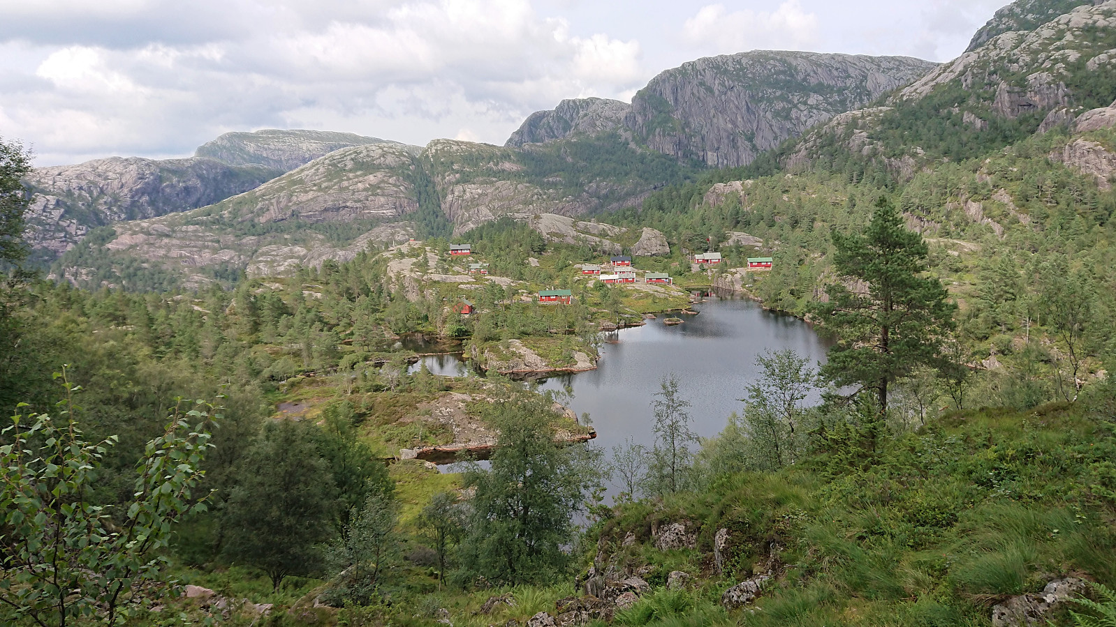 I started by taking the bus (or rather buses, four in total) to arrive at Nordkvingo where I got off at the stop called Sønsthaugen. Here I easily located the marked trailhead for Kalvedalshytta , which I then proceeded to follow. At first the trail was relatively steep, helped by various stone steps and metal railing, but it soon levelled off and it did not take too long before it started descending towards Gjelet where it connected with the new trail coming up from Nordkvingo p-plass .
The trail was marked with red T's and was overall easy to follow. After briefly passing by Blådalsvatnet, the trail shortly descended to south of Setertjørna where I got the first views of both Storevasseggene and Blådalsnipa , plus a nice overview of Nordkvingesetret , before the trail again started ascending into the valley in between Storevasseggene and Klefjellnipa .
Just before the marked trail >>>
I started by taking the bus (or rather buses, four in total) to arrive at Nordkvingo where I got off at the stop called Sønsthaugen. Here I easily located the marked trailhead for Kalvedalshytta , which I then proceeded to follow. At first the trail was relatively steep, helped by various stone steps and metal railing, but it soon levelled off and it did not take too long before it started descending towards Gjelet where it connected with the new trail coming up from Nordkvingo p-plass .
The trail was marked with red T's and was overall easy to follow. After briefly passing by Blådalsvatnet, the trail shortly descended to south of Setertjørna where I got the first views of both Storevasseggene and Blådalsnipa , plus a nice overview of Nordkvingesetret , before the trail again started ascending into the valley in between Storevasseggene and Klefjellnipa .
Just before the marked trail >>>
Cycling: Glasskaråsen and Våganeset
- Datum:
- 04.08.2021
- Tourcharakter:
- Fahrradtour Straße
- Tourlänge:
- 3:12h
- Entfernung:
- 24,8km
 Short local cycling trip exploring Glasskaråsen and Våganeset/Nedre Åstveit.
Rødsaksla
- Datum:
- 03.08.2021
- Tourcharakter:
- Bergtour
- Tourlänge:
- 1:43h
- Entfernung:
- 4,3km
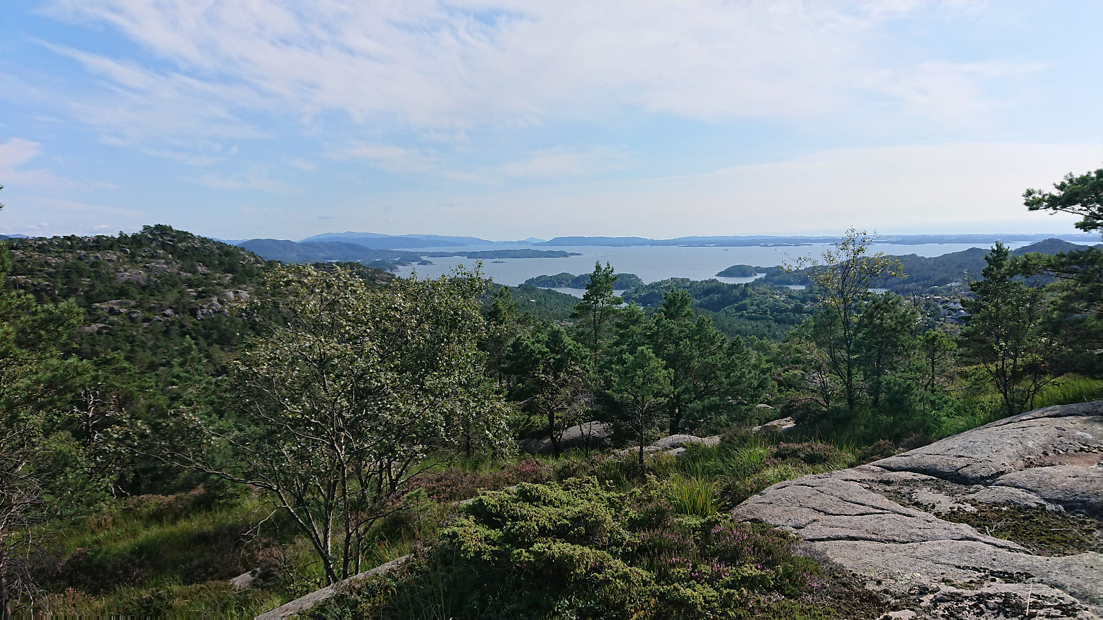 Afternoon hike with the goal of visiting Rødsaksla , a minor summit on the Alle topper i Bergen list. I started by taking the bus to Rød, where I for some reason thought that I ought to get off at the bus stop referred to as "Rød nord, Bergen", while the correct one would have been "Rød sør, Bergen" which is located right next to the trailhead. But after a short 500 meters walk along the road I arrived at the unmarked trailhead discovered by knutsverre (Knut S. Andersen) and Astrid (Astrid S. Andersen) on their hike to Rødsaksla a couple of months earlier .
This resulted in it being straightforward to get pretty close to the summit, even though the trail turned rather weak towards the end. (Note that as the GPS track indicates, I also made a short attempt at a more direct shortcut by following an alternative trail early on. But decided to return to the main trail when the alternative trail ended in a wet >>>
Afternoon hike with the goal of visiting Rødsaksla , a minor summit on the Alle topper i Bergen list. I started by taking the bus to Rød, where I for some reason thought that I ought to get off at the bus stop referred to as "Rød nord, Bergen", while the correct one would have been "Rød sør, Bergen" which is located right next to the trailhead. But after a short 500 meters walk along the road I arrived at the unmarked trailhead discovered by knutsverre (Knut S. Andersen) and Astrid (Astrid S. Andersen) on their hike to Rødsaksla a couple of months earlier .
This resulted in it being straightforward to get pretty close to the summit, even though the trail turned rather weak towards the end. (Note that as the GPS track indicates, I also made a short attempt at a more direct shortcut by following an alternative trail early on. But decided to return to the main trail when the alternative trail ended in a wet >>>
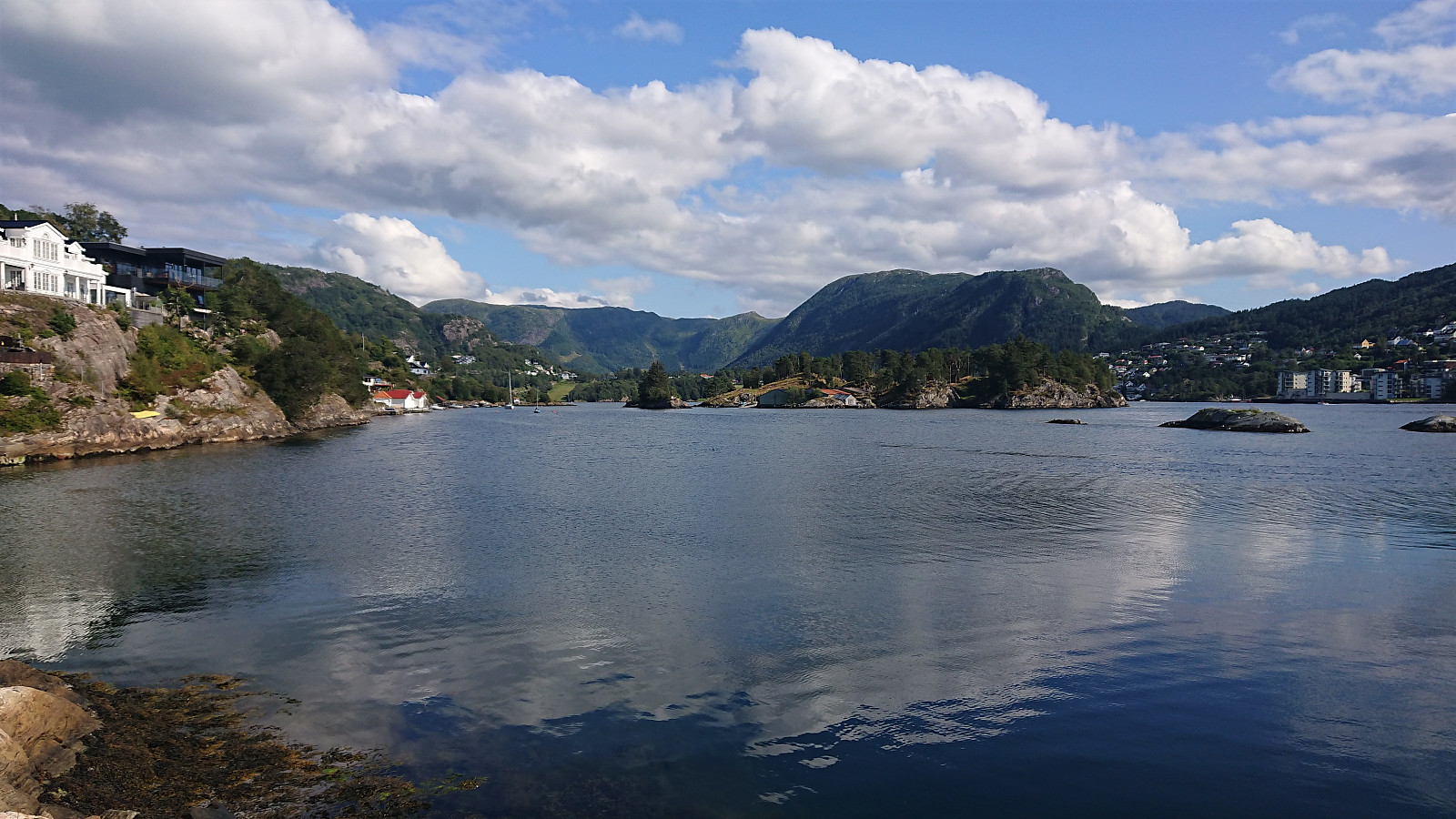
Across Hellen festning
- Datum:
- 02.08.2021
- Tourcharakter:
- Wanderung
- Tourlänge:
- 0:36h
- Entfernung:
- 3,1km
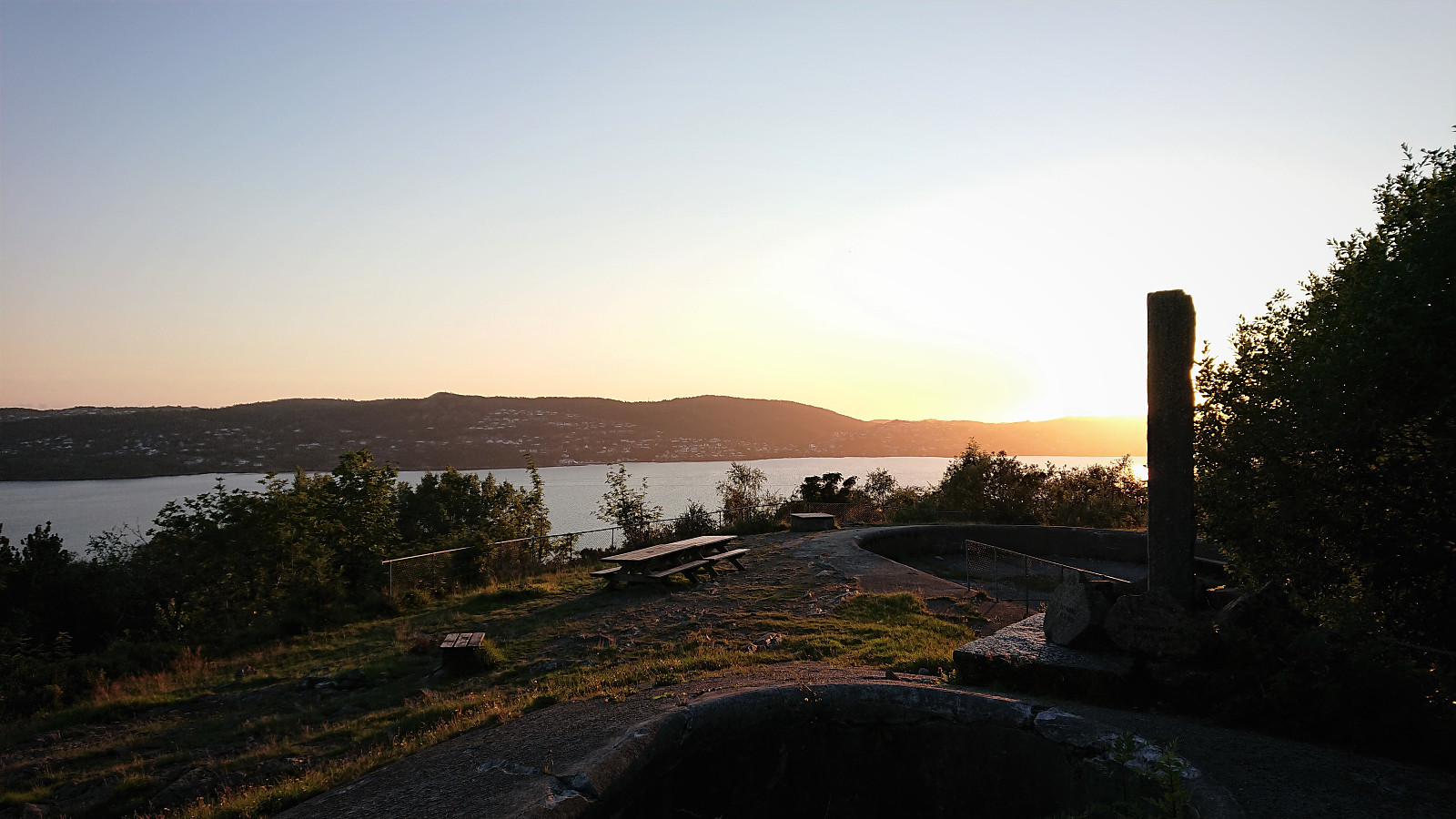 Short local evening hike after driving home from Sogndal.
Fannaråken from Turtagrø
- Datum:
- 01.08.2021
- Tourcharakter:
- Bergtour
- Tourlänge:
- 7:49h
- Entfernung:
- 19,2km
 We drove from Sogndal to Turtagrø and parked at the opposite side of the road from Turtagrø Hotell . Lots of other hikers at Turtagrø, but as soon as we started on the trail towards Helgedalen, the number of people rapidly decreased and we soon found ourselves all on our own. (In fact, we would meet less than 50 people for the entire hike.) We shortly connected with the gravel road in Helgedalen, which we then proceeded to follow until reaching the marked trail for Fannaråken below Ekrehytta.
After this easy start of just over 200 vertical meters spread out over a bit less than 5 km, the real hike started with another 900 meters left to climb over less than half the distance. The trail was clearly marked and overall easy to follow, and there were only a couple of short sections early on where hikers with a severe fear of heights might struggle. We actually >>>
We drove from Sogndal to Turtagrø and parked at the opposite side of the road from Turtagrø Hotell . Lots of other hikers at Turtagrø, but as soon as we started on the trail towards Helgedalen, the number of people rapidly decreased and we soon found ourselves all on our own. (In fact, we would meet less than 50 people for the entire hike.) We shortly connected with the gravel road in Helgedalen, which we then proceeded to follow until reaching the marked trail for Fannaråken below Ekrehytta.
After this easy start of just over 200 vertical meters spread out over a bit less than 5 km, the real hike started with another 900 meters left to climb over less than half the distance. The trail was clearly marked and overall easy to follow, and there were only a couple of short sections early on where hikers with a severe fear of heights might struggle. We actually >>>
Bjedlastølen from Åsen to Bjella
- Datum:
- 31.07.2021
- Tourcharakter:
- Bergtour
- Tourlänge:
- 3:01h
- Entfernung:
- 4,2km
 Short hike from Åsen p-plass to Bjella via Bjedlastølen with the main objective of looking for blueberries and cloudberries. In the end, the former was much more successful than the latter. Marked and easy to follow trails.
Cycling: Dalavatnet and Anestølen
- Datum:
- 30.07.2021
- Tourcharakter:
- Fahrradtour Straße
- Tourlänge:
- 2:34h
- Entfernung:
- 23,1km
 Cycling trip along Dalavatnet starting from Hollekvebrui p-lomme and going all the way to Anestølen before returning. Most of the trip was on a paved road with very little traffic before a gravel road took over for the last stretch in to Anestølen. Overall the paved road was of good quality, however one should pay attention as there are areas where frost heaving has damaged the pavement. I of course managed to hit one of these tiny holes at a time when I was paying more attention to the views than the road, and in some strange way managed to tumble over the handle bars of my bike and hitting the asphalt. Luckily my speed was very low and I got way with only minor bruises and could continue cycling, but now paying at least slightly more attention to the road. In summary, an excellent trip with spectacular views along the >>>
Barsnesfjorden
- Datum:
- 27.07.2021
- Tourcharakter:
- Wanderung
- Tourlänge:
- 0:46h
- Entfernung:
- 3,7km
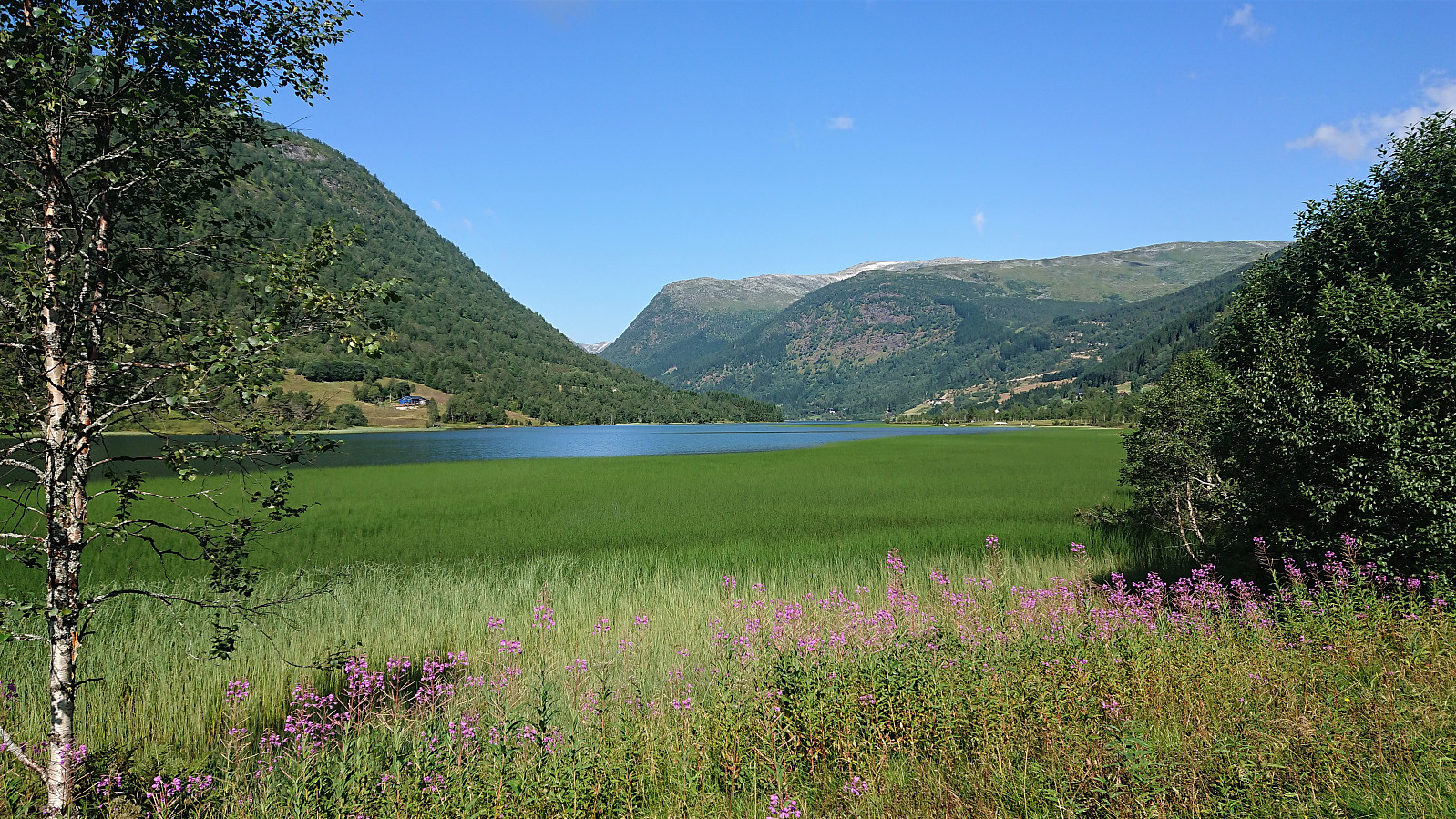
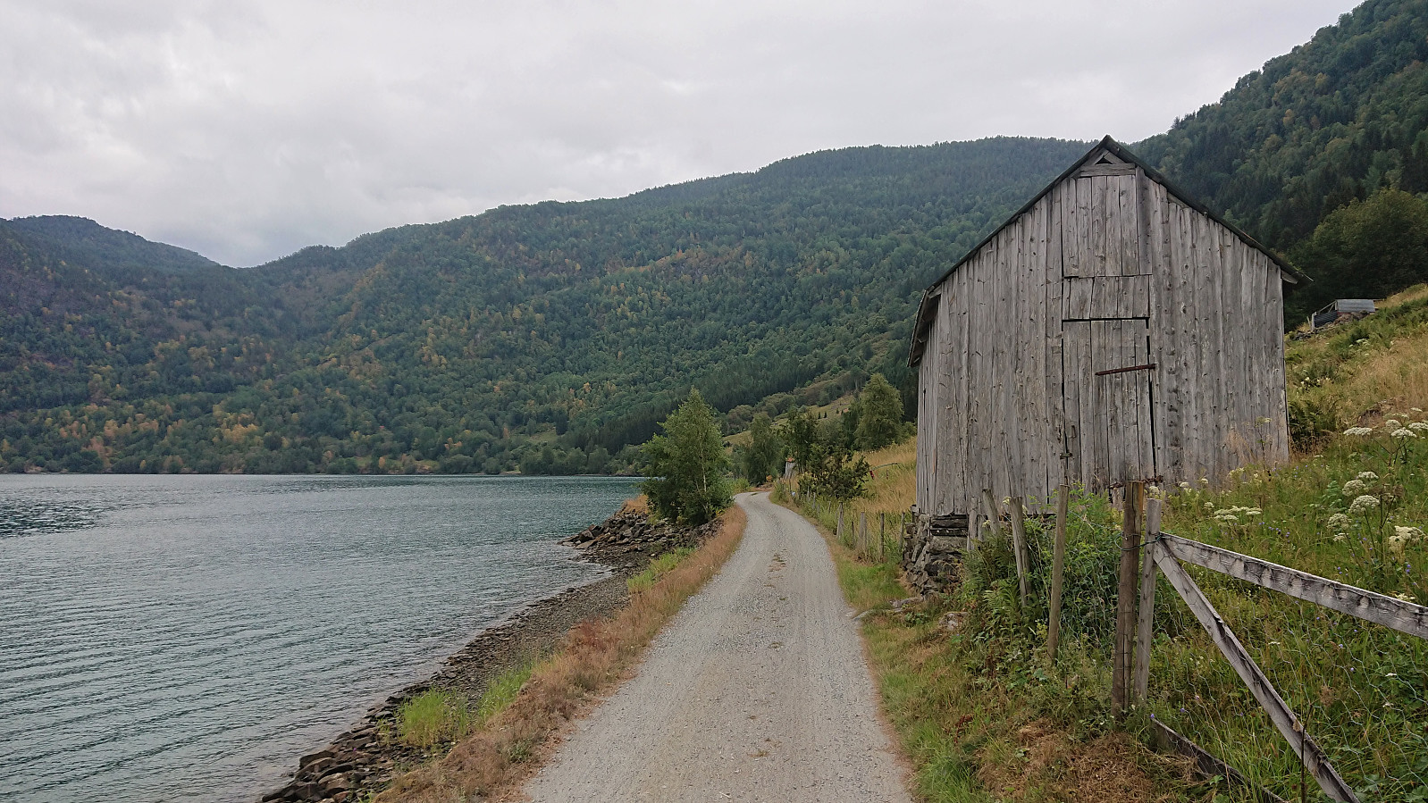 Another short walk along Barsnesfjorden.
(Note that the road this hike follows is private, i.e. no cars allowed. There are however a couple of parking spaces down by the small wharf along Barsnesfjorden just before the road turns west and starts climbing slightly towards the crossroads at Barsnes.)
Another short walk along Barsnesfjorden.
(Note that the road this hike follows is private, i.e. no cars allowed. There are however a couple of parking spaces down by the small wharf along Barsnesfjorden just before the road turns west and starts climbing slightly towards the crossroads at Barsnes.)
Austerdalsbreen from Tungestølen
- Datum:
- 26.07.2021
- Tourcharakter:
- Bergtour
- Tourlänge:
- 3:49h
- Entfernung:
- 11,7km
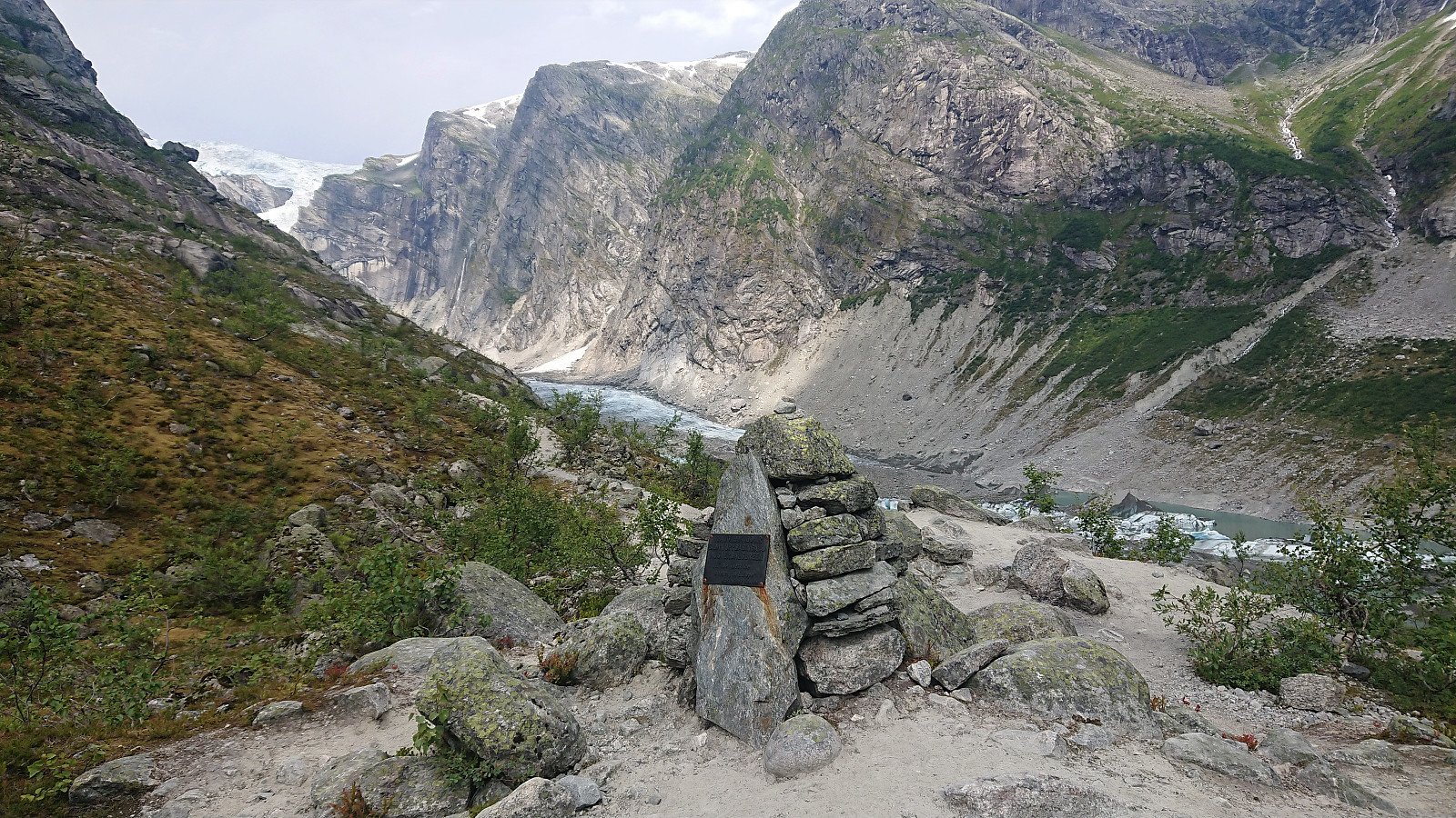 The initial plan of cycling along Veitastrondsvatnet was at the last minute replaced by instead driving to Tungestølen which meant that the trip could more easily be extended with a hike up to Austerdalsbreen . Note that the road to Veitastrond from Hafslo passes through several tunnels, varying in standard from relatively new to old and narrow without any lighting. When cycling it is however possible to avoid all but a very short one by using the cycling paths, i.e. the old road.
After enjoying the nice views along Veitastrondsvatnet, and paying the 70 kr toll at Høgebru bom (after finally managing to get a decent 4G connection allowing us to pay via VIPPS), we arrived at the parking lot next to Tungestølen . From here we continued on foot along the trail to Austerdalsbreen . The trail was easy to follow, with wooden bridges when needed, and we soon arrived at the Slingsby-monumentet . Sadly >>>
The initial plan of cycling along Veitastrondsvatnet was at the last minute replaced by instead driving to Tungestølen which meant that the trip could more easily be extended with a hike up to Austerdalsbreen . Note that the road to Veitastrond from Hafslo passes through several tunnels, varying in standard from relatively new to old and narrow without any lighting. When cycling it is however possible to avoid all but a very short one by using the cycling paths, i.e. the old road.
After enjoying the nice views along Veitastrondsvatnet, and paying the 70 kr toll at Høgebru bom (after finally managing to get a decent 4G connection allowing us to pay via VIPPS), we arrived at the parking lot next to Tungestølen . From here we continued on foot along the trail to Austerdalsbreen . The trail was easy to follow, with wooden bridges when needed, and we soon arrived at the Slingsby-monumentet . Sadly >>>
Børesteinen from Berge
- Datum:
- 25.07.2021
- Tourcharakter:
- Bergtour
- Tourlänge:
- 3:13h
- Entfernung:
- 5,1km
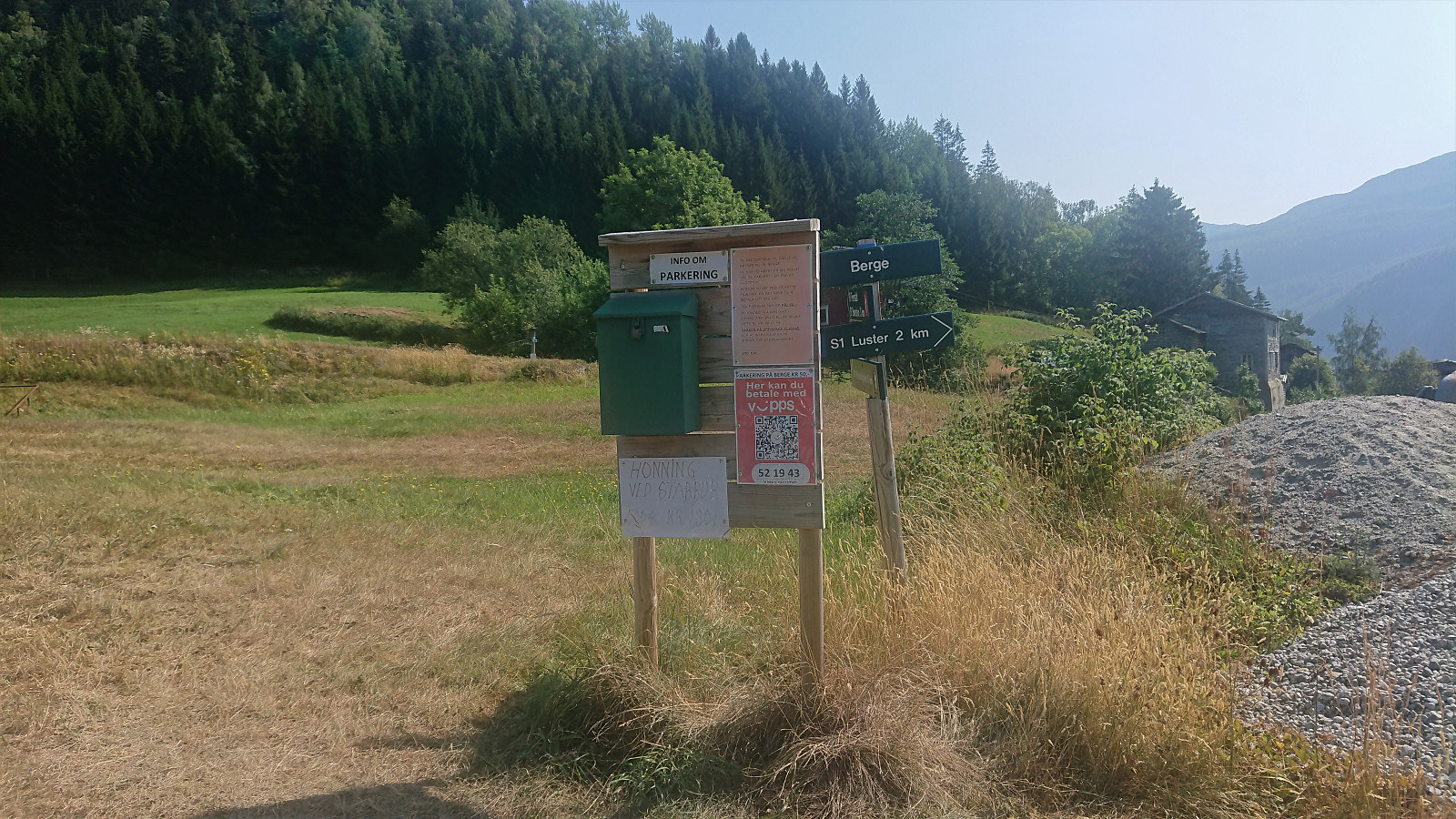 Based on a tip from my sister, we drove from Sogndal to Luster for a hike up to Børesteinen . A location that promised spectacular views. Upon arriving at Luster, we continued up the narrow and steep private gravel road to Berge, something we would not have done had we not known about the small private parking lot up there with room for maybe 4-5 cars. Here we happily paid the 50 kr parking fee via VIPPS and started on the marked trail to Børesteinen.
Note that if you do not feel like taking a chance on the private road up to Berge, there is also parking down by the main road with a marked trail up to Berge. But this of course adds another 370 vertical meters to the hike.
The trail from Berge was steep but of good quality and easy to follow. There were also several less steep sections, most notably when the trail made a detour >>>
Based on a tip from my sister, we drove from Sogndal to Luster for a hike up to Børesteinen . A location that promised spectacular views. Upon arriving at Luster, we continued up the narrow and steep private gravel road to Berge, something we would not have done had we not known about the small private parking lot up there with room for maybe 4-5 cars. Here we happily paid the 50 kr parking fee via VIPPS and started on the marked trail to Børesteinen.
Note that if you do not feel like taking a chance on the private road up to Berge, there is also parking down by the main road with a marked trail up to Berge. But this of course adds another 370 vertical meters to the hike.
The trail from Berge was steep but of good quality and easy to follow. There were also several less steep sections, most notably when the trail made a detour >>>
