Archiv - Nach Datum
Archiv - Nach Aktivität
-
Andere Tour (3)
- Kayaking (3)
-
Fahrradtour (111)
- Fahrradtour Straße (86)
- Fahrradtour gemischt (25)
-
Fahrzeugtour (9)
- Autotour (9)
-
Fußtour (1897)
- Bergtour (1120)
- Jogging (1)
- Spaziergang (60)
- Wanderung (716)
-
Skitour (116)
- Langlauf (47)
- Tourenskilauf (69)
Gesammelte Listen
-
Utvalgte topper og turmål i Bergen
(349/351)
 99%
99% -
Alle topper i Bergen
(393/400)
98%
-
Voss ≥ 100m pf.
(96/98)
97%
-
Opptur Hordaland
(144/159)
90%
-
Stasjoner på Bergensbanen
(33/40)
82%
-
Ulvik ≥ 100m pf.
(30/38)
78%
-
Hordaland ≥ 100m pf.
(624/863)
72%
-
Mjølfjell PF > 100m
(21/31)
67%
-
Jondal ≥ 100m pf.
(15/23)
65%
-
Dagsturhyttene i Vestland
(36/61)
59%
-
Sunnhordland PF >= 100m
(105/186)
56%
-
Hordaland: Hardanger PF>=100m
(196/359)
54%
-
DNT-hytter i Hordaland
(23/45)
51%
-
Kvinnherad ≥ 100m pf.
(40/79)
50%
-
Eidfjord ≥ 100m pf.
(13/42)
30%
-
Sogndal ≥ 100m pf.
(23/81)
28%
-
Gulen ≥ 100m pf.
(15/54)
27%
-
Vik i Sogn ≥ 100m pf.
(10/46)
21%
-
Sogn - Sør for Sognefjorden PF>=100m
(31/159)
19%
-
DNT-hytter i Sogn og Fjordane
(8/47)
17%

Across Hellen festning
- Datum:
- 30.06.2020
- Tourcharakter:
- Wanderung
- Tourlänge:
- 0:54h
- Entfernung:
- 4,5km
 Short local evening hike.
Hovda
- Datum:
- 27.06.2020
- Tourcharakter:
- Bergtour
- Tourlänge:
- 0:55h
- Entfernung:
- 2,9km
 I arrived by bike after my earlier visit of Kongshaug , and easily located the tractor road marking the trailhead for Hovda . After leaving the bike behind at the start of the tractor road, as it was too wet and the grass too high to get any benefit out of cycling, I followed the tractor road until passing the steepest areas between me and the summit. I then ditched the tractor road and found my own more direct route towards the summit, partly following various deer tracks.
The ascent included its own short obstacle course with lots of fallen trees that I had to find my way over/under, but the terrain opened up at around 300 meters and from there to the summit it was straightforward to make progress. I also spotted two deer, or maybe the same deer on two different locations on my way upwards.
Before heading to the summit itself, >>>
I arrived by bike after my earlier visit of Kongshaug , and easily located the tractor road marking the trailhead for Hovda . After leaving the bike behind at the start of the tractor road, as it was too wet and the grass too high to get any benefit out of cycling, I followed the tractor road until passing the steepest areas between me and the summit. I then ditched the tractor road and found my own more direct route towards the summit, partly following various deer tracks.
The ascent included its own short obstacle course with lots of fallen trees that I had to find my way over/under, but the terrain opened up at around 300 meters and from there to the summit it was straightforward to make progress. I also spotted two deer, or maybe the same deer on two different locations on my way upwards.
Before heading to the summit itself, >>>
Kongshaug
- Datum:
- 27.06.2020
- Tourcharakter:
- Bergtour
- Tourlänge:
- 1:21h
- Entfernung:
- 4,5km
 Upon finally arriving at the trailhead for Kongshaug , I quickly found a place to leave my bike and followed the tractor road upwards until it ended at a picnic area with excellent views. At first I did not see any trails continuing from that point, but I soon happened upon a weak trail marked with white plastic ribbons. And although it was not exactly going towards the summit, I assumed it had its reasons, and decided to follow it anyway.
It quickly became apparent that this trail was indeed not heading towards the summit, but rather to a viewpoint to the south. By this time I was pretty close anyway, so I stuck with the trail until it came to an end at a visitor register .
Interestingly the visitor register was incorrectly marked with 229 meters, but the actual height was more like 209 meters. Still worth a visit if in the area though, as the views >>>
Upon finally arriving at the trailhead for Kongshaug , I quickly found a place to leave my bike and followed the tractor road upwards until it ended at a picnic area with excellent views. At first I did not see any trails continuing from that point, but I soon happened upon a weak trail marked with white plastic ribbons. And although it was not exactly going towards the summit, I assumed it had its reasons, and decided to follow it anyway.
It quickly became apparent that this trail was indeed not heading towards the summit, but rather to a viewpoint to the south. By this time I was pretty close anyway, so I stuck with the trail until it came to an end at a visitor register .
Interestingly the visitor register was incorrectly marked with 229 meters, but the actual height was more like 209 meters. Still worth a visit if in the area though, as the views >>>
Cycling: Malkenes - Skorpo - Våge - Lønborg
- Datum:
- 27.06.2020
- Tourcharakter:
- Fahrradtour Straße
- Tourlänge:
- 10:01h
- Entfernung:
- 97,1km
 Another ambitious cycling trip to Tysnes, this time with the goal of visiting Kongshaug and Hovda . I repeated the success of my previous trip and thus took the express ferry to Malkenes instead of starting by cycling the 40 km to Halhjem. From Malkenes I cycled to Skorpo, once again enjoying the excellent views along Onarheimsfjorden.
The trailhead for Kongshaug at Stykkenestet was easily located, and after a visit to Kongshaug (see the separate trip report here: Kongshaug ), I returned to Onarheim for a well-deserved ice cream before starting the climb up Fjellvegen towards Hovda.
After the visit to Hovda (see the separate trip report here: Hovda ), I was happy to see that I had plenty of time to get to the planned ferry at Våge, where I arrived with around 15 minutes to spare. From Halhjem the trip was then completed by cycling the around >>>
Another ambitious cycling trip to Tysnes, this time with the goal of visiting Kongshaug and Hovda . I repeated the success of my previous trip and thus took the express ferry to Malkenes instead of starting by cycling the 40 km to Halhjem. From Malkenes I cycled to Skorpo, once again enjoying the excellent views along Onarheimsfjorden.
The trailhead for Kongshaug at Stykkenestet was easily located, and after a visit to Kongshaug (see the separate trip report here: Kongshaug ), I returned to Onarheim for a well-deserved ice cream before starting the climb up Fjellvegen towards Hovda.
After the visit to Hovda (see the separate trip report here: Hovda ), I was happy to see that I had plenty of time to get to the planned ferry at Våge, where I arrived with around 15 minutes to spare. From Halhjem the trip was then completed by cycling the around >>>
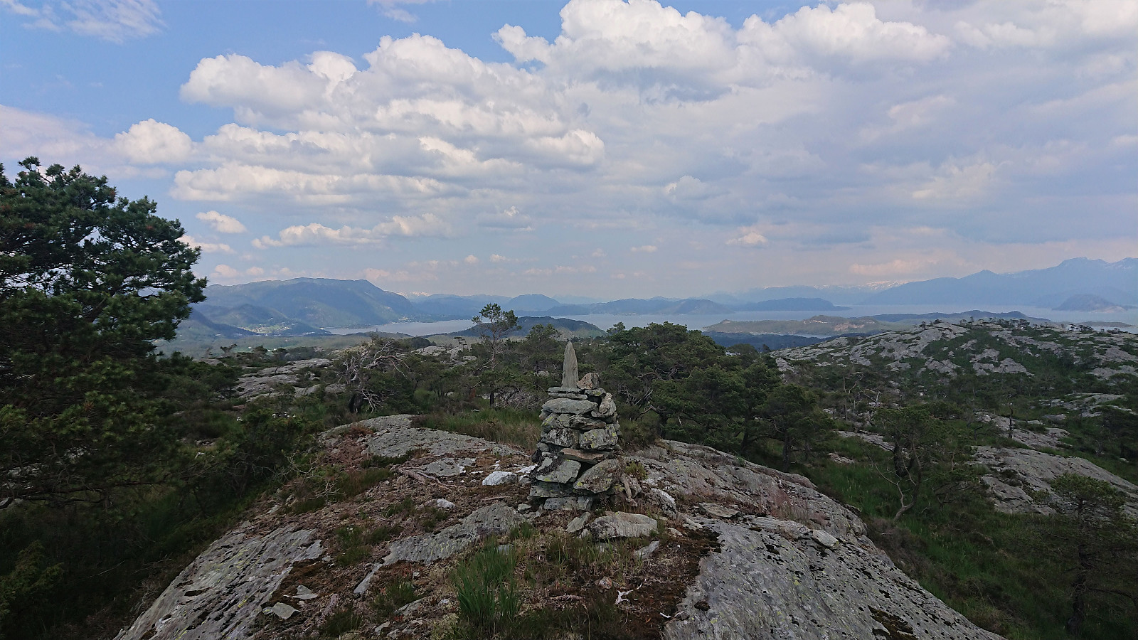
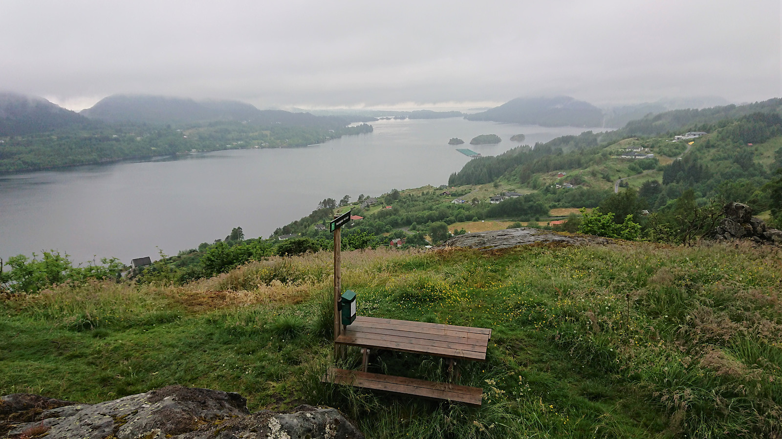
Fagerdalsfjellet, Ørneberget and Rognåsen
- Datum:
- 26.06.2020
- Tourcharakter:
- Bergtour
- Tourlänge:
- 3:04h
- Entfernung:
- 7,3km
 Short local evening hike.
Hjellafjellet, Trollskarnuten and Lurafjellet
- Datum:
- 25.06.2020
- Tourcharakter:
- Bergtour
- Tourlänge:
- 5:19h
- Entfernung:
- 14,9km
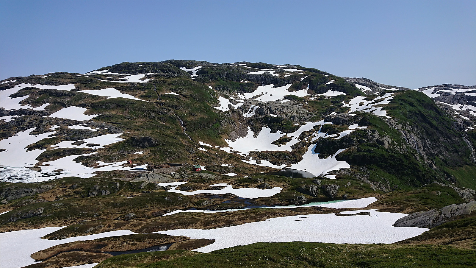 We parked at Kvitingen p-plass and, after paying the 50 kr parking fee, followed the gravel road in the direction of Dukabotnen. The trail started where the gravel road ended (but we got impatient and made a shortcut to skip the last bend of the road) and could easily be followed all the way to Nedsta Dukavatnet, including a bridge that made the river-crossing straightforward.
From Nedsta Dukavatnet I made a quick detour on my own to the summit of Hjellafjellet , which provided excellent views, including back down to Kvitingsvatnet, before returning along the same route. After a short lunch break, we started the initially steep ascent towards Trollskarnuten/Trollskardtiden . The later steep section could easily be avoided, although we did one steep shortcut in order to avoid a longer detour in the snow.
The remains of the trig marker at Trollskarnuten was thus easily >>>
We parked at Kvitingen p-plass and, after paying the 50 kr parking fee, followed the gravel road in the direction of Dukabotnen. The trail started where the gravel road ended (but we got impatient and made a shortcut to skip the last bend of the road) and could easily be followed all the way to Nedsta Dukavatnet, including a bridge that made the river-crossing straightforward.
From Nedsta Dukavatnet I made a quick detour on my own to the summit of Hjellafjellet , which provided excellent views, including back down to Kvitingsvatnet, before returning along the same route. After a short lunch break, we started the initially steep ascent towards Trollskarnuten/Trollskardtiden . The later steep section could easily be avoided, although we did one steep shortcut in order to avoid a longer detour in the snow.
The remains of the trig marker at Trollskarnuten was thus easily >>>
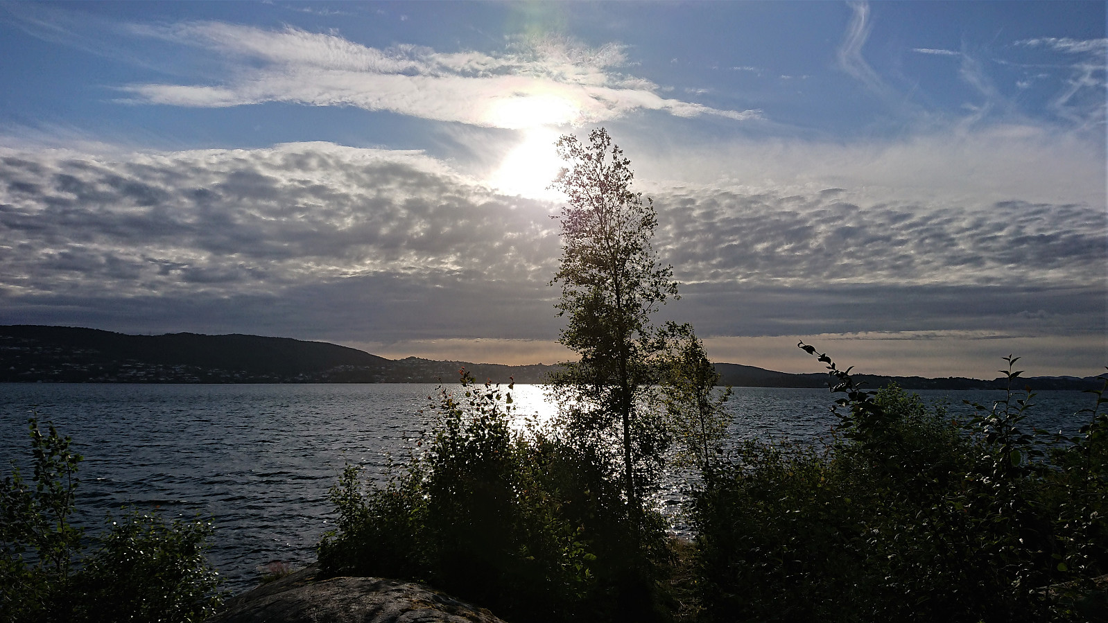
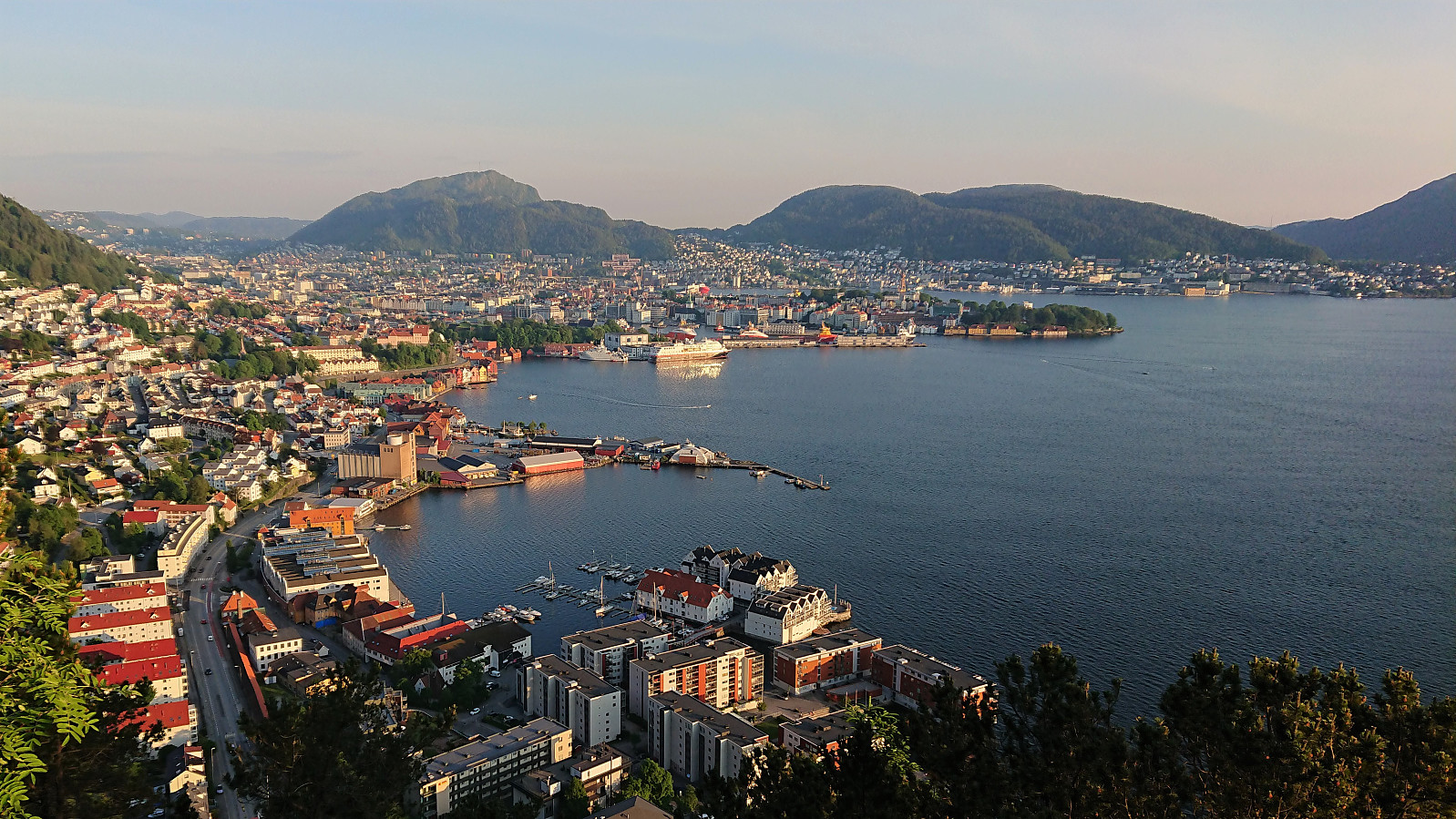
Hellen festning
- Datum:
- 22.06.2020
- Tourcharakter:
- Wanderung
- Tourlänge:
- 1:02h
- Entfernung:
- 5,4km
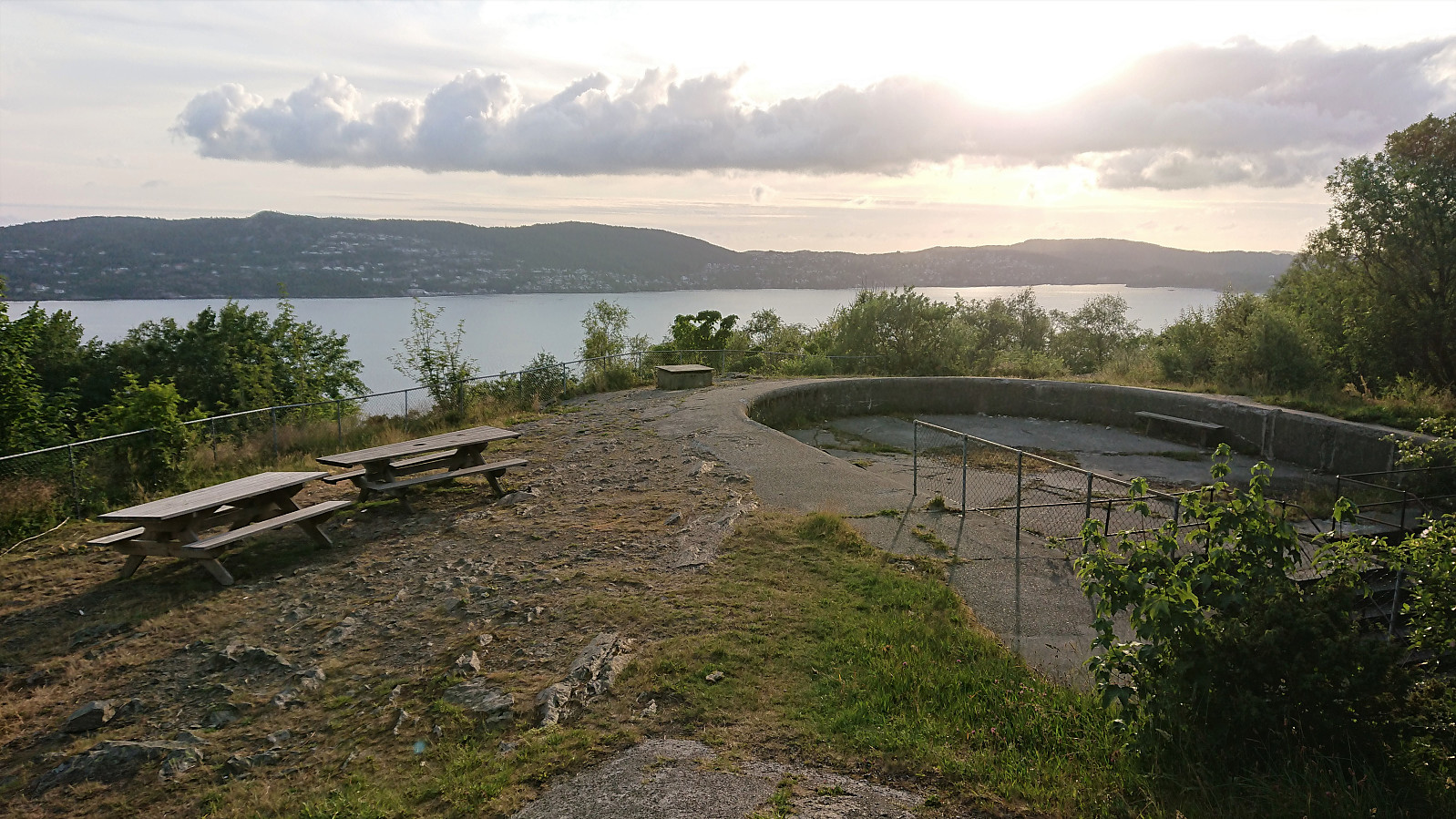 Short local evening hike.
Vetåsveten, Hestefjellet, Peparen and Vettåsfjellet
- Datum:
- 21.06.2020
- Tourcharakter:
- Bergtour
- Tourlänge:
- 2:08h
- Entfernung:
- 7,2km
 We intially tried to follow in Kjell51 (Kjell Øijorden) 's footsteps and start from Soltveit, but failed to find parking and instead had to start from the north. Our route followed various marked trails and tractor roads and resulted in a nice roundtrip with visits of Vetåsveten , Hestefjellet , Peparen and Vettåsfjellet .
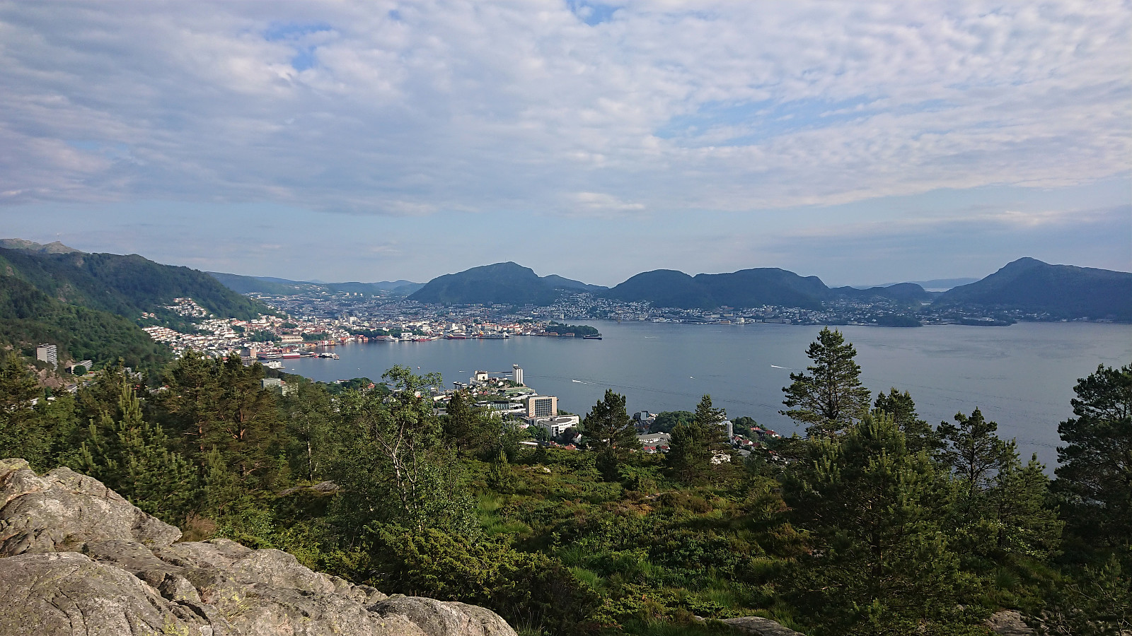
Ørneberget, Rognåsen and Håmanen
- Datum:
- 20.06.2020
- Tourcharakter:
- Bergtour
- Tourlänge:
- 1:43h
- Entfernung:
- 7,6km
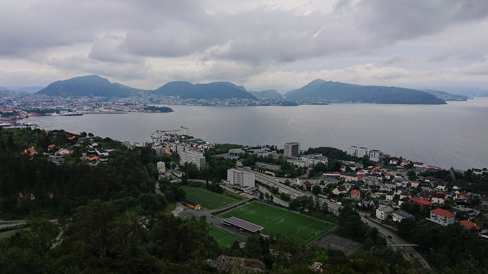 Only a short local hike this Saturday as I had signed up for a hike across Daurmålsegga organized by the Norwegian Trekking Association the day after. A hike that was sadly canceled Saturday morning due to poor weather forecasts, but by then it was too late to change my plans.
Sandviksbatteriet
- Datum:
- 18.06.2020
- Tourcharakter:
- Wanderung
- Tourlänge:
- 1:48h
- Entfernung:
- 9,4km
 Short local evening hike.
