Archiv - Nach Datum
Archiv - Nach Aktivität
-
Andere Tour (2)
- Kayaking (2)
-
Fahrradtour (98)
- Fahrradtour Straße (75)
- Fahrradtour gemischt (23)
-
Fahrzeugtour (7)
- Autotour (7)
-
Fußtour (1497)
- Bergtour (910)
- Jogging (1)
- Spaziergang (41)
- Wanderung (545)
-
Skitour (98)
- Langlauf (39)
- Tourenskilauf (59)
Gesammelte Listen
-
Utvalgte topper og turmål i Bergen
(301/306)
 98%
98% -
Alle topper i Bergen
(335/350)
95%
-
Vaksdal ≥ 100m pf.
(59/63)
93%
-
Nordhordland PF >= 100m
(205/221)
92%
-
Søyler (fastmerker) i Bergen
(91/100)
91%
-
Masfjorden ≥ 100m pf.
(49/55)
89%
-
Opptur Hordaland
(133/159)
83%
-
Modalen ≥ 100m pf.
(23/30)
76%
-
Hordaland ≥ 500m pf.
(23/30)
76%
-
Kvam ≥ 100m pf.
(32/44)
72%
-
Stasjoner på Bergensbanen
(26/36)
72%
-
Voss ≥ 100m pf.
(68/97)
70%
-
Hordaland ≥ 100m pf.
(510/862)
59%
-
Dagsturhyttene i Vestland
(31/60)
51%
-
Sunnhordland PF >= 100m
(83/186)
44%
-
DNT-hytter i Hordaland
(18/45)
40%
-
Kvinnherad ≥ 100m pf.
(26/79)
32%
-
Hordaland: Hardanger PF>=100m
(117/357)
32%
-
Ulvik ≥ 100m pf.
(11/36)
30%
-
Sogndal ≥ 100m pf.
(23/79)
29%

Across Hellen festning
- Datum:
- 29.04.2020
- Tourcharakter:
- Wanderung
- Tourlänge:
- 0:41h
- Entfernung:
- 3,7km
 Short local afternoon hike.
Blåvang and Lundekvam
- Datum:
- 28.04.2020
- Tourcharakter:
- Bergtour
- Tourlänge:
- 4:35h
- Entfernung:
- 24,3km
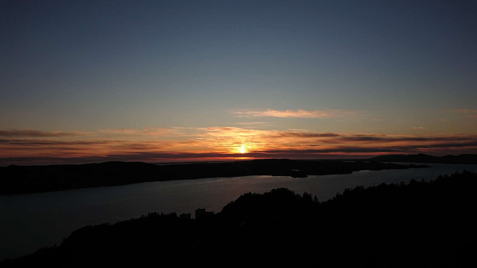
 Started out as a short local evening hike to Blåvang and Lundekvam , but got significantly longer due what turned out to be a spectacular sunset!
Tyely
- Datum:
- 27.04.2020
- Tourcharakter:
- Bergtour
- Tourlänge:
- 3:12h
- Entfernung:
- 12,5km
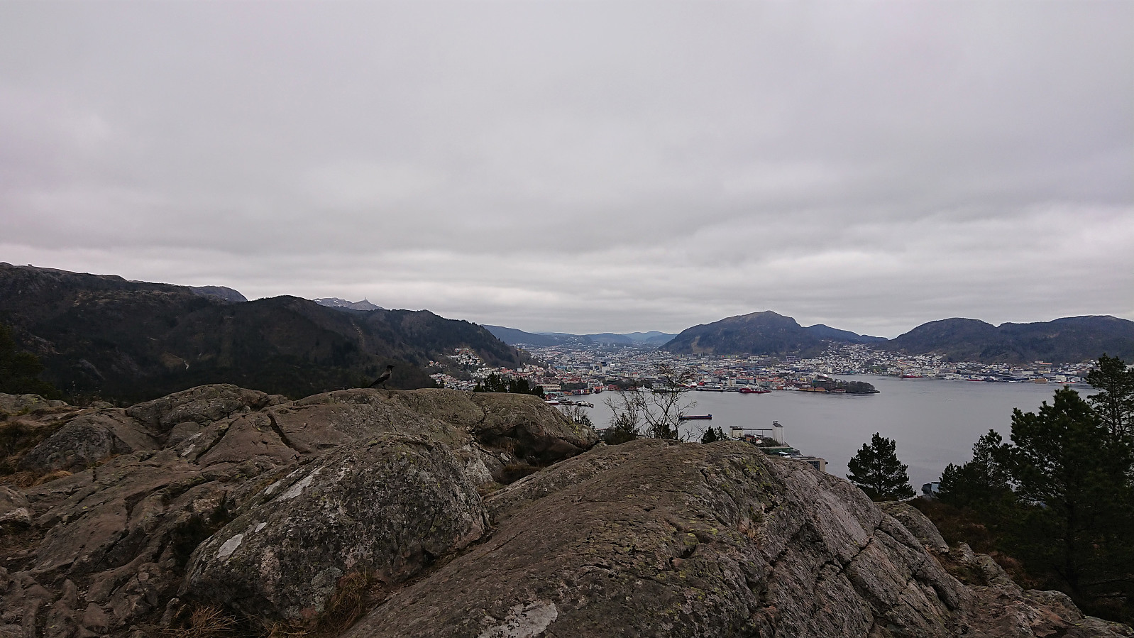
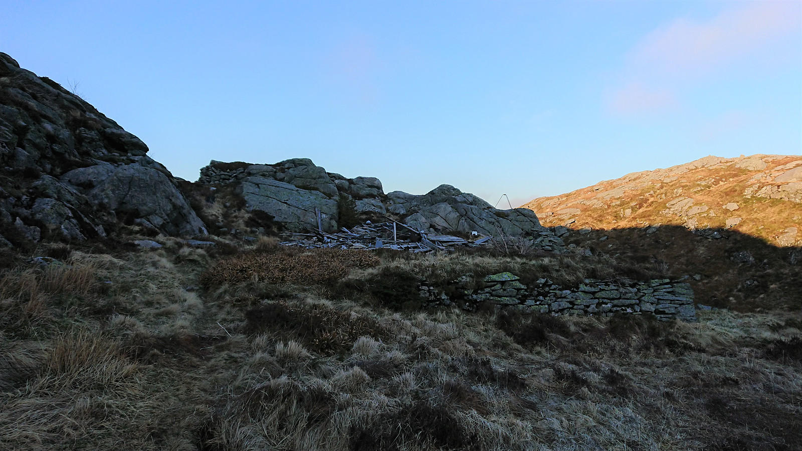
 Local evenig hike with the goal to visit Tyely (ruin) . Rather limited views from the cabin itself, but spectacular views from the small hills on either side.
Ørneberget and Rognåsen
- Datum:
- 26.04.2020
- Tourcharakter:
- Bergtour
- Tourlänge:
- 1:41h
- Entfernung:
- 5,9km
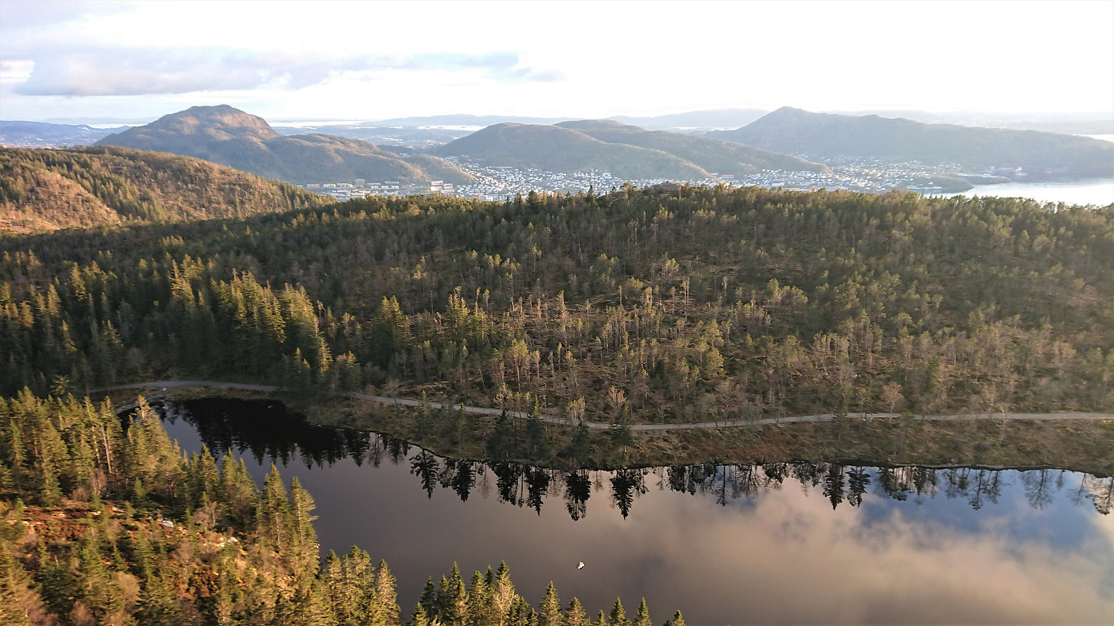
 Only a short local hike today after yesterday's long cycling trip to Halhjem.
Cycling: Halhjem
- Datum:
- 25.04.2020
- Tourcharakter:
- Fahrradtour Straße
- Tourlänge:
- 6:34h
- Entfernung:
- 90,9km
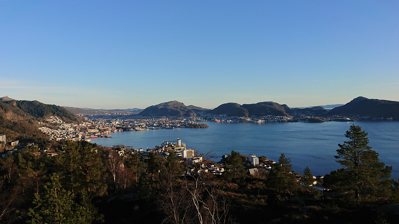
 Trial run to check the feasibility of cycling to Halhjem instead of taking the bus, with the goal being to use the bike to reach new peaks when hiking at Tysnes. At Halhjem I was almost tempted by the ferry to Våge arriving just as I was starting my journey home, but there was realistically no time for going to Tysnes today. And in the end the trip home was tough enough on its own. Overall, a very nice bike ride with excellent views along the way, and where almost all of the time was spent on walking/cycling paths or on roads with very limited traffic.
Trollborg, Urdalstua, Balaklava, Ly and Hyttely
- Datum:
- 24.04.2020
- Tourcharakter:
- Bergtour
- Tourlänge:
- 3:45h
- Entfernung:
- 14,3km
 The search for old cabins at Sandviksfjellet continues! After a detailed search of an old aerial photo from 1951, I thought I had found Trollborg . The spot was easily located, and there were indeed some ruins to be found, but it turned out not to be Trollborg.
I therefore explored the surrounding area in search for other ruins, but came up empty handed. Later, after looking through "Bergensernes Fjellverden II", I found a picture of Trollborg (page 54), that looked identical to the ruins southeast of the summit of Sandviksfjellet. The ruins I had found are simply listed as "Brakke", i.e. barracks.
Next on my list were three cabins at Ravnehaugen: Urdalstua , Balaklava and Ly . The two first are located in the small valley southeast of Breidablikk , while Ly is located pretty much in between Breidablikk and Utsikten . Note that >>>
The search for old cabins at Sandviksfjellet continues! After a detailed search of an old aerial photo from 1951, I thought I had found Trollborg . The spot was easily located, and there were indeed some ruins to be found, but it turned out not to be Trollborg.
I therefore explored the surrounding area in search for other ruins, but came up empty handed. Later, after looking through "Bergensernes Fjellverden II", I found a picture of Trollborg (page 54), that looked identical to the ruins southeast of the summit of Sandviksfjellet. The ruins I had found are simply listed as "Brakke", i.e. barracks.
Next on my list were three cabins at Ravnehaugen: Urdalstua , Balaklava and Ly . The two first are located in the small valley southeast of Breidablikk , while Ly is located pretty much in between Breidablikk and Utsikten . Note that >>>
Fjellstova, Nordlys and Hyttely
- Datum:
- 23.04.2020
- Tourcharakter:
- Bergtour
- Tourlänge:
- 2:53h
- Entfernung:
- 12,7km
 Another local evening hike. This time with the goal to visit the ruins of Nordlys .
Cycling: Kalandsvatnet
- Datum:
- 22.04.2020
- Tourcharakter:
- Fahrradtour Straße
- Tourlänge:
- 3:39h
- Entfernung:
- 57,3km
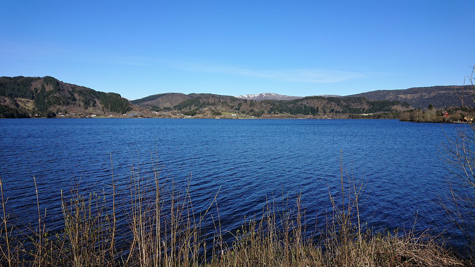 Cycling trip around Kalandsvatnet and returning via Rådalen. Highly recommended!
Sandviksfjellet: Trollborg and Fjeldborg
- Datum:
- 21.04.2020
- Tourcharakter:
- Bergtour
- Tourlänge:
- 3:09h
- Entfernung:
- 14,9km
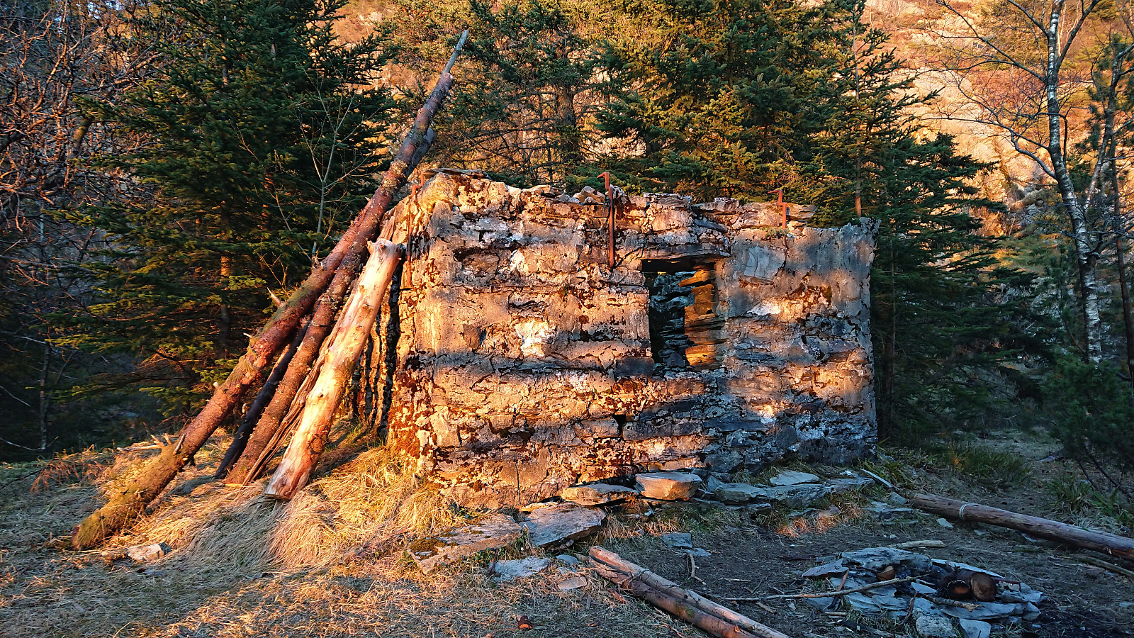 The first goal of this local evening hike was to locate the remains of Trollborg south of Sandviksfjellet that Kjell51 (Kjell Øijorden) came across during his recent hike , which turned out to be easier than expected as it was clearly visible from the trail. I must have passed it many times even without noticing it.
When taking a closer look at the cabin, I also came across a trail heading south that I had not seen before, which I of course had to explore. The trail was a bit weak at times, but was overall not too difficult to follow. It turned relatively steep towards the end, before, as expected, connecting with the gravel road in Skredderdalen.
But while the discovery of the trail had been a success, it today ended up being a rather long detour, given that the second goal of the evening was to visit Fjeldborg , so there was nothing to do but head back up Skredderdalen.
The first goal of this local evening hike was to locate the remains of Trollborg south of Sandviksfjellet that Kjell51 (Kjell Øijorden) came across during his recent hike , which turned out to be easier than expected as it was clearly visible from the trail. I must have passed it many times even without noticing it.
When taking a closer look at the cabin, I also came across a trail heading south that I had not seen before, which I of course had to explore. The trail was a bit weak at times, but was overall not too difficult to follow. It turned relatively steep towards the end, before, as expected, connecting with the gravel road in Skredderdalen.
But while the discovery of the trail had been a success, it today ended up being a rather long detour, given that the second goal of the evening was to visit Fjeldborg , so there was nothing to do but head back up Skredderdalen.
Ørneberget and Rognåsen
- Datum:
- 20.04.2020
- Tourcharakter:
- Bergtour
- Tourlänge:
- 1:11h
- Entfernung:
- 5,7km
 Short local evening hike.
