Archiv - Nach Datum
Archiv - Nach Aktivität
-
Andere Tour (3)
- Kayaking (3)
-
Fahrradtour (111)
- Fahrradtour Straße (86)
- Fahrradtour gemischt (25)
-
Fahrzeugtour (9)
- Autotour (9)
-
Fußtour (1897)
- Bergtour (1120)
- Jogging (1)
- Spaziergang (60)
- Wanderung (716)
-
Skitour (116)
- Langlauf (47)
- Tourenskilauf (69)
Gesammelte Listen
-
Utvalgte topper og turmål i Bergen
(349/351)
 99%
99% -
Alle topper i Bergen
(393/400)
98%
-
Voss ≥ 100m pf.
(96/98)
97%
-
Opptur Hordaland
(144/159)
90%
-
Stasjoner på Bergensbanen
(33/40)
82%
-
Ulvik ≥ 100m pf.
(30/38)
78%
-
Hordaland ≥ 100m pf.
(624/863)
72%
-
Mjølfjell PF > 100m
(21/31)
67%
-
Jondal ≥ 100m pf.
(15/23)
65%
-
Dagsturhyttene i Vestland
(36/61)
59%
-
Sunnhordland PF >= 100m
(105/186)
56%
-
Hordaland: Hardanger PF>=100m
(196/359)
54%
-
DNT-hytter i Hordaland
(23/45)
51%
-
Kvinnherad ≥ 100m pf.
(40/79)
50%
-
Eidfjord ≥ 100m pf.
(13/42)
30%
-
Sogndal ≥ 100m pf.
(23/81)
28%
-
Gulen ≥ 100m pf.
(15/54)
27%
-
Vik i Sogn ≥ 100m pf.
(10/46)
21%
-
Sogn - Sør for Sognefjorden PF>=100m
(31/159)
19%
-
DNT-hytter i Sogn og Fjordane
(8/47)
17%

Ustedalsfjorden
- Datum:
- 14.09.2019
- Tourcharakter:
- Wanderung
- Tourlänge:
- 2:23h
- Entfernung:
- 11,7km
 Walk around Ustedalsfjorden (and Veslefjorden) while spending the weekend at Geilo to celebrate my mother's birthday. I followed the very nice gravel road for close to the entire hike, except for an attempted shortcut across the islands in between Ustedalsfjorden and Veslefjorden, which I ended up abandoning due to the second bridge being halfway under water.
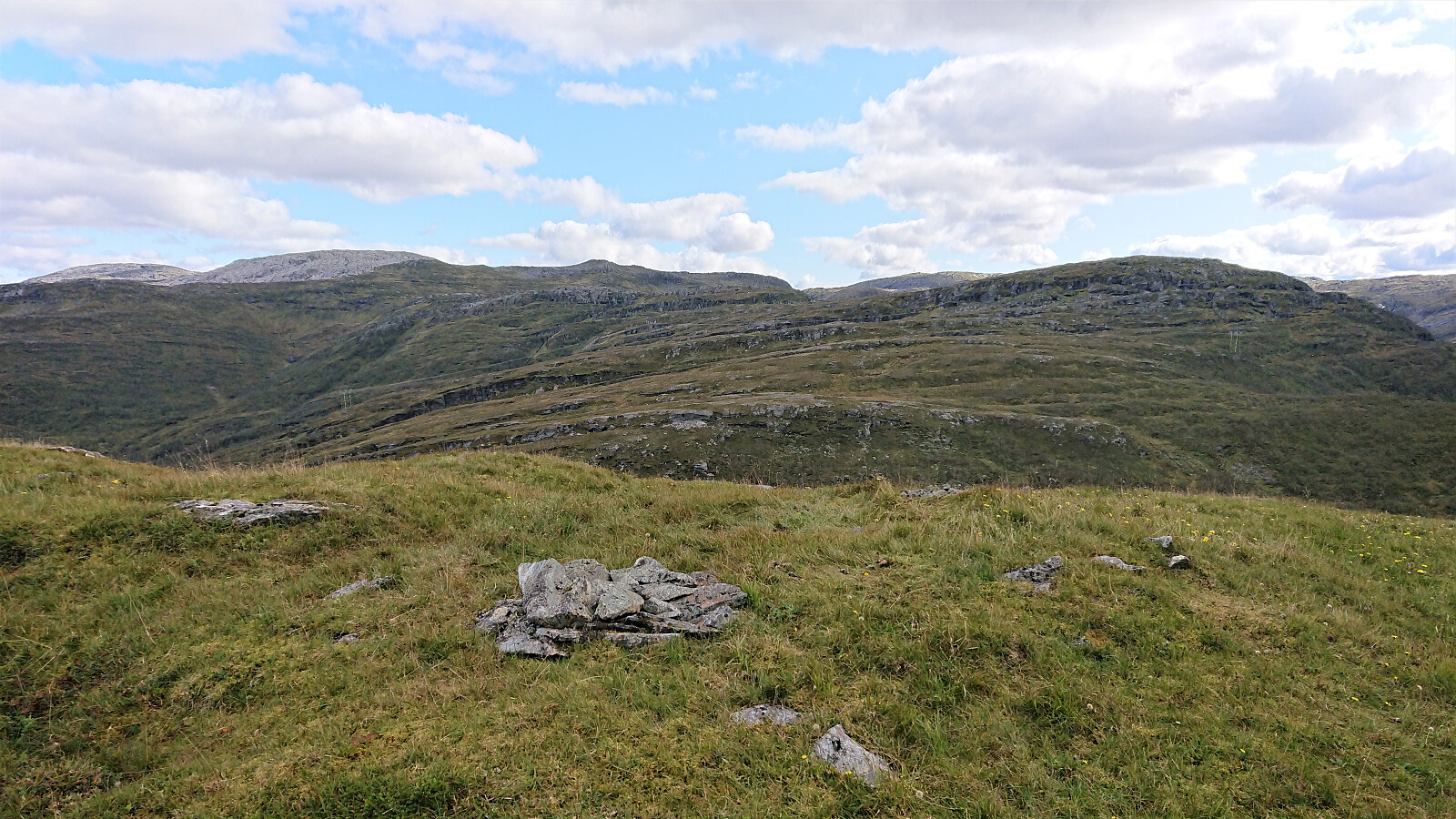
Kvitafjellet, Bakkaheii, Stølshorgi and Jonshorgi
- Datum:
- 08.09.2019
- Tourcharakter:
- Bergtour
- Tourlänge:
- 7:50h
- Entfernung:
- 19,3km
 Warning: This hike includes a short steep off-trail descent into Tuftedalen that is most likely not to everyone's liking. Consider the track with care!
I started by taking the train to Bolstadøyri where I was picked up by a colleague coming by car. This had the benefit that the surprisingly steep and narrow gravel road up to Rasdalen was more quickly covered compared to my initial plan of walking up from the train station. At Rasdalsvatnet, we were asked by a local farmer to pass through a gate and park at a second parking lot 100 meters up the road, as a helicopter pick-up was planned later that same day. The first parking lot is probably the one generally recommended for visitors though.
We followed the marked trail along the river, crossing at Røyrbakken, and soon arrived at Vibotnen. The >>>
Warning: This hike includes a short steep off-trail descent into Tuftedalen that is most likely not to everyone's liking. Consider the track with care!
I started by taking the train to Bolstadøyri where I was picked up by a colleague coming by car. This had the benefit that the surprisingly steep and narrow gravel road up to Rasdalen was more quickly covered compared to my initial plan of walking up from the train station. At Rasdalsvatnet, we were asked by a local farmer to pass through a gate and park at a second parking lot 100 meters up the road, as a helicopter pick-up was planned later that same day. The first parking lot is probably the one generally recommended for visitors though.
We followed the marked trail along the river, crossing at Røyrbakken, and soon arrived at Vibotnen. The >>>
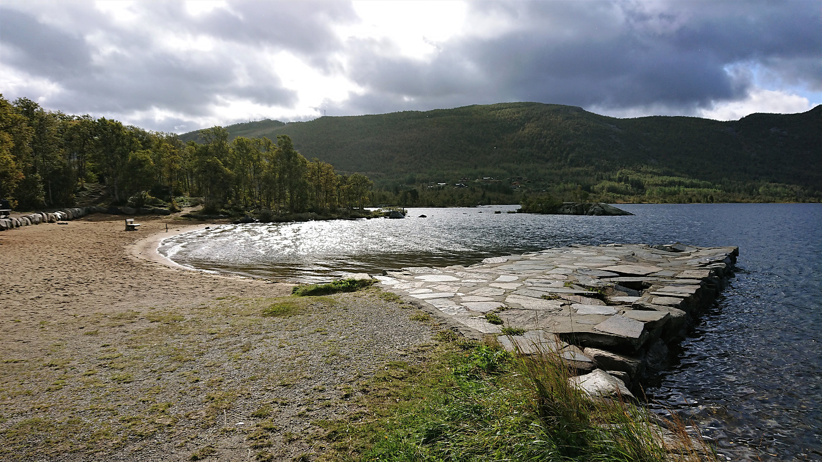
Helleneset, Ørneberget and Hellen festning
- Datum:
- 07.09.2019
- Tourcharakter:
- Bergtour
- Tourlänge:
- 2:08h
- Entfernung:
- 10,3km
 Local hike in excellent September weather.
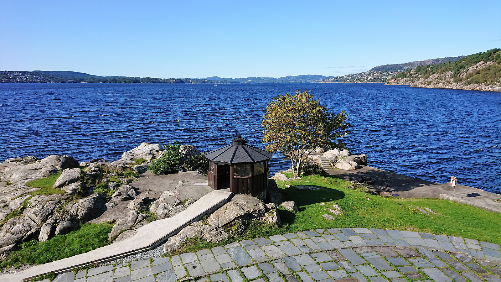
Across Hellen festning
- Datum:
- 02.09.2019
- Tourcharakter:
- Wanderung
- Tourlänge:
- 0:37h
- Entfernung:
- 3,6km
 Short local hike after work.
Veten from Grøvlesvingen
- Datum:
- 01.09.2019
- Tourcharakter:
- Bergtour
- Tourlänge:
- 2:36h
- Entfernung:
- 9,9km
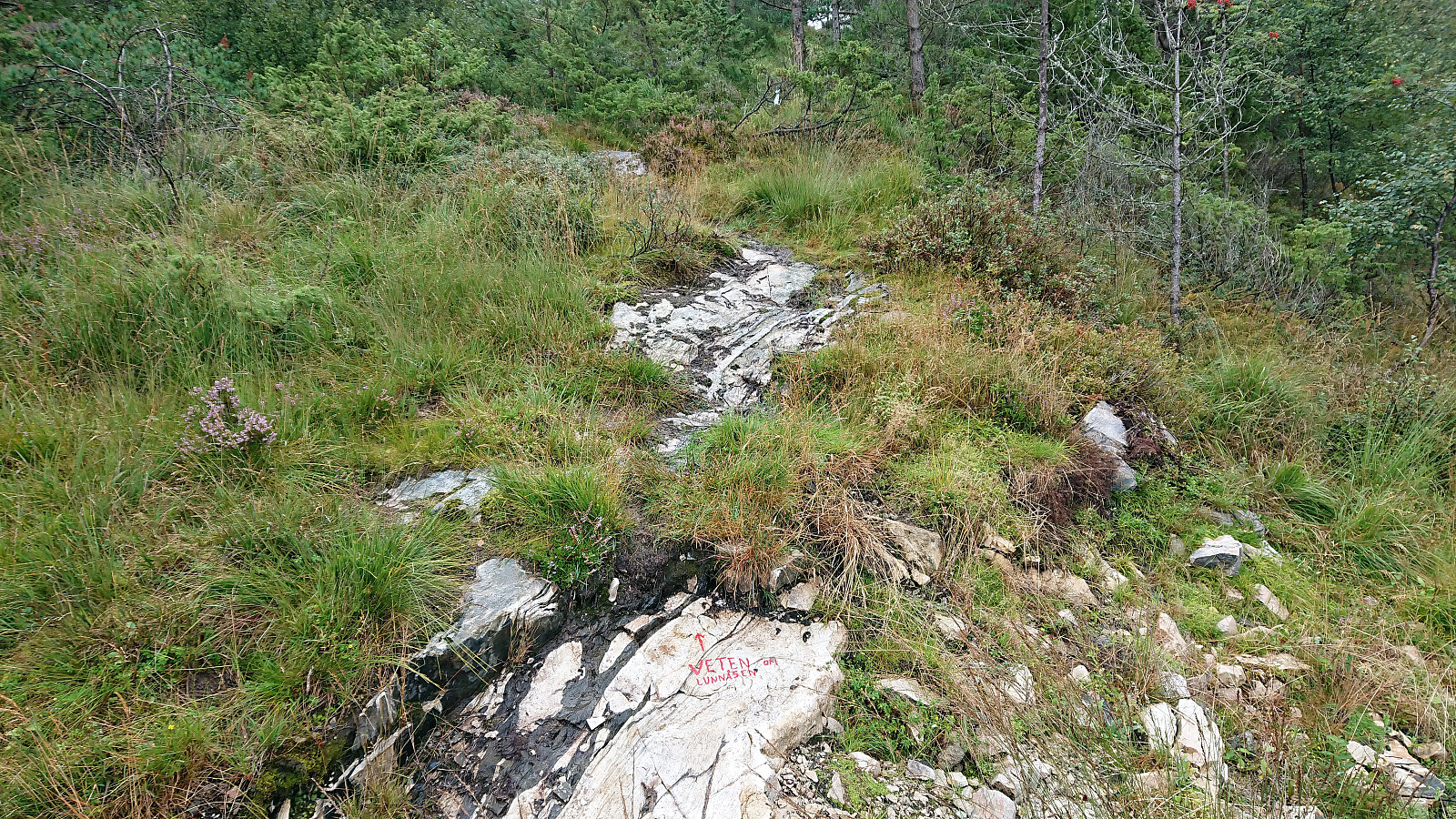 Another revisit of Veten i Åsane , but this time starting from Grøvlesvingen. Just as I was getting off the bus it started raining heavily, which made it more difficult to confer with the GPS. I still managed to get to the gravel road on the other side of the main road, but was here surprised to find a "no entry" sign. I therefore backtracked a bit and instead followed a weak trail that would hopefully take me around the construction site.
This trail however quickly disappeared and soon I was back on the gravel road anyway, taking me northwest and thus away from the summit. I did meet a couple of people coming the opposite way though, so maybe the "no entry" sign is ignored by the locals on Sundays?
Later the road finally turned southeast towards the summit. I did not stay on it for very >>>
Another revisit of Veten i Åsane , but this time starting from Grøvlesvingen. Just as I was getting off the bus it started raining heavily, which made it more difficult to confer with the GPS. I still managed to get to the gravel road on the other side of the main road, but was here surprised to find a "no entry" sign. I therefore backtracked a bit and instead followed a weak trail that would hopefully take me around the construction site.
This trail however quickly disappeared and soon I was back on the gravel road anyway, taking me northwest and thus away from the summit. I did meet a couple of people coming the opposite way though, so maybe the "no entry" sign is ignored by the locals on Sundays?
Later the road finally turned southeast towards the summit. I did not stay on it for very >>>
