Archiv - Nach Datum
Archiv - Nach Aktivität
-
Andere Tour (3)
- Kayaking (3)
-
Fahrradtour (111)
- Fahrradtour Straße (86)
- Fahrradtour gemischt (25)
-
Fahrzeugtour (9)
- Autotour (9)
-
Fußtour (1897)
- Bergtour (1120)
- Jogging (1)
- Spaziergang (60)
- Wanderung (716)
-
Skitour (116)
- Langlauf (47)
- Tourenskilauf (69)
Gesammelte Listen
-
Utvalgte topper og turmål i Bergen
(349/351)
 99%
99% -
Alle topper i Bergen
(393/400)
98%
-
Voss ≥ 100m pf.
(96/98)
97%
-
Opptur Hordaland
(144/159)
90%
-
Stasjoner på Bergensbanen
(33/40)
82%
-
Ulvik ≥ 100m pf.
(30/38)
78%
-
Hordaland ≥ 100m pf.
(624/863)
72%
-
Mjølfjell PF > 100m
(21/31)
67%
-
Jondal ≥ 100m pf.
(15/23)
65%
-
Dagsturhyttene i Vestland
(36/61)
59%
-
Sunnhordland PF >= 100m
(105/186)
56%
-
Hordaland: Hardanger PF>=100m
(196/359)
54%
-
DNT-hytter i Hordaland
(23/45)
51%
-
Kvinnherad ≥ 100m pf.
(40/79)
50%
-
Eidfjord ≥ 100m pf.
(13/42)
30%
-
Sogndal ≥ 100m pf.
(23/81)
28%
-
Gulen ≥ 100m pf.
(15/54)
27%
-
Vik i Sogn ≥ 100m pf.
(10/46)
21%
-
Sogn - Sør for Sognefjorden PF>=100m
(31/159)
19%
-
DNT-hytter i Sogn og Fjordane
(8/47)
17%

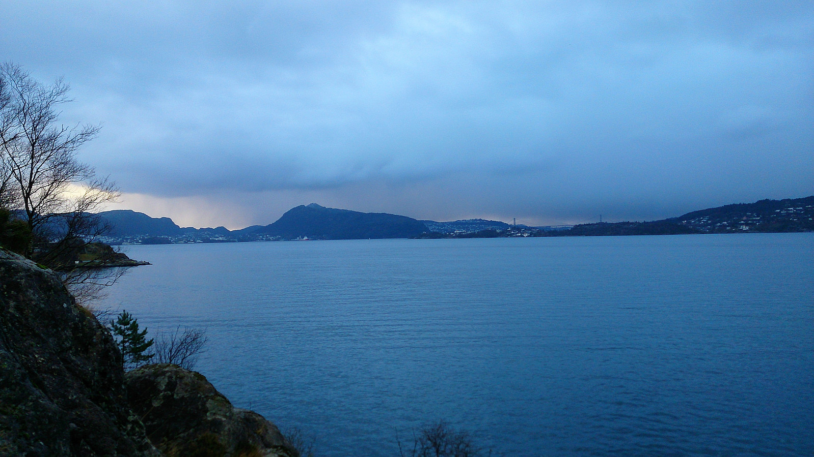
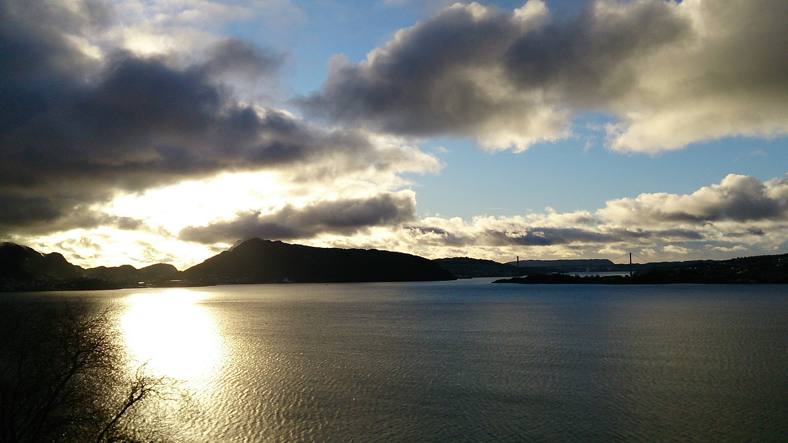
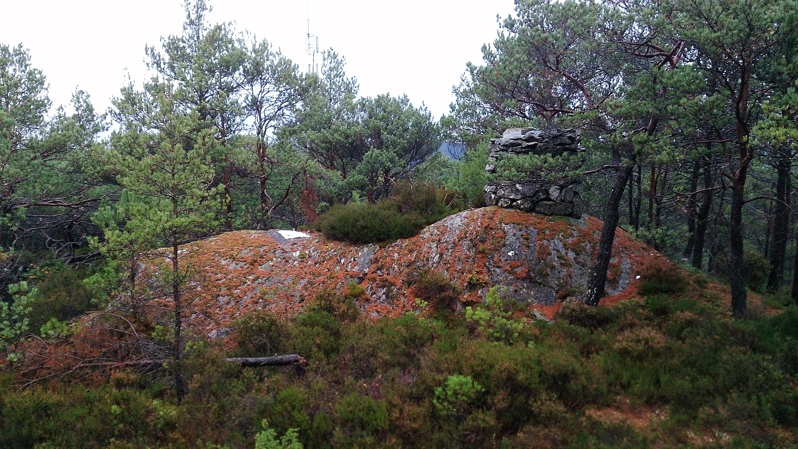
Ørneberget, Rognåsen and Hellefjellet
- Datum:
- 09.12.2017
- Tourcharakter:
- Bergtour
- Tourlänge:
- 2:19h
- Entfernung:
- 6,5km
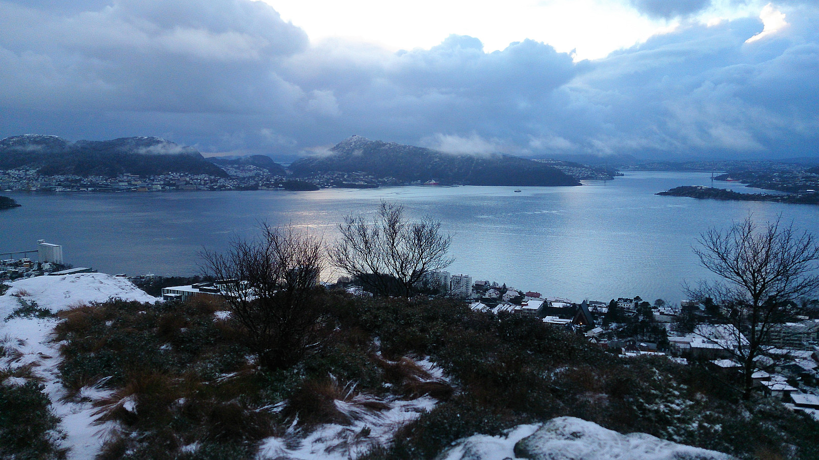 Short local hike across Ørneberget and Rognåsen before passing by Hellefjellet on the way back to Lønborg.
Midtneset and Hellen festning
- Datum:
- 03.12.2017
- Tourcharakter:
- Wanderung
- Tourlänge:
- 1:11h
- Entfernung:
- 5,2km
 Short local hike down to Midtneset and then across Hellen festning.
Sandviksbatteriet (the steep route) and Håmanen
- Datum:
- 02.12.2017
- Tourcharakter:
- Bergtour
- Tourlänge:
- 2:02h
- Entfernung:
- 5,8km
 Given that my previous attempt to follow the steep route from Fjellveien to Sandviksbatteriet went a bit wrong (see Sandviksbatteriet - the steep route with a detour ), I decided to retrace my steps to see where I made the wrong turn.
Once again I started from the bus stop in Munkebotn and followed the (initially) nice trail in the direction of Sandviksbatteriet, but at the last bend in the trail I now turned left towards Sandviksbatteriet instead of continuing the climb upwards. This route also included a small bit of very light climbing (although a lot less than the previous hike) and the trail is not very clear until getting close to the small concrete tower (which is more or less at the same level as Sandviksbatteriet). From there it is straightforward to arrive at Sandviksbatteriet.
No views today due to rain and low-hanging clouds, so I quickly continued >>>
Given that my previous attempt to follow the steep route from Fjellveien to Sandviksbatteriet went a bit wrong (see Sandviksbatteriet - the steep route with a detour ), I decided to retrace my steps to see where I made the wrong turn.
Once again I started from the bus stop in Munkebotn and followed the (initially) nice trail in the direction of Sandviksbatteriet, but at the last bend in the trail I now turned left towards Sandviksbatteriet instead of continuing the climb upwards. This route also included a small bit of very light climbing (although a lot less than the previous hike) and the trail is not very clear until getting close to the small concrete tower (which is more or less at the same level as Sandviksbatteriet). From there it is straightforward to arrive at Sandviksbatteriet.
No views today due to rain and low-hanging clouds, so I quickly continued >>>
Slettafjellet, Nukane, Storsåta and Raunfjellet
- Datum:
- 30.11.2017
- Tourcharakter:
- Bergtour
- Tourlänge:
- 3:39h
- Entfernung:
- 12,7km
 Started from the bus stop in Ervikveien (bus stop called "Øvre Ervik sør") and from there crossed the bridge to Glasskaret, which I then followed all the way to the top, before taking the (unmarked) trail towards Slettafjellet .
After a quick visit of Slettafjellet I continued north to Nukane , before crossing Storsåta on the way down to Raunfjellet .
Usually the trail here is quite good, but today it was covered by snow and ice. Hence the GPS track does not follow the trail very closely. But when turning west towards Raunfjellet I came across a single pair of footprints in the snow, making it easier to follow the otherwise hidden trail.
From Raunfjellet I continued down to Vinddalsveien, passing by Setervatnet on the way. The hike was then concluded by walking along the roads back to Lønborg.
Started from the bus stop in Ervikveien (bus stop called "Øvre Ervik sør") and from there crossed the bridge to Glasskaret, which I then followed all the way to the top, before taking the (unmarked) trail towards Slettafjellet .
After a quick visit of Slettafjellet I continued north to Nukane , before crossing Storsåta on the way down to Raunfjellet .
Usually the trail here is quite good, but today it was covered by snow and ice. Hence the GPS track does not follow the trail very closely. But when turning west towards Raunfjellet I came across a single pair of footprints in the snow, making it easier to follow the otherwise hidden trail.
From Raunfjellet I continued down to Vinddalsveien, passing by Setervatnet on the way. The hike was then concluded by walking along the roads back to Lønborg.
Down to the sea and then across Hellen festning
- Datum:
- 26.11.2017
- Tourcharakter:
- Wanderung
- Tourlänge:
- 0:38h
- Entfernung:
- 3,6km
 Short local hike due to rain and fog in the morning and other plans in the afternoon.
Tirevollsfjellet from Raknesvågen
- Datum:
- 19.11.2017
- Tourcharakter:
- Bergtour
- Tourlänge:
- 1:47h
- Entfernung:
- 5,7km
 Tirevollsfjellet
After last weekend's failure to locate the trail(s) to Tirevollsfjellet (see Trying to find a shortcut to Tirevollsfjellet ), I had to give it another go. This time starting from Raknesvågen, which we arrived at by car. The trailhead included a sign with the map of the marked trail to Tirevollfjellet, i.e. without the 's'.
We started out southeast along a tractor road, which later turned into a trail, passing by Tirevollsgarden before turning northwest towards the summit. Excellent views from the summit, especially towards Osterfjorden and beyond. A large cairn and a summit register was also available.
After a short stay at the summit, we continued northwest along the trail to Raknesvegen. When almost at the road, the trail more or less ended up in someone's garden, and we thought we had taken a wrong turn somewhere. But we shortly came >>>
Tirevollsfjellet
After last weekend's failure to locate the trail(s) to Tirevollsfjellet (see Trying to find a shortcut to Tirevollsfjellet ), I had to give it another go. This time starting from Raknesvågen, which we arrived at by car. The trailhead included a sign with the map of the marked trail to Tirevollfjellet, i.e. without the 's'.
We started out southeast along a tractor road, which later turned into a trail, passing by Tirevollsgarden before turning northwest towards the summit. Excellent views from the summit, especially towards Osterfjorden and beyond. A large cairn and a summit register was also available.
After a short stay at the summit, we continued northwest along the trail to Raknesvegen. When almost at the road, the trail more or less ended up in someone's garden, and we thought we had taken a wrong turn somewhere. But we shortly came >>>
Across Hellen festning
- Datum:
- 18.11.2017
- Tourcharakter:
- Wanderung
- Tourlänge:
- 0:33h
- Entfernung:
- 3,1km
 Short local hike across Hellen festing in the rain.
Trying to find a shortcut to Tirevollsfjellet
- Datum:
- 12.11.2017
- Tourcharakter:
- Bergtour
- Tourlänge:
- 4:05h
- Entfernung:
- 13,7km
 The plan: Tirevollsfjellet
After my recent visit to Burkelandsfjellet I had been looking for a way to get to the neighboring summit of Tirevollsfjellet , with the added constraint that it had to be possible to start from Valestrand and make it back to the ferry before it got too dark (which is quite early in mid-November). And after some detailed studying of the map I thought I'd found a potential route.
The plan was to utilize the valley called Smålandsskaret in between Burkelandsfjellet and Smålandsfjellet , and from the top of the valley follow the trail, and later tractor road, indicated on the map, which would take me down to Raknesvegen. From there it should only be a short distance to the trailhead at Børtveit. After reaching the top of Tirevollsfjellet I could then easily follow the same route back.
What actually happened
So that was >>>
The plan: Tirevollsfjellet
After my recent visit to Burkelandsfjellet I had been looking for a way to get to the neighboring summit of Tirevollsfjellet , with the added constraint that it had to be possible to start from Valestrand and make it back to the ferry before it got too dark (which is quite early in mid-November). And after some detailed studying of the map I thought I'd found a potential route.
The plan was to utilize the valley called Smålandsskaret in between Burkelandsfjellet and Smålandsfjellet , and from the top of the valley follow the trail, and later tractor road, indicated on the map, which would take me down to Raknesvegen. From there it should only be a short distance to the trailhead at Børtveit. After reaching the top of Tirevollsfjellet I could then easily follow the same route back.
What actually happened
So that was >>>
Bjørnaåsen, Vassliåsen and Stordalsåsen
- Datum:
- 11.11.2017
- Tourcharakter:
- Bergtour
- Tourlänge:
- 1:53h
- Entfernung:
- 6,3km
 Bjørnaåsen
Started by taking the bus to Haljemsmarka snuplass and from there walking along the road up to the trailhead for Bjørnaåsen in between Haljemsmarka 296 and 298. The trailhead was not marked (by name), but it did contain several wooden sculptures (see picture).
After reading previous trip reports on PB my expectations for Bjørnaåsen were not very high, but there was actually a clear, although very wet, trail that could be followed almost all the way to the summit.
The trail was rather weak at times, and did not seem to pass by the summit, but it was still an improvement compared to having no trail. The summit provided close to no views due to all the trees, and I did not stay long before returning more or less the same way back down to the road.
Vassliåsen
I doubled back to the bus stop and >>>
Bjørnaåsen
Started by taking the bus to Haljemsmarka snuplass and from there walking along the road up to the trailhead for Bjørnaåsen in between Haljemsmarka 296 and 298. The trailhead was not marked (by name), but it did contain several wooden sculptures (see picture).
After reading previous trip reports on PB my expectations for Bjørnaåsen were not very high, but there was actually a clear, although very wet, trail that could be followed almost all the way to the summit.
The trail was rather weak at times, and did not seem to pass by the summit, but it was still an improvement compared to having no trail. The summit provided close to no views due to all the trees, and I did not stay long before returning more or less the same way back down to the road.
Vassliåsen
I doubled back to the bus stop and >>>
Sandviksbatteriet - the steep route with a detour
- Datum:
- 06.11.2017
- Tourcharakter:
- Bergtour
- Tourlänge:
- 2:53h
- Entfernung:
- 8,1km
 Sandviksbatteriet
Warning: While this hike starts out easy, it also involves some quite steep sections which requires light climbing in areas where it is possible to get stuck if taking the wrong route. In other words, proceed with caution.
Started from the bus stop at Munkebotn and from there walked up to Fjellveien, which I immediately crossed and started the planned ascent towards Sandviksbatteriet . The trail/road starts our very nicely as it winds its way up the mountain side. When getting close to Sandviksbatteriet the trail however more or less disappears and one is left climbing in-between the rocks.
On a previous visit (before I started recording my hikes in PB) I thought I had ended up going west towards Sandviksbatteriet too early. This time I therefore decided to rather continue the ascent further on >>>
Sandviksbatteriet
Warning: While this hike starts out easy, it also involves some quite steep sections which requires light climbing in areas where it is possible to get stuck if taking the wrong route. In other words, proceed with caution.
Started from the bus stop at Munkebotn and from there walked up to Fjellveien, which I immediately crossed and started the planned ascent towards Sandviksbatteriet . The trail/road starts our very nicely as it winds its way up the mountain side. When getting close to Sandviksbatteriet the trail however more or less disappears and one is left climbing in-between the rocks.
On a previous visit (before I started recording my hikes in PB) I thought I had ended up going west towards Sandviksbatteriet too early. This time I therefore decided to rather continue the ascent further on >>>
