Archiv - Nach Datum
Archiv - Nach Aktivität
-
Andere Tour (3)
- Kayaking (3)
-
Fahrradtour (108)
- Fahrradtour Straße (83)
- Fahrradtour gemischt (25)
-
Fahrzeugtour (9)
- Autotour (9)
-
Fußtour (1836)
- Bergtour (1088)
- Jogging (1)
- Spaziergang (55)
- Wanderung (692)
-
Skitour (112)
- Langlauf (46)
- Tourenskilauf (66)
Gesammelte Listen
- Utvalgte topper og turmål i Bergen
- Alle topper i Bergen
- Voss ≥ 100m pf.
- Opptur Hordaland
- Stasjoner på Bergensbanen
- Ulvik ≥ 100m pf.
- Hordaland ≥ 100m pf.
- Mjølfjell PF > 100m
- Jondal ≥ 100m pf.
- Sunnhordland PF >= 100m
- Dagsturhyttene i Vestland
- Hordaland: Hardanger PF>=100m
- DNT-hytter i Hordaland
- Kvinnherad ≥ 100m pf.
- Sogndal ≥ 100m pf.
- Vik i Sogn ≥ 100m pf.
- Gulen ≥ 100m pf.
- DNT-hytter i Sogn og Fjordane
- Eidfjord ≥ 100m pf.
- Sogn - Sør for Sognefjorden PF>=100m
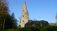
Burg Dagstuhl
- Datum:
- 16.10.2017
- Tourcharakter:
- Spaziergang
- Tourlänge:
- 0:15h
Høgelikampen, Vardafjellet and Ulvenfjellet
- Datum:
- 14.10.2017
- Tourcharakter:
- Bergtour
- Tourlänge:
- 5:24h
- Entfernung:
- 21,0km
 Høgelikampen
Started by taking the bus to Ulvenskiftet and walking southwest along the roads until reaching Hovland. This was close to 5 km and took around 50 minutes. The start of the trail to Høgelikampen was clearly marked and visible from the main road.
It started out as a newly improved gravel road which later turned into an older, but still quite good, tractor road. Note that my route is perhaps not the quickest one, as it did include a small descent before starting the final climb. As I got closer to the summit I also visited a spot with a very nice southern view, which I added as a new PB element.
The summit itself provided very limited views, but the views from where the sign and the visitor register is located provided nice views north towards Lysefjorden and Krokeide.
Vardafjellet
From Høgelikampen >>>
Vassberget, Kvamsfjellet, Svarthamrane and Tveitavarden
- Datum:
- 08.10.2017
- Tourcharakter:
- Bergtour
- Tourlänge:
- 4:17h
- Entfernung:
- 11,5km
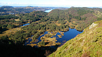 Vassberget
Started by taking the bus to Øvre Isdalen (to the bus stop called Åse) and from there following the unmarked gravel road northeast in the valley between Kvamsfjellet and Vassberget . My original plan was to take the trail that was supposed to start right after the small building on the right side of the road shortly after leaving the main road, but I did not manage to locate this trail, and therefore instead continued to the main trail further up the gravel road.
The trailhead was marked, but the quality of the trail was initially very wet and muddy. This improved slightly as the trail started climbing up the mountain, but there were still with lots of muddy areas, which would turn out to be the theme of the day... The views from the summit were excellent though, and I also continued a bit beyond the summit, >>>
Fjellhytten
- Datum:
- 07.10.2017
- Tourcharakter:
- Wanderung
 Started from Vetrlidsallmenningen and followed the roads to Skomakerdiket were we took the shortcut to Søre Midtfjellet and Fjellhytten . From Fjellhytten we passed Brushytten on the way down to Munkebotn, before finally ending up in Lønborg.
No GPS-tracking as I for once forgot to start the tracking, probably due to hiking in very familiar territory and thus not really needing the GPS. ;)
Hellen festning (Peakbook vs. Norgeskart - Part 1)
- Datum:
- 04.10.2017
- Tourcharakter:
- Wanderung
- Entfernung:
- 3,2km
 Short hike to test the use of the Peakbook app for GPS tracking. Specifically, to compare the altitude measurements of the two apps.
For a comparison against a very similar hike using the Norgeskart app see: Hellen Festning .
Peakbook app settings:
geoid correction turned on tracking accuracy set to maximum movement recognition turned off Norgeskart app settings:
update interval set to 2 seconds minimum distance between updates set to 2 meters height correction and smoothing of tracks turned on As a general observation, the results from the Peakbook app seems to be more accurate when it comes to altitude, resulting in a more correct measurement of the total number of vertical meters (261 for the Norgeskart app vs. 106 for the Peakbook app). However, the GPS tracking from the Norgeskart app has significantly >>>
Iseggene from Valestrand
- Datum:
- 01.10.2017
- Tourcharakter:
- Bergtour
- Tourlänge:
- 3:06h
- Entfernung:
- 10,8km
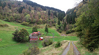 Locating the trailhead
Started by taking the bus and ferry to Valestrand and from there following Hamrenesvegen northwest in search for the trailhead indicated on the map. However, upon reaching the location of where the trail ought to start, I could not initially see any clear trails, and had to search for a bit to finally find a potential trailhead. The get to the trailhead I had to cross a small field, and there were no indications regarding where to cross. In other words, one has to be a bit lucky to spot the start of the trail. The trick is to look for the small ridge on the other side of the field, as the trail starts more or less at the northwestern end of this ridge. See the GPS track for details.
Dalsnipa and Iseggene
As soon as the starting point was found, the trail (sometimes marked >>>
Cycling: Eidsvågsneset Roundtrip
- Datum:
- 25.09.2017
- Tourcharakter:
- Fahrradtour Straße
- Tourlänge:
- 1:09h
- Entfernung:
- 15,3km
 Short local bike ride around Eidsvågsneset, with a quick visit to Sandviksbatteriet . Note that the steep and bumpy gravel road up to Sandviksbatteriet is not really made for cycling though. ;)
Baugtveit Roundtrip
- Datum:
- 24.09.2017
- Tourcharakter:
- Bergtour
- Tourlänge:
- 3:03h
- Entfernung:
- 8,9km
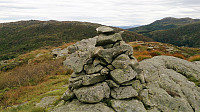 Started by taking the bus to Støbotn and walking up to Baugtveit and the trail towards Nordgardsfjellet . I then followed the standard trail to Nordgardsfjellet, Tellevikafjellet and Høgstefjellet . On the way down from Høgstefjellet, I took a quick detour to the summit of Midtfjellet , before completing the circle and arriving at Baugtveit, from where I walked back to Støbotn and the bus back towards the city center. Overall, the trail was easy to follow, but the quality was varied, with several wet and muddy sections. But all in all, a nice hike that can be recommended.
Nukane, Storsåta, Øst for Stangelifjellet and Rundemanen
- Datum:
- 23.09.2017
- Tourcharakter:
- Bergtour
- Tourlänge:
- 5:33h
- Entfernung:
- 19,5km
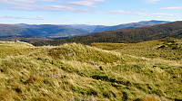 Started by taking the bus to Hesthaugen and from there walked up to Kolåsen to locate the trailhead. (Note the sharp left in between the two buildings that is needed to find the sign and the trailhead. See GPS track for details.) I then followed the trail southeast across Nukane , Storsåta and Stangelifjellet to arrive at Vikinghytten , before turning west to Rundemanen .
From Rundemanen I headed northwest, passing by Ankerhytten on the way down to Munkebotsvatnet, before following the roads on the Eidsvåg-side of Eidsvågfjellet, ending with walking down Fagerbakken to Helleveien.
All in all, a very nice hike along overall good trails, the clear exception being the first part of the trail down from Ankerhytten, which on this day felt more like a muddy river than a trail.
Sykkel-VM 2017 - Fløyen
- Datum:
- 20.09.2017
- Tourcharakter:
- Wanderung
- Tourlänge:
- 4:04h
- Entfernung:
- 11,5km
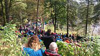 Hike across Fløyen to experience the atmosphere during the individual time trial event with the finishing line at the top of Fløibanen. Significantly longer breaks and a lot more people than on my usual hikes! ;)


