Archiv - Nach Datum
Archiv - Nach Aktivität
-
Andere Tour (3)
- Kayaking (3)
-
Fahrradtour (108)
- Fahrradtour Straße (83)
- Fahrradtour gemischt (25)
-
Fahrzeugtour (9)
- Autotour (9)
-
Fußtour (1836)
- Bergtour (1088)
- Jogging (1)
- Spaziergang (55)
- Wanderung (692)
-
Skitour (112)
- Langlauf (46)
- Tourenskilauf (66)
Gesammelte Listen
- Utvalgte topper og turmål i Bergen
- Alle topper i Bergen
- Voss ≥ 100m pf.
- Opptur Hordaland
- Stasjoner på Bergensbanen
- Ulvik ≥ 100m pf.
- Hordaland ≥ 100m pf.
- Mjølfjell PF > 100m
- Jondal ≥ 100m pf.
- Sunnhordland PF >= 100m
- Dagsturhyttene i Vestland
- Hordaland: Hardanger PF>=100m
- DNT-hytter i Hordaland
- Kvinnherad ≥ 100m pf.
- Sogndal ≥ 100m pf.
- Vik i Sogn ≥ 100m pf.
- Gulen ≥ 100m pf.
- DNT-hytter i Sogn og Fjordane
- Eidfjord ≥ 100m pf.
- Sogn - Sør for Sognefjorden PF>=100m
Ramberget, Lysskarfjellet, Høgeåsen and Fanasåta
- Datum:
- 25.04.2017
- Tourcharakter:
- Bergtour
- Tourlänge:
- 2:53h
- Entfernung:
- 7,1km
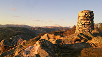 Started by taking the bus to the parking lot at Fanafjellet and walking in the southern direction along the gravel road. I quickly noticed that this was a mistake though, and that I rather should have taken the path right next to the buildings on my right. Instead of going back to the starting point (as there was a fence I thought I should not cross), I took a shortcut through the terrain to connect to the proper trail. I then follow this marked trail to Ramberget for some excellent views.
Next, I continued along the marked trail towards Lyseskarfjellet (called "Linken" on all the local signs and hiking maps). The trail was easy to follow, and included stairs to get to the summit at the end, but the trail itself was very muddy. Nice views here as well, but the summit is a bit ruined by what I assume is a >>>
Brakstadfjellet, Tveitanipa, Røysetfjellet and Storfjellet
- Datum:
- 22.04.2017
- Tourcharakter:
- Bergtour
- Tourlänge:
- 4:30h
- Entfernung:
- 12,4km
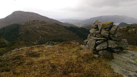 Brakstadfjellet
Started by taking the bus (or rather buses, four in total) to Valde (called Vollo on the map) and from there followed a gravel road and later a very muddy trail to the summit of Brakstadfjellet . Excellent views from the summit in all directions! I walked around a bit to see if I could get an even better view to the northeast, but the terrain was not really made for this and in the end the views were not much improved anyway.
Tveitanipa
From Brakstadfjellet I doubled back almost to the gravel road and then continued in the northern direction for around 100 meters before taking a right turn to the east and followed the trail the next top of the day: Tveitanipa . Again the trail had its muddy sections, but overall a nice trail that was easy to follow. I quickly arrived at the summit and from there continued >>>
Smådal to Kirkebirkeland
- Datum:
- 17.04.2017
- Tourcharakter:
- Bergtour
- Tourlänge:
- 4:13h
- Entfernung:
- 12,8km
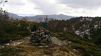 Last day of the 2017 Easter holidays and time for a new hike in the area around Kalandsvatnet. Started by taking the bus to Kaland skole and from there walking along E39 in the direction of Os. After walking for a couple of minutes and not finding the signs towards Orrtua and/or Vardafjellet , which I thought I'd seen when passing the area by car a couple of weeks earlier, I checked the GPS and discovered that I had already passed the planned start of the hike: Smådal. I therefore doubled back and quickly found the missed exit. There were no proper signs (at least none that I could see), but there was a map. One has to cross the road to see it though, so this could be clearer. But if keeping an eye on the GPS, the start of the trail should be easy to locate.
I then followed a well-marked trail (indicated with >>>
Reppanipa
- Datum:
- 15.04.2017
- Tourcharakter:
- Tourenskilauf
- Tourlänge:
- 2:46h
- Entfernung:
- 10,2km
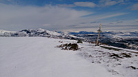 Started from the parking lot at Hodlekve and began by following the "lysløype" with some family members, before taking off on my own towards Kollsetestølen. I partly followed some old snow scooter tracks until reaching the cabins at the southern end of Reppanipa . From there I could not find any more tracks towards the summit, but it was fairly easy to find a safe route. After taking lots of pictures, as apparently the only visitor for some time, I followed pretty much the same route back to the parking lot under perfect skiing conditions!
Helleberget
- Datum:
- 14.04.2017
- Tourcharakter:
- Tourenskilauf
- Tourlänge:
- 2:36h
- Entfernung:
- 10,2km
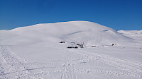 Started from the parking lot at Rindabotn and followed the marked trail towards Høgehaug, but before getting to Rysete we instead took the trail towards Fagreggi and ascended Helleberget from the south. Similar route back, but with a couple of shortcuts through the terrain.
Hiking alongside Barsnesfjorden
- Datum:
- 14.04.2017
- Tourcharakter:
- Wanderung
- Tourlänge:
- 1:45h
- Entfernung:
- 8,2km
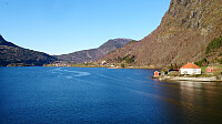 Started from the center of Sogndal and walked along the roads, and later gravel roads, to the end of Barsnesfjorden.
(Note that the road this hike follows towards the end is private, i.e. no cars allowed. There are however a couple of parking spaces down by the small wharf along Barsnesfjorden just before the road turns west and starts climbing slightly towards the crossroads at Barsnes.)
Romnaholten
- Datum:
- 13.04.2017
- Tourcharakter:
- Bergtour
- Tourlänge:
- 3:17h
- Entfernung:
- 9,2km
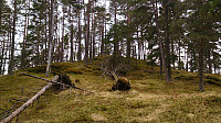 Started from Barsnes and walked along Barsnesfjorden until following the marked trail towards Helgasete . However, before reaching Dal we took a shortcut/more direct route to Dal. From Dal we partly followed a trail and partly found our own to reach the top of Romnaholten . Limited views from the summit, but there were several nice viewpoints just to the south of the summit. We more or less followed the same route for the descent, but this time following the main trail from Dal down to Barsnesfjorden.
(Note that the road to where the trail starts is private, i.e. no cars allowed. There are however a couple of parking spaces down by the small wharf along Barsnesfjorden just before the road turns west and starts climbing slightly towards the crossroads at Barsnes.)
Høgehaug
- Datum:
- 12.04.2017
- Tourcharakter:
- Langlauf
- Tourlänge:
- 1:59h
- Entfernung:
- 9,1km
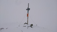 Easter 2017. Started from the parking lot at Rindabotn and followed the marked trail to Høgehaug in mostly snow and low clouds. Very limited views from the top. Same route back.
Storhovden, Midtfjellet and Rundemanen
- Datum:
- 09.04.2017
- Tourcharakter:
- Bergtour
- Tourlänge:
- 4:54h
- Entfernung:
- 20,0km
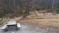 Started by talking the bus to Flaktveitrinden and walking to Søre Hjortland. There I followed a nice gravel road to the end, where I located two trails I assumed were both heading towards the top of Storehovden. I ended up taking the left one (see picture), and followed it almost all the way to the top, only taking a shortcut at the very end. There was practically no view at the top (something that was going to be a theme for the day, more on that later), but I'd still recommend a visit as the gravel road leading up to the trail was quite nice and it's an easy peak to get to.
From the top of Storehovden, I followed a trail going southeast, hoping it would return me back to where I started the accent, which turned out to be correct. In other words, both of the potential trails located at the >>>
Straumsfjellet and Storhovden
- Datum:
- 08.04.2017
- Tourcharakter:
- Bergtour
- Tourlänge:
- 2:19h
- Entfernung:
- 7,9km
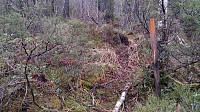 Short Saturday hike to cover two smaller peaks I had not yet visited. Started by talking the bus to Bjørndalsbakken and from there walking up Bjørgeveien. I then located the trail to Straumsfjellet and easily made it to the top. Decent views for such a small peak.
From the top of Straumsfjellet I continued south to Bjørndalsskogen and then down to Bjørndalsvatnet. After reaching the northern end of Bjørndalsvatnet I followed the marked trail towards Krokatjørna, but after a while started looking for trails going in the direction of Storhovden. Did not find any clear trails, but found something I thought would take me in the direction of the top and tried to followed this one. The trail almost disappeared a couple of times (see picture), but also connected to/crossed other more easily visible >>>


