Archiv - Nach Datum
Archiv - Nach Aktivität
-
Andere Tour (3)
- Kayaking (3)
-
Fahrradtour (110)
- Fahrradtour Straße (85)
- Fahrradtour gemischt (25)
-
Fahrzeugtour (9)
- Autotour (9)
-
Fußtour (1893)
- Bergtour (1118)
- Jogging (1)
- Spaziergang (60)
- Wanderung (714)
-
Skitour (116)
- Langlauf (47)
- Tourenskilauf (69)
Gesammelte Listen
-
Utvalgte topper og turmål i Bergen
(349/350)
 99%
99% -
Alle topper i Bergen
(393/398)
98%
-
Voss ≥ 100m pf.
(96/98)
97%
-
Opptur Hordaland
(144/159)
90%
-
Stasjoner på Bergensbanen
(33/40)
82%
-
Ulvik ≥ 100m pf.
(28/38)
73%
-
Hordaland ≥ 100m pf.
(622/863)
72%
-
Mjølfjell PF > 100m
(21/31)
67%
-
Jondal ≥ 100m pf.
(15/23)
65%
-
Dagsturhyttene i Vestland
(36/61)
59%
-
Sunnhordland PF >= 100m
(105/186)
56%
-
Hordaland: Hardanger PF>=100m
(194/359)
54%
-
DNT-hytter i Hordaland
(23/45)
51%
-
Kvinnherad ≥ 100m pf.
(40/79)
50%
-
Eidfjord ≥ 100m pf.
(13/42)
30%
-
Sogndal ≥ 100m pf.
(23/81)
28%
-
Gulen ≥ 100m pf.
(15/54)
27%
-
Vik i Sogn ≥ 100m pf.
(10/46)
21%
-
Sogn - Sør for Sognefjorden PF>=100m
(31/159)
19%
-
DNT-hytter i Sogn og Fjordane
(8/47)
17%

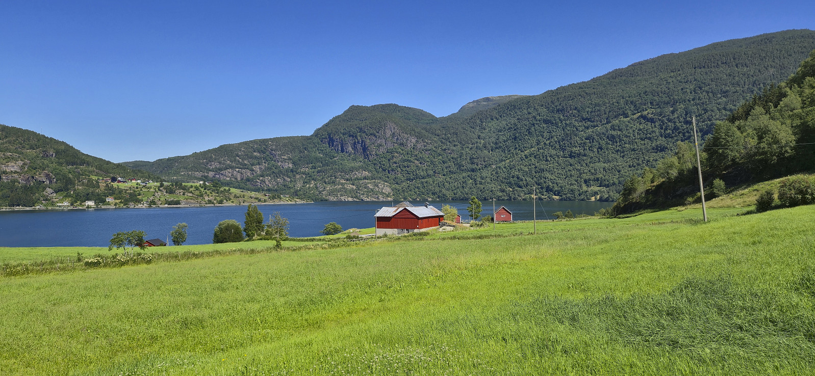
Aksdalsneset to Skånevik
- Datum:
- 19.07.2025
- Tourcharakter:
- Bergtour
- Tourlänge:
- 7:47h
- Entfernung:
- 19,5km
 After arriving late in Skånevik the day before and spending the night at Skånevik Fjordhotel , I got up early to catch the 08:30 bus from Skånevik to Aksdalsneset. Note that the bus had to be ordered by calling Skyss at least one day in advance. Also, it was not actually a bus, but a rather a taxi. In other words, if you have not called in advance, you may risk being left behind at the bus stop, or that there is no taxi showing up in the first place.
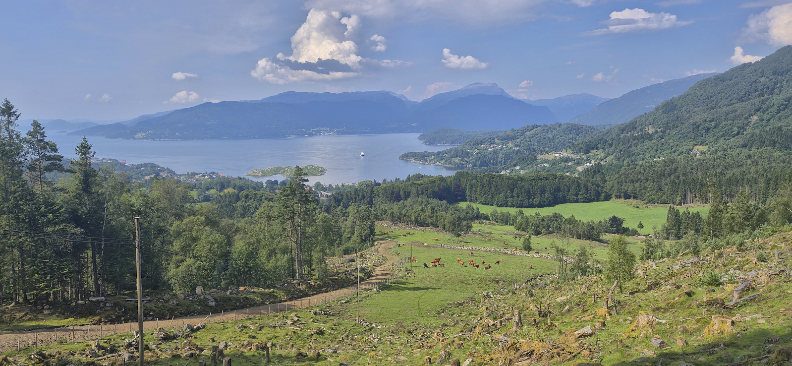
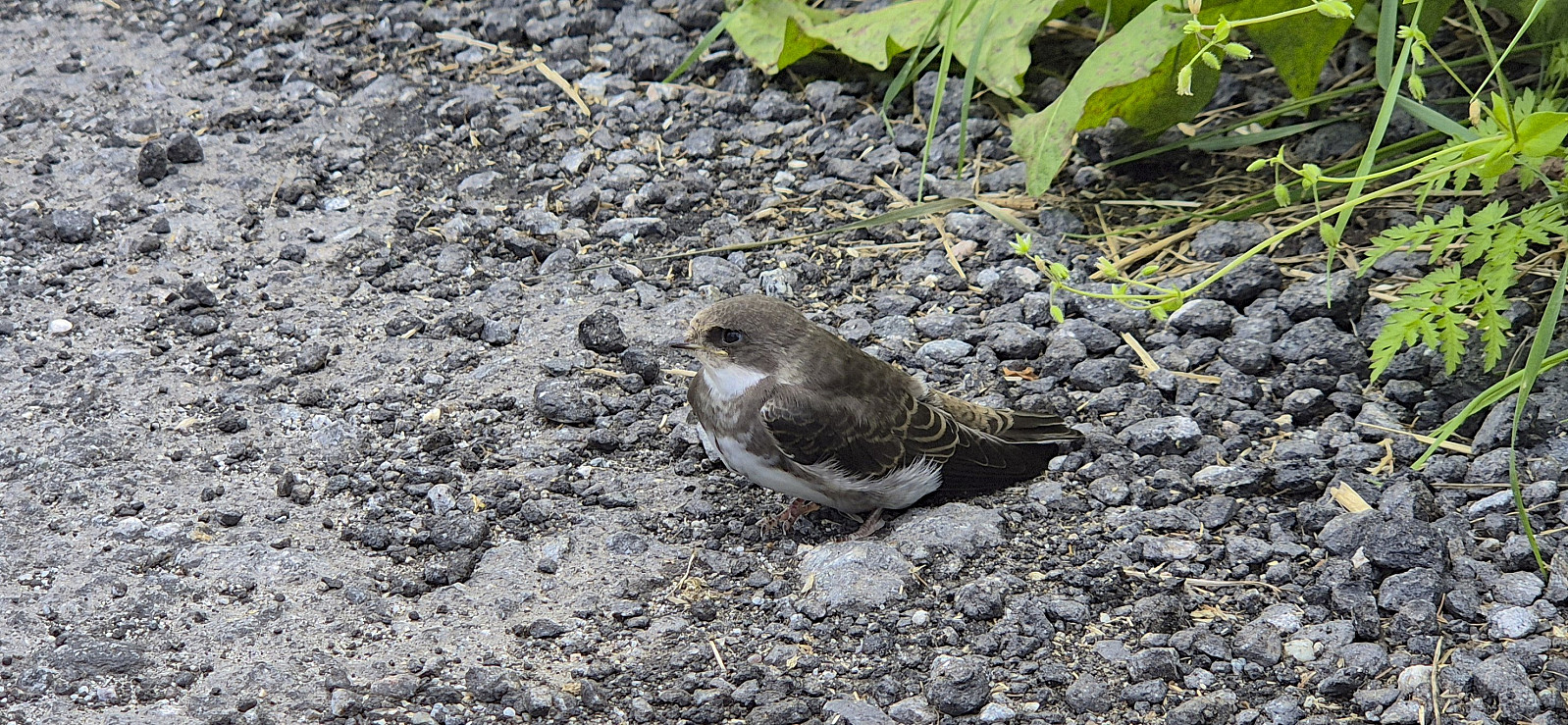
I got dropped off at Aksdalsneset from where I had come across a hiking suggestion at ut.no indicating what looked like a nice route to the summit of Børkjenesnuten . First I followed a gravel road that quickly turned into a tractor road taking me up to the unmarked trailhead.
The start of the trail was easy to miss but after crossing a wet area early on it was overall straightforward to follow until getting near Vasstølsvatnet. Here the trail turned >>>
After arriving late in Skånevik the day before and spending the night at Skånevik Fjordhotel , I got up early to catch the 08:30 bus from Skånevik to Aksdalsneset. Note that the bus had to be ordered by calling Skyss at least one day in advance. Also, it was not actually a bus, but a rather a taxi. In other words, if you have not called in advance, you may risk being left behind at the bus stop, or that there is no taxi showing up in the first place.
I got dropped off at Aksdalsneset from where I had come across a hiking suggestion at ut.no indicating what looked like a nice route to the summit of Børkjenesnuten . First I followed a gravel road that quickly turned into a tractor road taking me up to the unmarked trailhead.
The start of the trail was easy to miss but after crossing a wet area early on it was overall straightforward to follow until getting near Vasstølsvatnet. Here the trail turned >>>
Skånevik: Skålnestangen and Peparen
- Datum:
- 18.07.2025
- Tourcharakter:
- Spaziergang
- Entfernung:
- 1,7km
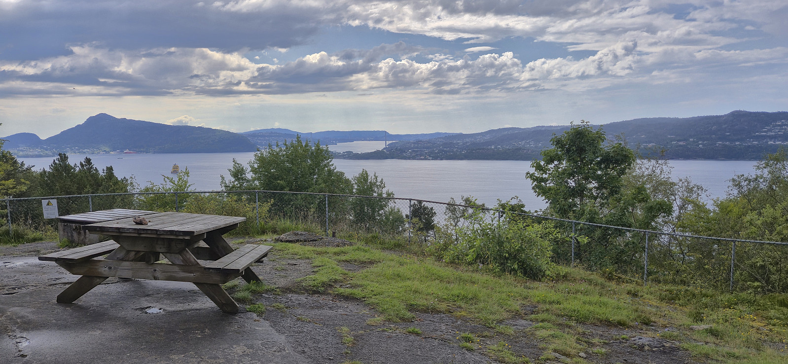
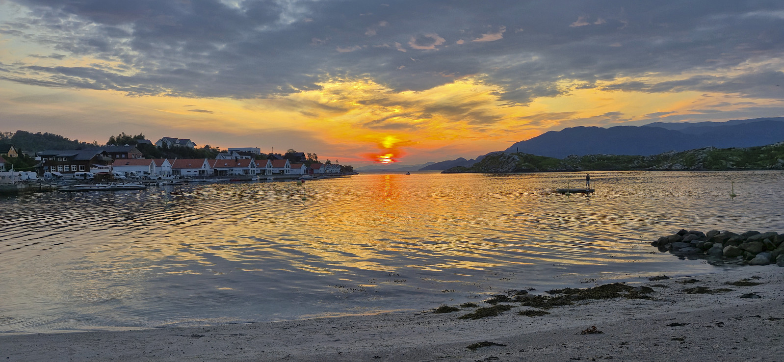 Short late evening stroll after travelling from Bergen to spend the weekend hiking in Skånevik. A journey that turned out much longer than expected given that the boat I was supposed to transfer to at Leirvik had technical issues. Those of us travelling to Skånevik therefore instead had to stay on the boat from Bergen one more stop to Sunde. There we were promised that a taxi would be waiting for to drive us to Utåker such that we could catch the next ferry to Skånevik. The ferry had even agreed to delay its departure by five minutes, which would have been just enough, if the taxi had been there when we got off the boat. It was not, and when it finally arrived the ferry had already left Utåker. As a result, we ended up with almost two hours waiting for the next ferry at Utåker. On the >>>
Storetunga and Vetle Hansbunuten from Finse
- Datum:
- 17.07.2025
- Tourcharakter:
- Bergtour
- Tourlänge:
- 5:49h
- Entfernung:
- 20,0km
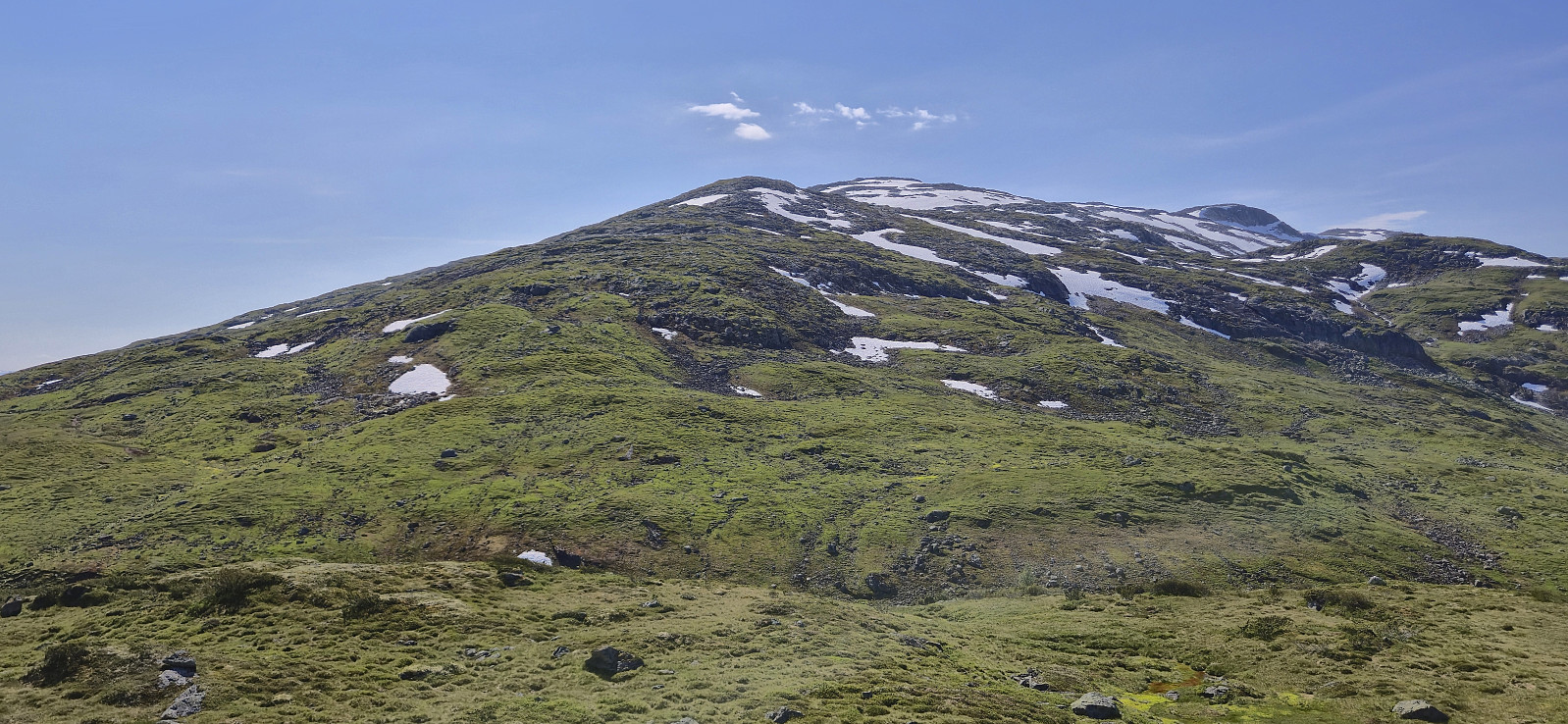
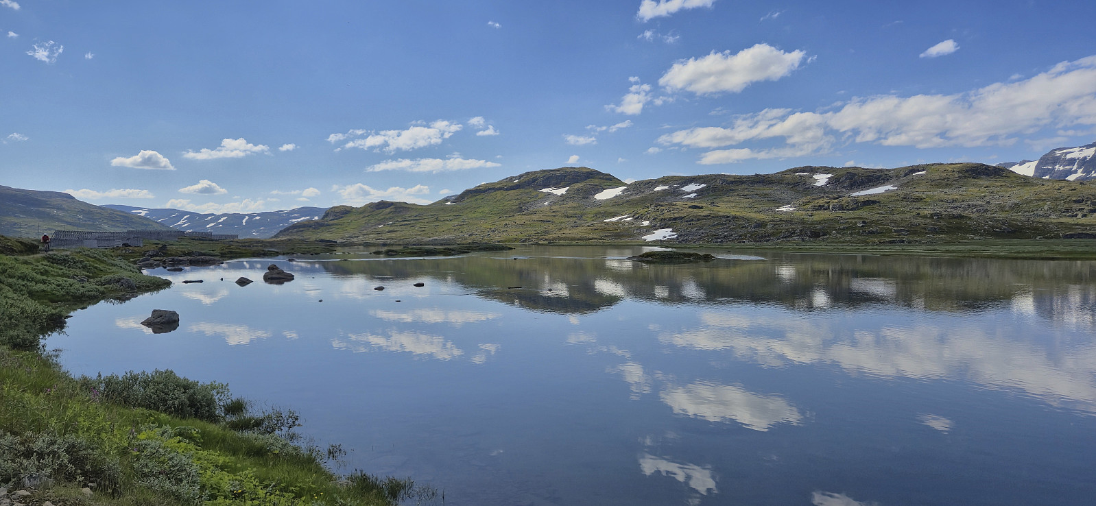 On yet another very warm day, I decided to escape some of the heat by heading up to Finse to visit two relatively recent additions to the Hordaland ≥ 100m pf. list , both of which had been upgraded due to more accurate LiDAR data . First up was Storetunga . After getting off the train at Finse, I headed southeast along Rallarvegen before later leaving the gravel road and heading off-trail towards the summit. Besides some annoying undergrowth early on, the terrain was generally easy to travers and the summit was reached without any difficulties.
After a break next to the summit cairn to take in the excellent views, I returned along the same route to Rallarvegen before crossing the river along a small bridge underneath the larger railroad bridge and started my ascent of Vetle Hansbunuten . There were a couple of small cairns in the area around the bridge but I quickly lost >>>
On yet another very warm day, I decided to escape some of the heat by heading up to Finse to visit two relatively recent additions to the Hordaland ≥ 100m pf. list , both of which had been upgraded due to more accurate LiDAR data . First up was Storetunga . After getting off the train at Finse, I headed southeast along Rallarvegen before later leaving the gravel road and heading off-trail towards the summit. Besides some annoying undergrowth early on, the terrain was generally easy to travers and the summit was reached without any difficulties.
After a break next to the summit cairn to take in the excellent views, I returned along the same route to Rallarvegen before crossing the river along a small bridge underneath the larger railroad bridge and started my ascent of Vetle Hansbunuten . There were a couple of small cairns in the area around the bridge but I quickly lost >>>
Ørneberget and Rognåsen
- Datum:
- 16.07.2025
- Tourcharakter:
- Bergtour
- Tourlänge:
- 1:29h
- Entfernung:
- 6,2km
 Short local hike on a very warm summer day.
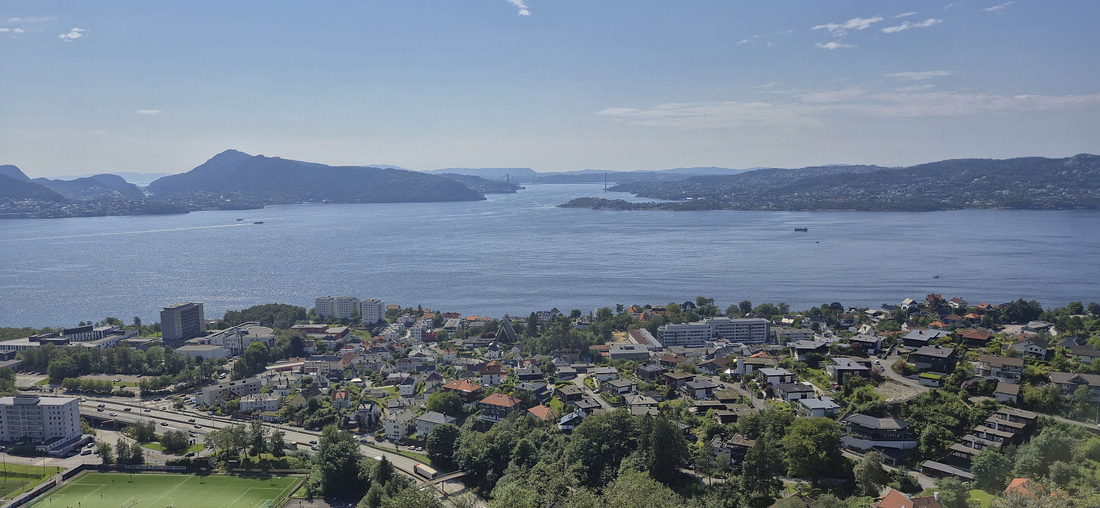
Across Hellen festning
- Datum:
- 15.07.2025
- Tourcharakter:
- Wanderung
- Tourlänge:
- 0:34h
- Entfernung:
- 3,2km
 Short local hike after returning from Sogndal to Bergen.
Barsnesfjorden
- Datum:
- 14.07.2025
- Tourcharakter:
- Wanderung
- Tourlänge:
- 1:38h
- Entfernung:
- 4,4km
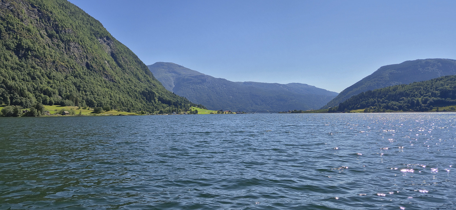
 Short walk along Barsnesfjorden before the drive back to Bergen.
(Note that the road this hike follows is private, i.e. no cars allowed. There are however a couple of parking spaces down by the small wharf along Barsnesfjorden just before the road turns west and starts climbing slightly towards the crossroads at Barsnes.)
Short walk along Barsnesfjorden before the drive back to Bergen.
(Note that the road this hike follows is private, i.e. no cars allowed. There are however a couple of parking spaces down by the small wharf along Barsnesfjorden just before the road turns west and starts climbing slightly towards the crossroads at Barsnes.)
Vardafjellet from Rindabotn
- Datum:
- 13.07.2025
- Tourcharakter:
- Bergtour
- Tourlänge:
- 3:04h
- Entfernung:
- 7,6km
 We found parking next to the road above Rindabotn and from there continued up the gravel road. It would probably have been possible to drive further but then the parking options were less certain. We later left the gravel road and followed a marked trail heading north towards Kokkstadfjellet , however we did not head all the way there before turning west to Vardafjellet . On our way there, we had the best views of the day. Most notably north in the direction of Anestølsvatnet. At Vardafjellet, my niece continued on her own to Kambafjellet while my parents and I headed more directly south to the car. First along a marked trail and then along the winding gravel road. As a results, my niece got to Rindabotn long before us and we later picked her along Hodlekvevegen.
Kayaking on Barsnesfjorden
- Datum:
- 12.07.2025
- Tourcharakter:
- Kayaking
- Tourlänge:
- 1:37h
- Entfernung:
- 4,3km
 Combined kayaking and rowing trip on Barsnesfjorden where I switched from kayak to row boat halfway through.
Barsnesfjorden
- Datum:
- 12.07.2025
- Tourcharakter:
- Wanderung
- Tourlänge:
- 2:35h
- Entfernung:
- 1,9km
 Walk along Barsnesfjorden for a short hiking/rowing trip .
(Note that the road this hike follows is private, i.e. no cars allowed. There are however a couple of parking spaces down by the small wharf along Barsnesfjorden just before the road turns west and starts climbing slightly towards the crossroads at Barsnes.)
Walk along Barsnesfjorden for a short hiking/rowing trip .
(Note that the road this hike follows is private, i.e. no cars allowed. There are however a couple of parking spaces down by the small wharf along Barsnesfjorden just before the road turns west and starts climbing slightly towards the crossroads at Barsnes.)
Helleberget from Rindabotn
- Datum:
- 11.07.2025
- Tourcharakter:
- Bergtour
- Tourlänge:
- 2:55h
- Entfernung:
- 7,6km
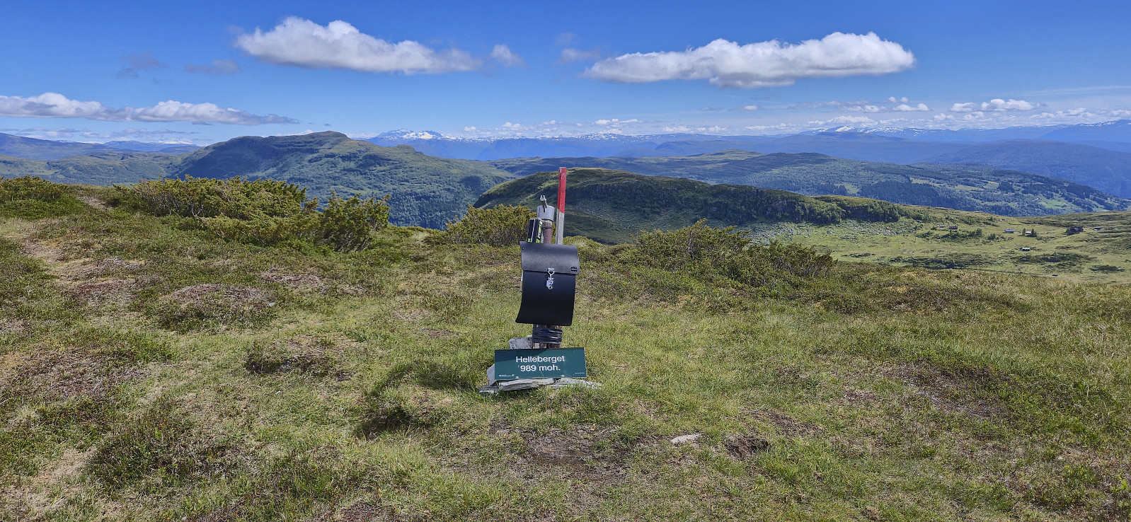 We parked at the large parking lot at Rindabotn and from there followed the marked route to Fagereggi. First along a gravel path, then across a wooden bridge, and finally along a nice trail. We briefly lost the trail east of Fagreggjevatnet but easily picked it up again when rounding the lake on the southern side and then followed it to reconnect with our ascent route. Before this I however made a short off-trail detour on my own to the top of Helleberget .
