Archiv - Nach Datum
Archiv - Nach Aktivität
-
Andere Tour (3)
- Kayaking (3)
-
Fahrradtour (108)
- Fahrradtour Straße (83)
- Fahrradtour gemischt (25)
-
Fahrzeugtour (9)
- Autotour (9)
-
Fußtour (1808)
- Bergtour (1072)
- Jogging (1)
- Spaziergang (54)
- Wanderung (681)
-
Skitour (110)
- Langlauf (45)
- Tourenskilauf (65)
Gesammelte Listen
-
Utvalgte topper og turmål i Bergen
(335/340)
 98%
98% -
Voss ≥ 100m pf.
(96/98)
97%
-
Alle topper i Bergen
(380/392)
96%
-
Opptur Hordaland
(144/159)
90%
-
Stasjoner på Bergensbanen
(31/40)
77%
-
Ulvik ≥ 100m pf.
(28/38)
73%
-
Hordaland ≥ 100m pf.
(614/863)
71%
-
Mjølfjell PF > 100m
(21/31)
67%
-
Jondal ≥ 100m pf.
(15/23)
65%
-
Sunnhordland PF >= 100m
(105/186)
56%
-
Dagsturhyttene i Vestland
(33/61)
54%
-
Hordaland: Hardanger PF>=100m
(186/359)
51%
-
Kvinnherad ≥ 100m pf.
(40/79)
50%
-
DNT-hytter i Hordaland
(22/45)
48%
-
Sogndal ≥ 100m pf.
(23/81)
28%
-
Gulen ≥ 100m pf.
(10/54)
18%
-
Vik i Sogn ≥ 100m pf.
(8/46)
17%
-
DNT-hytter i Sogn og Fjordane
(8/47)
17%
-
Eidfjord ≥ 100m pf.
(7/42)
16%
-
Etne ≥ 100m pf.
(8/51)
15%

Rødsfjellet and Møsnuken
- Datum:
- 27.04.2018
- Tourcharakter:
- Bergtour
- Tourlänge:
- 5:48h
- Entfernung:
- 15,6km
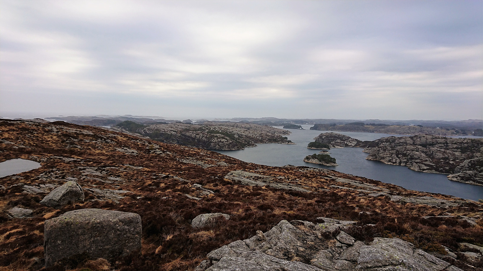
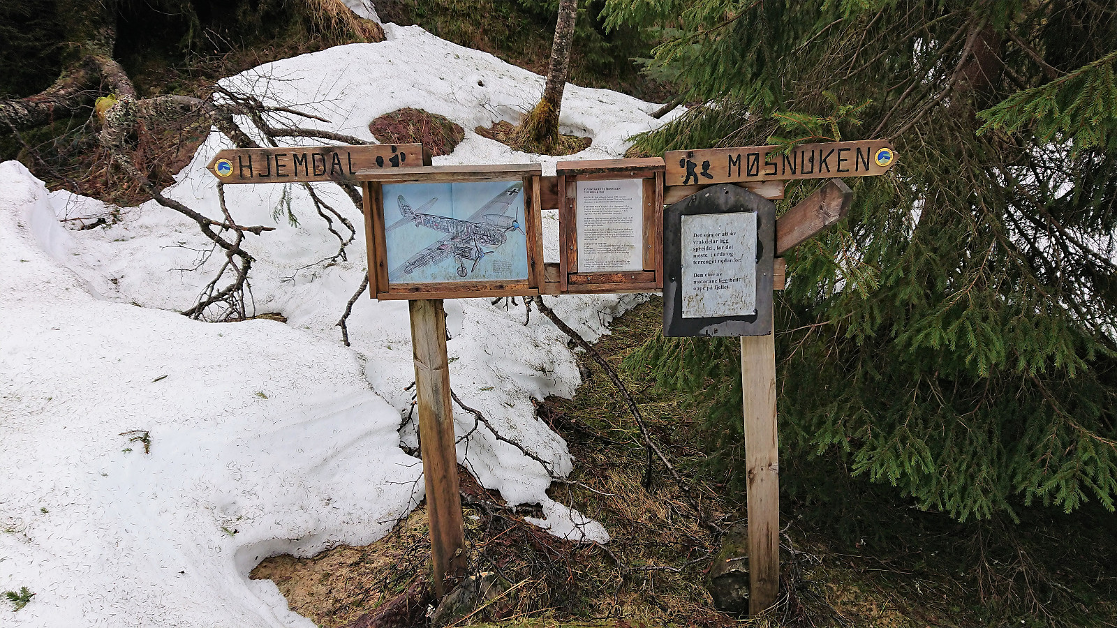 After a meeting at Solstrand I walked up to the main road from where I took the bus to Gjemdal. The marked trailhead was quickly found, which started out as a nice tractor road up the valley in between Rødsfjellet and Møsnuken called Gjemdalsskaret. Decided to follow the red trail towards Rødsfjellet, which was overall well-marked and easy to follow. Sadly it started raining, which combined with low-hanging clouds reduced the views. The rain came and went until reaching the summit, where I walked around a bit hoping for better conditions, but in the end I gave up and started the descent.
For the descent I followed the white trail, which was also well-marked, but I did lose it at one point due to it being hidden by snow. Luckily the white painted trail markers were easily visible from a distance and the trail >>>
After a meeting at Solstrand I walked up to the main road from where I took the bus to Gjemdal. The marked trailhead was quickly found, which started out as a nice tractor road up the valley in between Rødsfjellet and Møsnuken called Gjemdalsskaret. Decided to follow the red trail towards Rødsfjellet, which was overall well-marked and easy to follow. Sadly it started raining, which combined with low-hanging clouds reduced the views. The rain came and went until reaching the summit, where I walked around a bit hoping for better conditions, but in the end I gave up and started the descent.
For the descent I followed the white trail, which was also well-marked, but I did lose it at one point due to it being hidden by snow. Luckily the white painted trail markers were easily visible from a distance and the trail >>>
Lillevågen and Ørneberget
- Datum:
- 22.04.2018
- Tourcharakter:
- Bergtour
- Tourlänge:
- 1:43h
- Entfernung:
- 6,9km
 Short local hike with explorations of Lillevågen (a part of Tømmervågen friluftsområde) before passing by Ørneberget on the way to Lønborg.
Kolåsen and Tveitåsen
- Datum:
- 21.04.2018
- Tourcharakter:
- Bergtour
- Tourlänge:
- 3:00h
- Entfernung:
- 14,0km
 Started by taking the bus to Manger and from there walking along the road to Dalland. Only sidewalks at the very start, but not a lot of traffic so this part was slightly better than feared. As soon as I passed the last houses at Dalland the road changed into a tractor road that I followed almost to the end before starting my search for the trailhead to Kolåsen .
My initial search was unsuccessful, but after consulting GPS tracks from previous PB reports to Kolåsen I managed to locate the hidden entrance in between the trees. To my surprise the trail itself was marked (something that would also have been a good idea for the trailhead?) and I soon found myself at the fallen trig marker. As expected there were no views at all from the summit.
Given that the marked trail continued southeast, I decided >>>
Started by taking the bus to Manger and from there walking along the road to Dalland. Only sidewalks at the very start, but not a lot of traffic so this part was slightly better than feared. As soon as I passed the last houses at Dalland the road changed into a tractor road that I followed almost to the end before starting my search for the trailhead to Kolåsen .
My initial search was unsuccessful, but after consulting GPS tracks from previous PB reports to Kolåsen I managed to locate the hidden entrance in between the trees. To my surprise the trail itself was marked (something that would also have been a good idea for the trailhead?) and I soon found myself at the fallen trig marker. As expected there were no views at all from the summit.
Given that the marked trail continued southeast, I decided >>>
Sandviksbatteriet, Håmanen and Ørneberget
- Datum:
- 15.04.2018
- Tourcharakter:
- Bergtour
- Tourlänge:
- 2:23h
- Entfernung:
- 9,7km
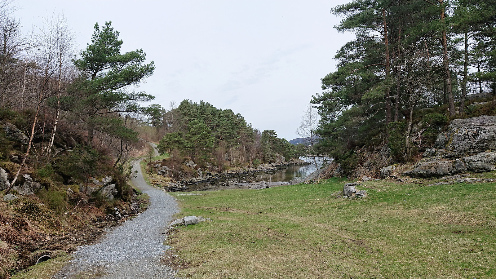
 Started from Skuteviken and took a short walk through Sandviken before following Fjellveien back towards Sandviksbatteriet which I ascended via the steep trail directly from Fjellveien. From Sandviksbatteriet I visited both Håmanen and Ørneberget on my way to Lønborg, making this my first 2018 visit of Ørneberget where there was no snow or ice.
Bakkanosi and Fetanipa
- Datum:
- 14.04.2018
- Tourcharakter:
- Tourenskilauf
- Tourlänge:
- 7:07h
- Entfernung:
- 21,2km
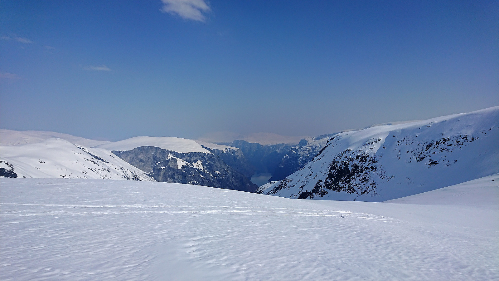 Trip organized by the Norwegian Trekking Association which started by taking the train to Voss and then a joint taxi to Jordalen. We followed the standard route to Bakkanosi , which started out a bit steep along a snow-covered tractor road before levelling off through Slettedalen and the final ascent towards the summit.
The summit itself was quickly passed as we moved closer to the edge for better views. Although getting close the 1300 meters vertical drop down to Nærøyfjorden had to wait for later a summer visit, as the snow made it impossible to see where the firm ground ended, the views were still quite spectacular, but slightly reduced due to a light haze in the distance.
After lunch, half of us made a detour to Fetanipa , where the views could not compare with Bakkanosi. Perhaps explaining why there have been so few registered visits on >>>
Trip organized by the Norwegian Trekking Association which started by taking the train to Voss and then a joint taxi to Jordalen. We followed the standard route to Bakkanosi , which started out a bit steep along a snow-covered tractor road before levelling off through Slettedalen and the final ascent towards the summit.
The summit itself was quickly passed as we moved closer to the edge for better views. Although getting close the 1300 meters vertical drop down to Nærøyfjorden had to wait for later a summer visit, as the snow made it impossible to see where the firm ground ended, the views were still quite spectacular, but slightly reduced due to a light haze in the distance.
After lunch, half of us made a detour to Fetanipa , where the views could not compare with Bakkanosi. Perhaps explaining why there have been so few registered visits on >>>
Across Hellen festning
- Datum:
- 12.04.2018
- Tourcharakter:
- Wanderung
- Tourlänge:
- 0:34h
- Entfernung:
- 3,2km
 Short local hike across Hellen festning.
Furefjellet and Raudfjellet
- Datum:
- 11.04.2018
- Tourcharakter:
- Bergtour
- Tourlänge:
- 2:28h
- Entfernung:
- 11,2km
 Hitched a ride with a colleague to Mjåtveit and quickly located the trailhead for Furefjellet . The trailhead was marked, but Furefjellet was not mentioned on the signs until later on. Short but nice trail to the summit (although today a bit wet at times), which provided much better views than expected. Even though the views would have benefitted greatly from removing a couple of the many pine trees giving the peak its name.
From the summit I followed a weak trail northwest towards Dalstøvegen. Clearly not the most used trail, but still relatively easy to follow. Upon reaching the road I turned north towards Raudfjellet . The plan had been to ascend via the tractor road starting south of the summit, but as this involved walking along the main road with high-speed traffic and no sidewalk, I decided to instead try >>>
Hitched a ride with a colleague to Mjåtveit and quickly located the trailhead for Furefjellet . The trailhead was marked, but Furefjellet was not mentioned on the signs until later on. Short but nice trail to the summit (although today a bit wet at times), which provided much better views than expected. Even though the views would have benefitted greatly from removing a couple of the many pine trees giving the peak its name.
From the summit I followed a weak trail northwest towards Dalstøvegen. Clearly not the most used trail, but still relatively easy to follow. Upon reaching the road I turned north towards Raudfjellet . The plan had been to ascend via the tractor road starting south of the summit, but as this involved walking along the main road with high-speed traffic and no sidewalk, I decided to instead try >>>
Sandviken and Hellen festning
- Datum:
- 08.04.2018
- Tourcharakter:
- Wanderung
- Tourlänge:
- 1:31h
- Entfernung:
- 6,4km
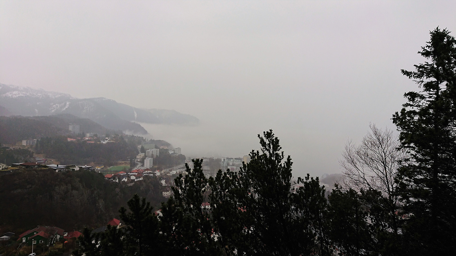 Short local hike due to rain and fog.
Nipa, Brotavarden and Ryggjastykket
- Datum:
- 07.04.2018
- Tourcharakter:
- Bergtour
- Tourlänge:
- 3:32h
- Entfernung:
- 12,8km
 Started by taking the bus to Telavåg (bus stop called Tælavåg Nordsjøfartmuseet) and locating the marked trailhead just north of the two football fields. The trail itself was clearly marked with the familiar blue marks of Nordsjøløypa and I quickly arrived at the summit of Nipa . Nice views from the summit, but the gray weather reduced the visibility somewhat.
From Nipa I continued north towards Brotavarden , still following the marked trail. I however turned west too early (at the sign for Nesvika, instead of waiting for the sign for Brotavarden). This resulted in having to find my own shortcut to connect with the proper trail to Brotavarden. Not too difficult, but pretty sure it would have been easier to wait for the correct sign.
The wind started picking up as I approached Brotavarden. I therefore did >>>
Started by taking the bus to Telavåg (bus stop called Tælavåg Nordsjøfartmuseet) and locating the marked trailhead just north of the two football fields. The trail itself was clearly marked with the familiar blue marks of Nordsjøløypa and I quickly arrived at the summit of Nipa . Nice views from the summit, but the gray weather reduced the visibility somewhat.
From Nipa I continued north towards Brotavarden , still following the marked trail. I however turned west too early (at the sign for Nesvika, instead of waiting for the sign for Brotavarden). This resulted in having to find my own shortcut to connect with the proper trail to Brotavarden. Not too difficult, but pretty sure it would have been easier to wait for the correct sign.
The wind started picking up as I approached Brotavarden. I therefore did >>>
Skiing at Fløyen
- Datum:
- 05.04.2018
- Tourcharakter:
- Langlauf
- Tourlänge:
- 2:25h
- Entfernung:
- 12,6km
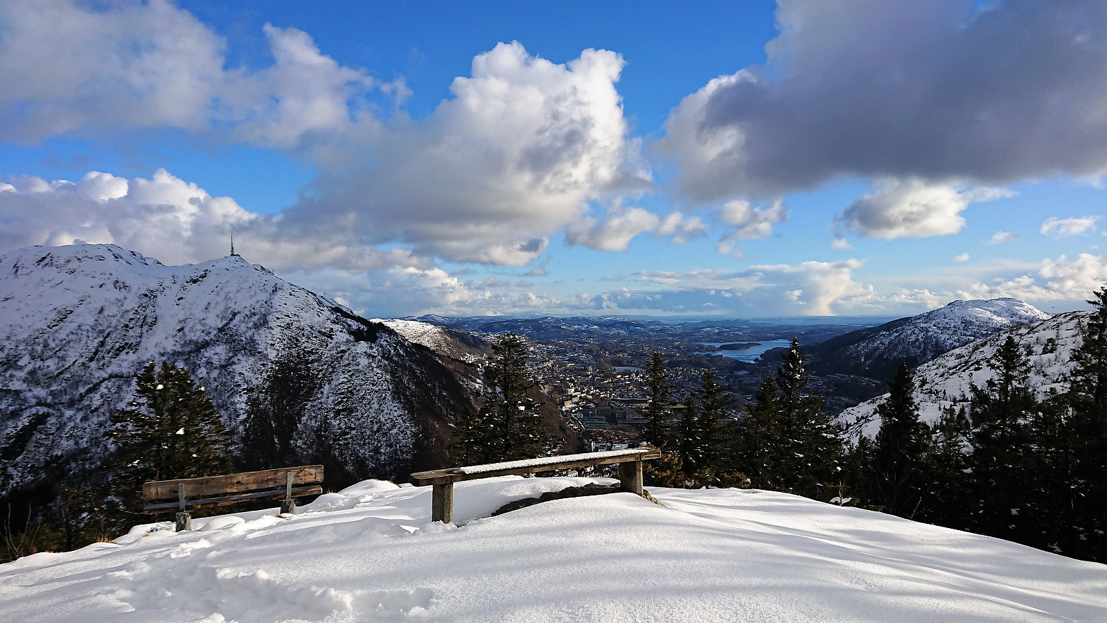 Skiing at Fløyen after work. Started in nice sunny weather but ended with wet snow from above. Lots of new snow from the night before, but most of it had melted during the day, so not the best conditions for skiing, but still an enjoyable trip.
