Archiv - Nach Datum
Archiv - Nach Aktivität
-
Andere Tour (3)
- Kayaking (3)
-
Fahrradtour (110)
- Fahrradtour Straße (85)
- Fahrradtour gemischt (25)
-
Fahrzeugtour (9)
- Autotour (9)
-
Fußtour (1893)
- Bergtour (1118)
- Jogging (1)
- Spaziergang (60)
- Wanderung (714)
-
Skitour (116)
- Langlauf (47)
- Tourenskilauf (69)
Gesammelte Listen
-
Utvalgte topper og turmål i Bergen
(349/350)
 99%
99% -
Alle topper i Bergen
(393/398)
98%
-
Voss ≥ 100m pf.
(96/98)
97%
-
Opptur Hordaland
(144/159)
90%
-
Stasjoner på Bergensbanen
(33/40)
82%
-
Ulvik ≥ 100m pf.
(28/38)
73%
-
Hordaland ≥ 100m pf.
(622/863)
72%
-
Mjølfjell PF > 100m
(21/31)
67%
-
Jondal ≥ 100m pf.
(15/23)
65%
-
Dagsturhyttene i Vestland
(36/61)
59%
-
Sunnhordland PF >= 100m
(105/186)
56%
-
Hordaland: Hardanger PF>=100m
(194/359)
54%
-
DNT-hytter i Hordaland
(23/45)
51%
-
Kvinnherad ≥ 100m pf.
(40/79)
50%
-
Eidfjord ≥ 100m pf.
(13/42)
30%
-
Sogndal ≥ 100m pf.
(23/81)
28%
-
Gulen ≥ 100m pf.
(15/54)
27%
-
Vik i Sogn ≥ 100m pf.
(10/46)
21%
-
Sogn - Sør for Sognefjorden PF>=100m
(31/159)
19%
-
DNT-hytter i Sogn og Fjordane
(8/47)
17%

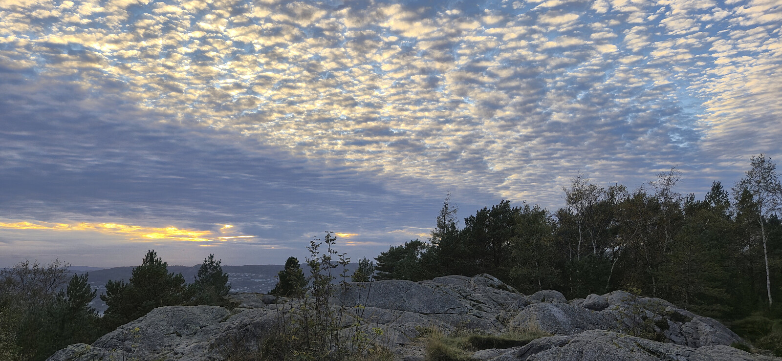
Hellemyrstien, Furukammen and Hellen festning
- Datum:
- 04.10.2025
- Tourcharakter:
- Wanderung
- Tourlänge:
- 3:27h
- Entfernung:
- 8,2km
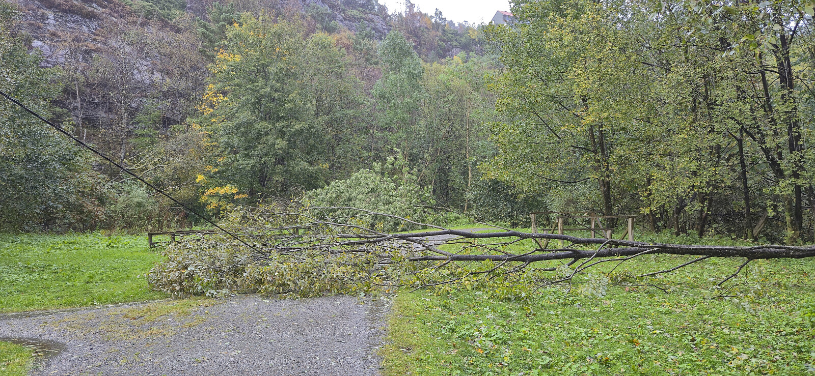 Local Saturday hike to look at the aftermath of the strong winds during the night. Lots of fallen trees, especially at Furukammen and Hellen festning .
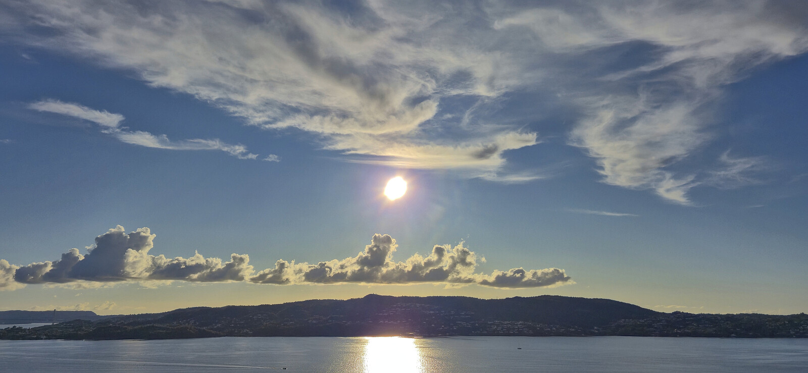
Ørneberget NV and Furukammen
- Datum:
- 30.09.2025
- Tourcharakter:
- Bergtour
- Tourlänge:
- 0:48h
- Entfernung:
- 3,4km
 Short local hike after work.
Herdabreida and Kistenuten from Øyaset
- Datum:
- 27.09.2025
- Tourcharakter:
- Bergtour
- Tourlänge:
- 5:09h
- Entfernung:
- 11,8km
 After our ascent of Eggjane , we drove the short distance southeast to Øyaset where we found parking next to the road. Note that the use of the gravel road from Rong to Øyaset requires you to pay a fee of 50 kr. This can be paid by Vipps, however there was no cell phone reception at the start of the gavel road nor at Øyaset, and we therefore did not manage to pay until halfway up the first ascent.
Our initial plan had been to ascend off-trail on the westside of Kaldåni, but after easily crossing the small river from Furevatnet we got a better look at the terrain and decided to abandon that idea. Briefly we considered following the dry Kaldåni but quickly gave up on that idea as well and instead started on a trail east of it. This turned out to be a very good choice as this trail would take us all the way to the top of the steep gorge made by the river >>>
After our ascent of Eggjane , we drove the short distance southeast to Øyaset where we found parking next to the road. Note that the use of the gravel road from Rong to Øyaset requires you to pay a fee of 50 kr. This can be paid by Vipps, however there was no cell phone reception at the start of the gavel road nor at Øyaset, and we therefore did not manage to pay until halfway up the first ascent.
Our initial plan had been to ascend off-trail on the westside of Kaldåni, but after easily crossing the small river from Furevatnet we got a better look at the terrain and decided to abandon that idea. Briefly we considered following the dry Kaldåni but quickly gave up on that idea as well and instead started on a trail east of it. This turned out to be a very good choice as this trail would take us all the way to the top of the steep gorge made by the river >>>
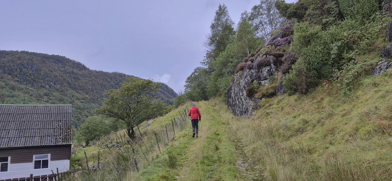
Eggjane via Kulset
- Datum:
- 27.09.2025
- Tourcharakter:
- Bergtour
- Tourlänge:
- 3:40h
- Entfernung:
- 11,7km
 Endre picked me up at my place shortly after 07:00 and together we drove to Voss and Bordalen where we parked at Nyestølen p-plass .
The original plan had been to continue all the way to Kulset, but due to a locked gate at the start of the gravel road , we had to do the extra 200 vertical meters on foot. This was however straightforward and it did not take long before we could begin on the marked trail to Horgaholet. Here we left the trail and continued off-trail to the top of Eggjane . Excellent panoramic views from the summit, however a strong cold wind resulted in short stay before returning the same way. In summary, a nice hike, largely along a marked trail, which can be highly recommended.
Back in the car, we drove the short distance southeast to Øyaset to ascend Herdabreida and Kistenuten .
Endre picked me up at my place shortly after 07:00 and together we drove to Voss and Bordalen where we parked at Nyestølen p-plass .
The original plan had been to continue all the way to Kulset, but due to a locked gate at the start of the gravel road , we had to do the extra 200 vertical meters on foot. This was however straightforward and it did not take long before we could begin on the marked trail to Horgaholet. Here we left the trail and continued off-trail to the top of Eggjane . Excellent panoramic views from the summit, however a strong cold wind resulted in short stay before returning the same way. In summary, a nice hike, largely along a marked trail, which can be highly recommended.
Back in the car, we drove the short distance southeast to Øyaset to ascend Herdabreida and Kistenuten .
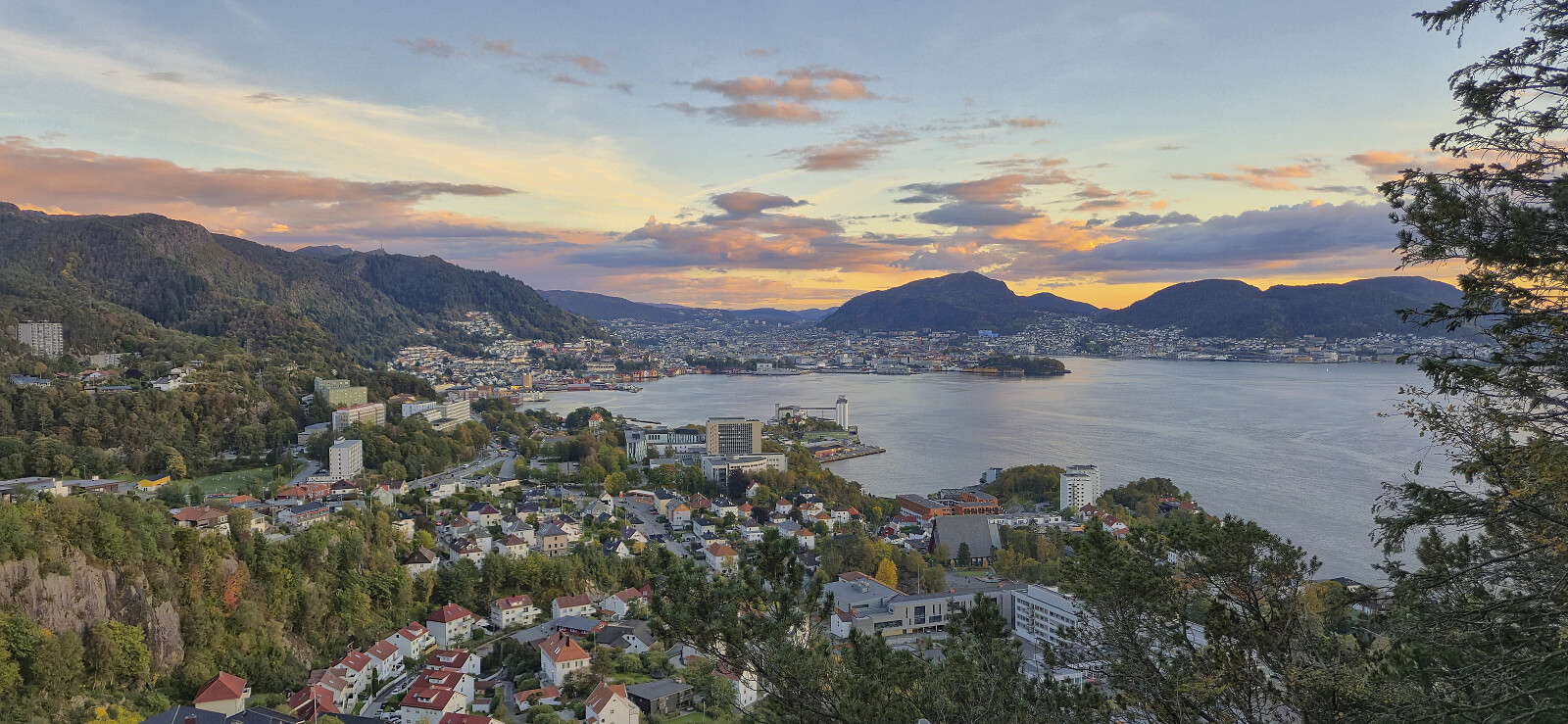
Haukeland sykehus to Sandviken sykehus
- Datum:
- 24.09.2025
- Tourcharakter:
- Wanderung
- Tourlänge:
- 1:30h
- Entfernung:
- 7,2km
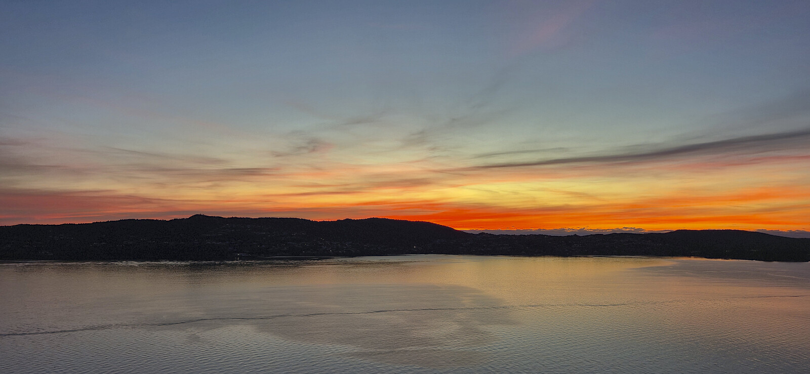 Given the nice weather I decided to walk most of the way home from work.
Across Hellen festning
- Datum:
- 23.09.2025
- Tourcharakter:
- Wanderung
- Tourlänge:
- 0:39h
- Entfernung:
- 3,2km
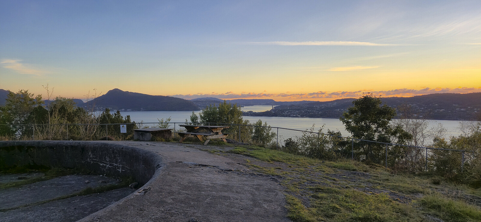 Short local hike after work.
Kampestølsrusta, Giskanuten and Nordvest for Jonåsen
- Datum:
- 20.09.2025
- Tourcharakter:
- Bergtour
- Tourlänge:
- 4:15h
- Entfernung:
- 11,1km
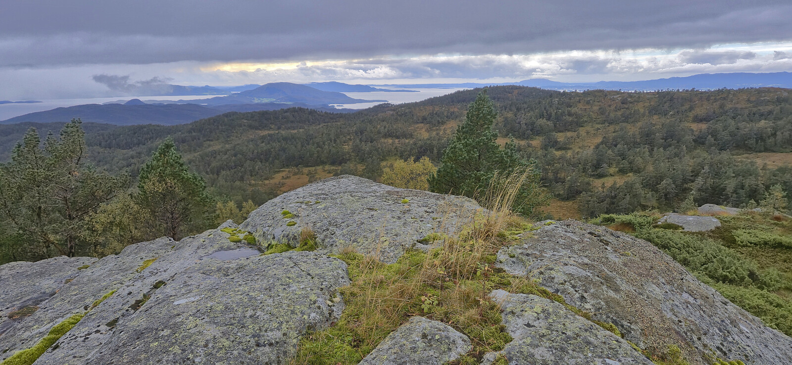 After ascending Holmedalsfjellet , Petter and I drove the short distance north to Tveitedalen p-plass . Here we left the car behind and continued on a gravel road on the east side of Bakkastølsvatnet. After crossing a bridge north of the lake we then made our way off-trail towards the summit of Kampestølsrusta , following deer tracks whenever these seem to head in the wanted direction.
Except for one steepish section that required a bit of easy route-finding, we had no real challenges getting up to the ridge which we then proceeded to follow via several false summits to arrive at the highest point. We did not stay long before descending the same way and then followed a road used for skiing that took us to the bridge on the west side of Bakkastølsvatnet. Petter than returned to the car, while I started my off-trail ascent to Giskanuten , a summit he had already visited >>>
After ascending Holmedalsfjellet , Petter and I drove the short distance north to Tveitedalen p-plass . Here we left the car behind and continued on a gravel road on the east side of Bakkastølsvatnet. After crossing a bridge north of the lake we then made our way off-trail towards the summit of Kampestølsrusta , following deer tracks whenever these seem to head in the wanted direction.
Except for one steepish section that required a bit of easy route-finding, we had no real challenges getting up to the ridge which we then proceeded to follow via several false summits to arrive at the highest point. We did not stay long before descending the same way and then followed a road used for skiing that took us to the bridge on the west side of Bakkastølsvatnet. Petter than returned to the car, while I started my off-trail ascent to Giskanuten , a summit he had already visited >>>
Holmedalsfjellet from Holmedal
- Datum:
- 20.09.2025
- Tourcharakter:
- Bergtour
- Tourlänge:
- 1:53h
- Entfernung:
- 5,5km
 I was picked up by Petter at my place at 07:15 for the drive to Gjermundshamn and the 09:00-ferry to Årsnes. After another hour of driving we arrived at Holmedal to start our ascent of Holmedalsfjellet . There were no proper parking spaces but after talking to some of the locals we were allowed to park more or less at the start of a tractor road which would take us most of the way to the summit.
To our surprise, the tractor road, and the later trail, was marked with red T's, although most of the markers were very faded and often difficult to spot. When the tractor road later came to an end, we continued on a weak and wet trail that took us to a second tractor road which we then follow until it turned into a trail that, although rather weak, could be followed all the way to the summit.
There was a large cairn near >>>
I was picked up by Petter at my place at 07:15 for the drive to Gjermundshamn and the 09:00-ferry to Årsnes. After another hour of driving we arrived at Holmedal to start our ascent of Holmedalsfjellet . There were no proper parking spaces but after talking to some of the locals we were allowed to park more or less at the start of a tractor road which would take us most of the way to the summit.
To our surprise, the tractor road, and the later trail, was marked with red T's, although most of the markers were very faded and often difficult to spot. When the tractor road later came to an end, we continued on a weak and wet trail that took us to a second tractor road which we then follow until it turned into a trail that, although rather weak, could be followed all the way to the summit.
There was a large cairn near >>>
Ørneberget and Furukammen
- Datum:
- 17.09.2025
- Tourcharakter:
- Bergtour
- Tourlänge:
- 0:55h
- Entfernung:
- 3,8km
 Local evening hike.
Lønborg to Skuteviken
- Datum:
- 14.09.2025
- Tourcharakter:
- Wanderung
- Tourlänge:
- 1:01h
- Entfernung:
- 5,4km
 Short local Sunday hike.
