Archiv - Nach Datum
Archiv - Nach Aktivität
-
Andere Tour (3)
- Kayaking (3)
-
Fahrradtour (108)
- Fahrradtour Straße (83)
- Fahrradtour gemischt (25)
-
Fahrzeugtour (9)
- Autotour (9)
-
Fußtour (1854)
- Bergtour (1100)
- Jogging (1)
- Spaziergang (55)
- Wanderung (698)
-
Skitour (115)
- Langlauf (47)
- Tourenskilauf (68)
Gesammelte Listen
-
Utvalgte topper og turmål i Bergen
(344/345)
 99%
99% -
Alle topper i Bergen
(390/397)
98%
-
Voss ≥ 100m pf.
(96/98)
97%
-
Opptur Hordaland
(144/159)
90%
-
Stasjoner på Bergensbanen
(31/40)
77%
-
Ulvik ≥ 100m pf.
(28/38)
73%
-
Hordaland ≥ 100m pf.
(617/863)
71%
-
Mjølfjell PF > 100m
(21/31)
67%
-
Jondal ≥ 100m pf.
(15/23)
65%
-
Sunnhordland PF >= 100m
(105/186)
56%
-
Dagsturhyttene i Vestland
(34/61)
55%
-
Hordaland: Hardanger PF>=100m
(189/359)
52%
-
DNT-hytter i Hordaland
(23/45)
51%
-
Kvinnherad ≥ 100m pf.
(40/79)
50%
-
Sogndal ≥ 100m pf.
(23/81)
28%
-
Eidfjord ≥ 100m pf.
(10/42)
23%
-
Vik i Sogn ≥ 100m pf.
(10/46)
21%
-
Gulen ≥ 100m pf.
(10/54)
18%
-
DNT-hytter i Sogn og Fjordane
(8/47)
17%
-
Sogn - Sør for Sognefjorden PF>=100m
(26/159)
16%

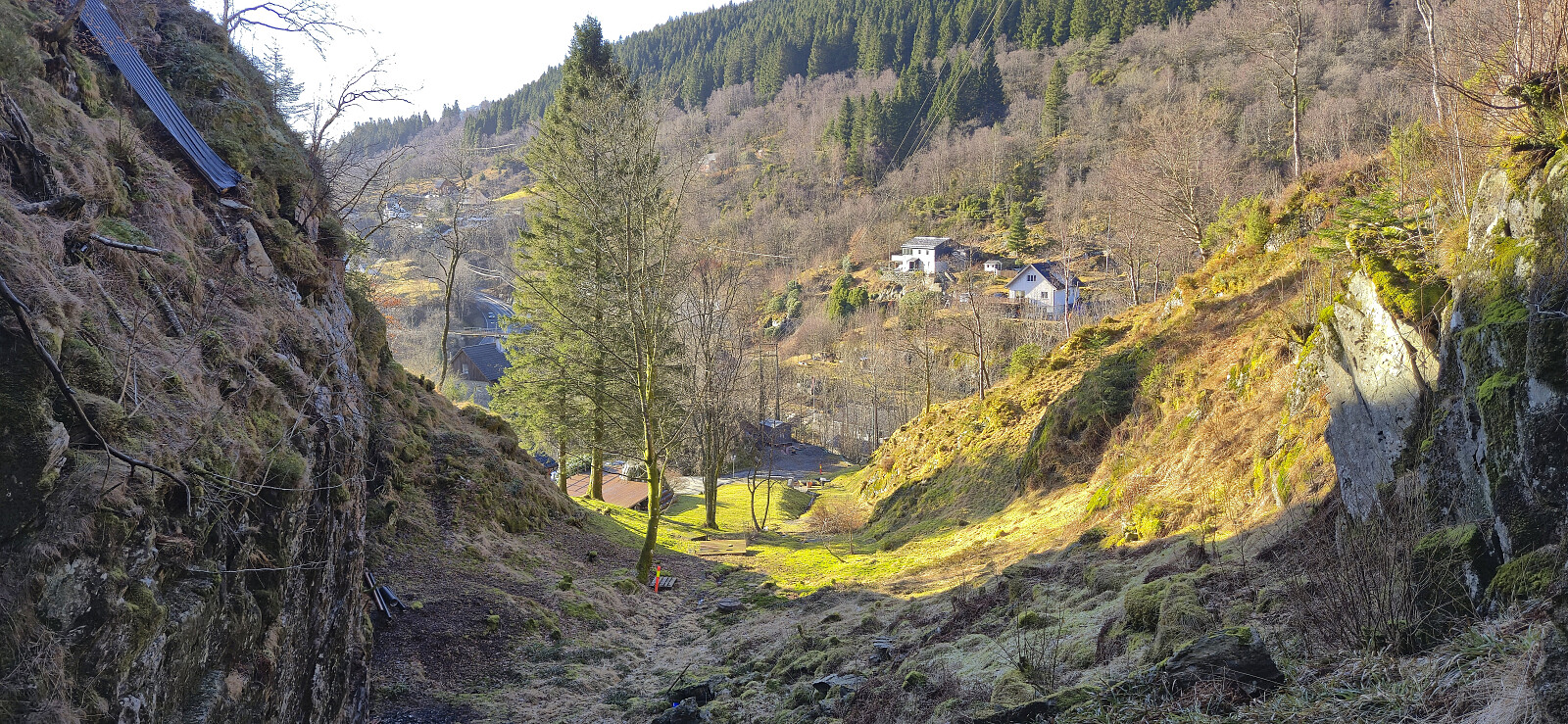
Across Hellen festning
- Datum:
- 21.03.2026
- Tourcharakter:
- Wanderung
- Tourlänge:
- 0:35h
- Entfernung:
- 3,2km
 Short local Saturday hike in light rain.
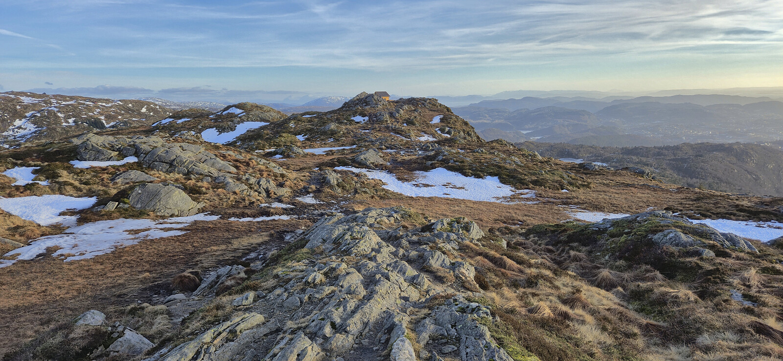
Rundemanen via Brakhaugen
- Datum:
- 20.03.2026
- Tourcharakter:
- Bergtour
- Tourlänge:
- 3:07h
- Entfernung:
- 13,6km
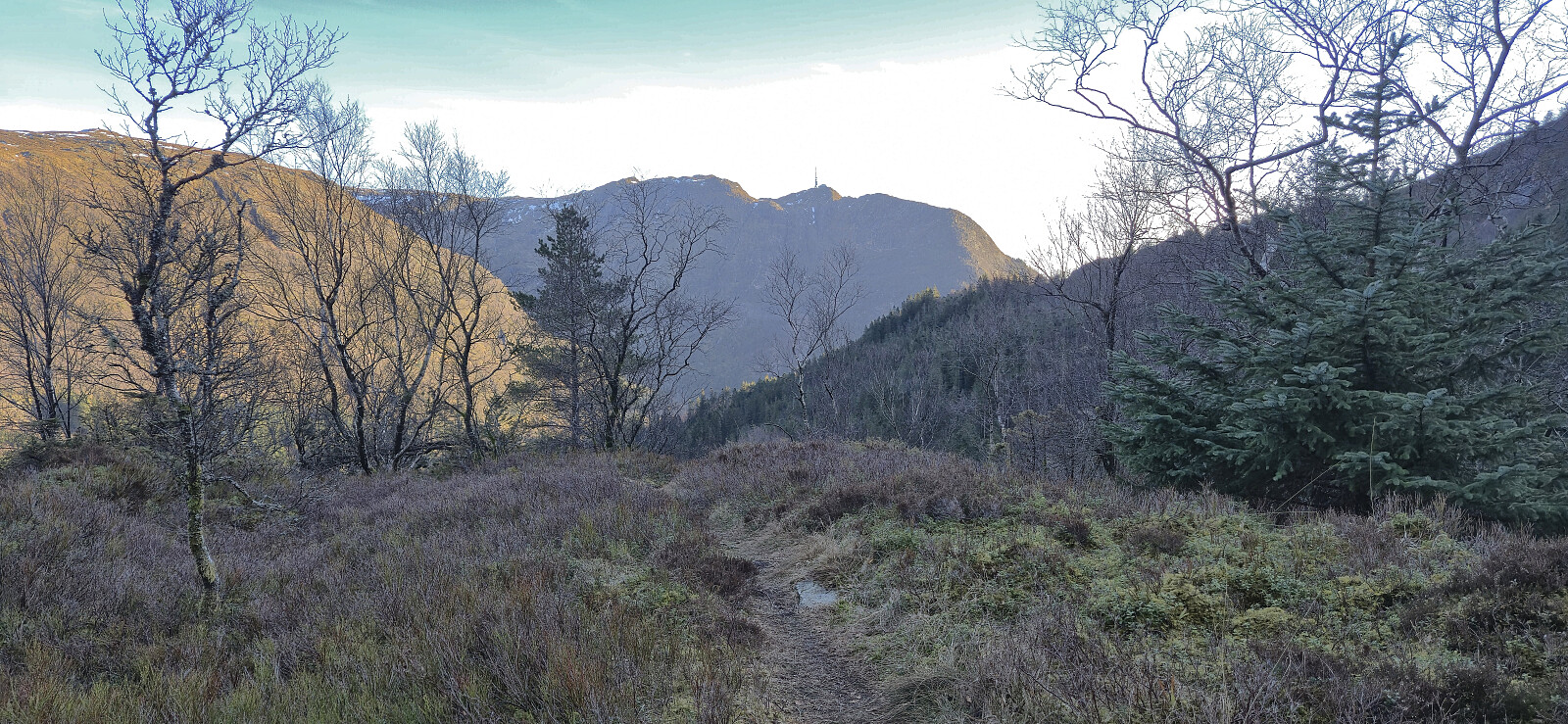 Before heading home from work I decided to try a (for me) new trail to Rundemanen from Tarlebøveien via Brakhaugen. The trail seemed to mainly be used for downhill cycling, although I did not see cyclists, or anyone else for that matter, this evening. Overall, the route can be recommended and provided some relatively unusual views. Even the very familiar antenna at Rundemanen felt different when approached from the southeast.
Fjellveien, Sandviksbatteriet and Håmanen
- Datum:
- 15.03.2026
- Tourcharakter:
- Bergtour
- Tourlänge:
- 2:16h
- Entfernung:
- 8,8km
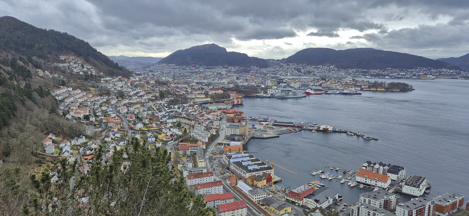 Local Sunday hike.
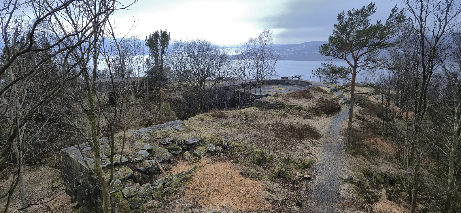
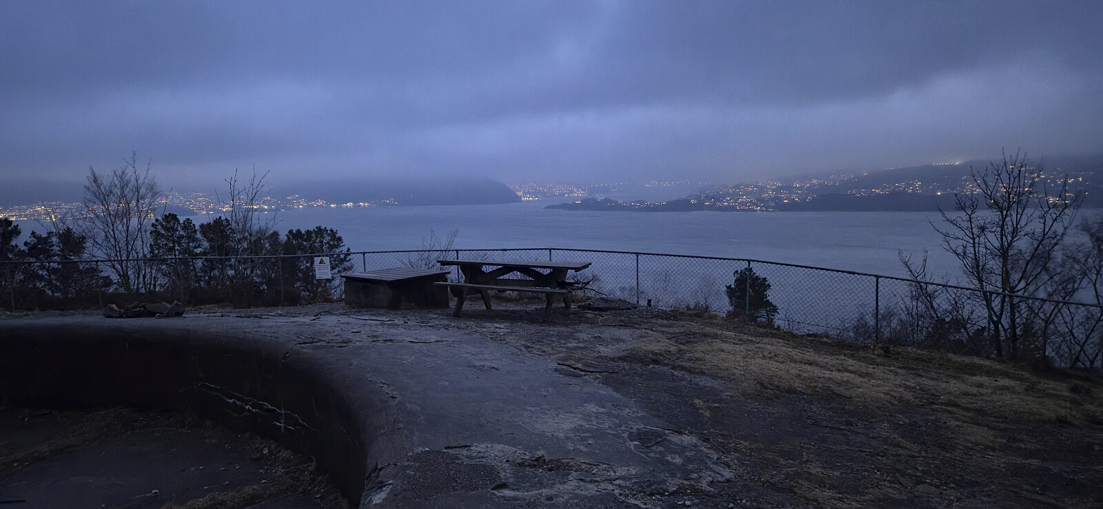
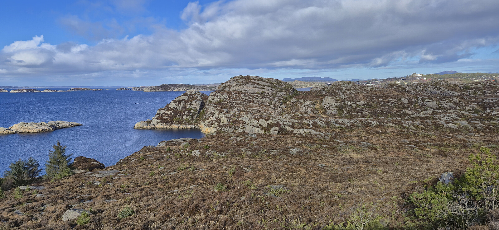
Ørneberget, Furukammen and Hellen festning
- Datum:
- 14.03.2026
- Tourcharakter:
- Bergtour
- Tourlänge:
- 1:03h
- Entfernung:
- 4,0km
 Short local Saturday hike around sunset.
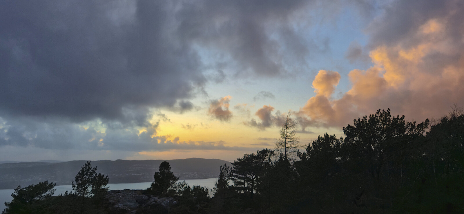
Across Hellen festning
- Datum:
- 10.03.2026
- Tourcharakter:
- Wanderung
- Tourlänge:
- 0:36h
- Entfernung:
- 3,2km
 Short local hike after work.
Fjellveien
- Datum:
- 08.03.2026
- Tourcharakter:
- Wanderung
- Tourlänge:
- 2:10h
- Entfernung:
- 8,6km
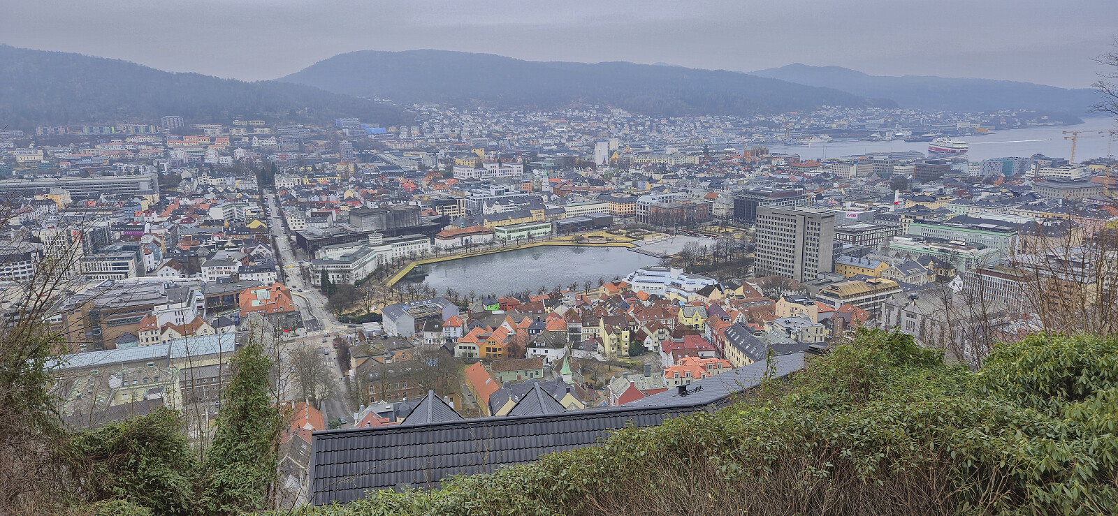 Short hike on a gray Sunday.
Store Bjoreinuten, Fagernuten and Vetle Allgarden
- Datum:
- 07.03.2026
- Tourcharakter:
- Tourenskilauf
- Tourlänge:
- 5:10h
- Entfernung:
- 17,8km
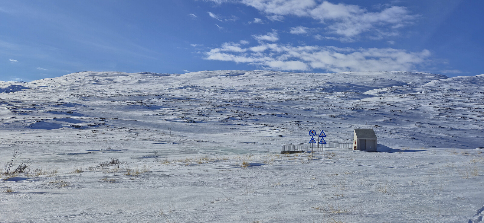 After a long drive from Bergen, most of it in very dense fog, we could finally leave the poor visibility behind shortly after beginning the ascent from Eidfjord and when parking the car next to the road north of Store Bjoreinuten the sun was shining from an almost cloudless sky. After crossing Bjoreio we easily made our way to the highest point of Store Bjoreinuten, passing by the old northwestern summit marked by a small cairn on the way.
Next, we headed more or less directly southwest towards Fagernuten , rounded the summit on the eastern side and made the final ascent from the south. After a short break next the cairn, we descended northeast into the valley between Fagernuten and Store Allgarden before turning north and passing by Drøllstøl on our way to Vetle Allgarden .
The ascent to Vetle Allgarden was a mixed bag. It started with a minor struggle >>>
After a long drive from Bergen, most of it in very dense fog, we could finally leave the poor visibility behind shortly after beginning the ascent from Eidfjord and when parking the car next to the road north of Store Bjoreinuten the sun was shining from an almost cloudless sky. After crossing Bjoreio we easily made our way to the highest point of Store Bjoreinuten, passing by the old northwestern summit marked by a small cairn on the way.
Next, we headed more or less directly southwest towards Fagernuten , rounded the summit on the eastern side and made the final ascent from the south. After a short break next the cairn, we descended northeast into the valley between Fagernuten and Store Allgarden before turning north and passing by Drøllstøl on our way to Vetle Allgarden .
The ascent to Vetle Allgarden was a mixed bag. It started with a minor struggle >>>
Oppstemten, Ulriken and Landåseggen
- Datum:
- 04.03.2026
- Tourcharakter:
- Bergtour
- Tourlänge:
- 1:57h
- Entfernung:
- 6,8km
 Short hike before heading home from work. Sunny, but cold wind at the top.
Hanøyna and Ramsøyna
- Datum:
- 01.03.2026
- Tourcharakter:
- Bergtour
- Tourlänge:
- 3:02h
- Entfernung:
- 9,3km
 Inspired by Kjell 's trip to Ramsøyna almost exactly one year ago, we drove to Hanøyna were we parked at the almost empty parking lot outside Hanøy Skole (it was Sunday after all). From there we followed the main road southwest to Ramsøyna for a visit of Ramsøy Fort and Nordvestre Ramsøytangen. On the way back to the car we made quick stops at Stora Lauvøyna and Hanøyklubben , both accessible via ok trails. Note that the latter is part of Hanøyklubben naturreservat and is off limits for hikers between April 15th and July 31st due to the seabird nesting season.
Bratland Camping to Midtun via Ørnatua and Dyngelandsåsen
- Datum:
- 28.02.2026
- Tourcharakter:
- Bergtour
- Tourlänge:
- 3:10h
- Entfernung:
- 11,0km
 A return to Bratland Camping to explore a new trail I had discovered during last weekend's hike from Sædalen to Bratland Camping via Hauggjelsvarden . In the process I also visited a new minor peak now added to the Alle topper i Bergen list , namely Ørnatua . The start of the trail from Bratland Camping is marked and easy to follow, while for the rest of the route southwest to Grimeneset the trail was weaker and unmarked but still overall easy to follow.
After reconnecting with the paved road I continued southwest with the plan to ascend Dyngelandsåsen from the east, however I failed to locate any trailheads and ended up rounding the hill and instead ascending via Tårnnebben from the southwest.
The hike was concluded by a quick visit of Midtun holdeplass , a stop at Gamle Vossebanen , before getting on a bus back to the city center.
A return to Bratland Camping to explore a new trail I had discovered during last weekend's hike from Sædalen to Bratland Camping via Hauggjelsvarden . In the process I also visited a new minor peak now added to the Alle topper i Bergen list , namely Ørnatua . The start of the trail from Bratland Camping is marked and easy to follow, while for the rest of the route southwest to Grimeneset the trail was weaker and unmarked but still overall easy to follow.
After reconnecting with the paved road I continued southwest with the plan to ascend Dyngelandsåsen from the east, however I failed to locate any trailheads and ended up rounding the hill and instead ascending via Tårnnebben from the southwest.
The hike was concluded by a quick visit of Midtun holdeplass , a stop at Gamle Vossebanen , before getting on a bus back to the city center.
