Archiv - Nach Datum
Archiv - Nach Aktivität
-
Andere Tour (1)
- Expedition (1)
-
Andere Wintertour (9)
- Schneeschuhtour (9)
- Fahrradtour (2)
- Fußtour (222)
-
Klettern (8)
- Alpinklettern (7)
- Mixed-Klettern (1)
-
Skitour (48)
- Randonnée/Telemark (48)

To Mount Urfjellet with my Son Dag
- Datum:
- 16.07.2016
- Tourcharakter:
- Wanderung
- Tourlänge:
- 3:25h
- Entfernung:
- 10,7km
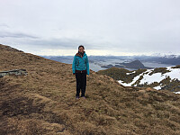
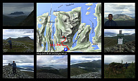 Just outside the little village of Slyngstad, you'll find an old road over Mount Remefjellet, and then down to the fjord called Samfjorden on the other side of the mountain (see map). This old road was once upon a time the main road to the village of Brattvåg. Later on, however, a new road was built, with a tunnel through the mountain; and the old road is now no longer being maintained, and it is now mainly used by tour walkers and mountain trekkers. Tour walkers are actually still using the entire length of the road to get from one side of the mountain to the other; whereas for the mountain trekkers about half of it has become the first leg of the trail up to Mount Urfjellet [839 m.a.m.s.l.] and Mount Storfjellet [950 m.a.m.s.l.].
My son and I parked our car at a little parking lot at Slyngstad, >>>
Hiking to Mount Blåskjerdingen with my Sister
- Datum:
- 02.07.2016
- Tourcharakter:
- Wanderung
- Tourlänge:
- 5:04h
- Entfernung:
- 9,8km
 My sister is living in another part of our beautiful country, but whenever she's visiting our part of the country, she frequently asks me to take her on some mountain trip. Now, I don't dare to take her on the steepest and most challenging climbs, so when she asks me for that, I say to her, just as when we were kids: "No, you're too young...!" Nevertheless, I considered that she would do quite well with Mount Blåskjærdingen, so on this day we agreed to go there. Now, Mount Blåskjerdingen has two summits, with a characteristic V-shaped cleft in between them; and this actually makes it quite easy to spot the mountain even from afar.
We parked our car at a parking lot in Vatnedalen Valley (see map). Her on Peakbook this parking lot has actually been named after the mountain, i.e. you'll >>>
Evening Hike Up the Northwest Ridge of Mount Ulriken
- Datum:
- 20.06.2016
- Tourcharakter:
- Wanderung
- Tourlänge:
- 2:44h
- Entfernung:
- 9,8km
 On this longest day of the year, I made this combined run and hike in the city of Bergen, Norway. I started out by running along Lake Alrekstadvatnet [commonly referred to as Svartediket, i.e. "The Black Dike"] in Ulriksdalen Valley. At the end of the valley I circumscribed the east end of the lake, passing the valleys of Våkendalen, Hardbakkedalen and Isdalen; and then came to the foot of the mountain ridge called Ulrikseggen. [The proper translation of "Ulrikseggen" is "The Mount Ulriken mountain ridge", though the Norwegian word "egg" in Ulrikseggen actually corresponds to the English word "edge"]. At the foot of The Mount Ulrik Ridge, there's some dense birch forrest, and there where multiple trails in the forrest, hence a little bit difficult >>>
Hiking to Mount Trolltind from Tomresetra with my Son Dag
- Datum:
- 18.06.2016
- Tourcharakter:
- Wanderung
- Tourlänge:
- 4:34h
- Entfernung:
- 10,4km
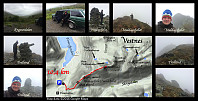 Mountain hiking to Brustind (1170 m.a.m.s.l.) with my son Dag on this day. We chose a different outset from what I did when I climbed this mountain on November 1st last year, allowing us to climb even the mountain Middagsfjellet on our way up. The literal meaning of the name "Middagsfjellet" is the "Mid-Day Mountain" or the "Noon Mountain", a name probably applied to the mountain because of its location just south of the village Tomra by the fjord Tomrefjord. At 12 o'clock the sun would be standing just above this particular mountain (for an observer in Tomrefjord); hence the inhabitants in Tomra used the mountain to mark out the time for noon back in the old days when common people didn't go around wearing watches.
This hike isn't too steep. The first part goes >>>
Combined run and hike the "rear way" up to Mount Ulriken
- Datum:
- 16.06.2016
- Tourcharakter:
- Wanderung
- Tourlänge:
- 2:24h
- Entfernung:
- 12,0km
 On this day I had a combined workout, i.e. I run along the road called Tarlebøveien in the Ulriksdalen Valley , and then hiked up a valley called Isdalen. Where the valley called Ulriksdalen ends, it actually divides into three separate valleys, that are called (from west to east) Våkendalen, Hardbakkedalen, and Isdalen ["dal" is the Norwegian word for "valley"]. In its upper part, Isdalen Valley is called Smalisdalen , as it narrows in a bit up there. So, I hiked up Isdalen and Smalisdalen up to the mountain plateau of which Mount Ulriken is a part. From the entrance to the plateau I ran alongside the southeast side of Mount Ulriken, and then followed a commonly used trail back down to the districts of Montana and Lægdene, where I'm renting an apartment in Bergen. (Back >>>
With my daughter Vår to the summit of Mount Storhornet
- Datum:
- 30.04.2016
- Tourcharakter:
- Wanderung
- Tourlänge:
- 0:57h
- Entfernung:
- 3,3km
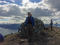 I had a combined hike and run to Mount Storhornet with my daughter Vår vaarsolholm (Vår Solholm) on this day. We wanted to see how quickly we could get up there (from the parking lot at Hestvika - i.e. The Horse's Bay). We walked quickly up to the plateau where Lake Alnesvatnet is located, then run east along the edge of the plateau, before we continued with quick walking up the mountain ridge towards Storhornet, with a final short run even at the little summit "plateau". As we were pushing on all the way up, I actually also used my Endomondo App as a stop-watch; which is why I only tracked the climb up, and not the descent back down from the mountain on this occasion.
For a more thorough trail description, and for a more proper GPS tracking, see my tour description from March 26th 2016, when I climbed the >>>
Evening Hike Up Mount Ulriken
- Datum:
- 16.04.2016
- Tourcharakter:
- Wanderung
- Tourlänge:
- 0:46h
- Entfernung:
- 1,8km
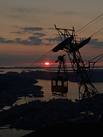 This evening I hiked Mount Ulriken. I started out from my Bergen apartment just behind Haukeland University Hospital, and hiked along a trail that goes pretty much parallel to the cable car, though it also crosses a few time underneath the cable line. This route is very nice, in that it goes through the forrest until you've come to the forrest boundary; thereafter it just goes through heather and over stones and rock. I arrived at the area of the upper cable car stop just in time for the sunset, and managed to capture some nice images.
With my daughter Sol to the summit of Mount Storhornet
- Datum:
- 26.03.2016
- Tourcharakter:
- Wanderung
- Tourlänge:
- 2:44h
- Entfernung:
- 6,8km
 As on multiple other occasions, I ascended the summit of Storhornet, the highest peak on the mountain of the island Godøy, in Giske Municipality, in Møre & Romsdal County on the west coast of Norway. I have frequently climbed this mountain alone, but on several occasions I've also climbed the mountain along with one of my children; and on this day it was my oldest daughter Sol who joined me for the hike. We parked our car on the parking lot in Hestvika [i.e. The Horse's Bay], and started out from there. This parking place is spacious, and it's free of charge, so I recommend it to anyone who's planning to do this hike. The trail up the north face of the mountain starts about 100 meters from the parking lot. There is a combined pedestrian and bicycle lane on the other side of the road, >>>
Another Winter Hike to Mount Storehornet on Godøy Island
- Datum:
- 05.03.2016
- Tourcharakter:
- Wanderung
- Tourlänge:
- 2:45h
- Entfernung:
- 7,0km
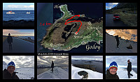 On this day a made a hike to the summit Storhornet on Godøy Island off the coast of Møre & Romsdal County on the west coast of Norway, along with my son Dag. We parked at the new parking lot in Hestvika [i.e. The Horse's Bay], where there's plenty of space even during the tourist season, and set out from there. We followed the regular route up to the plateau where Lake Alnesvatnet (250 m.a.m.s.l.) is located, then continued along the lake till we reached the northeast end of it, from where we followed the usual path along the mountain ridge to the summit of the mountain. There was snow all the way up on this particular day (snow often comes and goes during the winter, as the island is located within the Gulf Stream of the Atlantic Ocean). Back down we used the same route as we had used >>>
Winter Hike to the "Big Horn" on Godøy Island
- Datum:
- 06.02.2016
- Tourcharakter:
- Wanderung
- Tourlänge:
- 4:05h
- Entfernung:
- 10,4km
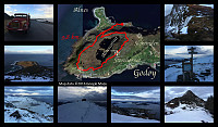 I've been hiking to the summits Storhornet and Lesten on the mountain of the island Godøy multiple times. This afternoon I did this trek again. I set out from the relatively new parking lot in the bay called Hestvika [i.e. The Horse's bay]; which is rather spacious, making it possible even to park there with a lorry. I frequently borrow either my wife's car or my son's car when I go trekking, but on this day they were both at work; hence I had to use my truck/lorry, as that's the only vehicle owned by me. I climbed up to the plateau on which lake Alnesvatnet is located, and continued up the ridge just north east of the lake, towards Storhornet. The trail curves southwards, and then southwest as you approach the summit of Storhornet (495 m.a.m.s.l.). From Storhornet it is possible to just continue >>>

