Archiv - Nach Datum
Archiv - Nach Aktivität
-
Andere Tour (1)
- Expedition (1)
-
Andere Wintertour (10)
- Schneeschuhtour (10)
- Fahrradtour (2)
- Fußtour (228)
-
Klettern (8)
- Alpinklettern (7)
- Mixed-Klettern (1)
-
Skitour (49)
- Randonnée/Telemark (49)


Gesammelte Listen
-
Romsdal ≥ 100m pf.
(134/301)
 44%
44% -
Sunnmøre ≥ 100m pf.
(78/531)
14%
-
Norges 1000 største fjell målt i primærfaktor
(52/1000)
5%

Fottur til Englafjellet, Ulvanosa og Geitadalstinden
- Datum:
- 20.09.2025
- Tourcharakter:
- Bergtour
- Tourlänge:
- 8:53h
- Entfernung:
- 21,8km
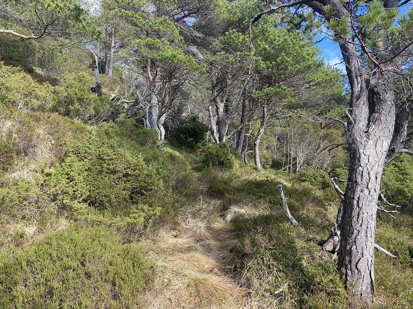
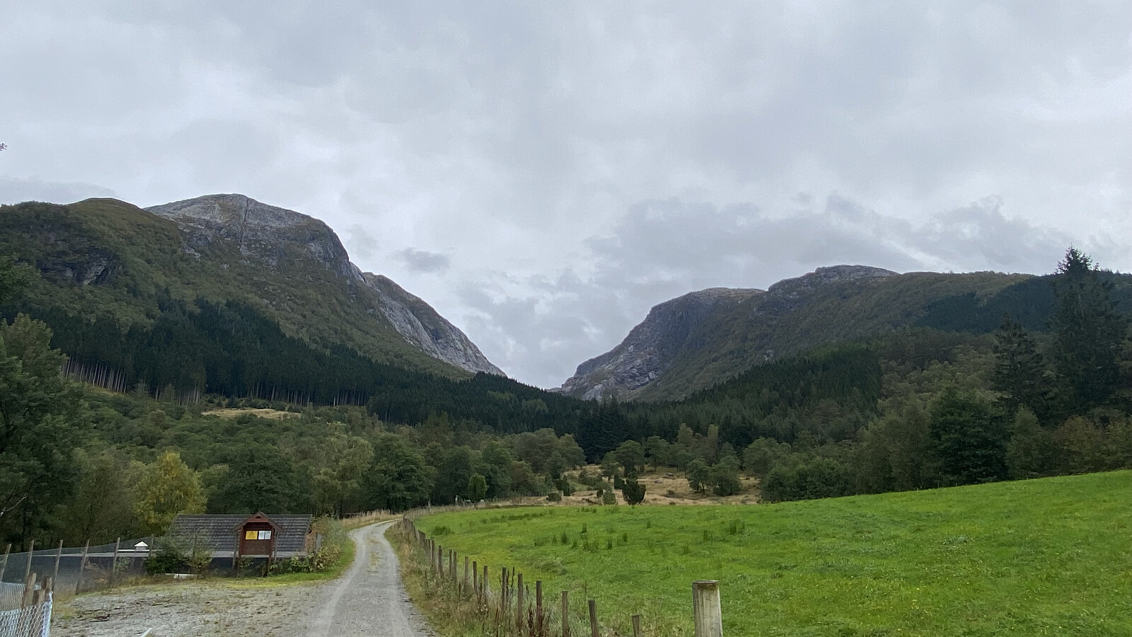 Jeg var på besøk hos venner i Uskedalen da jeg la ut på denne turen. Været var skyet, og ikke på noen måte det beste, men jeg var blitt lokket til disse traktene med at det skulle være så fine fjell her omkring, og da var det liksom ikke så aktuelt å ikke få seg en fjelltur i løpet av helgen. Vennene jeg besøkte bor omtrent akkurat der Eikedalselva kommer ned, og dermed var enkleste veien til fjells rett og slett å ta veien oppover Eikedalen. Dagens turmål var Englafjell [1200 m.o.h.]. Man kan også bestige dette fjellet ved å følge fjellryggen opp fra Uskedalen, men da måtte jeg enten starte i selve Uskedalen, ved gardsbruket Fet, eller så måtte jeg et eller annet sted krysse Eikedalselva, for å komme meg bort til ryggen.
Jeg fulgte grusveien oppover Eikedalselva så langt >>>
Jeg var på besøk hos venner i Uskedalen da jeg la ut på denne turen. Været var skyet, og ikke på noen måte det beste, men jeg var blitt lokket til disse traktene med at det skulle være så fine fjell her omkring, og da var det liksom ikke så aktuelt å ikke få seg en fjelltur i løpet av helgen. Vennene jeg besøkte bor omtrent akkurat der Eikedalselva kommer ned, og dermed var enkleste veien til fjells rett og slett å ta veien oppover Eikedalen. Dagens turmål var Englafjell [1200 m.o.h.]. Man kan også bestige dette fjellet ved å følge fjellryggen opp fra Uskedalen, men da måtte jeg enten starte i selve Uskedalen, ved gardsbruket Fet, eller så måtte jeg et eller annet sted krysse Eikedalselva, for å komme meg bort til ryggen.
Jeg fulgte grusveien oppover Eikedalselva så langt >>>
Til Taskedalshornet og Taskedalstinden
- Datum:
- 19.07.2025
- Tourcharakter:
- Bergtour
- Tourlänge:
- 5:52h
- Entfernung:
- 14,3km
 Jeg hadde helga i forveien besøkt Grønfonnfjellet [1509] og Brekkehornet [1525 m.o.h.] sammen med min eldste sønn. Vi hadde da egentlig snakket om å fortsette fra Brekkehornet bort på Taskedalstinden [1609 m.o.h.], og så følge ryggen mellom Taskedalstinden og Taskedalshornet [1406 m.o.h.] tilbake til start, slik at vi fikk oss en rundtur som omkranset hele Taskedalen. Oppe på Brekkehornet kom vi imidlertid til at det var litt for sent på dag for dette, og tok oss derfor i stedet ned i Taskedalen, og kom oss ned igjen på denne måten [se turbeskrivelse her: Til Grønfonnfjellet og Brekkehornet ]. Og dermed bestemte jeg meg for å ta turen opp på Taskedalstinden denne dagen i stedet.
Jeg parkerte på Nedre Røsta P-plass oppe ved Bøstølen, og fulgte stien innover i dalføret mellom Taskedalshornet og Kammen [1096 m.o.h.]. >>>
Jeg hadde helga i forveien besøkt Grønfonnfjellet [1509] og Brekkehornet [1525 m.o.h.] sammen med min eldste sønn. Vi hadde da egentlig snakket om å fortsette fra Brekkehornet bort på Taskedalstinden [1609 m.o.h.], og så følge ryggen mellom Taskedalstinden og Taskedalshornet [1406 m.o.h.] tilbake til start, slik at vi fikk oss en rundtur som omkranset hele Taskedalen. Oppe på Brekkehornet kom vi imidlertid til at det var litt for sent på dag for dette, og tok oss derfor i stedet ned i Taskedalen, og kom oss ned igjen på denne måten [se turbeskrivelse her: Til Grønfonnfjellet og Brekkehornet ]. Og dermed bestemte jeg meg for å ta turen opp på Taskedalstinden denne dagen i stedet.
Jeg parkerte på Nedre Røsta P-plass oppe ved Bøstølen, og fulgte stien innover i dalføret mellom Taskedalshornet og Kammen [1096 m.o.h.]. >>>
Til Grønfonnfjellet og Brekkehornet
- Datum:
- 12.07.2025
- Tourcharakter:
- Hochtour
- Tourlänge:
- 9:33h
- Entfernung:
- 14,9km
 Jeg har i den senere tid tatt turen opp på en del av fjella i Innfjordsområdet, og hadde dagene i forkant av denne dagen planlagt en tur opp på Grønfonnfjellet [1509 m.o.h.] og Brekkehornet [1525 m.o.h.]. Egentlig hadde jeg tenkt å fortsette fra Brekkehornet videre opp på Taskedalstinden [1609 m.o.h.], men det ble det til at vi droppet. Vår eldste sønn, Dag, hadde vært på Grønfonnfjellet før, men ikke på de to andre, så han bestemte seg for å hive seg med på turen.
Vi kjørte inn til Innfjorden, tok veien oppover mot Bøstølen [420-480 m.o.h.], og parkerte oppe på Tuten parkeringsplass [480 m.o.h.]. Herfra gav vi oss i vei videre oppover grusveien som går oppover langs Grønfonnelva i retning Strupen [600 m.o.h.]. Etter omkring 800 meters gange, tok vi av på en sti som går >>>
Jeg har i den senere tid tatt turen opp på en del av fjella i Innfjordsområdet, og hadde dagene i forkant av denne dagen planlagt en tur opp på Grønfonnfjellet [1509 m.o.h.] og Brekkehornet [1525 m.o.h.]. Egentlig hadde jeg tenkt å fortsette fra Brekkehornet videre opp på Taskedalstinden [1609 m.o.h.], men det ble det til at vi droppet. Vår eldste sønn, Dag, hadde vært på Grønfonnfjellet før, men ikke på de to andre, så han bestemte seg for å hive seg med på turen.
Vi kjørte inn til Innfjorden, tok veien oppover mot Bøstølen [420-480 m.o.h.], og parkerte oppe på Tuten parkeringsplass [480 m.o.h.]. Herfra gav vi oss i vei videre oppover grusveien som går oppover langs Grønfonnelva i retning Strupen [600 m.o.h.]. Etter omkring 800 meters gange, tok vi av på en sti som går >>>
Til Storbua og Månvasstinden
- Datum:
- 21.06.2025
- Tourcharakter:
- Bergtour
- Tourlänge:
- 7:04h
- Entfernung:
- 14,5km
 For knappe 5 år siden besøkte jeg Sandfjellet [1470 m.o.h.], som er det høyeste fjellet i Vestnes kommune. Siden den gang har jeg vært innom parkeringsplassen høyt oppe i Øvstedalen to ganger til fots, i forbindelse med at jeg var på vei ned igjen fra henholdsvis Rollsbotnskorka [1334 m.o.h.] og Brudefølget [1343 m.o.h.]; men jeg hadde ikke gått flere turer med utgangspunkt i Dalskleiva Parkering [390 m.o.h.] før nå. Jeg har imidlertid lenge tenkt på å ta turen oppom Storbua [1498 m.o.h.] herfra, og denne dagen gjorde jeg alvor av det.
For turbeskrivelse fra ovenfor nevnte turer, følg disse lenkene:
To Mount Sandfjellet in Vestnes Municipality Til Storskorka, Litleskorka og Rollsbotnskorka Brudefølget Jeg betalte bompenger som seg hør og bør nede i Øvstedalen, og kjørte opp til Dalskleiva parkering, som ligger helt oppe på 390 m.o.h. Underveis opp hit passerer man ei kjøretøy-sluse >>>
For knappe 5 år siden besøkte jeg Sandfjellet [1470 m.o.h.], som er det høyeste fjellet i Vestnes kommune. Siden den gang har jeg vært innom parkeringsplassen høyt oppe i Øvstedalen to ganger til fots, i forbindelse med at jeg var på vei ned igjen fra henholdsvis Rollsbotnskorka [1334 m.o.h.] og Brudefølget [1343 m.o.h.]; men jeg hadde ikke gått flere turer med utgangspunkt i Dalskleiva Parkering [390 m.o.h.] før nå. Jeg har imidlertid lenge tenkt på å ta turen oppom Storbua [1498 m.o.h.] herfra, og denne dagen gjorde jeg alvor av det.
For turbeskrivelse fra ovenfor nevnte turer, følg disse lenkene:
To Mount Sandfjellet in Vestnes Municipality Til Storskorka, Litleskorka og Rollsbotnskorka Brudefølget Jeg betalte bompenger som seg hør og bør nede i Øvstedalen, og kjørte opp til Dalskleiva parkering, som ligger helt oppe på 390 m.o.h. Underveis opp hit passerer man ei kjøretøy-sluse >>>
Til Skåla og Opstadhornet på Otrøya
- Datum:
- 19.04.2025
- Tourcharakter:
- Bergtour
- Tourlänge:
- 4:57h
- Entfernung:
- 13,5km
 Jeg har de siste årene drevet og samlet på topper i Romsdalen, og tenkte denne dagen at jeg skulle ta turen oppom en av de tre toppene jeg fortsatt manglet ute i Misund, nemlig Skåla [607 m.o.h.]. Jeg var like ved denne toppen i fjor en gang, men da ble det til at vi etter å ha vært på Foksåta la turen ned i Vågsdalen i stedet for å gå over Skåla på vei tilbake til Rakvågen. Jeg kjørte ut til Brattvågen, tok ferja over til Dryna, og fortsatte til Sør-Heggdal, før jeg tok av til venstre, passerte et gårdsbruk, og parkerte omtrent der Heggdalselva møter Lappedalselva. Herfra tok jeg beina fatt, og fulgte en grusvei nordvestover i retning Heggdalskaret og Skarsheia.
På tvers av Otrøya går det et dalføre i retning nord-sør, og grusveien jeg nå gikk på, løper hele veien >>>
Jeg har de siste årene drevet og samlet på topper i Romsdalen, og tenkte denne dagen at jeg skulle ta turen oppom en av de tre toppene jeg fortsatt manglet ute i Misund, nemlig Skåla [607 m.o.h.]. Jeg var like ved denne toppen i fjor en gang, men da ble det til at vi etter å ha vært på Foksåta la turen ned i Vågsdalen i stedet for å gå over Skåla på vei tilbake til Rakvågen. Jeg kjørte ut til Brattvågen, tok ferja over til Dryna, og fortsatte til Sør-Heggdal, før jeg tok av til venstre, passerte et gårdsbruk, og parkerte omtrent der Heggdalselva møter Lappedalselva. Herfra tok jeg beina fatt, og fulgte en grusvei nordvestover i retning Heggdalskaret og Skarsheia.
På tvers av Otrøya går det et dalføre i retning nord-sør, og grusveien jeg nå gikk på, løper hele veien >>>
Til Sukkertoppen med broder'n & Co.
- Datum:
- 18.04.2025
- Tourcharakter:
- Bergtour
- Tourlänge:
- 2:06h
- Entfernung:
- 4,0km
 Sukkertoppen i Ålesund [314 m.o.h.] er en topp jeg ikke har vært på før. Hadde man bod på Hessa, er nok Sukkertoppen et fjell man tidt og ofte ville lagt en løpetur opp på når man skulle ha seg en workout; og hadde man bodd i Ålesund sentrum, hadde man kanskje tatt gjester med seg dit opp fra tid til annen for å vise dem utsikten over byen. Men nå har det seg slik at vi bor utenbys, og dermed så hadde jeg ikke vært på Sukkertoppen før nå. Denne påsken var imidlertid min bror med familie på besøk hos min mor, som bor i Ålesund, og så tenkte de å ta seg en tur opp på Sukkertoppen, og så lurte de på om noen av oss ville være med; og dermed ble det til at jeg og eldste datter, som var på besøk hos oss, hev oss rundt og ble med.
Vi kjørte ut på Hessa, parkerte på Hessa >>>
Sukkertoppen i Ålesund [314 m.o.h.] er en topp jeg ikke har vært på før. Hadde man bod på Hessa, er nok Sukkertoppen et fjell man tidt og ofte ville lagt en løpetur opp på når man skulle ha seg en workout; og hadde man bodd i Ålesund sentrum, hadde man kanskje tatt gjester med seg dit opp fra tid til annen for å vise dem utsikten over byen. Men nå har det seg slik at vi bor utenbys, og dermed så hadde jeg ikke vært på Sukkertoppen før nå. Denne påsken var imidlertid min bror med familie på besøk hos min mor, som bor i Ålesund, og så tenkte de å ta seg en tur opp på Sukkertoppen, og så lurte de på om noen av oss ville være med; og dermed ble det til at jeg og eldste datter, som var på besøk hos oss, hev oss rundt og ble med.
Vi kjørte ut på Hessa, parkerte på Hessa >>>
Hiking to Jemo and Wochecha with two colleagues of mine
- Datum:
- 23.03.2025
- Tourcharakter:
- Bergtour
- Tourlänge:
- 6:13h
- Entfernung:
- 24,0km
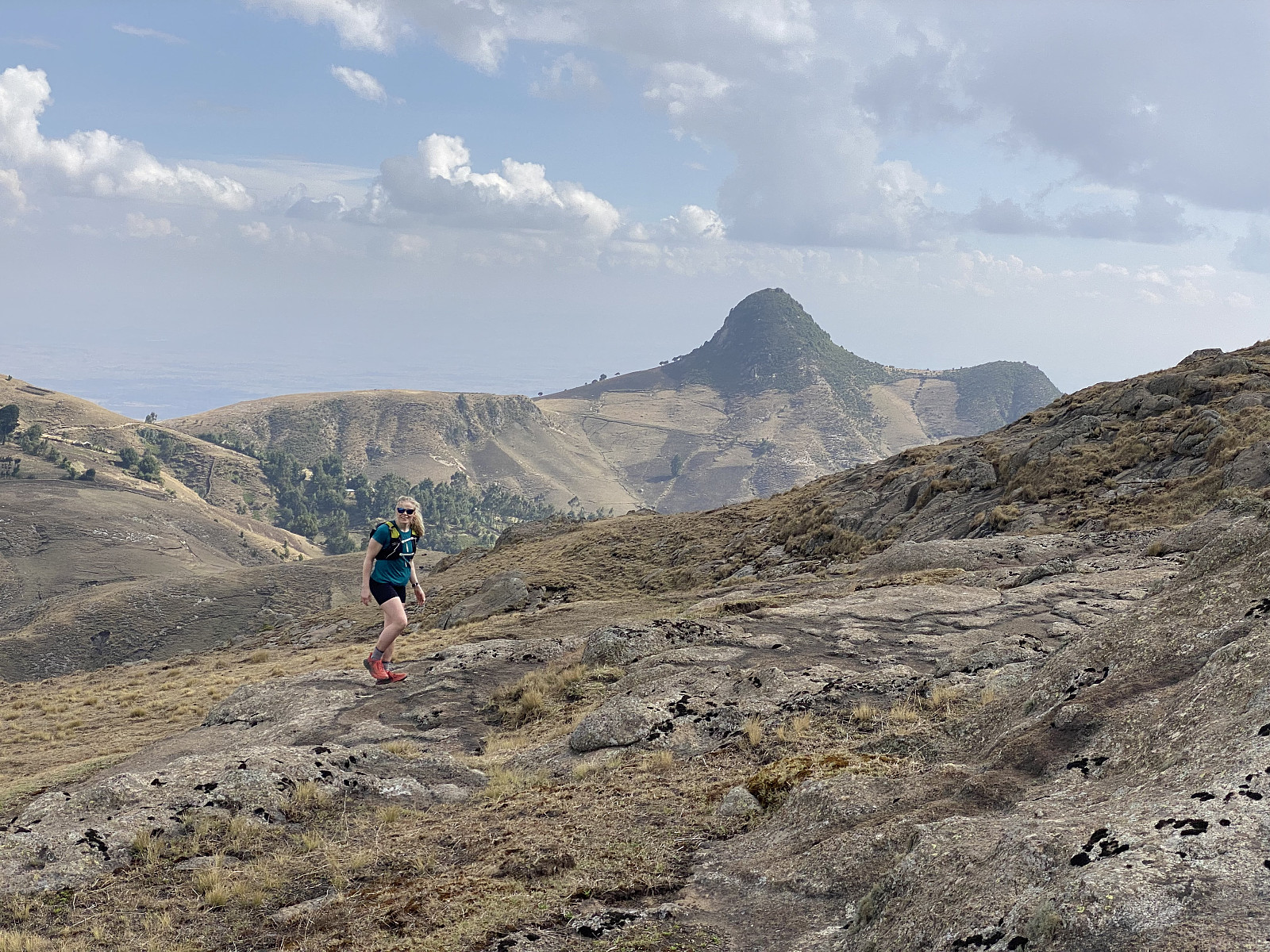 I have previously ascended the Wochecha mountain three times; two times alone, and one time along with a colleague of mine. For descriptions of my previous three ascents of this mountain, check out these links, where GPS tracks are also provided:
My first ascent of Wochecha: 12 timers fottur fra Addis Ababa til Wochecha Mountain t/r (tour description in Norwegian, but the pictures are nice even if you don't speak Norwegian). My second ascent of Wochecha, where I also ascended Moglē Korebta: Climbing Mount Wochecha and encircling the old crater (tour description in English). My third ascent, where I was joined by a colleague that had been working along with me at the Black Lion Hospital in Addis Ababa: Hiking to Jemo and Wochecha with a colleague of mine (tour description in English). Now I was visiting Addis Ababa once again, along with 25 other Norwegians health care workers, in connection with a heart surgery program that we've been part of. Sure, >>>
I have previously ascended the Wochecha mountain three times; two times alone, and one time along with a colleague of mine. For descriptions of my previous three ascents of this mountain, check out these links, where GPS tracks are also provided:
My first ascent of Wochecha: 12 timers fottur fra Addis Ababa til Wochecha Mountain t/r (tour description in Norwegian, but the pictures are nice even if you don't speak Norwegian). My second ascent of Wochecha, where I also ascended Moglē Korebta: Climbing Mount Wochecha and encircling the old crater (tour description in English). My third ascent, where I was joined by a colleague that had been working along with me at the Black Lion Hospital in Addis Ababa: Hiking to Jemo and Wochecha with a colleague of mine (tour description in English). Now I was visiting Addis Ababa once again, along with 25 other Norwegians health care workers, in connection with a heart surgery program that we've been part of. Sure, >>>
Digergubben, Blåhammaren, Klausethornet og Misundhornet
- Datum:
- 08.02.2025
- Tourcharakter:
- Bergtour
- Tourlänge:
- 3:45h
- Entfernung:
- 9,9km
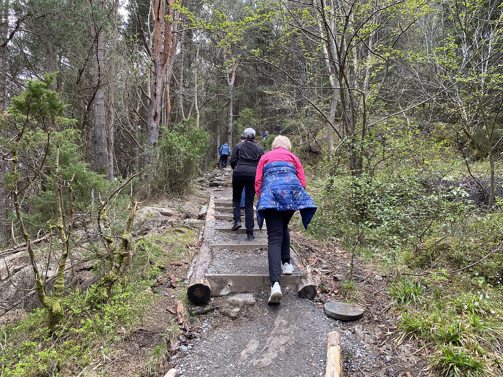
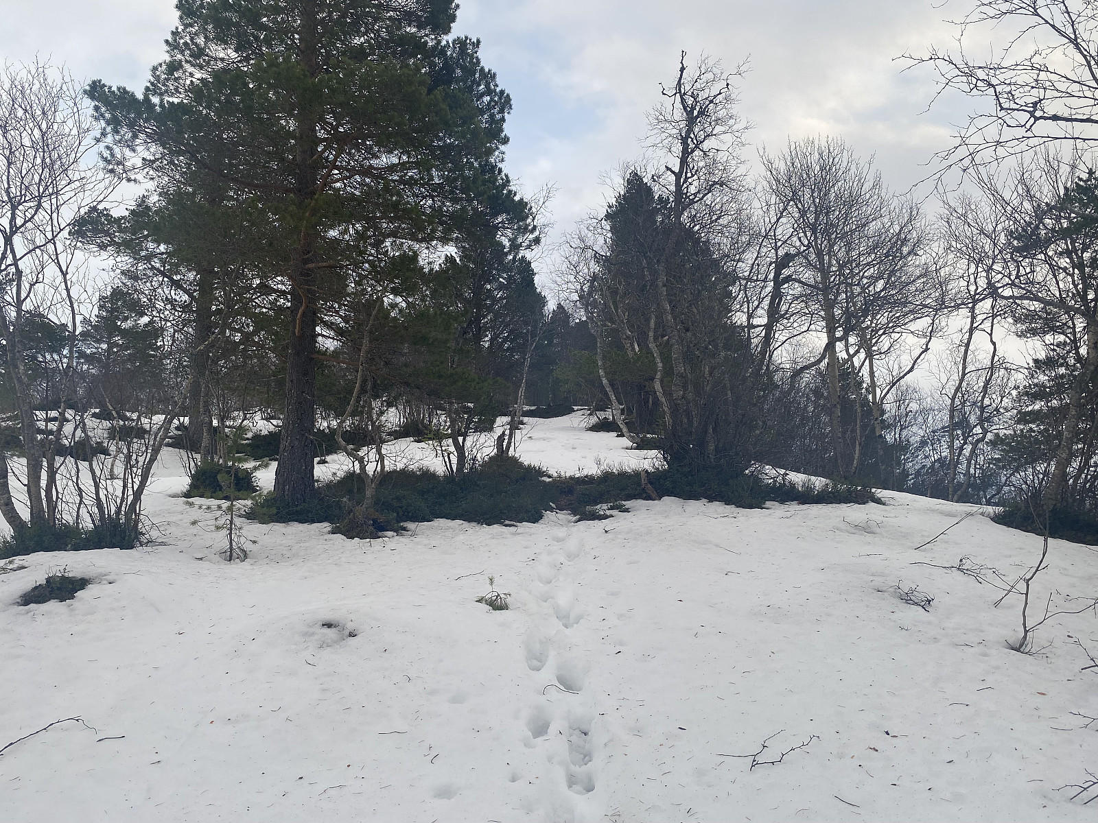
 Det var en fin vinterdag, men med for lite snø i fjellet til at jeg så for meg det ville være noe særlig å gå på ski; og dermed bestemte jeg meg for en fottur opp på noen av toppene ute i Midsund i stedet. Jeg kjørte til Brattvågen, tok ferja over til Dryna, fortsatte gjennom Midsund sentrum; og tok Utsidevegen (Fylkesvei 668) opp til Bakken, der det var en liten parkeringslomme hvor det var skiltet med at her var de Midsundtrappene som blant annet fører opp til Midsundhornet . Her parkerte jeg bilen, og så bar det avsted.
Jeg hadde ikke gått langt, før jeg kom til foten av trappene, og herfra bar det ganske så bratt oppover. Trappene førte dels gjennom småskog, og dels gjennom stein og ur (se bilde #2). Ved 275 m.o.h. kom jeg til et sted der det var skiltet "Kumlokket", >>>
Det var en fin vinterdag, men med for lite snø i fjellet til at jeg så for meg det ville være noe særlig å gå på ski; og dermed bestemte jeg meg for en fottur opp på noen av toppene ute i Midsund i stedet. Jeg kjørte til Brattvågen, tok ferja over til Dryna, fortsatte gjennom Midsund sentrum; og tok Utsidevegen (Fylkesvei 668) opp til Bakken, der det var en liten parkeringslomme hvor det var skiltet med at her var de Midsundtrappene som blant annet fører opp til Midsundhornet . Her parkerte jeg bilen, og så bar det avsted.
Jeg hadde ikke gått langt, før jeg kom til foten av trappene, og herfra bar det ganske så bratt oppover. Trappene førte dels gjennom småskog, og dels gjennom stein og ur (se bilde #2). Ved 275 m.o.h. kom jeg til et sted der det var skiltet "Kumlokket", >>>
Til Storaksla i Isfjorden
- Datum:
- 28.12.2024
- Tourcharakter:
- Bergtour
- Tourlänge:
- 2:20h
- Entfernung:
- 6,6km
 Jeg var litt i tvil om hva slags fjell jeg skulle velge å bestige denne dagen, for det var lite snø og antagelig dårlig skiføre de fleste steder her omkring. Jeg tok en titt på lista Romsdal ≥ 100m pf , og valgte meg ut Storaksla i Isfjorden, som jeg ikke hadde vært på før. Jeg lurte litt på å ta turen som en trugetur, men så kom jeg til at såpass mye av snøen nok hadde regnet bort siste uka; at det ikke var noe poeng med truger, og dermed ble det til at jeg lot dem ligge igjen hjemme. Da jeg kom frem til parkeringsplassen oppe i Hellerøra [ Hellerøra parkeringsplass ], angret jeg litt på dette, for det lå en del snø akkurat rundt parkeringsplassen. Jeg hadde imidlertid fra avstand lagt merke til at fjellryggen opp på vestsida av Storaksla i stor grad var var; så jeg regnet med det ville gå greit >>>
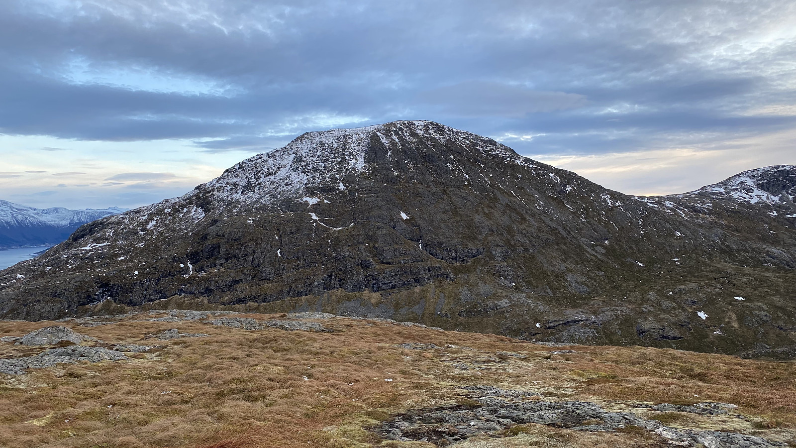
Rundtur til Nyken, Blåtinden og Liahornet
- Datum:
- 09.11.2024
- Tourcharakter:
- Bergtour
- Tourlänge:
- 6:30h
- Entfernung:
- 14,6km
 Denne dagen bestemte vi oss for å besøke noen topper mellom Liabygda og Valldalen, topper som vi ikke tidligere hadde vært på. Det var ikke mer enn 14 dager siden vi var på Berdalsnibba og Vasstinden, men da unnlot vi å besøke Blåtinden , som ligger bare ca. 1 km vest for Vasstinden (i luftlinje); og som på en måte kan sees på som bare en knaus på Vasstinden, ettersom den har primærfaktor på bare 90 meter. Vi bestemte oss med andre ord for å ta Blåtinden som en separat tur i stedet, og la denne dagen derfor opp en runde der vi besøkte både Nyken [1122 m.o.h.], Blåtinden [1341 m.o.h.] og Blåtinden Vest [1341 m.o.h.]. Ingen av disse toppene har PF > 100 meter, og inngår dermed ikke i noen liste jeg i øyeblikket samler på, men de har finfin utsikt, og hører med som en >>>
