Archiv - Nach Datum
Archiv - Nach Aktivität
-
Andere Tour (1)
- Expedition (1)
-
Andere Wintertour (10)
- Schneeschuhtour (10)
- Fahrradtour (2)
- Fußtour (228)
-
Klettern (8)
- Alpinklettern (7)
- Mixed-Klettern (1)
-
Skitour (49)
- Randonnée/Telemark (49)


Gesammelte Listen
-
Romsdal ≥ 100m pf.
(134/301)
 44%
44% -
Sunnmøre ≥ 100m pf.
(78/531)
14%
-
Norges 1000 største fjell målt i primærfaktor
(52/1000)
5%

Til Jønshornet med min sønn
- Datum:
- 22.10.2016
- Tourcharakter:
- Bergtour
- Tourlänge:
- 6:34h
- Entfernung:
- 12,7km
 Jønshornet er en fjelltopp som mange på Sunnmøre har vært på, og som det gjerne prates og fortelles om; og er man bosatt på Sunnmøre, er det ikke usannsynlig at man før eller siden får spørsmålet ”Hva, har du ikke vært på Jønshornet?” Og slik gikk det til at også jeg og eldste sønnen vår satte kursen mot Barstadvika denne oktoberdagen i 2016. Vi tok ferge fra Sunde [Solevågseidet] til Festøy, kjørte fra Festøy til Barstadvika, hvor vi tok av til venstre. Vi hadde på forhånd lest en turbeskrivelse i en bok om fjellturer på Sunnmøre, så vi visste det skulle finnes en parkeringsplass oppe ved Melbøsætra, som var anlagt slik at det var lett å starte turen derfra.
Stien vi fulgte til fjells var godt merket. Den første delen gikk gjennom skog, men vi kom relativt >>>
Jønshornet er en fjelltopp som mange på Sunnmøre har vært på, og som det gjerne prates og fortelles om; og er man bosatt på Sunnmøre, er det ikke usannsynlig at man før eller siden får spørsmålet ”Hva, har du ikke vært på Jønshornet?” Og slik gikk det til at også jeg og eldste sønnen vår satte kursen mot Barstadvika denne oktoberdagen i 2016. Vi tok ferge fra Sunde [Solevågseidet] til Festøy, kjørte fra Festøy til Barstadvika, hvor vi tok av til venstre. Vi hadde på forhånd lest en turbeskrivelse i en bok om fjellturer på Sunnmøre, så vi visste det skulle finnes en parkeringsplass oppe ved Melbøsætra, som var anlagt slik at det var lett å starte turen derfra.
Stien vi fulgte til fjells var godt merket. Den første delen gikk gjennom skog, men vi kom relativt >>>
Across Mount Storhornet on Godøy Island From North to South
- Datum:
- 15.10.2016
- Tourcharakter:
- Wanderung
- Tourlänge:
- 3:01h
- Entfernung:
- 7,5km
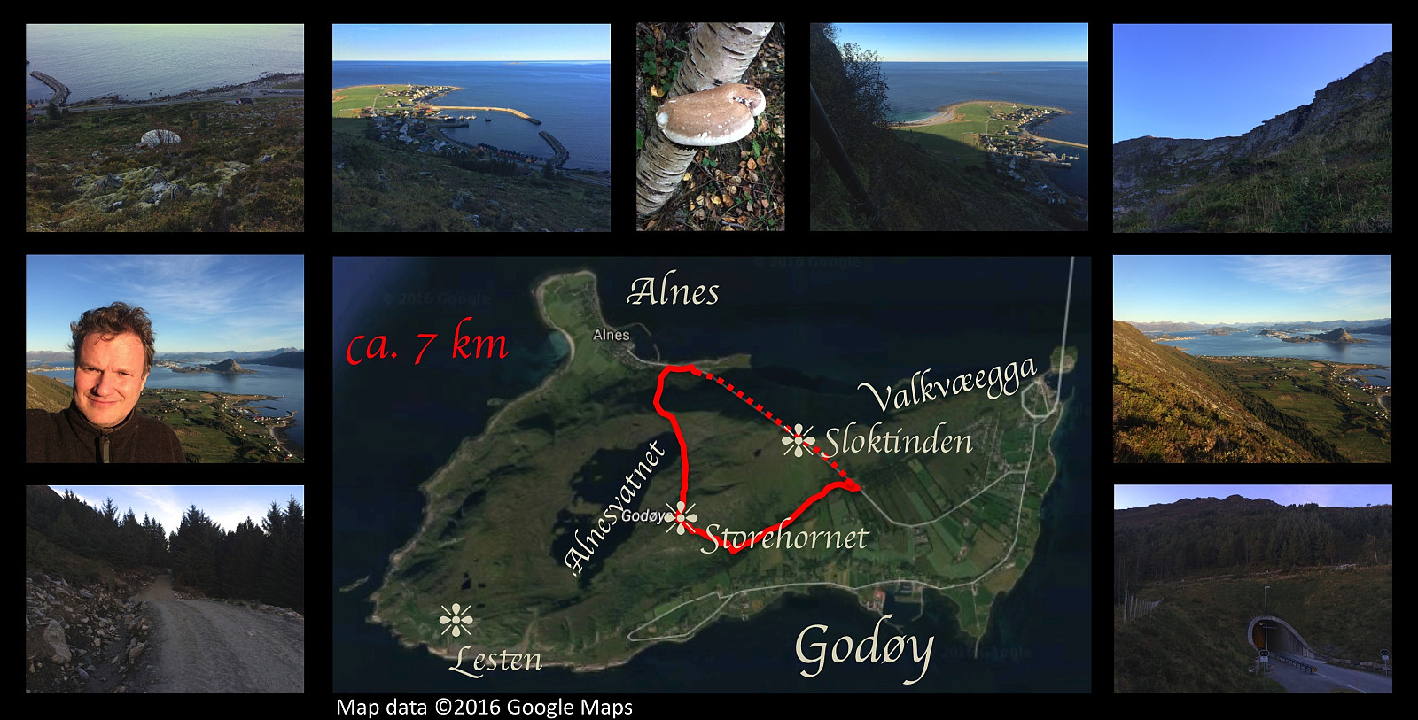 I have climbed the mountain of the island called Godøya a large number of times, but I've mostly used the various commonly used trails to get up and down; though I did once climb up a very steep slope without any trail on the western aspect of the island (for that particular climb, see here: A Different Climb on the Godøy Island and Mount Storehornet ). Now, in order to get some variation, I decided to do a somewhat unusual trek even on this day; so I started out from the parking lot in the bay called Hestevika, and embarked upon a climb more or less straight up the mountain side (see map). At about 250 m.a.m.s.l., this island has a plateau with a lake that serves as the main water supply for the local community, which is comprised of the 4 islands Vigra, Valderøy, Giske and Godøy. Now, in order to bring the water to the community, there's a pipeline >>>
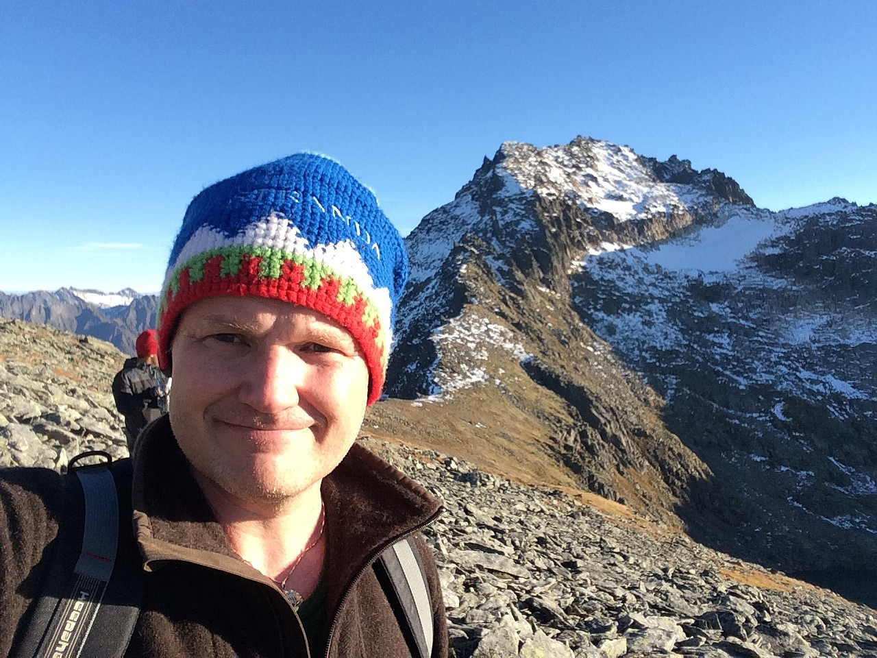
Trolltindtraversen [Brustindtraversen]
- Datum:
- 24.09.2016
- Tourcharakter:
- Hochtour
- Tourlänge:
- 5:40h
- Entfernung:
- 15,6km
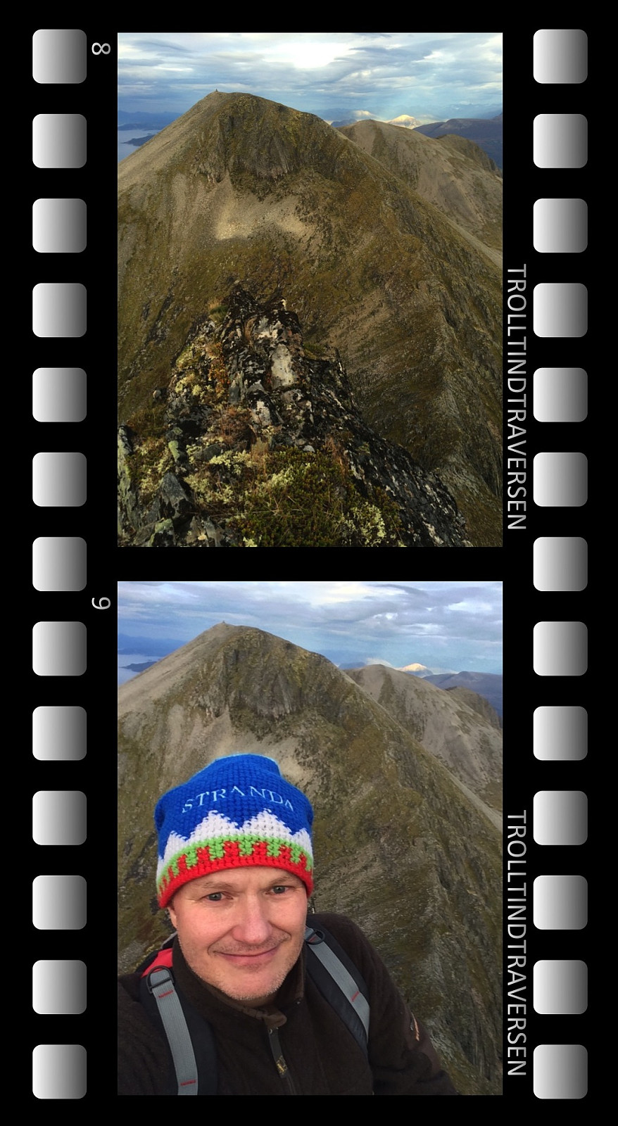 Jeg hadde på dette tidspunkt vært én gang på Ytstetind og én gang på Trolltind [Brustind], og jeg hadde lenge siklet etter å gå denne traversen. Da jeg besøkte Trolltind i oktober året før, husker jeg at jeg stod oppe på kanten og kikket nedover traversen mot Ytstetind, og at jeg syntes den var altfor bratt å skulle prøve seg på. Men jeg husker også at jeg tenkte det måtte være mulig å prøve seg andre veien, altså å gå traversen fra Ytstetind opp på Trolltind, og siden var denne muligheten blitt som en besettelse inne i hodet mitt. Jeg hadde søkt på nettet uten å finne veldig mye om denne traversen. Jeg fant noen innlegg av folk som hadde klatret opp med sikring og ordentlig fjellklatrerutstyr, men jeg fant ikke svar på om det i det var mulig for en som aldri har >>>
Hildrehesten på langs
- Datum:
- 27.08.2016
- Tourcharakter:
- Bergtour
- Tourlänge:
- 5:24h
- Entfernung:
- 14,9km
 Eldste sønnen går mye på fjelltur, og denne lørdagen lurte han på om ikke jeg ville bli med en tur på Hildrehesten. Vi kjørte til Brattvåg sentrum, svingte opp mot Synnalandsvatnet, og parkerte bilen på parkeringsplassen rett ved demningen. Så krysset vi over på demningen, og la avgårde oppover fjellsida. Stien opp mot Store Hestevatnet og Hildrehesten var godt merka, og turen opp gjennom skogen gikk radig.
Oppe ved Store Hestevatnet tok vi oss tid til å fotografere litt, før vi gikk videre. Der elva fra vatnet renner over i Hestetjønnene, var det en liten demning, hvor vatnet fosset over med en dybde på ca. 25 cm. Min sønn hadde høye fjellstøvler, og vasset greit over. Mine var lavere, så jeg tok av meg på føttene, og vasset barføtt over. Stien videre gikk i en slakk >>>
Eldste sønnen går mye på fjelltur, og denne lørdagen lurte han på om ikke jeg ville bli med en tur på Hildrehesten. Vi kjørte til Brattvåg sentrum, svingte opp mot Synnalandsvatnet, og parkerte bilen på parkeringsplassen rett ved demningen. Så krysset vi over på demningen, og la avgårde oppover fjellsida. Stien opp mot Store Hestevatnet og Hildrehesten var godt merka, og turen opp gjennom skogen gikk radig.
Oppe ved Store Hestevatnet tok vi oss tid til å fotografere litt, før vi gikk videre. Der elva fra vatnet renner over i Hestetjønnene, var det en liten demning, hvor vatnet fosset over med en dybde på ca. 25 cm. Min sønn hadde høye fjellstøvler, og vasset greit over. Mine var lavere, så jeg tok av meg på føttene, og vasset barføtt over. Stien videre gikk i en slakk >>>
Til Remmemstind - opp Midtryggen og ned Brastadryggen
- Datum:
- 20.08.2016
- Tourcharakter:
- Hochtour
- Tourlänge:
- 4:59h
- Entfernung:
- 12,2km
 Det var fint vær denne lørdagen, da jeg og yngste datteren bestemte oss for å legge ut på tur. Vi kjørte til Vestnes, betalte kr. 30 i bompenger, og tok bilen helt opp til parkeringsplassen ca. 190 m.o.h. oppi Remmemsdalen. Derfra gikk vi grusveien opp til Remmemssetra, fortsatte stien opp til Hellandssetra og videre opp på Heia. Denne fjellryggen fulgte vi så opp til vi var omtrent på høyde med Remmemsvatnet, der tok vi stien til venstre, og krysset like i forkant av Remmemsvatnet over til midtryggen, som egentlig er en slags fortsettelse av fjellryggen med Bjørnetua og Vardfjellet.
Oppover midtryggen bar det, og skikkelig bratt blir det et stykke oppi der; denne traséen byr på noe klyving, selv om vanskelighetsgraden ligger et hakk under nordøstryggen. Jeg hadde vært på dette >>>
Det var fint vær denne lørdagen, da jeg og yngste datteren bestemte oss for å legge ut på tur. Vi kjørte til Vestnes, betalte kr. 30 i bompenger, og tok bilen helt opp til parkeringsplassen ca. 190 m.o.h. oppi Remmemsdalen. Derfra gikk vi grusveien opp til Remmemssetra, fortsatte stien opp til Hellandssetra og videre opp på Heia. Denne fjellryggen fulgte vi så opp til vi var omtrent på høyde med Remmemsvatnet, der tok vi stien til venstre, og krysset like i forkant av Remmemsvatnet over til midtryggen, som egentlig er en slags fortsettelse av fjellryggen med Bjørnetua og Vardfjellet.
Oppover midtryggen bar det, og skikkelig bratt blir det et stykke oppi der; denne traséen byr på noe klyving, selv om vanskelighetsgraden ligger et hakk under nordøstryggen. Jeg hadde vært på dette >>>
Fjelltur i ørkenen
- Datum:
- 13.08.2016
- Tourcharakter:
- Bergtour
- Tourlänge:
- 1:51h
- Entfernung:
- 6,1km
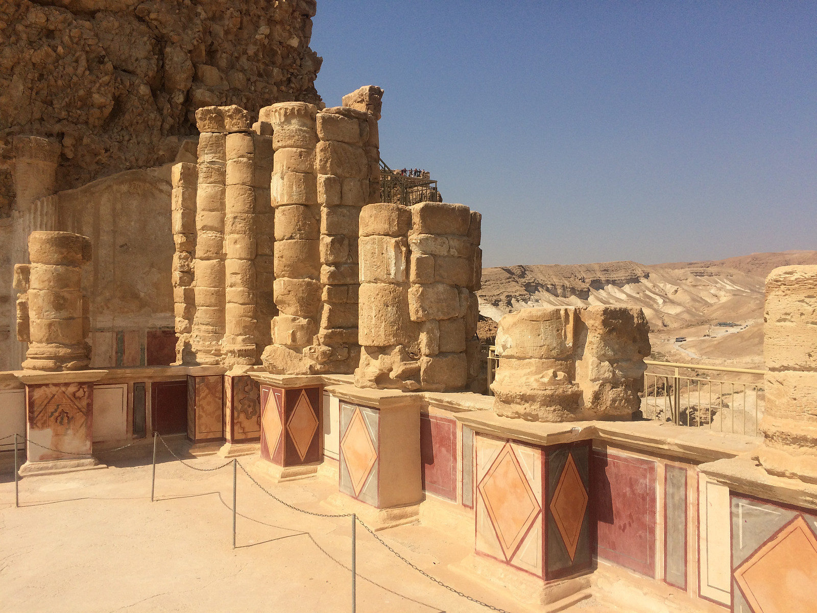 Masada er en kalksteinsklippe i Judea-ørkenen i Israel, rett vest for Dødehavet. Klippen har et nokså flatt platå på toppen, og her oppe bygde kong Herodes den store (ca. 73 - ca. 4 f.Kr) et palass hvor han kunne bo om vinteren, når han syntes det var for kaldt i Jerusalem, som ligger ca. 750 m.o.h. Ruinene av dette palasset er i seg selv verd et besøk, også om man må benytte kabelvognen for å komme seg opp. Jeg hadde imidlertid vært der en gang før, og det som tiltrakk meg ved denne anledningen var tanken på å gå stien opp fra dødehavssletta opp til toppen av Masada.
Det som er utfordrende med turen opp på Masada er ikke høyden, men den intense heten. Masada-platået ligger bare ca. 30 m.o.h., mens turistsenteret, hvor man finner slike ting som parkering, suvenirbutikk og >>>
Masada er en kalksteinsklippe i Judea-ørkenen i Israel, rett vest for Dødehavet. Klippen har et nokså flatt platå på toppen, og her oppe bygde kong Herodes den store (ca. 73 - ca. 4 f.Kr) et palass hvor han kunne bo om vinteren, når han syntes det var for kaldt i Jerusalem, som ligger ca. 750 m.o.h. Ruinene av dette palasset er i seg selv verd et besøk, også om man må benytte kabelvognen for å komme seg opp. Jeg hadde imidlertid vært der en gang før, og det som tiltrakk meg ved denne anledningen var tanken på å gå stien opp fra dødehavssletta opp til toppen av Masada.
Det som er utfordrende med turen opp på Masada er ikke høyden, men den intense heten. Masada-platået ligger bare ca. 30 m.o.h., mens turistsenteret, hvor man finner slike ting som parkering, suvenirbutikk og >>>
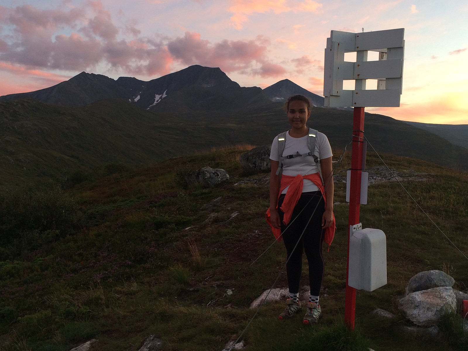
To Mount Slogen with my Two Daughters
- Datum:
- 30.07.2016
- Tourcharakter:
- Hochtour
- Tourlänge:
- 8:03h
- Entfernung:
- 8,8km
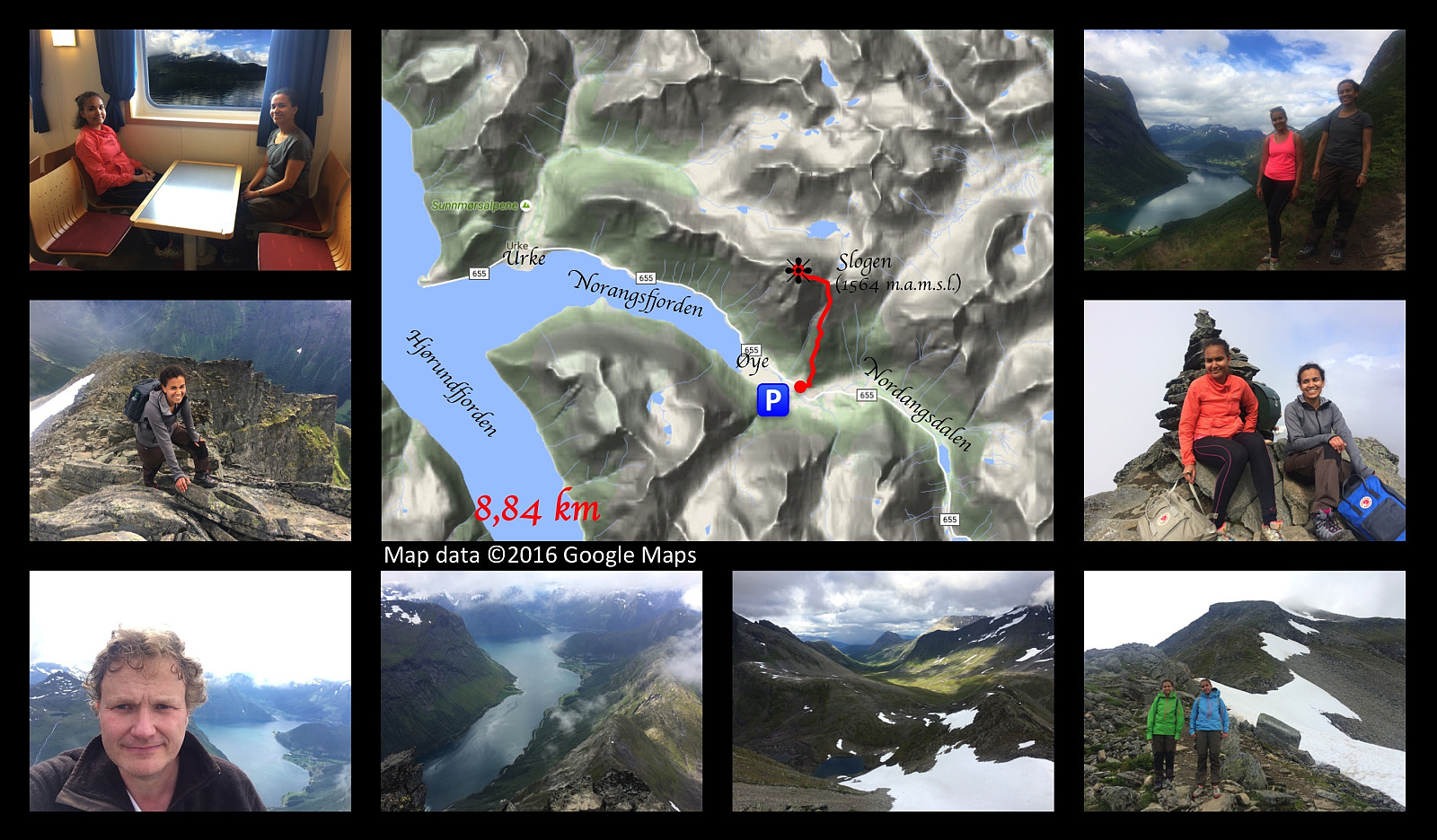 In order to get to Mount Slogen from where we live, you have to cross the fjord called Storfjorden [i.e. “The Large Fjord”], and so on this occasion I went by car with my two daughters to a place called Magerholm; from where we crossed the fjord by ferry, arriving at a headland called Ørsneset, not far from the village of Sykkylven. From Sykkylven we continued our drive to the village of Stranda, then on to the village of Hellesylt; and finally a few kilometres after we had passed Hellesylt, we took the road to the right, which took us down to a fjord called Nordangsfjorden, a side arm of the beautiful fjord of Hjørundfjorden.
We parked at a parking lot at a place called Øye, and immediately embarked upon our climb. The climb up Mount Slogen is quite steep all the way from the beginning >>>
In order to get to Mount Slogen from where we live, you have to cross the fjord called Storfjorden [i.e. “The Large Fjord”], and so on this occasion I went by car with my two daughters to a place called Magerholm; from where we crossed the fjord by ferry, arriving at a headland called Ørsneset, not far from the village of Sykkylven. From Sykkylven we continued our drive to the village of Stranda, then on to the village of Hellesylt; and finally a few kilometres after we had passed Hellesylt, we took the road to the right, which took us down to a fjord called Nordangsfjorden, a side arm of the beautiful fjord of Hjørundfjorden.
We parked at a parking lot at a place called Øye, and immediately embarked upon our climb. The climb up Mount Slogen is quite steep all the way from the beginning >>>
To Mount Urfjellet with my Son Dag
- Datum:
- 16.07.2016
- Tourcharakter:
- Wanderung
- Tourlänge:
- 3:25h
- Entfernung:
- 10,7km
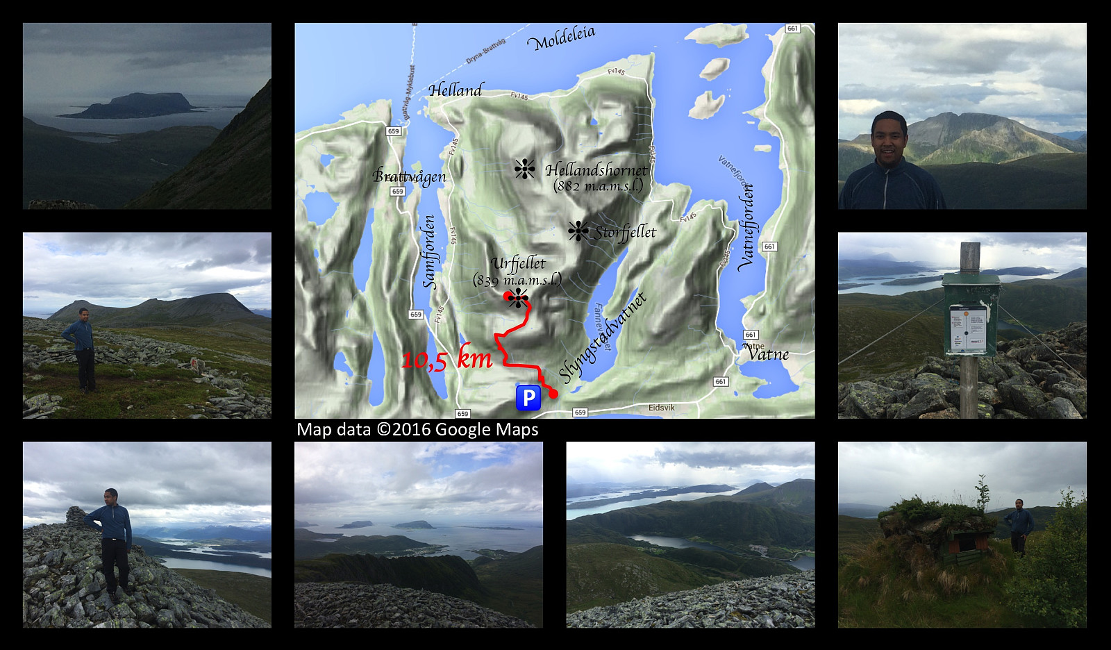 Just outside the little village of Slyngstad, you'll find an old road over Mount Remefjellet, and then down to the fjord called Samfjorden on the other side of the mountain (see map). This old road was once upon a time the main road to the village of Brattvåg. Later on, however, a new road was built, with a tunnel through the mountain; and the old road is now no longer being maintained, and it is now mainly used by tour walkers and mountain trekkers. Tour walkers are actually still using the entire length of the road to get from one side of the mountain to the other; whereas for the mountain trekkers about half of it has become the first leg of the trail up to Mount Urfjellet [839 m.a.m.s.l.] and Mount Storfjellet [950 m.a.m.s.l.].
My son and I parked our car at a little parking lot at Slyngstad, >>>
Just outside the little village of Slyngstad, you'll find an old road over Mount Remefjellet, and then down to the fjord called Samfjorden on the other side of the mountain (see map). This old road was once upon a time the main road to the village of Brattvåg. Later on, however, a new road was built, with a tunnel through the mountain; and the old road is now no longer being maintained, and it is now mainly used by tour walkers and mountain trekkers. Tour walkers are actually still using the entire length of the road to get from one side of the mountain to the other; whereas for the mountain trekkers about half of it has become the first leg of the trail up to Mount Urfjellet [839 m.a.m.s.l.] and Mount Storfjellet [950 m.a.m.s.l.].
My son and I parked our car at a little parking lot at Slyngstad, >>>
Visiting Mount Lauparen and Mount Grytavasstinden
- Datum:
- 10.07.2016
- Tourcharakter:
- Hochtour
- Tourlänge:
- 9:00h
- Entfernung:
- 19,5km
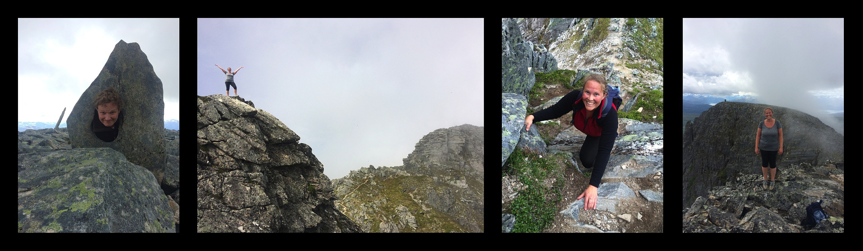
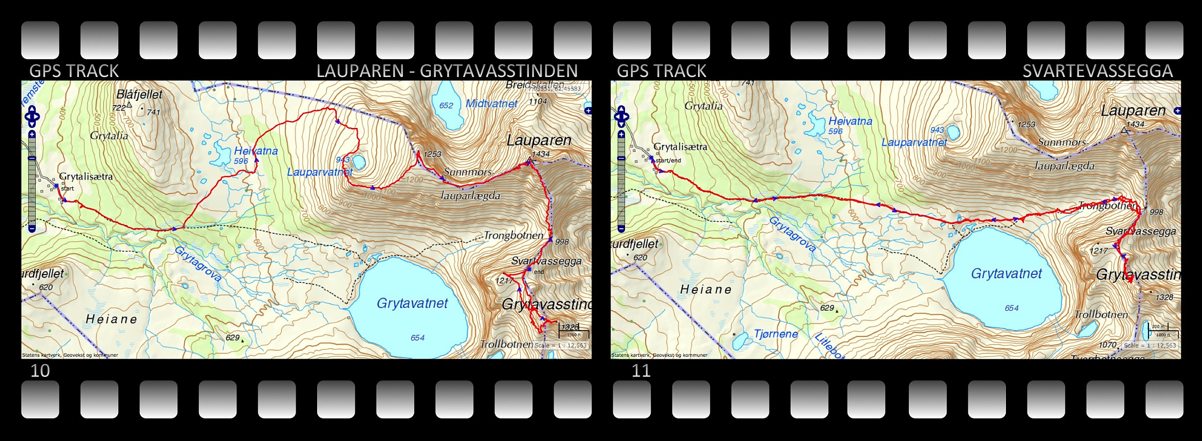 On this day I climbed up to the summits of Mount Lauparen and Mount Grytavasstinden. I started out from the parking lot at Grytalisetra (see map), and followed the regular trail for climbing these mountains for about 1,5 km, and then I took left towards the foot of Mount Sunnmørslauparen, which isn't actually a real mountain by itself, but rather a huge westward going ridge on Mount Lauparen. I climbed up the mountain side and at about 950 m.a.m.s.l., I reached a plateau on which a lake called Lake Lauparvatnet is located. From the Lake I continued up a huge mountain ridge to a new plateau, where you actually find the spot that is called Sunnmørslauparen [1254 m.a.m.s.l.] here on Peakbook. From there i continued up another mountain ridge towards the summit of Lauparen. This ridge got steeper >>>
Hiking to Mount Blåskjerdingen with my Sister
- Datum:
- 02.07.2016
- Tourcharakter:
- Wanderung
- Tourlänge:
- 5:04h
- Entfernung:
- 9,8km
 My sister is living in another part of our beautiful country, but whenever she's visiting our part of the country, she frequently asks me to take her on some mountain trip. Now, I don't dare to take her on the steepest and most challenging climbs, so when she asks me for that, I say to her, just as when we were kids: "No, you're too young...!" Nevertheless, I considered that she would do quite well with Mount Blåskjærdingen, so on this day we agreed to go there. Now, Mount Blåskjerdingen has two summits, with a characteristic V-shaped cleft in between them; and this actually makes it quite easy to spot the mountain even from afar.
We parked our car at a parking lot in Vatnedalen Valley (see map). Her on Peakbook this parking lot has actually been named after the mountain, i.e. you'll >>>
My sister is living in another part of our beautiful country, but whenever she's visiting our part of the country, she frequently asks me to take her on some mountain trip. Now, I don't dare to take her on the steepest and most challenging climbs, so when she asks me for that, I say to her, just as when we were kids: "No, you're too young...!" Nevertheless, I considered that she would do quite well with Mount Blåskjærdingen, so on this day we agreed to go there. Now, Mount Blåskjerdingen has two summits, with a characteristic V-shaped cleft in between them; and this actually makes it quite easy to spot the mountain even from afar.
We parked our car at a parking lot in Vatnedalen Valley (see map). Her on Peakbook this parking lot has actually been named after the mountain, i.e. you'll >>>
