Archiv - Nach Datum
Archiv - Nach Aktivität
-
Andere Tour (1)
- Expedition (1)
-
Andere Wintertour (10)
- Schneeschuhtour (10)
- Fahrradtour (2)
- Fußtour (228)
-
Klettern (8)
- Alpinklettern (7)
- Mixed-Klettern (1)
-
Skitour (49)
- Randonnée/Telemark (49)


Gesammelte Listen
-
Romsdal ≥ 100m pf.
(134/301)
 44%
44% -
Sunnmøre ≥ 100m pf.
(78/531)
14%
-
Norges 1000 største fjell målt i primærfaktor
(52/1000)
5%

Min tredje Free-heel-tur til Alnestinden
- Datum:
- 14.06.2019
- Tourcharakter:
- Randonnée/Telemark
- Tourlänge:
- 3:23h
- Entfernung:
- 5,7km
 Topptursesongen for toppturer på ski var på hell, i hvert fall for mitt vedkommende, men jeg hadde lyst på én skitur til før jeg pakket bort utstyret for sommeren, og da var Alnestinden et av de få stedene i området hvor man fortsatt kunne gå på ski mer eller mindre helt fra bilveien hvor man parkerer. I tillegg hadde jeg så langt kun kommet meg opp på toppen av Alnestinden to av de gangene jeg hadde forsøkt meg på å nå toppen, så jeg tenkte det kunne være greit å bedre statisikken min i så måte. Sist gang jeg var på toppen, var det forøvrig såpass med tåke at det ikke var så veldig mye vi fikk sett der oppe fra.
Jeg parkerte bilen samme sted som sist, dvs. litt nedenfor Alnesreset, spente på meg skiene, og la av sted. Etter knapt en kilometer, var det et ei steinur >>>
Topptursesongen for toppturer på ski var på hell, i hvert fall for mitt vedkommende, men jeg hadde lyst på én skitur til før jeg pakket bort utstyret for sommeren, og da var Alnestinden et av de få stedene i området hvor man fortsatt kunne gå på ski mer eller mindre helt fra bilveien hvor man parkerer. I tillegg hadde jeg så langt kun kommet meg opp på toppen av Alnestinden to av de gangene jeg hadde forsøkt meg på å nå toppen, så jeg tenkte det kunne være greit å bedre statisikken min i så måte. Sist gang jeg var på toppen, var det forøvrig såpass med tåke at det ikke var så veldig mye vi fikk sett der oppe fra.
Jeg parkerte bilen samme sted som sist, dvs. litt nedenfor Alnesreset, spente på meg skiene, og la av sted. Etter knapt en kilometer, var det et ei steinur >>>
Fjelltur til Skulen på Flemsøya med min sønn
- Datum:
- 01.06.2019
- Tourcharakter:
- Wanderung
- Tourlänge:
- 2:48h
- Entfernung:
- 9,0km
 Denne turen var det min eldste sønn som dro meg med på. Fjellet Skulen ligger på Flemsøya i kystkommunen Haram, enskjønt hele Haram Kommune etter planen skal innlemmes i Ålesund Kommune om ikke lenge. Flemsøya har navnet sitt fra gårdsbruket Flem, som ligger nokså langt vest på øya. Fra gammelt av ble øya også kalt Skuløya etter navnet på fjellet, men med tiden har det vokst fram et ørlite tettsted på Longva som ligger omtrent midt på sørsida av øya; og når man i dag spør folk fra Flemsøya om hvor de kommer fra, er det stadig flere som svarer at de kommer "fra Longva." Min sønn hadde nylig vært på Flemsøya og Skulen for å få brukt opp et fergekort som var i ferd med å gå ut på dato, og fasinert av hvor fint det var der ute, sa han en dag til meg: "Pappa, >>>
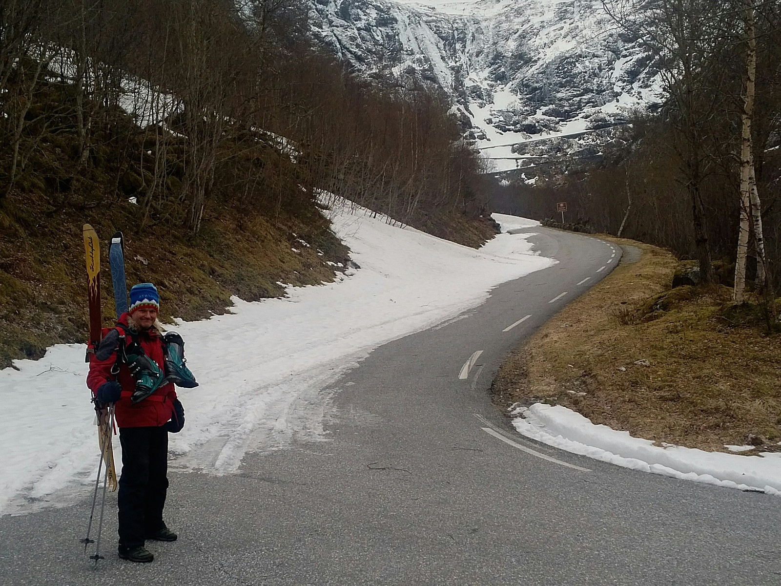
På Telemark-ski til Alnestinden med min datter
- Datum:
- 25.05.2019
- Tourcharakter:
- Randonnée/Telemark
- Tourlänge:
- 3:05h
- Entfernung:
- 6,1km
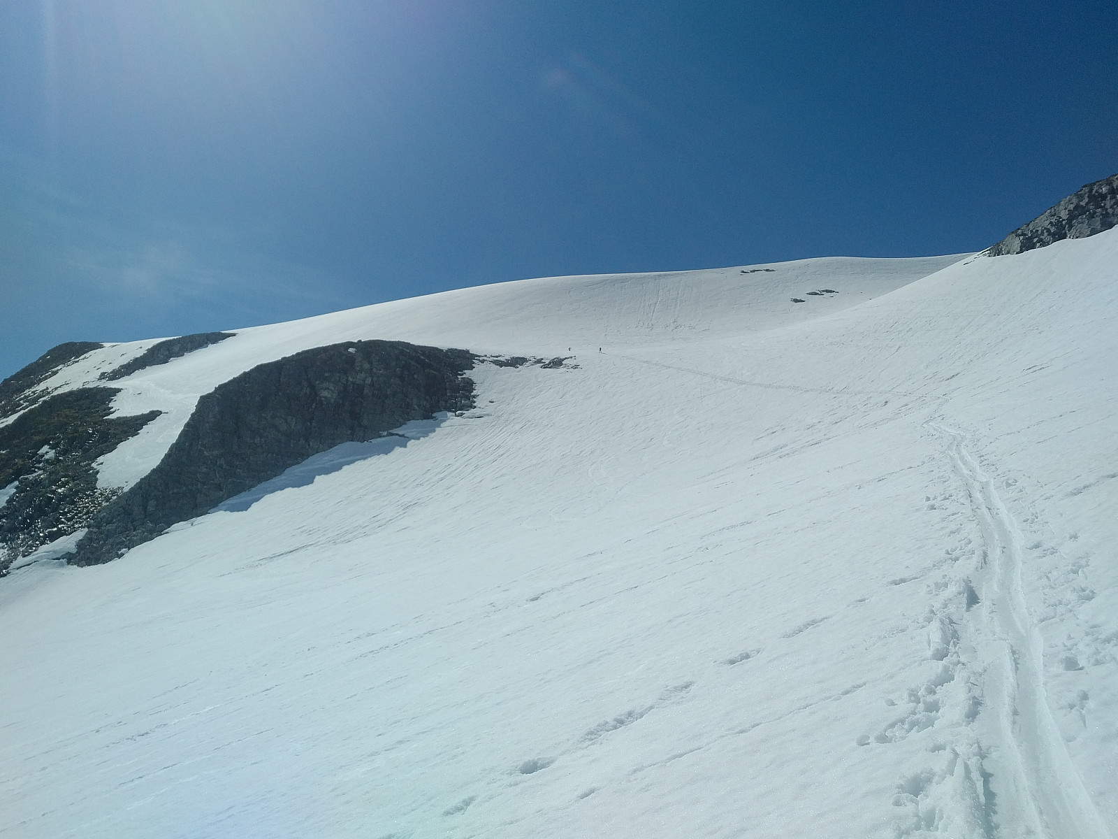
 Det var min yngste datter som gjerne ville ha meg med på Alnestinden denne mai-dagen. Jeg hadde vært der halvannen måned tidligere (se turbeskrivelse fra 06.03.2019), men da var Trollstigen stengt, og jeg gikk helt fra Isterdalen for å komme meg opp. Nå var Trollstigen åpen. Værmeldingen for området var ikke den beste, men vi kjørte nå inn til Alnesreset ikke så langt fra Trollstigsenteret, spente på oss skiene, og gikk opp derfra. Jeg hadde egentlig forsøkt meg på Alnestinden hele fire ganger tidligere, men kun nådd tåppen én gang. Det var derfor ikke så vanskelig for datteren å overtale meg, for jeg hadde så absolutt behov for å bedre Alnestind-statistikken min.
Nedenfor var det igrunnen grei sikt, men tåken tetnet til på vei oppover, og det ble etterhvert ikke noen >>>
Det var min yngste datter som gjerne ville ha meg med på Alnestinden denne mai-dagen. Jeg hadde vært der halvannen måned tidligere (se turbeskrivelse fra 06.03.2019), men da var Trollstigen stengt, og jeg gikk helt fra Isterdalen for å komme meg opp. Nå var Trollstigen åpen. Værmeldingen for området var ikke den beste, men vi kjørte nå inn til Alnesreset ikke så langt fra Trollstigsenteret, spente på oss skiene, og gikk opp derfra. Jeg hadde egentlig forsøkt meg på Alnestinden hele fire ganger tidligere, men kun nådd tåppen én gang. Det var derfor ikke så vanskelig for datteren å overtale meg, for jeg hadde så absolutt behov for å bedre Alnestind-statistikken min.
Nedenfor var det igrunnen grei sikt, men tåken tetnet til på vei oppover, og det ble etterhvert ikke noen >>>
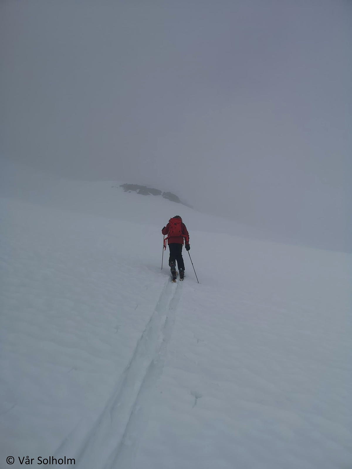
Til Gullfjellet (914) i tåke og regn
- Datum:
- 01.05.2019
- Tourcharakter:
- Bergtour
- Tourlänge:
- 5:20h
- Entfernung:
- 15,1km
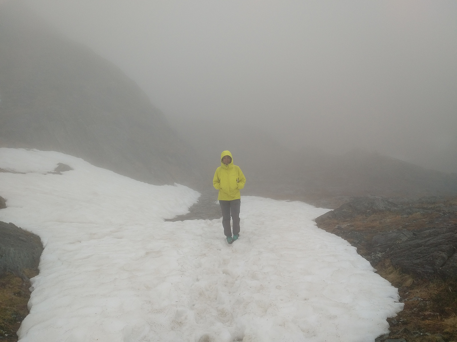 Dette var en ad-hoc-tur som jeg og ene datteren la ut på da vi begge hadde fri fra jobb 1. mai. Vi bestemte oss for å dra på tur først mens vi satt og spiste litt sen frokost samme dag, og vi brukte ikke lang tid på å planlegge, for da ville vi bare kommet oss enda senere av gårde. Vi hadde hørt folk i Bergen og Hordland snakke om Gullfjellet, og tenkte at "dit drar vi". Vi søkte opp Gullfjellet her i Peakbook, og fant et fint kart med GPS-tracking som vi avfotograferte. Hausdalen så ut til å kunne være et fint utgangspunkt, så vi satte oss i bilen til min datter, og kjørte dit. Det vi ikke la merke til, var at den høyeste toppen på Gullfjellet her i Peakbook heter Gullfjelltoppen, og at kartet jeg hadde avfotografert fra en dataskjerm med mobilkameraet kun tok oss >>>
Med konen til Synnalandshornet og Vasskarbolten
- Datum:
- 25.04.2019
- Tourcharakter:
- Bergtour
- Tourlänge:
- 3:52h
- Entfernung:
- 6,1km
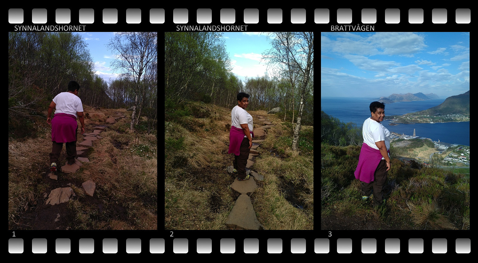 Jeg hadde to ganger tidligere besøkt Synnalandshornet, én gang alene, og én gang sammen med yngste datteren (se turbeskrivelse fra 29.09.18), og begge gangene hadde jeg også tatt turen innom Vasskarbolten, som jeg vil si er verdt å avlegge et besøk når man først tar turen innom Synnalandshornet. Første gangen jeg var der tok det en del tid å finne "bolten", andre gangen gikk jeg nesten rett på den, siden jeg da visste hvor den var. Når har min kone flere ganger bedt om at jeg må ta henne med på turer tilpasset hennes vanskelighetsgrad (det er først de siste par årene hun har begynt å gå litt i fjellene), og da har jeg tenkt på Vasskarbolten som et ikke for vanskelig fjell å ta henne med på.
Vi kjørte til Brattvågen, og parkerte på P-plassen akkurat ved demningen >>>
Jeg hadde to ganger tidligere besøkt Synnalandshornet, én gang alene, og én gang sammen med yngste datteren (se turbeskrivelse fra 29.09.18), og begge gangene hadde jeg også tatt turen innom Vasskarbolten, som jeg vil si er verdt å avlegge et besøk når man først tar turen innom Synnalandshornet. Første gangen jeg var der tok det en del tid å finne "bolten", andre gangen gikk jeg nesten rett på den, siden jeg da visste hvor den var. Når har min kone flere ganger bedt om at jeg må ta henne med på turer tilpasset hennes vanskelighetsgrad (det er først de siste par årene hun har begynt å gå litt i fjellene), og da har jeg tenkt på Vasskarbolten som et ikke for vanskelig fjell å ta henne med på.
Vi kjørte til Brattvågen, og parkerte på P-plassen akkurat ved demningen >>>
Running to the summit of Mount Tibidabu
- Datum:
- 11.04.2019
- Tourcharakter:
- Jogging
- Tourlänge:
- 2:45h
- Entfernung:
- 19,5km
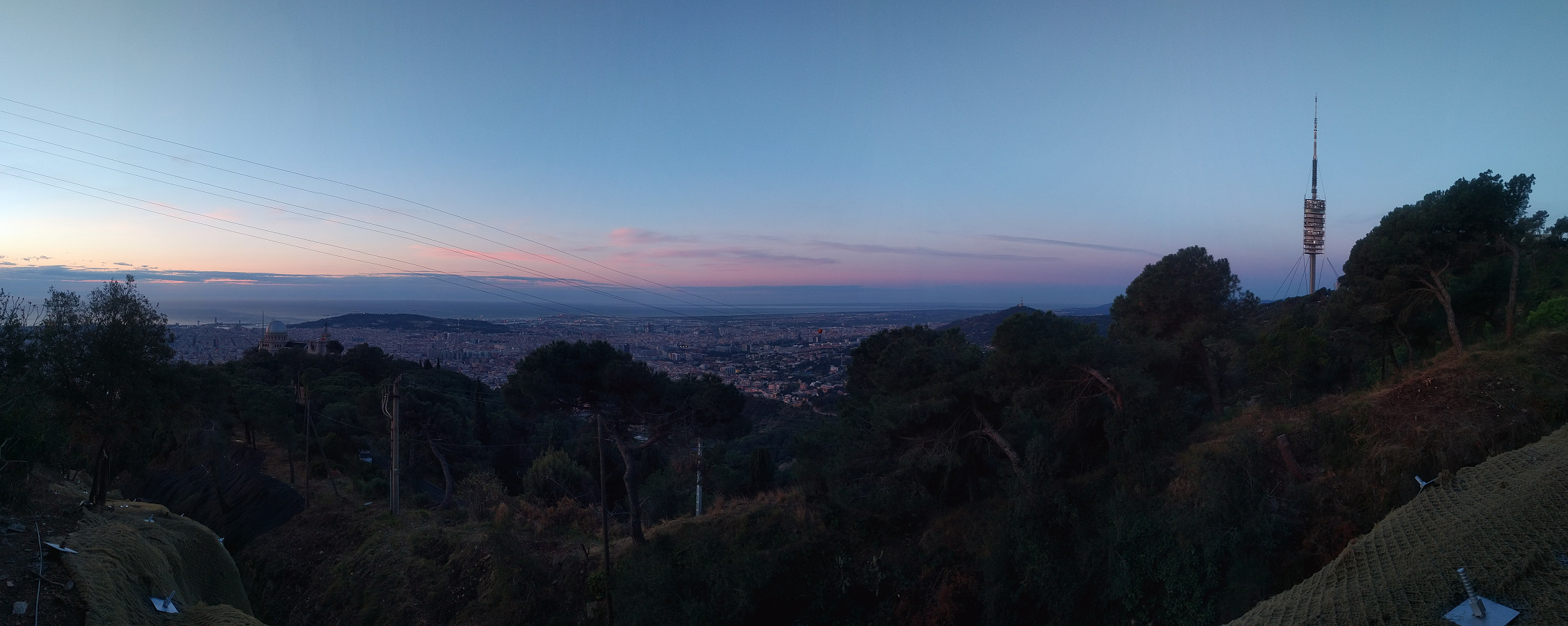 I was in Barcelona for 5 days, attending a medical conference (EuroELSO 2019 - a conference centered around ECMO treatment). While there, I was staying in a hotel in the Gothic Quarter, not far from La Rambla . I went running every morning before the congress started, except for Saturday morning. Most mornings I made a round in the city, in order to get aquatinted with it, but on this particular morning I had decided to head for the highest of the mountains that I had seen in the distance as I had been walking around in the city.
I left the hotel around six o'clock in the morning, and found my way through a narrow alleyway, into an open square, and then through another, rather short alleyway into the street called "La Rambla". Once in La Rambla, I headed west towards the mountains. >>>
I was in Barcelona for 5 days, attending a medical conference (EuroELSO 2019 - a conference centered around ECMO treatment). While there, I was staying in a hotel in the Gothic Quarter, not far from La Rambla . I went running every morning before the congress started, except for Saturday morning. Most mornings I made a round in the city, in order to get aquatinted with it, but on this particular morning I had decided to head for the highest of the mountains that I had seen in the distance as I had been walking around in the city.
I left the hotel around six o'clock in the morning, and found my way through a narrow alleyway, into an open square, and then through another, rather short alleyway into the street called "La Rambla". Once in La Rambla, I headed west towards the mountains. >>>
Hybrid-tur fra Isterdalen til Alnestinden
- Datum:
- 06.03.2019
- Tourcharakter:
- Randonnée/Telemark
- Tourlänge:
- 10:34h
- Entfernung:
- 21,6km
 Alnestinden har for mange vært et kjærkomment topptur-mål på vårparten/sommeren, i praksis etter at Trollstigen er åpnet en gang i mai/juni. Om vinteren ligger den mer utilgjengelig til for de fleste. I høst kom det plutselig en hel del snø uten at Trollstigen stengte sånn med én gang, og da var det mange som heiv seg rundt og tok turen dit opp. Jeg prøvde meg også på en tur opp dit i oktober en gang, men da var jeg usikker på veien, og når jeg så nærmet meg et veldig bratt parti litt før man når toppen, så tenkte jeg det var ikke verdt å utsette seg for rasfare når jeg ikke en gang var sikker på at det var riktige veien.
I diverse turbeskrivelser har jeg lest at man kan ta turen opp på Alnestinden også før Trollstigen åpner på vårparten, men at man da må påregne >>>
Alnestinden har for mange vært et kjærkomment topptur-mål på vårparten/sommeren, i praksis etter at Trollstigen er åpnet en gang i mai/juni. Om vinteren ligger den mer utilgjengelig til for de fleste. I høst kom det plutselig en hel del snø uten at Trollstigen stengte sånn med én gang, og da var det mange som heiv seg rundt og tok turen dit opp. Jeg prøvde meg også på en tur opp dit i oktober en gang, men da var jeg usikker på veien, og når jeg så nærmet meg et veldig bratt parti litt før man når toppen, så tenkte jeg det var ikke verdt å utsette seg for rasfare når jeg ikke en gang var sikker på at det var riktige veien.
I diverse turbeskrivelser har jeg lest at man kan ta turen opp på Alnestinden også før Trollstigen åpner på vårparten, men at man da må påregne >>>
På ski til Ørastolen
- Datum:
- 02.02.2019
- Tourcharakter:
- Randonnée/Telemark
- Tourlänge:
- 4:21h
- Entfernung:
- 8,2km
 Denne dagen var det yngste datteren som ville ha meg med ut på ski. Vi skjekket vær- og føreforhold online, og så kjørte vi avsted til Stordalen, forbi Overøye, og parkerte bilen på en fint tilrettelagt parkeringsplass like før brua som tar deg over til Pusken. Her spente vi på oss skiene, og gav oss av sted oppover fjellsida. Været var strålende, og det var kun noen bittesmå skyer å se på himmelen. Jeg hadde smurt meg inn med solkrem i ansiktet før vi dro avsted, og nå kom også solbriller på, for å unngå snøblindhet. Den første del av turen går gjennom overveiende bjørkeskog. Til å begynne med er trærne relativt store, men de blir gradvis mindre, og til slutt var det slutt på skogen. Det var mange som hadde tatt turen opp på Ørastolen siden forrige snøfall, så >>>
Til Frostadtind via Høgsætra og Engsetbotnen
- Datum:
- 15.12.2018
- Tourlänge:
- 2:26h
- Entfernung:
- 8,3km
 Frostatinden er ikke så fælt høy, og sånn sett et fint fjell å starte topptursesongen. Nå ble riktignok dette min tredje skitur denne sesongen, for den første snøen kom allerede i oktober, men så forsvant den igjen, pluss at jeg reiste til Etiopia og var der en måneds tid, og dermed så ble det bare én tur på Geitenibba og ett forsøk på Alnestinden før jeg nå altså bestemte meg for å ta en tur på Frostatind. Jeg hadde én gang tidligere vært på Frostatinden, men det var til fots, og da gikk jeg en helt annen rute. Jeg prøvde meg på en skitur dit opp sist vinter også sammen med yngste datteren, men da var tåka så tett oppå der, at vi snudde et lite stykke før vi kom opp på toppen.
Denne gangen var det eldste sønnen min som heiv seg på og ville være med. Vi kjørte >>>
Frostatinden er ikke så fælt høy, og sånn sett et fint fjell å starte topptursesongen. Nå ble riktignok dette min tredje skitur denne sesongen, for den første snøen kom allerede i oktober, men så forsvant den igjen, pluss at jeg reiste til Etiopia og var der en måneds tid, og dermed så ble det bare én tur på Geitenibba og ett forsøk på Alnestinden før jeg nå altså bestemte meg for å ta en tur på Frostatind. Jeg hadde én gang tidligere vært på Frostatinden, men det var til fots, og da gikk jeg en helt annen rute. Jeg prøvde meg på en skitur dit opp sist vinter også sammen med yngste datteren, men da var tåka så tett oppå der, at vi snudde et lite stykke før vi kom opp på toppen.
Denne gangen var det eldste sønnen min som heiv seg på og ville være med. Vi kjørte >>>
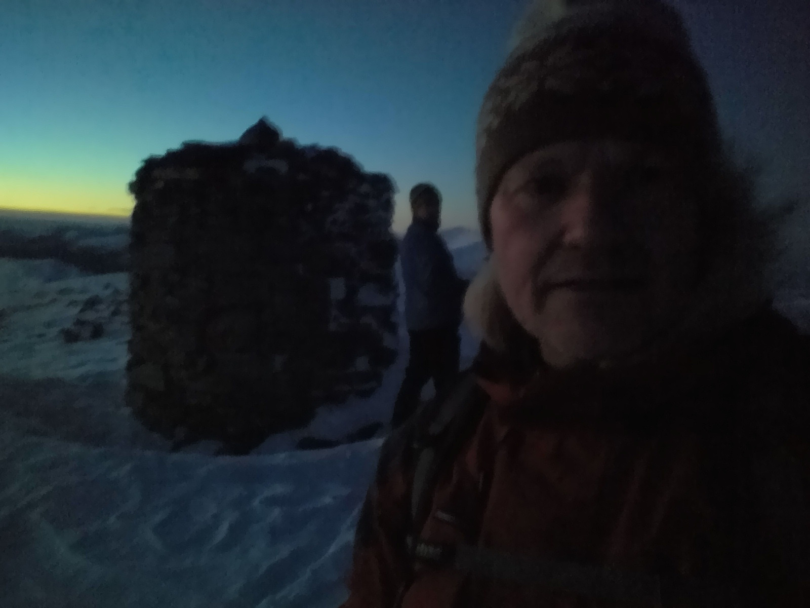
Ascending Ras Bwahit
- Datum:
- 25.11.2018
- Tourcharakter:
- Bergtour
- Tourlänge:
- 3:46h
- Entfernung:
- 8,9km
 Starting out from Chenneck Camp (3620 m.a.m.s.l.), I climbed Ras Bwahit (4430 m.a.m.s.l.), the third highest mountain in Ethiopia, in only about one and an half hour, and I have to say I am a little bit proud of that. The key to be able to perform well in high elevation areas without getting altitude sickness or extreme shortness of breath, however, is acclimatization. Had I arrived in the Simien Mountains directly from home (where we live at about sea level), I would not have been able to do this 800 meters climb that rapidly. In connection with my work, however, I had just spent two and a half weeks in Addis Ababa (2400 m.a.m.s.l.) prior to heading north for the Simien Mountains. While in Addis, I had gone running between 6 and 7 in the morning about every second day (Images 2-9); and on >>>
