Archiv - Nach Datum
Archiv - Nach Aktivität
-
Andere Tour (1)
- Expedition (1)
-
Andere Wintertour (10)
- Schneeschuhtour (10)
- Fahrradtour (2)
- Fußtour (228)
-
Klettern (8)
- Alpinklettern (7)
- Mixed-Klettern (1)
-
Skitour (49)
- Randonnée/Telemark (49)


Gesammelte Listen
-
Romsdal ≥ 100m pf.
(134/301)
 44%
44% -
Sunnmøre ≥ 100m pf.
(78/531)
14%
-
Norges 1000 største fjell målt i primærfaktor
(52/1000)
5%

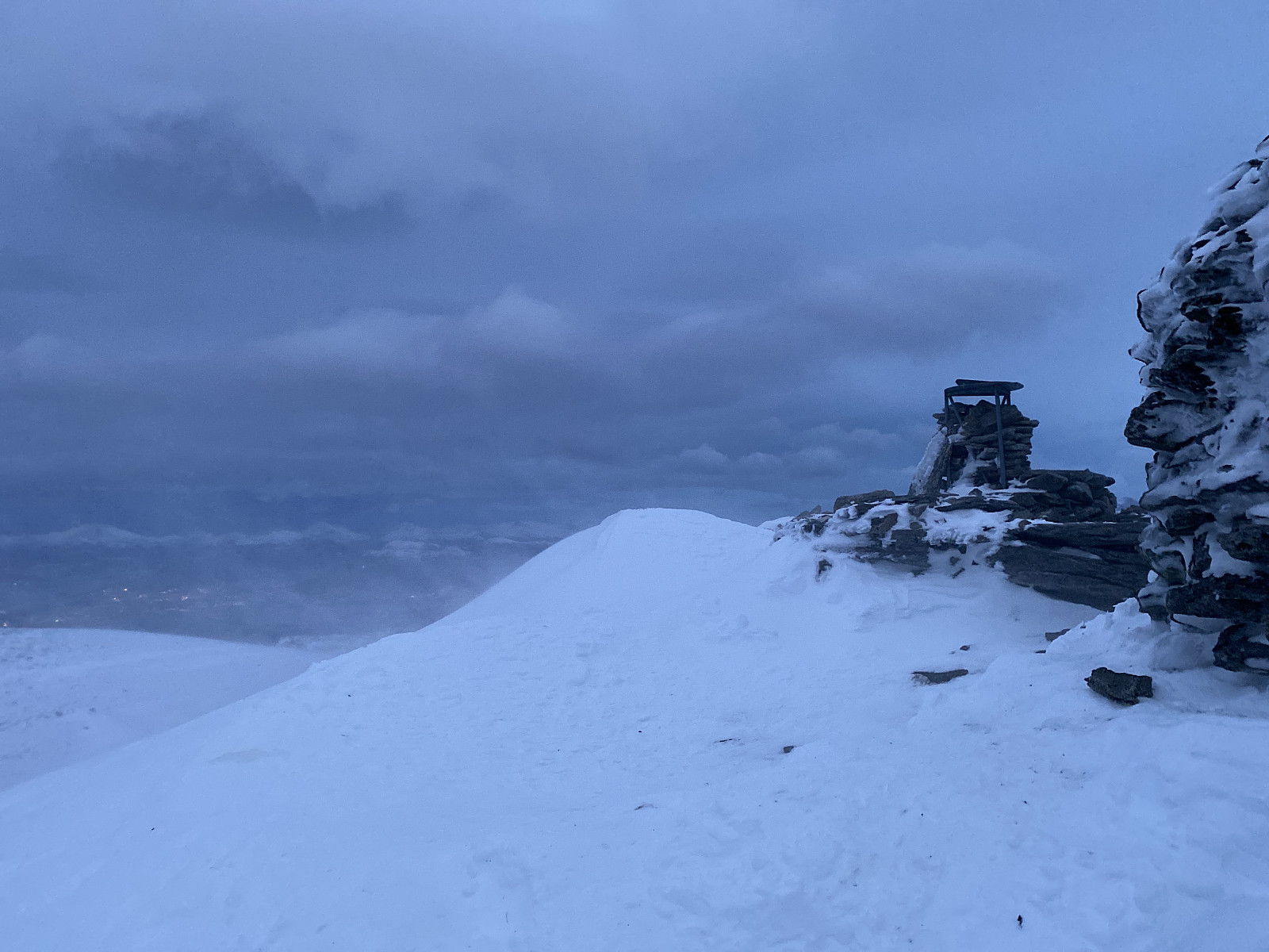
Snow Shoe Hike to Mount Myklebusthornet
- Datum:
- 30.01.2021
- Tourcharakter:
- Schneeschuhtour
- Tourlänge:
- 1:11h
- Entfernung:
- 4,4km
 Mount Myklebusthornet is a little mountain [329 m.a.m.s.l.] on an island called Ellingsøya in the municipality of Ålesund in the County of Møre & Romsdal on the west coast of Norway. The name Myklebusthornet is composed of the Norse word mykill bústaðr , which means large farm or l arge habitation; and the modern Norwegian horn, which simply means horn. The mountain is actually part of a mountain range that extends along the entire length of the island; with a number of peaks, among which Myklebusthornet is the highest. This mountain range is usually very well suited for jogging, as well as for short mountain treks, as the climb towards most of the peaks aren't that steep, though it depends of course a little on which route you choose for your climb. Moreover, due to its costal location, >>>
Moonlight Hike on Mount Ulriken
- Datum:
- 27.01.2021
- Tourcharakter:
- Bergtour
- Tourlänge:
- 1:11h
- Entfernung:
- 4,4km
 The city of Bergen, on the west coast of Norway, has traditionally been named The City Between the Seven Mountains . There has always been some discussions about which mountains should actually be counted among the seven, as you have several options; but it is generally agreed that Mount Ulriken is definitely one of them. The elevation of the summit is 643 m.a.m.s.l., with a vertical separation of only 40 meters. The summit isn't actually visible from downtown Bergen, however, so the peak or "top" that people generally refer to when they talk about Mount Ulriken, is the west peak, which has an elevation of 607 meters and a vertical separation of 19 meters. Moreover, this western peak of the mountain has a splendid viewpoint overlooking most of the city of Bergen, it has a nice little >>>
Ski Touring to Mount Snortungen [1193]
- Datum:
- 23.01.2021
- Tourcharakter:
- Randonnée/Telemark
- Tourlänge:
- 5:25h
- Entfernung:
- 10,3km
 I have lately been ascending a number of mountains in the Rauma Municipality in the county of Møre & Romsdal in the western part of Norway. This municipality has a lot of nice mountains, and my intention has been to climb at least all those with an altitude of more than 1000 m.a.m.s.l. one by one. And so, on this day, I drove to the fjord called Isfjorden [i.e. “The Ice Fjord”] in Rauma, intending to climb Mount Snortungen, which has an altitude of 1198 m.a.m.s.l.
I parked at a parking lot at a location called Breivik . In Norwegian, the word brei means broad, and the word vik means bay; so the meaning of the name “Breivik” is simply “The Broad Bay”. (Now, there are many broad bays along the 2000 km coast line of Norway, and this particular one has no connection to the Norwegian >>>
I have lately been ascending a number of mountains in the Rauma Municipality in the county of Møre & Romsdal in the western part of Norway. This municipality has a lot of nice mountains, and my intention has been to climb at least all those with an altitude of more than 1000 m.a.m.s.l. one by one. And so, on this day, I drove to the fjord called Isfjorden [i.e. “The Ice Fjord”] in Rauma, intending to climb Mount Snortungen, which has an altitude of 1198 m.a.m.s.l.
I parked at a parking lot at a location called Breivik . In Norwegian, the word brei means broad, and the word vik means bay; so the meaning of the name “Breivik” is simply “The Broad Bay”. (Now, there are many broad bays along the 2000 km coast line of Norway, and this particular one has no connection to the Norwegian >>>
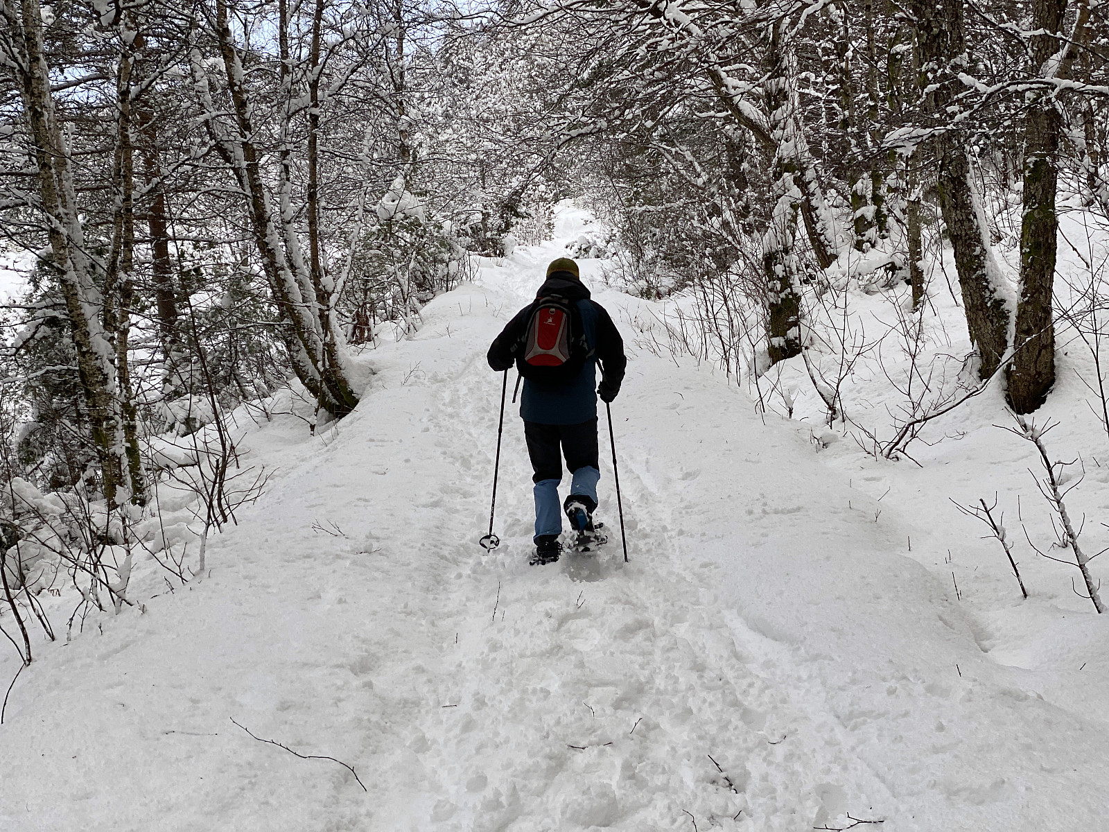
Attempt at Ski Touring to Mount Hesten in Rauma Municipality
- Datum:
- 16.01.2021
- Tourcharakter:
- Randonnée/Telemark
- Tourlänge:
- 4:17h
- Entfernung:
- 7,4km
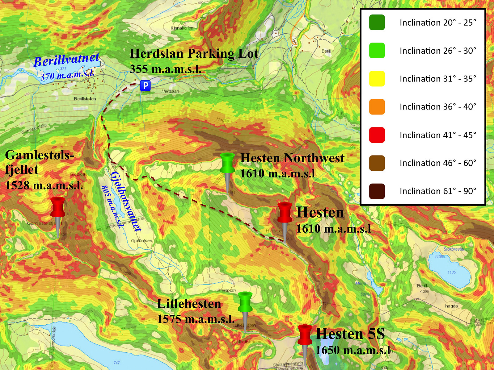 On this day, my son asked me if I'd like to join him on an alpine skiing tour to Mount Hesten. He had resently read a brief tour report on Facebook by someone who had recently visited the mountain on skis, and so he had figured he'd give the mountain a try as well. Mount Hesten is a mountain located in Rauma Municipality in the County of Møre & Romsdal. The mountain has several peaks located in a horseshoe-fashion. Here on Peakbook they have been named Hesten Northwest [1481 m.a.m.s.l.], Hesten [1610 m.a.m.s.l.], Hesten S1 [1580 m.a.m.s.l.], Hesten S2 [1590 m.a.m.s.l.], Hesten S3 [1634 m.a.m.s.l.], Hesten S4 [1560 m.a.m.s.l.], Hesten S5 [1650 m.a.m.s.l.], Hesten Southwest [1570 m.a.m.s.l.], and Litlehesten [1575 m.a.m.s.l.]. The meaning of the Norwegian word Hesten is The Horse, and the >>>
To Mount Sulafjellet in Bad Weather
- Datum:
- 09.01.2021
- Tourcharakter:
- Wanderung
- Tourlänge:
- 2:46h
- Entfernung:
- 11,4km
 Mount Sulafjellet is a mountain that I've ascended multiple times, and yet I will probably ascend that mountain even more times in the future; as it is not too far away from where we live, and also because it's feasible to climb even when there's too much snow to climb many other mountains around here. The mountain has several peaks, the highest of which has been named Tverrfjellet [i.e. "The Transverse Mountain"], though most people today just call it Vardane [i.e. "The Cairns"], due to the many cairns that mountain hikers have built up there.
The most feasible way to ascend this mountain is to start out from the parking lot at Mauseid (see map), and then follow a gravel road through the forests up to a cottage called Rollonhytta . The parking lot is located at about 50 m.a.m.s.l.; >>>
Mount Sulafjellet is a mountain that I've ascended multiple times, and yet I will probably ascend that mountain even more times in the future; as it is not too far away from where we live, and also because it's feasible to climb even when there's too much snow to climb many other mountains around here. The mountain has several peaks, the highest of which has been named Tverrfjellet [i.e. "The Transverse Mountain"], though most people today just call it Vardane [i.e. "The Cairns"], due to the many cairns that mountain hikers have built up there.
The most feasible way to ascend this mountain is to start out from the parking lot at Mauseid (see map), and then follow a gravel road through the forests up to a cottage called Rollonhytta . The parking lot is located at about 50 m.a.m.s.l.; >>>
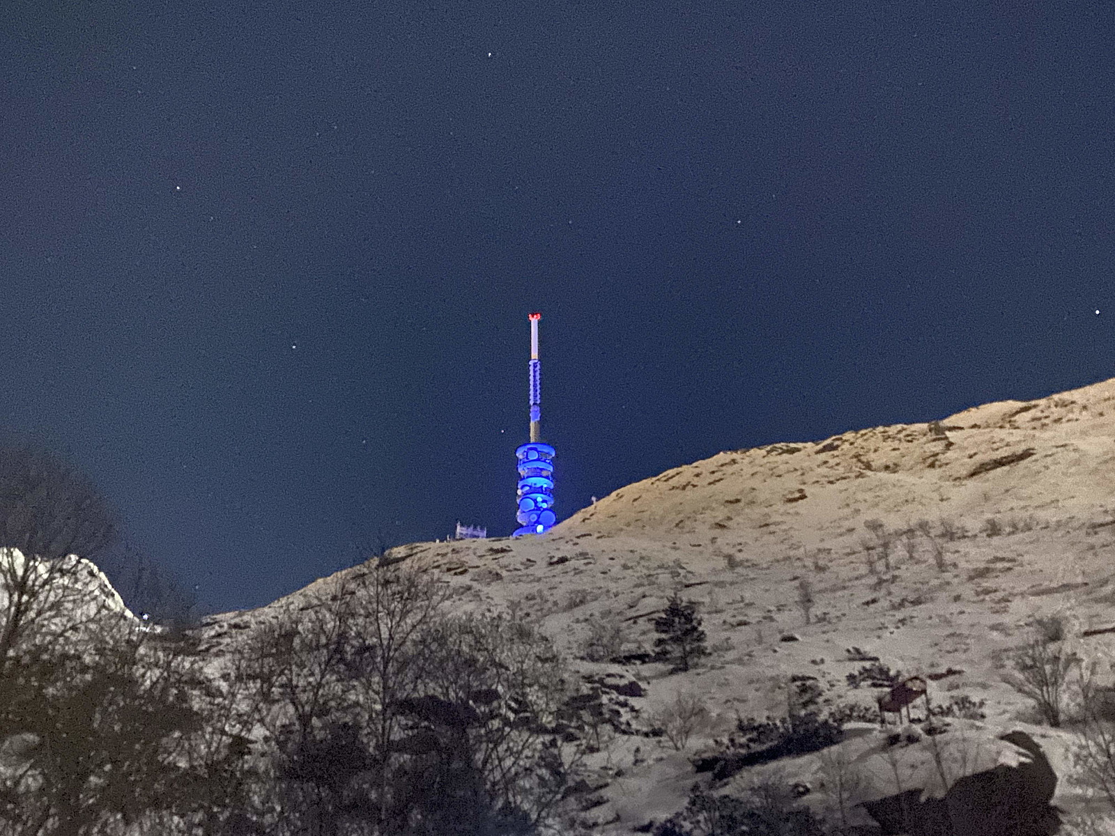
Two Trips to Mount Storehornet on Godøy Island
- Datum:
- 02.01.2021
- Tourlänge:
- 2:14h
- Entfernung:
- 6,9km
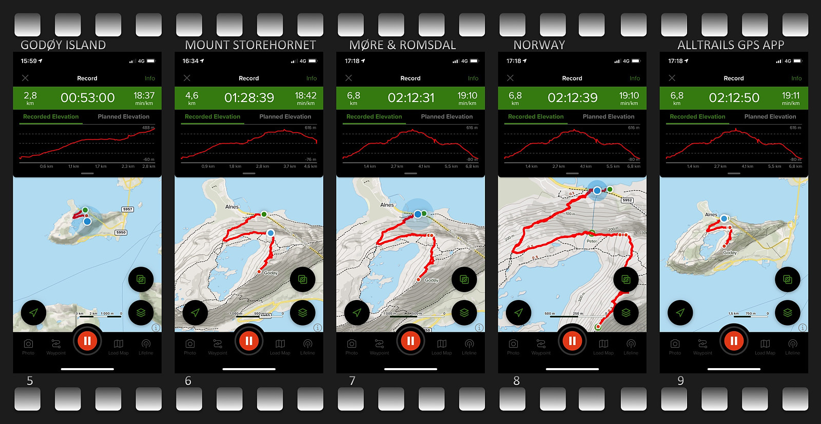 Mount Storehornet on Godøy Island is a mountain that I have frequently climbed. I usually don't publish my climbs of that mountain here on Peakbook, as I've climbed it so many times. I have, however, been having an idea of photographing the Norwegian costal town of Ålesund at the entrance to the Georgian New Year, as the people of this town usually have a spectacular firework at this time of the year. And so, in late evening of December 31st, I climbed the mountain again, this time carrying a backpack with a camera and some lenses, along with a tripod; planning to capture some long exposure photos up there. I sat out from the parking lot just outside the tunnel opening at the peninsula of Alnes shortly before 11 o'clock in the evening. Usually, an hour is plenty of time to climb the mountain, >>>
