Archiv - Nach Datum
Archiv - Nach Aktivität
-
Andere Tour (1)
- Expedition (1)
-
Andere Wintertour (10)
- Schneeschuhtour (10)
- Fahrradtour (2)
- Fußtour (228)
-
Klettern (8)
- Alpinklettern (7)
- Mixed-Klettern (1)
-
Skitour (49)
- Randonnée/Telemark (49)


Gesammelte Listen
-
Romsdal ≥ 100m pf.
(134/301)
 44%
44% -
Sunnmøre ≥ 100m pf.
(78/531)
14%
-
Norges 1000 største fjell målt i primærfaktor
(52/1000)
5%

Hiking to Mount Skjerdingen and Two Beautiful Lakes
- Datum:
- 28.05.2016
- Tourcharakter:
- Hochtour
- Tourlänge:
- 5:13h
- Entfernung:
- 13,6km
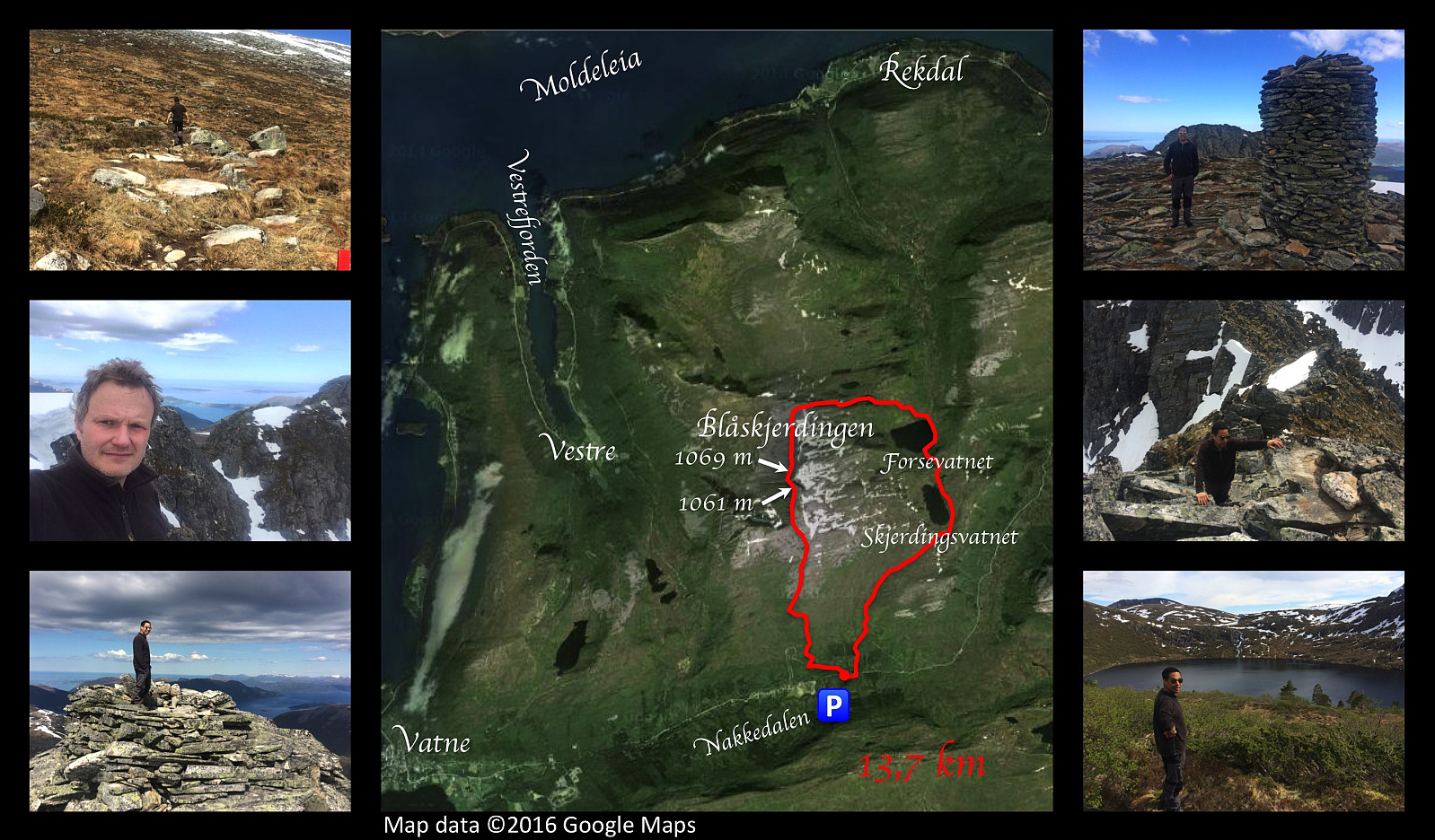 On this occasion, my son Dag and I went hiking to the mountain Blåskjerdingen . This mountain has a deep cleft that runs right through the top of the it; giving it two separate summits and a quite characteristic appearance that makes it easy to spot, even from a pretty long distance. We parked our car in a nearby valley called Nakkedalen, and made our climb to the first summit of Blåskjerdingen, which has an altitude of 1061 m.a.m.s.l. From there you look straight across the deep cleft onto the other summit, not even 50 meters away from you, and with an elevation of 1069 m.a.m.s.l. [Note: The names Skjerdingen and Blåskjerdingen are used interchangeably by many, but the local population in the villages at the foot of the mountain tend to refer to the higher (northern) summit as Blåskjerdingen, >>>
Til Hellandshornet
- Datum:
- 21.05.2016
- Tourlänge:
- 5:04h
- Entfernung:
- 7,0km
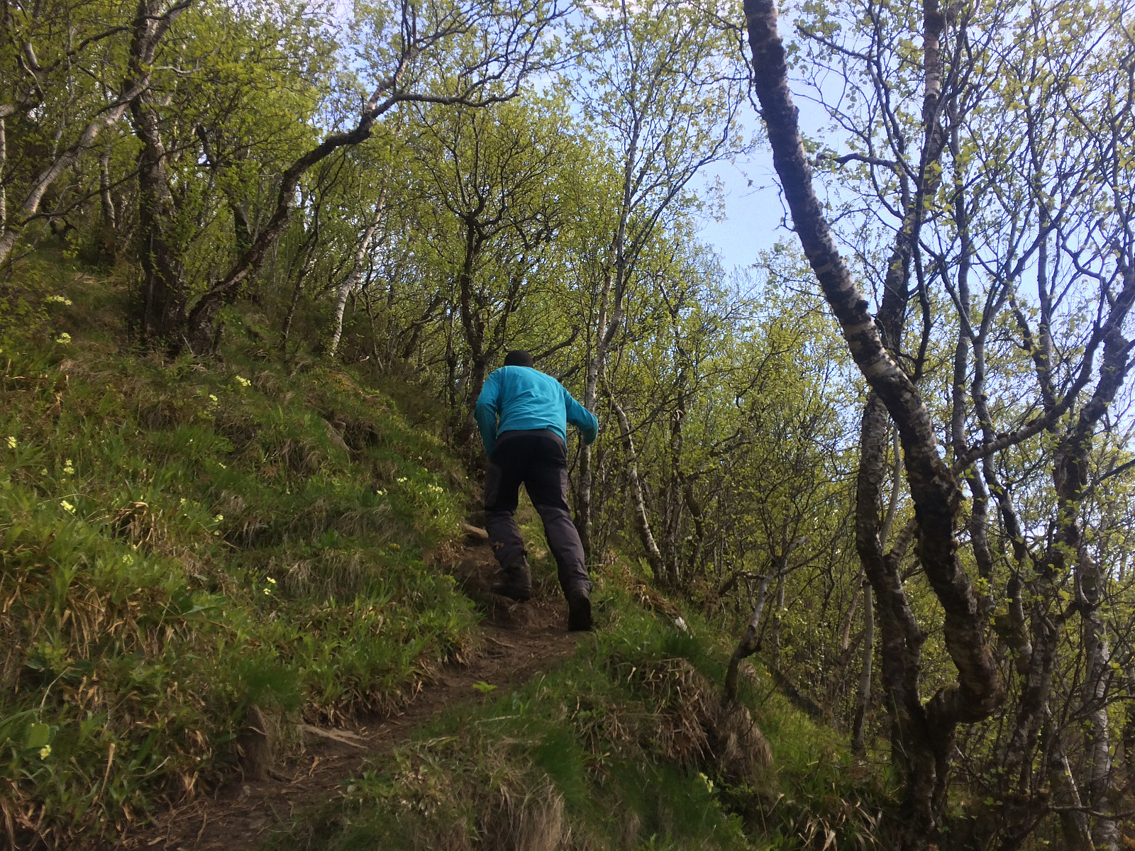 Det var strålende sol med litt spredte skyer den dagen vi la ut på denne turen; jeg, min eldste sønn dag, og en gammel klassekamerat av ham. Turen går bratt oppover allerede fra starten. Vi hadde kjørt til Hellandshamn, og satt bilen på en parkeringsplass ved Rundevika, parkeringsplassen ligger litt inn til høyre etter at man har rundet neset mellom Samfjorden og "Moldeleia". Spesielt bratt går turen fra ca. 100 høydemeter og opp til ca. 250 høydemeter. Stien går imidlertid gjennom tett skog dette stykket, så der er rikelig med trær å holde seg i, hvilket kan være kjekt spesielt på vei ned igjen.
Fra ca. 250 m.o.h. flater det noe ut, ikke som et plateau, men etter klatringen vi har lagt bak oss, føles det litt sånn, og vi kan speede opp tempoet en liten smule. Stien >>>
Det var strålende sol med litt spredte skyer den dagen vi la ut på denne turen; jeg, min eldste sønn dag, og en gammel klassekamerat av ham. Turen går bratt oppover allerede fra starten. Vi hadde kjørt til Hellandshamn, og satt bilen på en parkeringsplass ved Rundevika, parkeringsplassen ligger litt inn til høyre etter at man har rundet neset mellom Samfjorden og "Moldeleia". Spesielt bratt går turen fra ca. 100 høydemeter og opp til ca. 250 høydemeter. Stien går imidlertid gjennom tett skog dette stykket, så der er rikelig med trær å holde seg i, hvilket kan være kjekt spesielt på vei ned igjen.
Fra ca. 250 m.o.h. flater det noe ut, ikke som et plateau, men etter klatringen vi har lagt bak oss, føles det litt sånn, og vi kan speede opp tempoet en liten smule. Stien >>>
Hiking to Mount Tverrbotshornet with my son Dag
- Datum:
- 07.05.2016
- Tourcharakter:
- Hochtour
- Tourlänge:
- 3:18h
- Entfernung:
- 9,6km
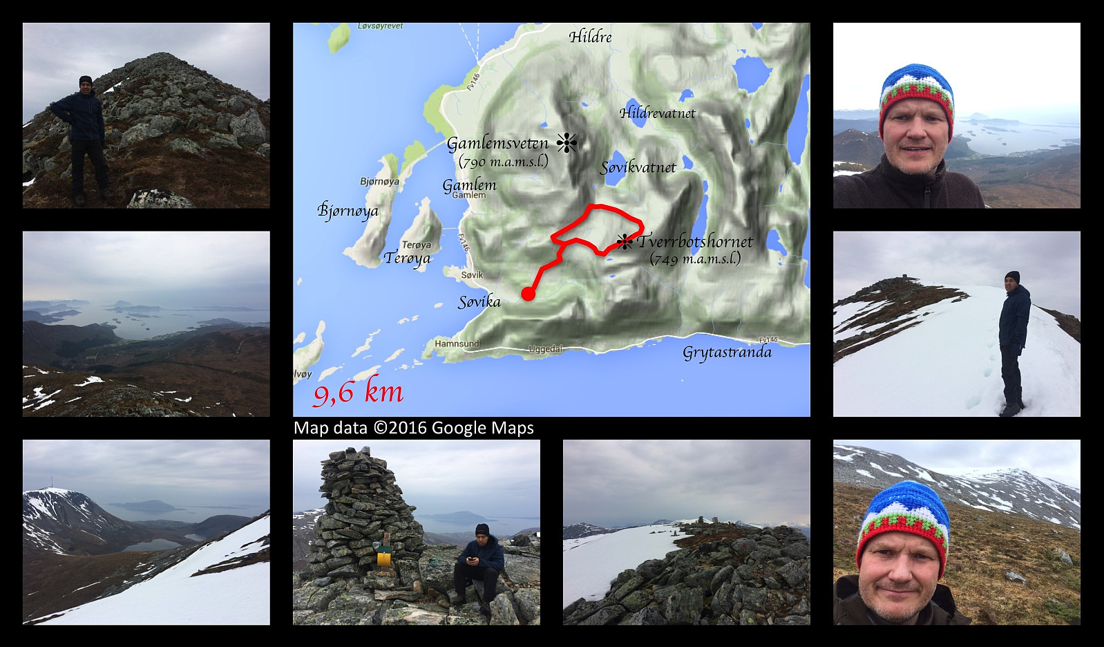 Hiking to the top of the mount Tverrbotshornet along with my son Dag. We drove to Søvika in Haram municipality, and parked at a parking lot in the valley called Søvikdalen. It's the same parking lot we've been using when visiting Mount Gamlemsveten. The first 1.5 km is the same as when you ascend Gamlemsveten, but then we took off to the right from the Road that climbs Gamlemsveten, crossed a marsh; and then started climbing up along a mountain ridge that leads up to the summit of the mountain. The ridge is quite stony, but otherwise not difficult to climb. The elevation of this mountain is 752 meters above main sea level, and we soon reached the summit. From there we continued about 400 meters in a north east direction, and then made our descent from the mountain in a north west direction >>>
