Archiv - Nach Datum
Archiv - Nach Aktivität
-
Andere Tour (1)
- Expedition (1)
-
Andere Wintertour (10)
- Schneeschuhtour (10)
- Fahrradtour (2)
- Fußtour (228)
-
Klettern (8)
- Alpinklettern (7)
- Mixed-Klettern (1)
-
Skitour (49)
- Randonnée/Telemark (49)


Gesammelte Listen
-
Romsdal ≥ 100m pf.
(134/301)
 44%
44% -
Sunnmøre ≥ 100m pf.
(78/531)
14%
-
Norges 1000 største fjell målt i primærfaktor
(52/1000)
5%

Nasjonaldagstur til Straumshornet i Sykkylven
- Datum:
- 17.05.2026
- Tourcharakter:
- Bergtour
- Tourlänge:
- 4:48h
- Entfernung:
- 8,1km
Randonne-tur til Finnan og til Alnestinden
- Datum:
- 16.05.2026
- Tourcharakter:
- Randonnée/Telemark
- Tourlänge:
- 5:37h
- Entfernung:
- 10,9km
Rundtur fra Jordalsvatnet
- Datum:
- 03.05.2026
- Tourcharakter:
- Wanderung
- Tourlänge:
- 4:34h
- Entfernung:
- 13,4km
På løpetur med Dag i byfjellene i Bergen
- Datum:
- 01.05.2026
- Tourcharakter:
- Jogging
- Tourlänge:
- 3:58h
- Entfernung:
- 23,0km
Til Varden og Rødlandstua
- Datum:
- 25.04.2026
- Tourcharakter:
- Wanderung
- Tourlänge:
- 2:18h
- Entfernung:
- 5,5km
Til Ansokhornet med Dag
- Datum:
- 21.03.2026
- Tourcharakter:
- Wanderung
- Tourlänge:
- 3:16h
- Entfernung:
- 9,2km
Til Tusten på truger
- Datum:
- 18.02.2026
- Tourcharakter:
- Schneeschuhtour
- Tourlänge:
- 5:57h
- Entfernung:
- 10,7km
Til Skolmelia og Såta på truger
- Datum:
- 17.01.2026
- Tourcharakter:
- Schneeschuhtour
- Tourlänge:
- 6:01h
- Entfernung:
- 10,3km
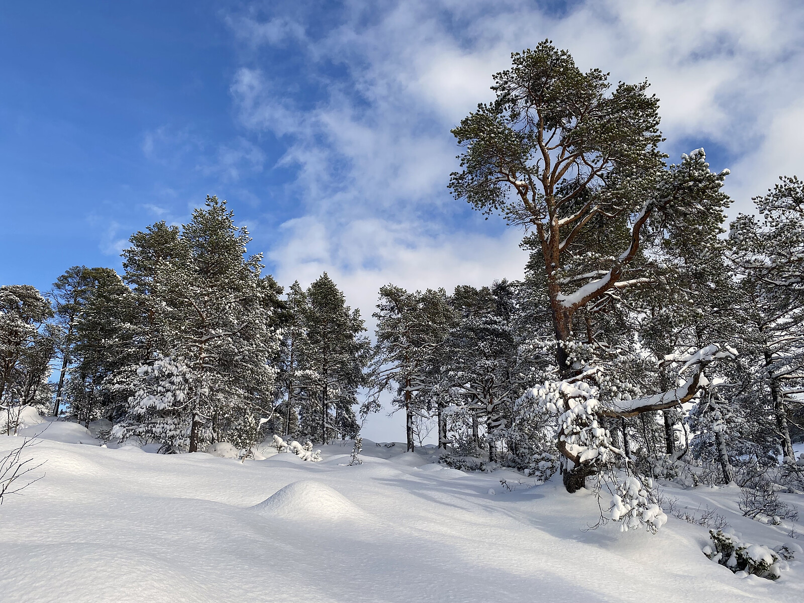
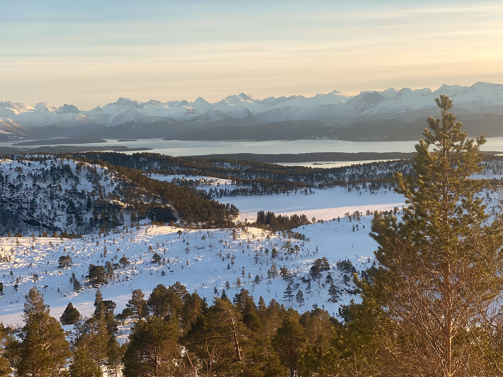 Jeg var i Molde og besøkte vår eldste datter denne helgen. Vi hadde på forhånd snakket om å ta oss en fjelltur, og under frokosten denne morgenen, ble vi enige om å ta turen opp på Skolmelia [626 m.o.h.] og Såta [631 m.o.h.]. Vår datter hadde vært på Såta en gang før, men det var på sommerstid, så da hadde hun fulgt grusveien opp til Moldevatnet [344-338 m.o.h.], deretter stien langs nordsida av Moldevatnet, og så til slutt sørvestryggen opp til topps på Såta. Nå var det imidlertid brukbart med snø, og jeg hadde sett for meg at vi kunne følge sørøstryggen via Skolmelia opp på Såta. Nå var det riktignok ganske avblåst i høyden, og neppe hensiktsmessig å gå med rando- eller fjellski (se bildene), men jeg hadde nylig kjøpt nye, flotte truger til meg selv og min >>>
Trugetur til Litleskjerdingen
- Datum:
- 10.01.2026
- Tourlänge:
- 2:16h
- Entfernung:
- 5,1km
 Jeg hadde kort tid før denne januardagen kjøpt meg et par helt nye truger, som jeg hadde lyst til å teste ut; og det passet fint med været, for det hadde kommet noe snø, men jeg var usikker på om det var nok snø for en skitur. Jeg parkerte bilen oppe på parkeringsplassen på Nakkereset, spente på meg trugene, og la i vei. Det er for bratt opp på Litleskjerdingen dersom man peiler seg rett inn mot toppen med det samme man har forlatt parkeringsplassen. I stedet går man mot nordvest til man liksom er borte ved "foten" av fjellet, for så å dreie vestover. Når man så har gått ca. 1 km fra utgangspunktet, vender man nesen nordover, og forsøker å finne en trasé opp gjennom skogen, uten for mye trær i veien. På denne måten får man oppstigningen et godt stykke vest >>>
