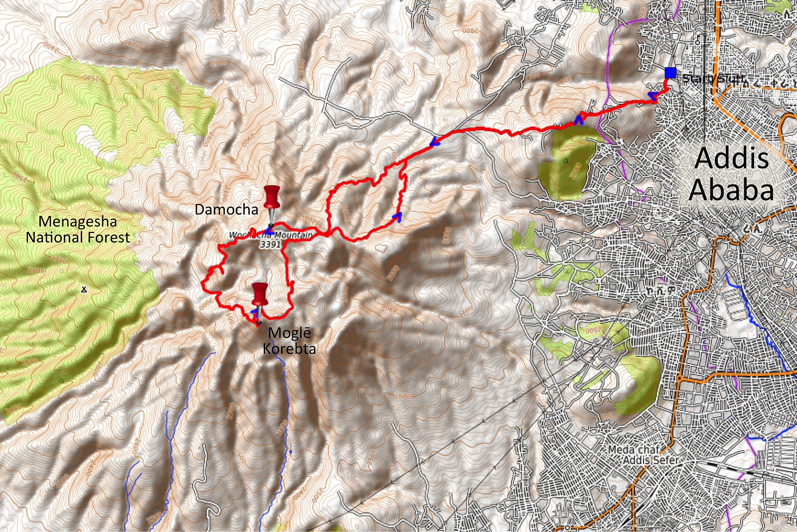
Climbing Mount Wochecha and encircling the old crater (02.11.2019)

| Tourcharakter | Bergtour |
|---|---|
| Tourlänge | 8h 40min |
| Entfernung | 32,1km |
| Höhenmeter | 5.832m |
| GPS |
|
| Besteigungen | Moglē Korebta (3.324m) | 02.11.2019 09:48 |
|---|---|---|
| Wochecha Mountain (3.391m) | 02.11.2019 09:48 |

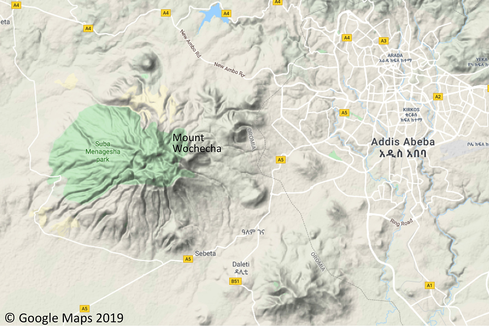
I have been to Addis Ababa in Ethiopia several times in connection with my work, and whenever I've been there, I've had a desire to climb or trek some of the mountains that surrounds the city, the highest of which is the Wochecha Mountain. I did actually climb that mountain when I visited Addis a year ago (see PB report in Norwegian dated November 11th 2018), but while standing on the summit, I realized that this mountain top was just the northern rim of an ancient volcanic crater; and you could actually see an almost circular mountain ridge surrounding the old crater while standing up there. As I was planning the current trip to Ethiopia, therefore, I had an idea of encircling the old crater; though I hesitated a little bit, realizing it wasn't quite straight forward to estimate how long time a trip like that was going to take.

Last year when I climbed Wochecha, I walked all the way from our hotel within the city, but that made the trip quite long, and it took me almost an entire day, so this time I had a taxi driver take me to the very western outskirts of the city, very close to the city border. Before I started hiking, I got the phone number of the taxi driver, and made an appointment that I would call him about one hour before I wanted him to come and pick me up. As I embarked on climbing the mountain, I tried to remember the trail that I had been following the previous year. The first part of the trip goes through a somewhat populated area, and you have to find the path that leads up to the mountain, and not one that just takes you to a group of houses. I twice picked the wrong way, but then I found the correct one, and so I tried to speed up a bit as I made may way up the mountainside. It was just two days since I arrived in Addis, however, so I had not yet adapted very much to the altitude; though I had in fact climbed Gara Furi Terara of 2839 m.a.s.l. two days earlier. Anyway, though the altitude and the thin air might have limited my speed, I was very eager to do my best, as I knew today's trip would make quite a number of kilometers.
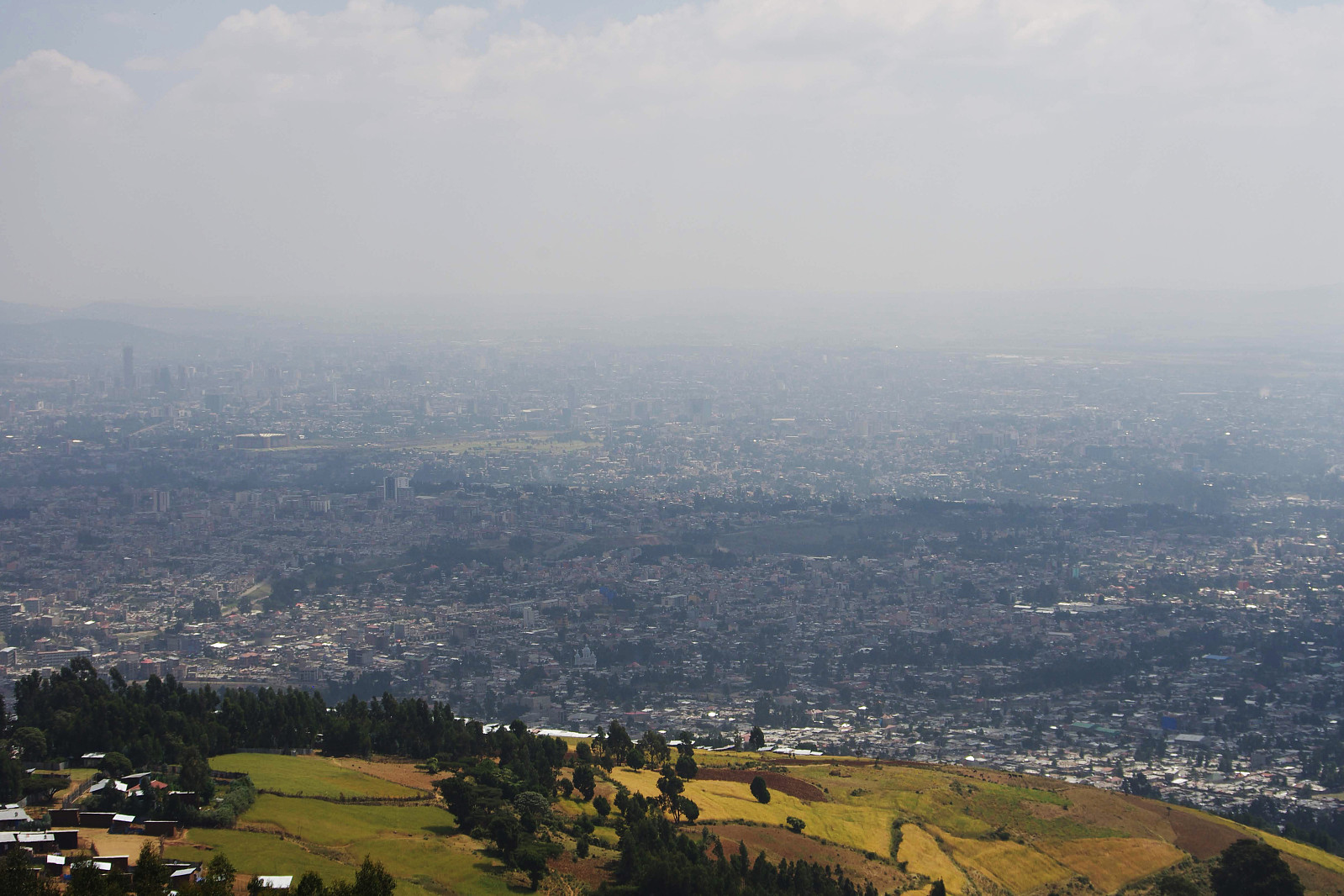
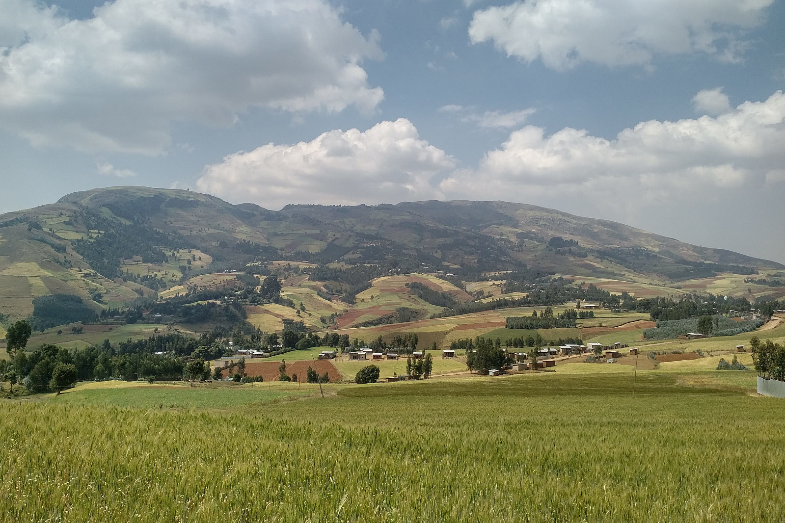
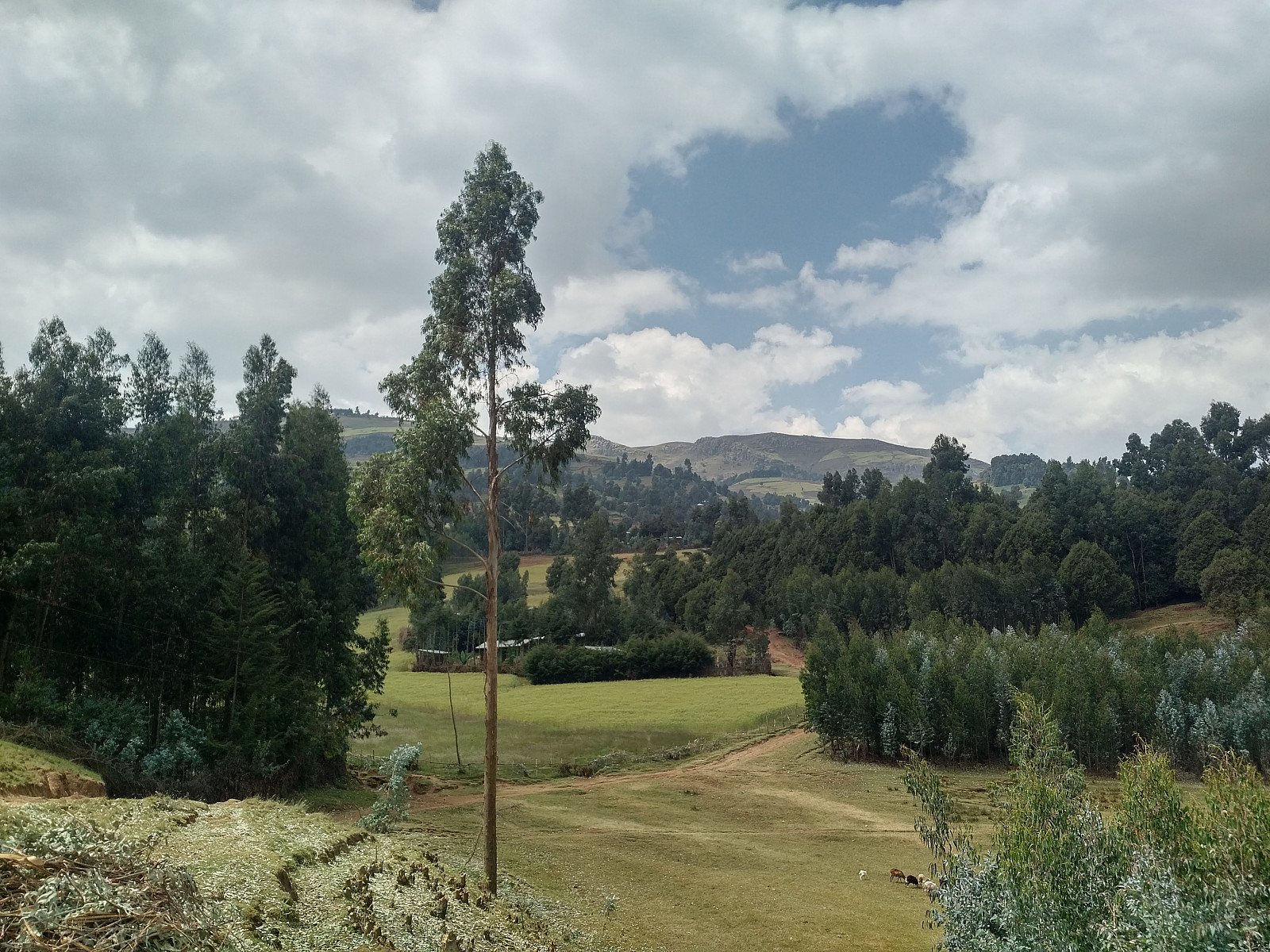
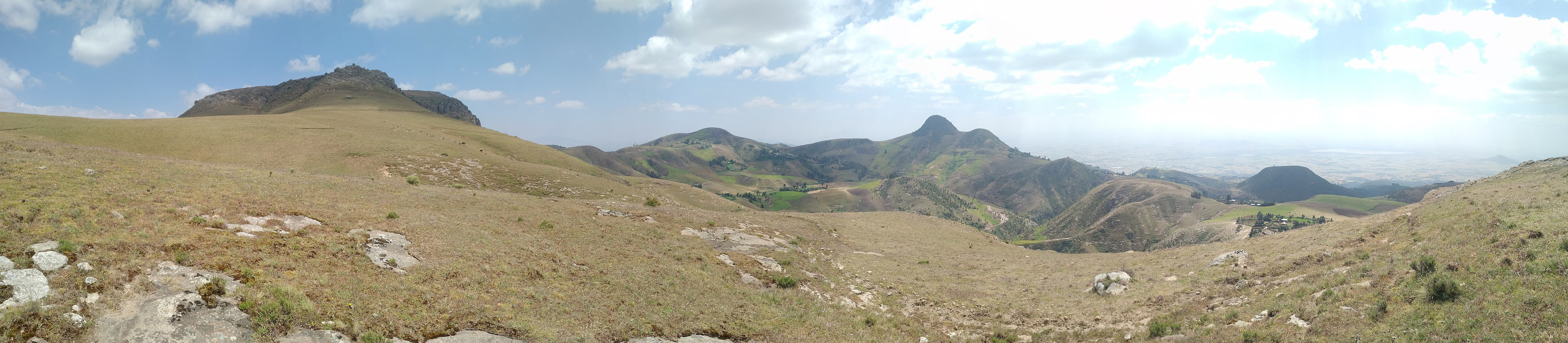
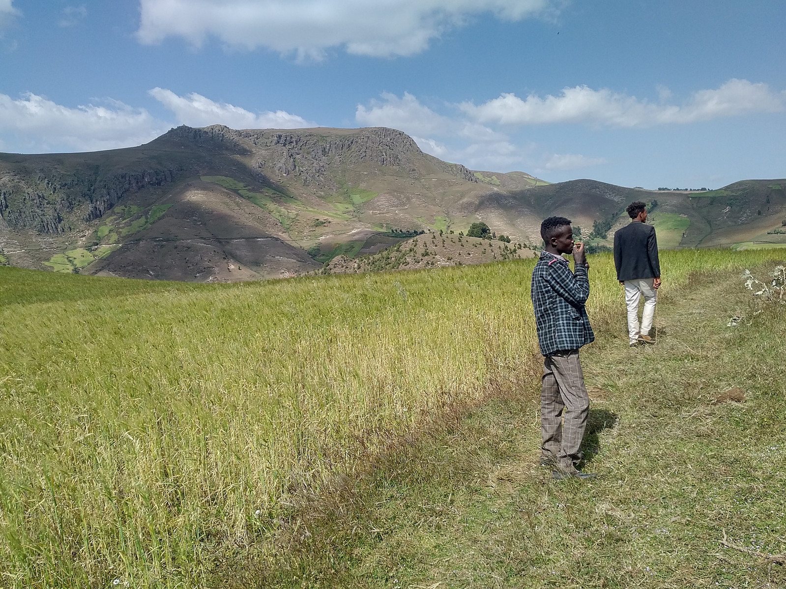
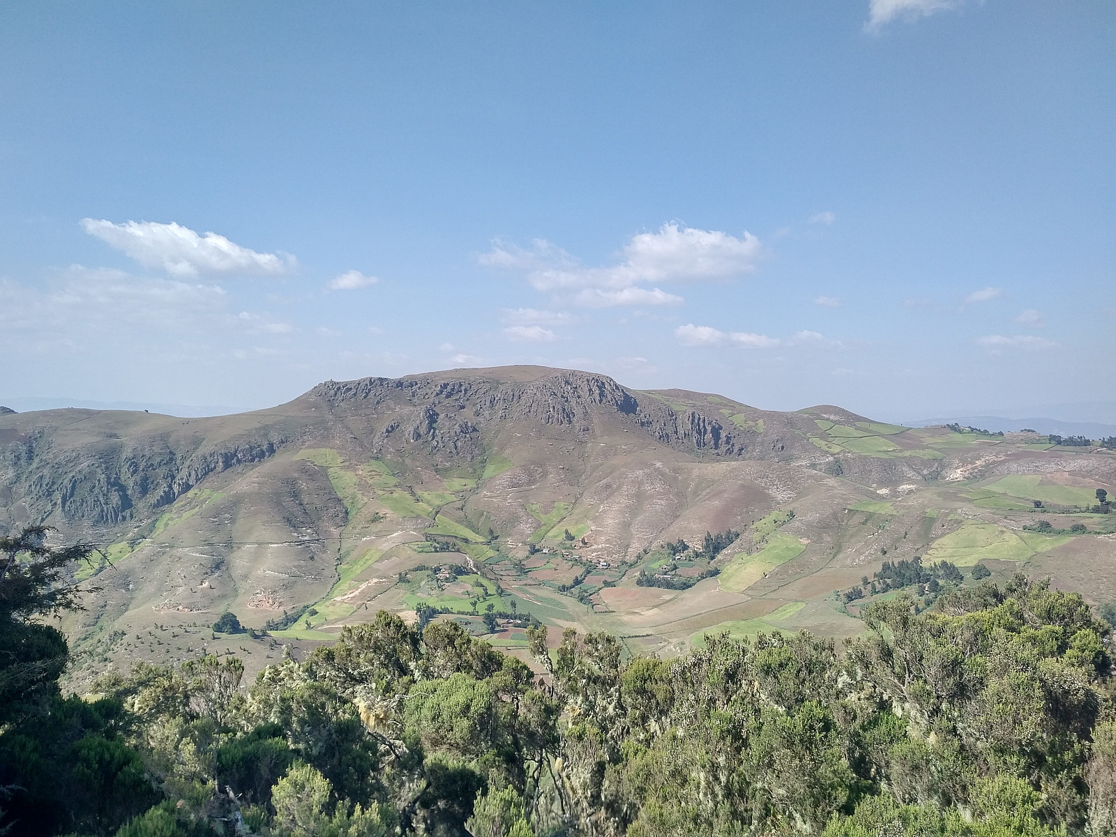
When you climb Wochecha from the Addis side like this, you first have to climb a mountain of two thousand and something meters just east of Wochecha (the mountain has just been named "Wochecha East" by someone here on Peakbook), and as you climb this mountain you get a better and better view of the city of Addis Ababa (Image #4). [I did shoot some images of the view, but due to haze they didn't become that good; actually the images I shot from the same spot a year ago turned out much better, see my PB report from last year.] You don't actually have to walk up to the very summit of Wochecha East, however, as the track passes the mountain at about 2880 m.a.s.l.; just beneath its summit. As you reach this pass-point on the first mountain, a beautiful valley with fields and villages open up in front of you, and beyond that valley the Wochecha Mountain reveals itself in all its majesty (Image #5).
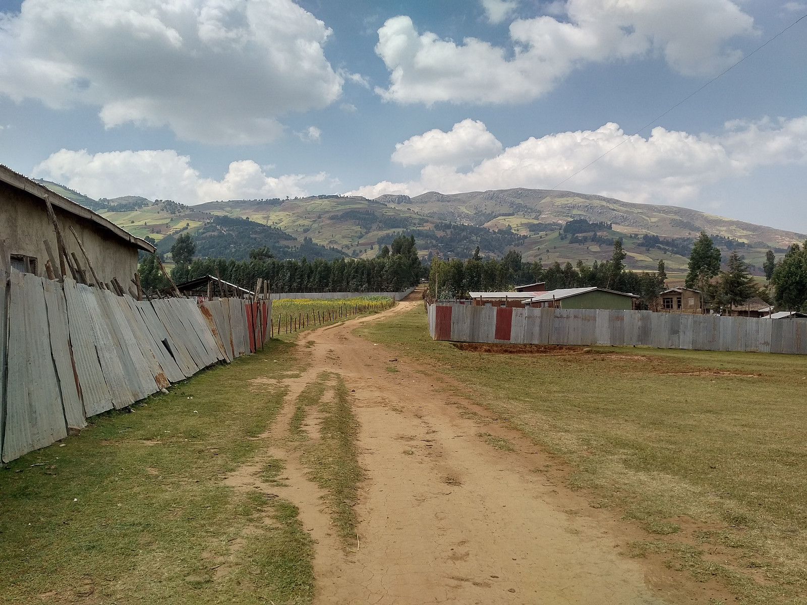
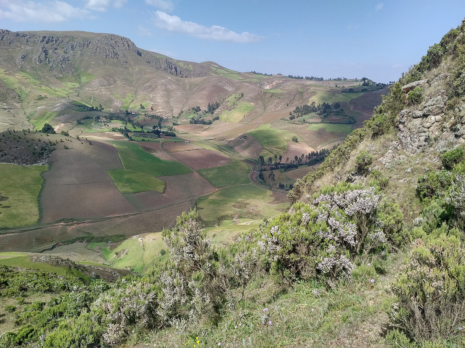
As you pass the "Wochecha east ridge", you'll come very close to a little village, and from there you just follow the little from the village down into the valley in front of you. It's not a paved road, it's just a dirt road, but it does the work. As you descend into the valley you'll get down to about 2750 m.a.s.l., before you start to climb again. In the bottom of the valley you the road merges with a slightly broader one, which you follow for not more than half a kilometer, and then you take left through a village (Image #6), at least that's the track I've followed both times I've climbed the mountain. Wochecha has a number of ridges that extend from the surrounding "lowland" towards the summit, and you have to chose one of them for your climb, though it might also be convenient to switch from one ridge to another during your climb, depending on which ridge you choose.
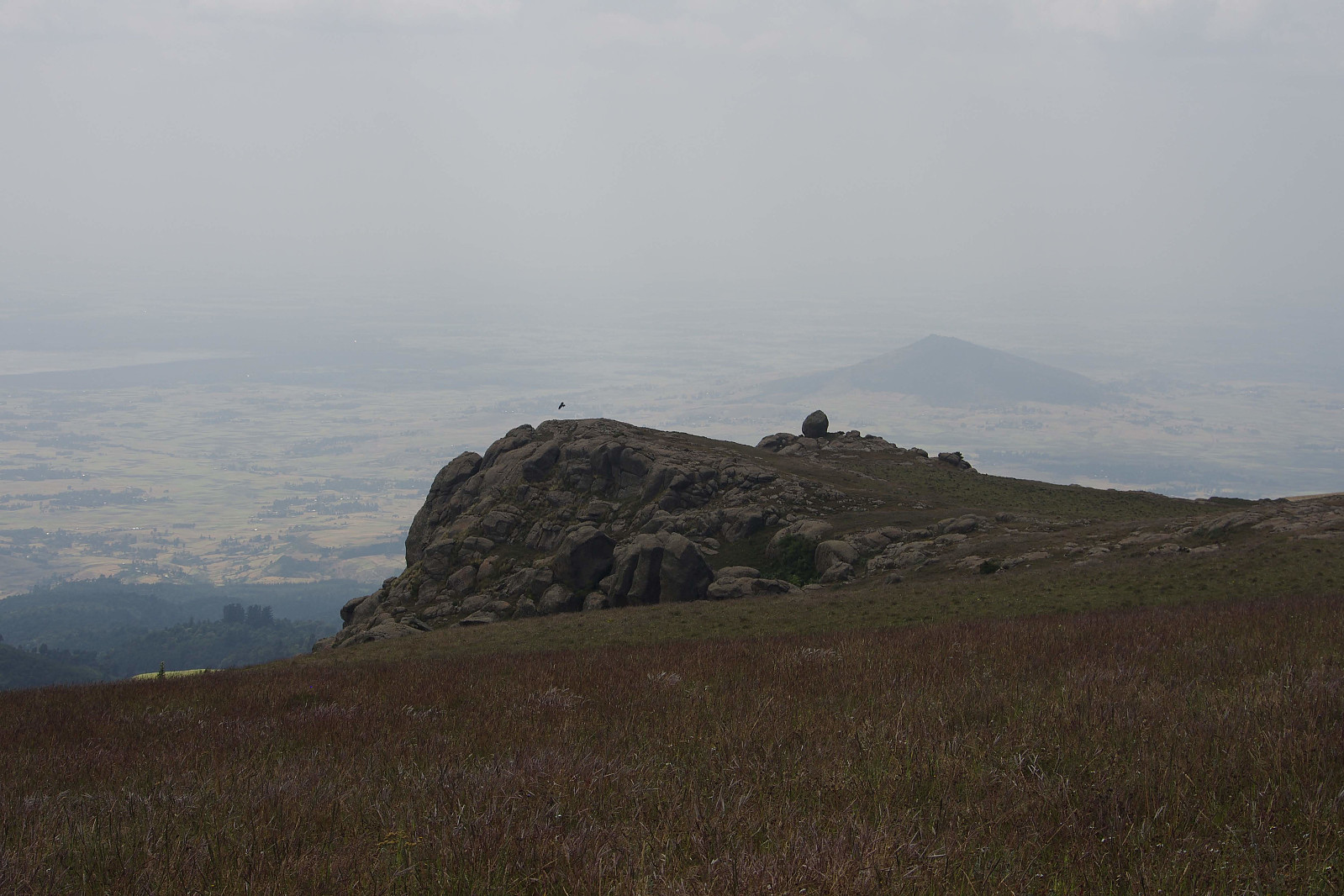
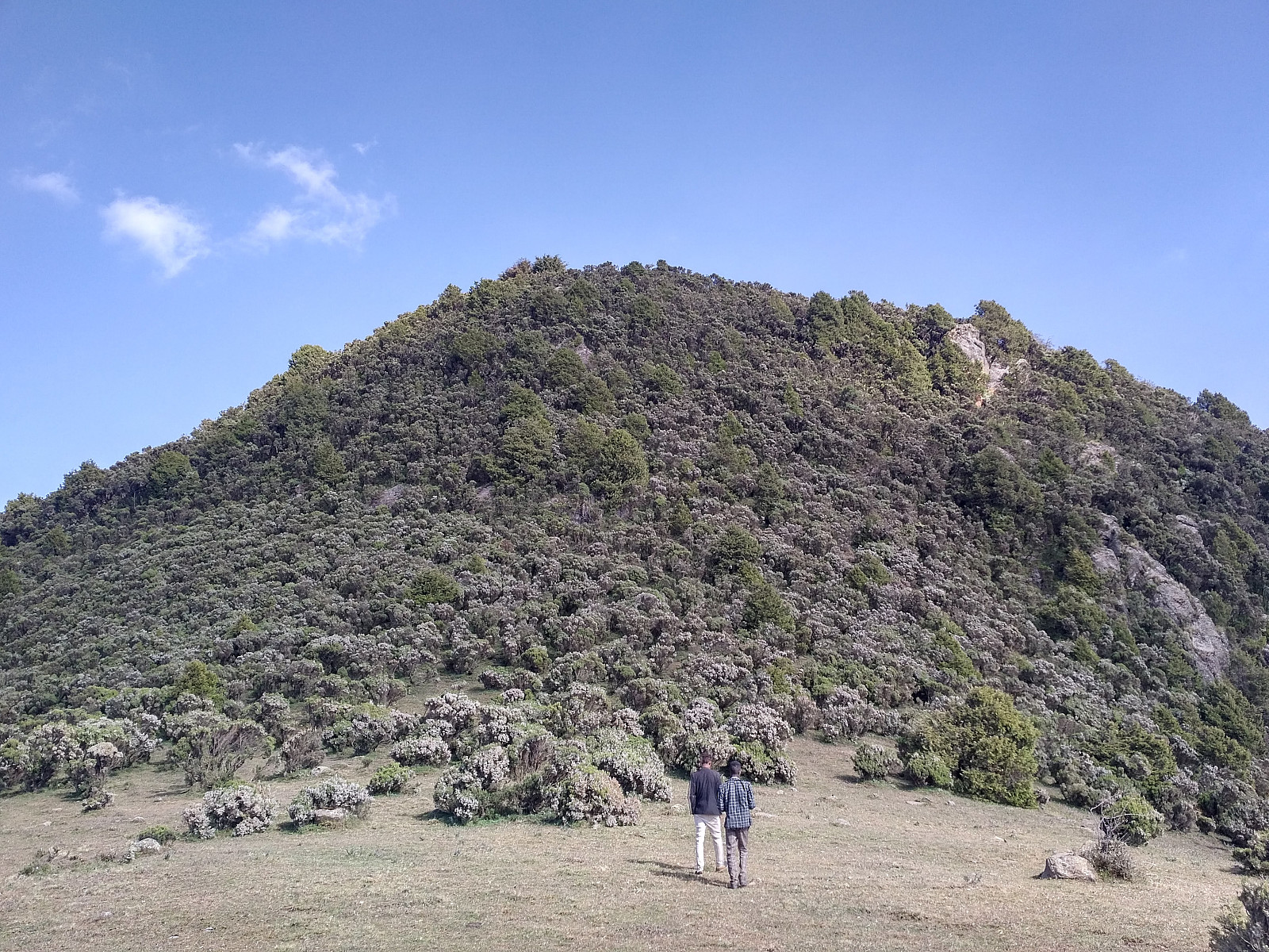
It took me a little less than 3 hours and 9 minutes to reach the summit of Wochecha. I had a short rest at the summit, captured a few photos, and ate some of the food that I had with me; before I decided to embark upon encircling the Wochecha crater. There was especially this funny mountain (i.e. Mount Moglē), located on the other side of the crater, which I wanted to climb as I encompassed the perimeter of the old volcano (Image #11).
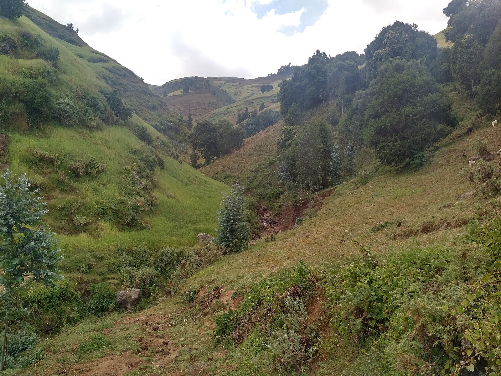
I started walking westwards, and after walking about 300 meters or so, I came to a fascinating knoll (Image #12) with bare rock, and which seemed to be a little bit steep on the west side, where I intended to go. I was in mood for a little climb at this moment, and I was just about to embark upon it, when four Ethiopian Ravens, so-called Thickbilled Ravens, started circling above me, and taking turns on attacking med. It is my guess that both pairs of Ravens were having their nest in the cliff side below the knoll, as these birds rarely attack humans unless they feel threatened by them. I headed about 100 meters northwards, therefore, and started descending at a different place, as may be seen on my GPS-tracking. The rim of this huge volcano has been worn down by erosion over thousands of years, hence the elevation is no longer the same all around its perimetry. The rainwater that falls into the old crater is all drained into one single river, witch escapes the crater to the west at about 2975 m.a.s.l.; hence in order to encircle the crater, I would have to get all the way back down to this altitude; before I could start climbing up to Moglē Korebta. This may of course sound a bit exhausting, but on the other hand, I was planning to climb Ras Dashen during this in Ethiopia, so I regarded this day an opportunity to adapt to the altitude.
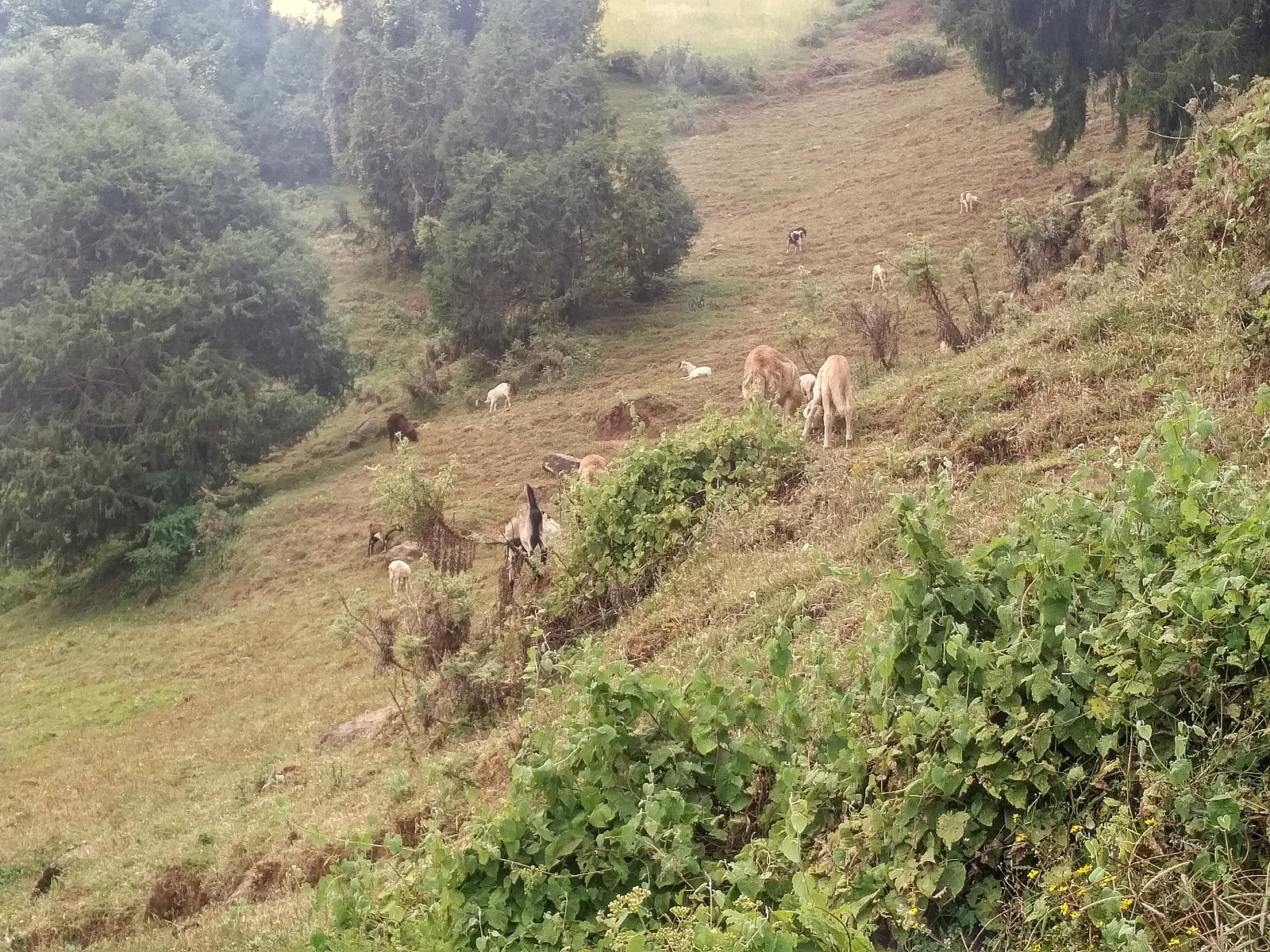
The descent westwards along the northern rim brought me down to some meadows where sheep, goats, and cattle were grazing; and were I encountered about 10 kids that were looking after their herd. Now it's not every day these children see a white man, and Ethiopian children are just as curious as other children; so they all started following med along the mountain ridge. Some of them tried to ask me something, possibly about where I was going; but they didn't speak much English, so it was impossible for me to communicate with them. I was wondering a little about how long they were going to follow me, and whether they were expecting to get something from me, when they suddenly started to shout something to me, and at the same time they seemed to point me in another direction. Then all of a sudden I understood what those kids had been shouting about, because right there in front of me was a very steep cliff with a vertical hight of about 20 meters. Whenever you climb Norwegian mountains, you tend to find a lot of fissures in the rock, that offer you something to hold onto as you climb. The rocks that I've seen at this altitude in Ethiopia tend to be more smooth, with less fissures to hold on to, probably due to less frost; but after a quick glance I spotted at least two places were it should be pretty safe to climb down, and so I did. Judging from the reaction of my "followers", they had never seen anyone climb down at this spot; and they actually stopped following me from there on.
I next passed very close to two or three very small villages surrounded by farmland, mostly comprised of barley fields. As I passed by the last one of them, heading onto a mountain knoll where I could get a good overview in order to pick the best route further on; a young man came running after me, waving his hands, as if to tell me I was heading in the wrong direction. He didn't speak a word of English, but I went back down from the knoll, and picked the track that he pointed at. As I so did, however, he started following me to show me the way, so I was kind of stuck with him. He asked me a lot of questions, which I didn't understand a word of, as he was speaking in Oromo language, his native tongue, which unfortunately, I do not speak. I guessed he was asking me where I was going, and by pointing at the mountains along the southern rim of the Wochecha crater, and then adding "Addis Ababa"; I was somehow able to explain to him that I intended to encompass the valley in the middle of the mountains by following the mountain ridge around it. The path that we were following now descended quite steeply down the mountainside to a new plateau with more fields and more rural houses and villages; and down at this altitude there were even teff fields in addition to the Barley fields. And there, on a stone by the path right in front of us, sat another young man just relaxing; and now he also wanted to join me on my hike. I had tried to explain to the first one that he didn't need to come with me, but it was futile; so with this new guy I didn't even bother to say so, I knew he was going to come along no matter what I would say.

It didn't bother me that the two young men wanted to come with me. For what I knew, it could prove useful to have two guides with on the climb up to Moglē Korebta. The second guy even knew a little English, though I can't say it was very much, nor can I say his English was extremely good. After just a few minutes we arrived at the above mentioned river that escapes the crater to the west (Image #16). The river wasn't very impressive in size at the moment, but the English-speaking young lad could confirm that it becomes much, much larger during the raining season. And it should be, as it is the sole drainage of this huge and impressive crater. I asked the guy if the water in the river was safe to drink, and he answered that the water from this river is what they drink in his village. As I started my trek in the morning, I brought with me 2 liters of beverage; i.e. 2 half-liters of water, 1 half-liter of Sprite, and one half-liter of Fanta. It had gradually dawned upon me that this wasn't quite enough of water for such a long hike, so I had tried to ration what I had; hence I had just consumed half a liter of water and half a liter of Sprite, saving the Fanta bottle for the ascent of Mount Moglē and the last bottle of water for the return to Addis Ababa. With this abundant water supply in front of me, I right away immediately my beverage saving plan. My GPS tracking told me we were still at an altitude of 2975 m.a.s.l. as we crossed this river, and many germs that live at lower altitudes don't live up here. Moreover, the current season was the dry season, which, I reasoned, makes it even safer to drink this water. During the rain season, the rainwater would probably bring excrements from grazing animals into the river; whereas during dry season, the water in the river would all be coming from springs out of the ground. So, before embarking upon the climb towards Moglē Korebta, I drank of the river water till I was no longer thirsty, and then I filled up my two empty bottles with more water from the river.
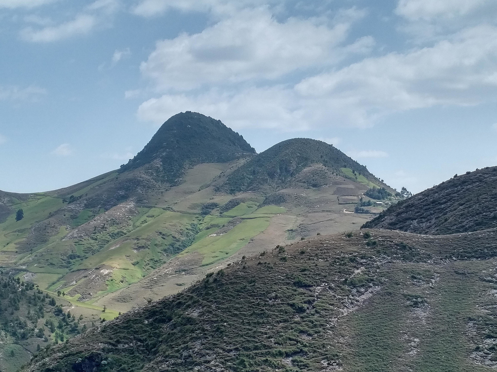

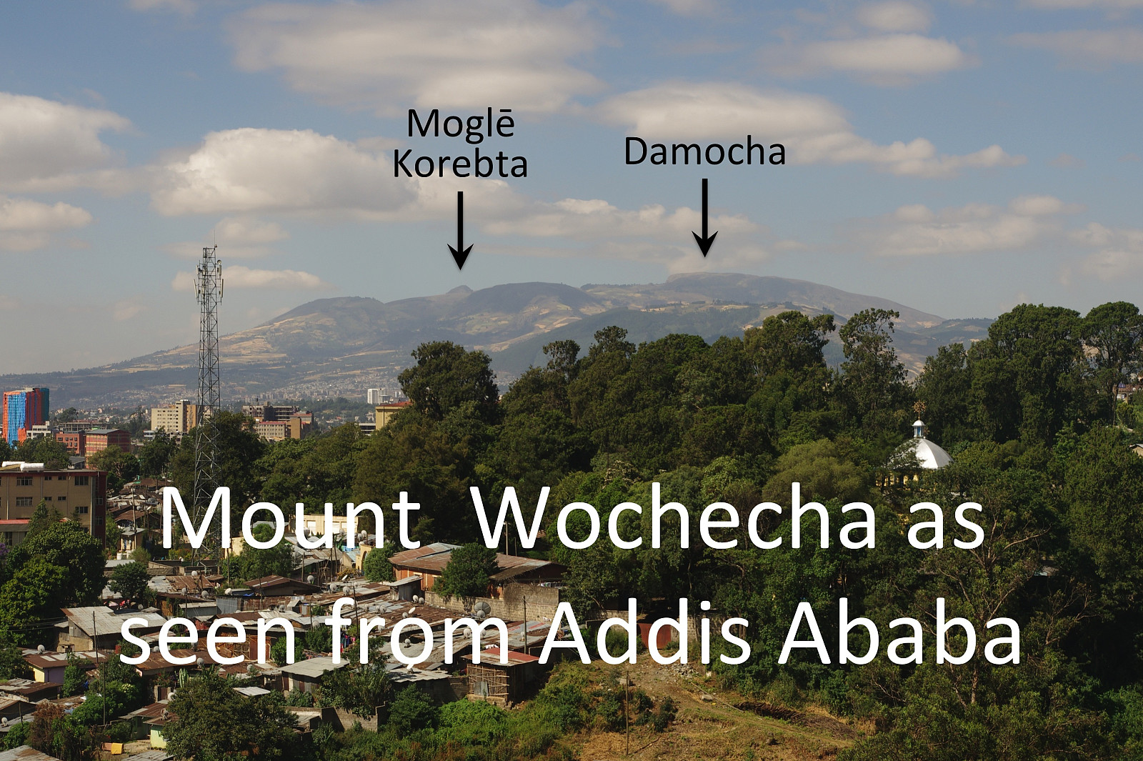
After this short brake by the river, we started the trek upwards along the mountain ridge on the south side of the huge Wochecha crater. The non-english-speaking guy suddenly gave me a handful of teff grains that he had picked from a field while I was drinking at the river. I obviously had to taste it, and they actually tasted quite good, so I consumed all of it. As we were climbing upwards along this mountain ridge towards the Mount Moglē, I asked the English-speaking guy about the names of these mountain; and it was actually only then that I learned that the mountain that we heading towards was called Moglē. He also explained to me that the proper name of the summit of Wochecha is Damocha, whereas Wochecha is actually the name of the entire mountain, including both Damocha and Moglē. Having the opportunity to learn the names of these mountains from the locals, was in itself worth having these two guys with me; as I had time an again asked people in Addis Ababa about the name of this mountain, without getting an answer. Most people in Addis simply don't know the names of these mountains, the only mountain name they tend to be familiar with, is that of Entoto.
After a while we came to a place where Mount Moglē was standing steeply up on the right side of the path that we were following. It was, obviously possible to follow the path, and encompass the old volcano crater bypassing the two summits of mount Moglē. We chose a smaller and less visible track, however, that led us into the western mountain side and the forest of Moglē Korebta. This was actually where it really proved useful to have the two lads with me, as they seemed to know the paths and tracks of this little forest very well. I would have been able to make my way to the two summits of Moglē even on my own, but it would have taken me some more time. We soon arrived at the lower (i.e. the western) summit of the mountain, and then into the saddle between the two summits (Image #20); and then we embarked upon the climb to the main summit of Mount Moglē. As we climbed this final part up to the summit of Moglē, we passed a little grotto by the track that we were following. From traces outside the grotto, it seemed like there was some kind of animal living in the cave, so I asked my English speaking guide about it; and he claimed there were hyenas living in the cave from time to time, though not at the moment. The view from the summit was fabulous. In the southeast you could see Gara Furi Terara, which I had climbed two days earlier, and beyond that mountain you could see all the way to Mount Zuqualla (2989 m.a.s.l.), an extinct volcano that has a lake within the crater, and therefore is a popular tourist attraction. In the north you could see over to Domocha, the summit of Wochecha, and you could actually se most of the valley between Domocha and Moglē from where we were standing.
I was just about to start descending from Mount Moglē, when the English-speaking lad asked me how much I was going to pay him. I have been living long enough in Africa that I expected this question, and as I also knew there was going to be some bargaining about the price, I started out lowly by offering him 100 Ethiopian Birr. He protested, and told me he works as a tourist guide, and that people usually pay him 2000 Birr or more for a hike like this. That might or might not be true, but he didn't have any other clients on this particular day, and after all, both of them had joined me about midway in my hike, though I hadn't at all asked them to do so. I ignored his remark for now, and started descending from the summit. We descended from Mount Moglē in a northern direction, as a descent to the east would be much steeper. As soon as we were below the forest, however, we came down to the path that we had been following before we climbed the two Moglē summits, and from there I could see it would be very easy to just follow this path eastwards past Mount Moglē, and then along the mountain ridge between Moglē and Damocha. It was now obvious that the two guys wanted to go back to their villages unless I came up with some money, so I spoke to the one that could understand what I was saying, and said to him: "I understand that people pay a lot for a hike like this, and if you had been walking with me all the way from Addis Ababa early this morning, I would have payed you 2000 birr or so. But you only joined me about halfway in my trip, and just for a short distance, and you can't expect me to pay you 2000 Birr for that." I gave him five hundred Birr, and then I said to him: "I want to give something to your friend here also, but I can't give him as much as I have given you, because he doesn't speak a word of English, and therefore he was not as useful as you were, so I'm going to give him two hundred Birr. These seven hundred Birr was actually all that I had brought with me, so I couldn't have payed them more even if I wanted. The guy seemed quite content with his five hundred Birr, but expressed that he thought two hundred was too much for the other guy: "He know no English," he said. I shaked them both by the hand and said good bye to them, and then I started walking on my way back to Addis along the planned part. The guy with whom I couldn't communicate much then returned home, whereas the other guy hesitated a little, and then decided to come along with me once again. He pointed at a house close to the path that we were going to follow, and explained that there lives a bad person in that house, but he knew the person, hence it was possible for him to protect me against him.
![#22: Mount Damocha [i.e. the highest peak of Wochecha] as seen from the ridge between Moglē and Damocha.](https://images1.peakbook.org/images/14939/Solan_20200101_5e0be28667f8b.jpg?p=xtralarge)
After about 1 km, we encountered the man that the young man had described as a bad person. The man came over to us, greeted us, and then started asking questions about what I was doing in Ethiopia and so on. I explained to him that I was working as a surgeon at the Black Lion Hospital, and when he asked me how long I was going to stay in Ethiopia, I explained that i was going to be two and a half weeks at the Black Lion Hospital, and that I was going to Gondar afterwards, for another week, intending to climb Ras Dashen. He next asked me if I was going to Gondar by car, but I then explained that I was going to fly there with Ethiopian Airlines. He then wondered where I was heading today, and when I said I was going to Addis Ababa, he protested, saying that was too long a journey, and that I couldn't go all the way to Addis today. The man, two friends that were with him, and the lad that had been walking with me now started discussing something in Oromo. I didn't pick up much of it, but from earlier experience with Africa I knew exactly what they were discussing, so I turned around, looked the man into his eyes, and said to him: "I do understand that you want me to spend the night in your village, so that you can earn some money from me, but I really need to go back to Addis today, and I don't have any money with me, so I couldn't spend the night here in the mountain even if I wanted to." The man took a little step back from me, and then said: "No, we're not after your money, but you are our guest, so we have some responsibility for you." The men then went on to discuss in Oromo. I still didn't understand their language, but I picked up some words like Gondar and taxi, and that was when I turned angry, and said to the men with a determined, and slightly elevated voice: "I know very well the way back to Addis, because I walked all the way from Addis today. And it is true that I don't have any money left on me. I payed for the plane ticket to Gondar many months ago, so I don't carry with me any money for that; and with the taxi driver I have an agreement that I'll pay him when I get back at the hotel. But right now I really have to push on, because I want to get back to Addis before it becomes dark." At that point the young man, the one that had been with me when I climbed Mount Moglē, suddenly looked a bit scared, and said: "Okay, okay, we are leaving you now." And then all of them suddenly shaked my hands, and said "good bye" to me, and I could continue my hike without them.
I continued over the ridge connecting Mount Moglē with Damocha, and then, as I was approaching the cliffs of Damocha (Image #22), I followed a track that curves to the right just in front of these cliffs. I soon came to a little village about one and a half kilometer from the Wochecha summit, one that I had passed when climbing the mountain in the morning. From there I knew the way back to Addis quite well, as I climbed this mountain not just early this morning, but I also climbed it about a year ago. I chose a different mountain ridge for my descent to the valley beneath, however, mostly for the variation. From the valley I followed the same route over Wochecha East, as I had done in the morning. As I past the top of this mountain, I phoned the taxi driver, and told him I would be back down where he had dropped me off in slightly less than an hour. I arrived at the spot about 15 or 20 minutes after darkness ensued, and the taxi driver was there. This taxi driver, whose name is Fikadu, is a very nice and reliable man. As we were driving back towards my hotel, I mentioned that I was looking forward to get back to the hotel and get something to drink. Understanding that I was thirsty, he immediately stopped by a little shop, and bought med two bottles of Sprite, which he actually payed for without taxing me any extra.

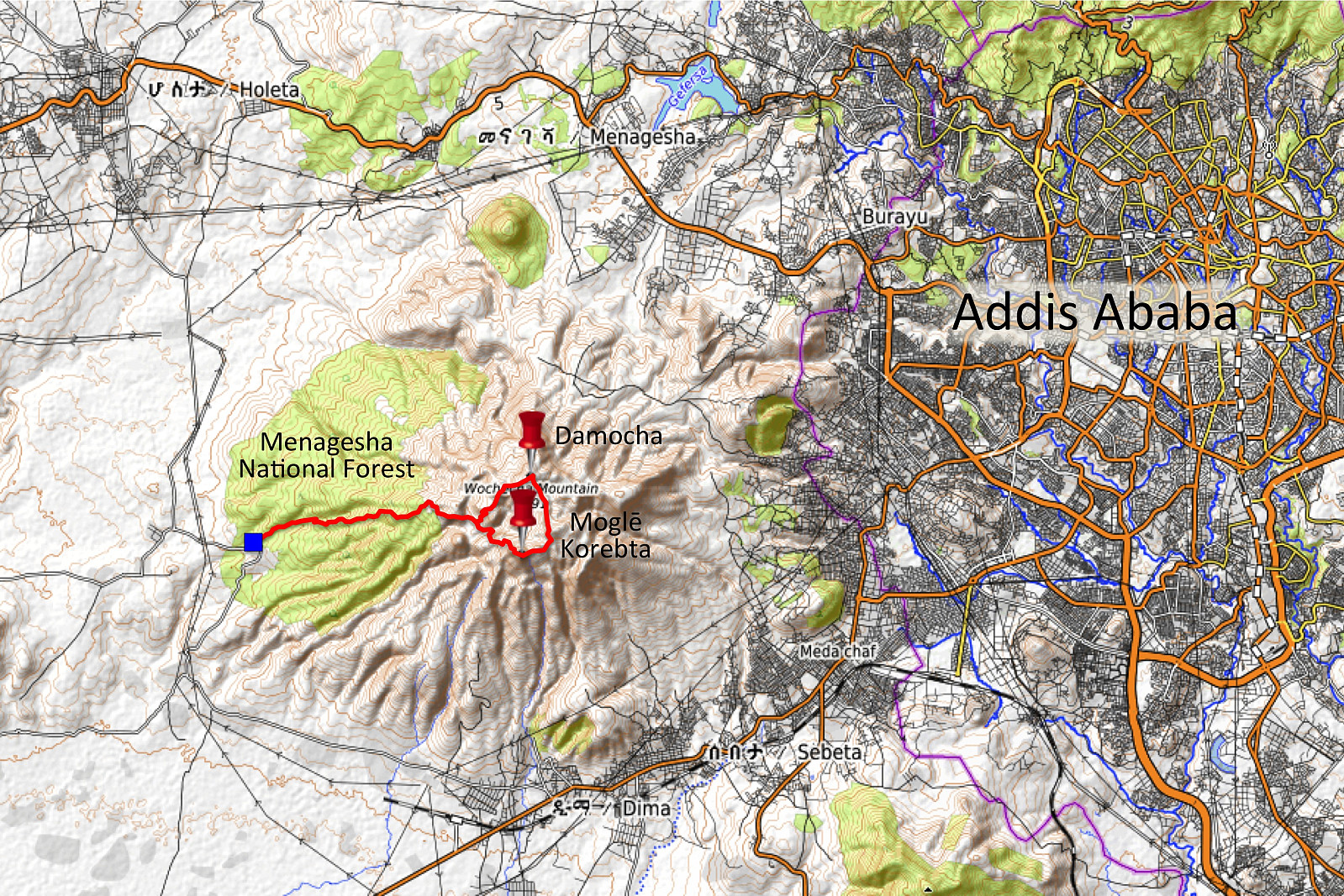
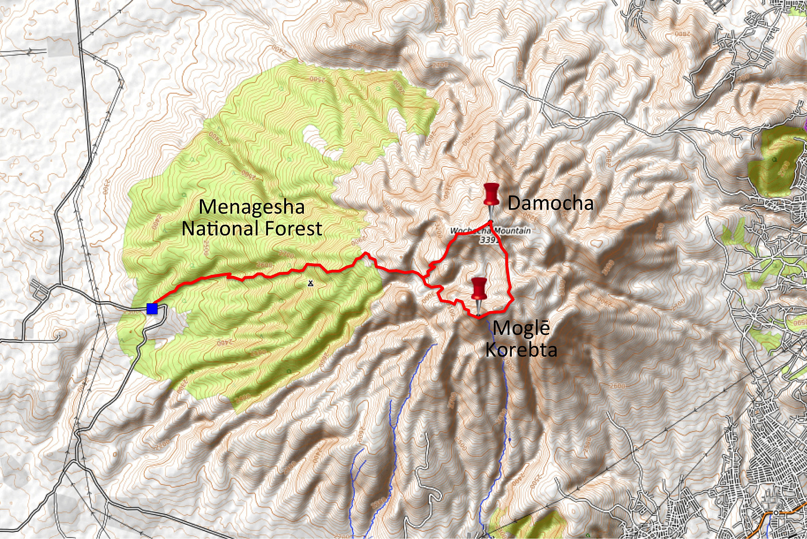
The mountain trek that I did on this day involved quite a bit of climbing and descending, which was perfect for me; as I intended to climb Ras Dashen less than three weeks from this day, and I wanted to acclimatize to the altitude and also to get as much training as I could in advance of that. It is, however, possible to encircle the Wochecha crater without having to descend as much as I did between Damocha and Moglē Korebta, if you access the mountain from the west, i.e. from the Menagesha National Park (Image #26 & # 27). If you do that, you only have to descend about 150 elevation meters, and then climb about 220 meters between Mount Moglē and Damocha. For someone not that eager on a long elevation workout, I think a trip like that would be a better option. In order to approach the mountain from that side, however, you would need someone to take you by car to the Menagesha National Park; and you would probably need a guide to come with you on the trek, as I don't think they would allow you to do a trek like this in the park without having a guide with you.

Benutzerkommentare