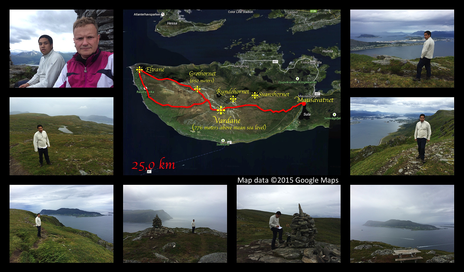
Upper left image: At Vardane, the summit of Mt. Sulafjellet. Upper right image: View towards the town of Ålesund. Middle left image: Heading west towards Eltrane. Middle right image: View towards the fjord called Borgundfjorden. Lower left image: View towards Godøy Island. Remaining lower images: At Eltrane, the westmost part of the mountain plateau.
This weekend we had a really long hiking trip on Sulafjellet mountain. We started out from lake Mauseidvatnet, and went up to the highest point of the mountain as we've done on several previous occations; and from there we went on to the westmost part of Sula island, to a part of the mountain that is called Eltrane. To get there, we just followed a path along the nordthern edge of the mountain plateau that comprises most of the western part of the island. The path was nice, easy to spot, and not at all difficult to walk. We chose a different path for our return, however, as I had seen a track that was marked out on my hiking map. That track, however, proved to be overgrown by grass and heather, and it was very difficult to follow the path that had once been there. It seemed that this track hadn't been used much for the last years, hence it was now disappearing little by little. About halfway back to Vardane (the summit of the mountain), there was no longer any track to follow; and so we just had to make our way through the heather over the platau, and this part of the trip definitely bacame the toughest of it all. We eventually made it back to our car, however (or else you wouldn't be reading this report), though it startet raining, and we were completely soaked when we got back...
Benutzerkommentare
Kommentartitel:
Zeichen: 1000
Kommentartext:
Du musst angemeldet sein, um Kommentare schreiben zu können.


Benutzerkommentare