Archiv - Nach Datum
Archiv - Nach Aktivität
-
Andere Tour (123)
- Expedition (123)
-
Andere Wintertour (7)
- Schneeschuhtour (7)
- Fahrradtour (1)
- Fußtour (34)
Peakbookfreunde
Gesammelte Listen


LA/BU-126 Brennåsen 704 m
- Datum:
- 29.12.2025
- Tourcharakter:
- Expedition
- Entfernung:
- 3,0km
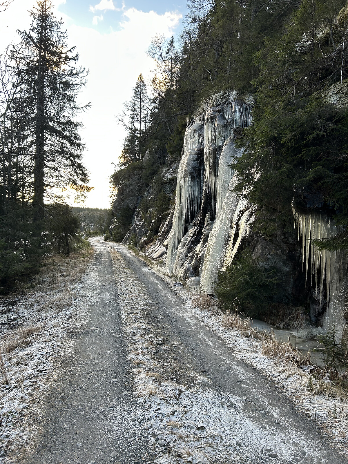 Denne turen hadde vært planlagt i flere uker, og vinteren 2025 var det endelig tid for å sanke inn 2+3 poeng.
I rapporter fra venner hørte jeg at veiene var glatte med mye is, og det var nesten ikke snø. Kjøreforholdene mot Svartjern parkeringsplass var ikke egnet for kjøring, selv med 4x4 og piggdekk. Veien var stengt, og flere valgte å kjøre videre til Bekkely parkeringsplass som startpunkt for turene.
I romjulen hadde jeg en del å gjøre, så det gjaldt bare å smøre seg med tålmodighet og vente på en åpning for å dra ut.
Mandagen ble den store dagen. Etter to uker med rapporter, og den siste på bare tre dager, var det bekreftet at veiene hadde blitt mye bedre. Den siste som hadde vært der, måtte parkere omtrent 800 meter fra Svartjern parkering. Med det fine været som hadde >>>
Denne turen hadde vært planlagt i flere uker, og vinteren 2025 var det endelig tid for å sanke inn 2+3 poeng.
I rapporter fra venner hørte jeg at veiene var glatte med mye is, og det var nesten ikke snø. Kjøreforholdene mot Svartjern parkeringsplass var ikke egnet for kjøring, selv med 4x4 og piggdekk. Veien var stengt, og flere valgte å kjøre videre til Bekkely parkeringsplass som startpunkt for turene.
I romjulen hadde jeg en del å gjøre, så det gjaldt bare å smøre seg med tålmodighet og vente på en åpning for å dra ut.
Mandagen ble den store dagen. Etter to uker med rapporter, og den siste på bare tre dager, var det bekreftet at veiene hadde blitt mye bedre. Den siste som hadde vært der, måtte parkere omtrent 800 meter fra Svartjern parkering. Med det fine været som hadde >>>
LA/TM-197 Snaunuten 812 m
- Datum:
- 20.12.2025
- Tourcharakter:
- Expedition
- Entfernung:
- 3,2km
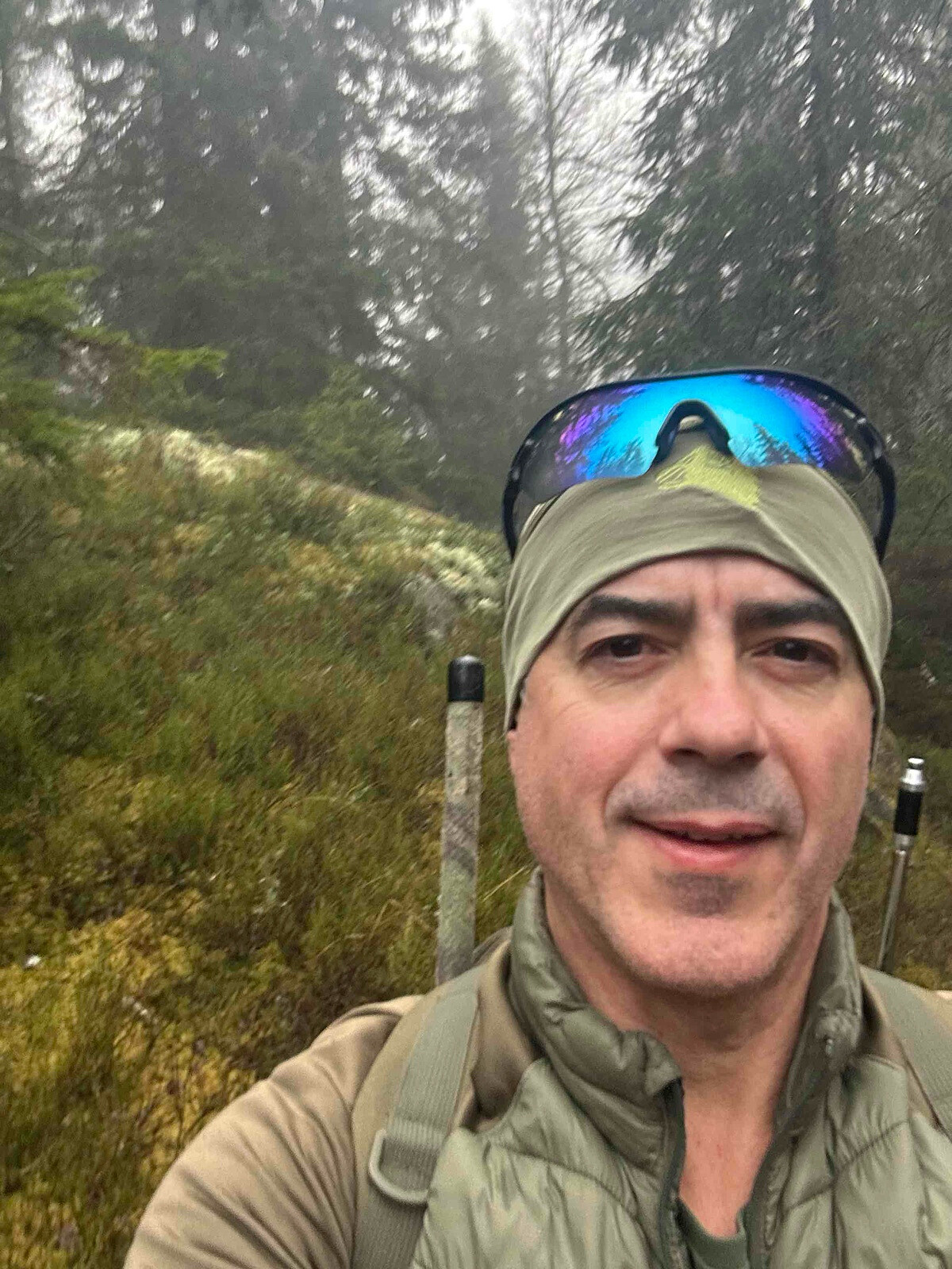
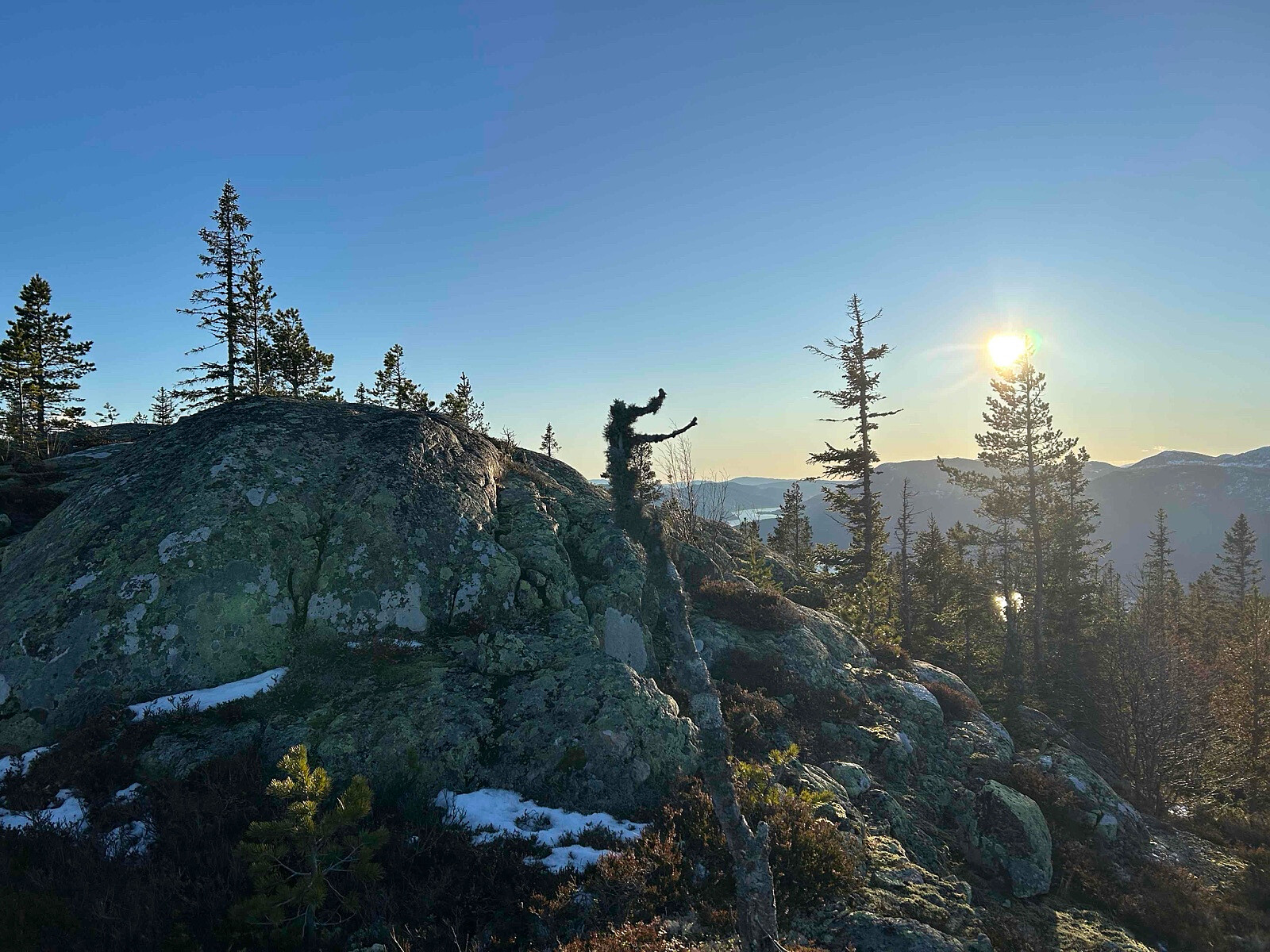 Det ble en fantastisk fin soldag, tross det var mye is langs ruten. Hadde vært bedre med mer snø :)
LA/TM-201 Ringberg 796 m
- Datum:
- 20.12.2025
- Tourcharakter:
- Expedition
- Entfernung:
- 1,7km
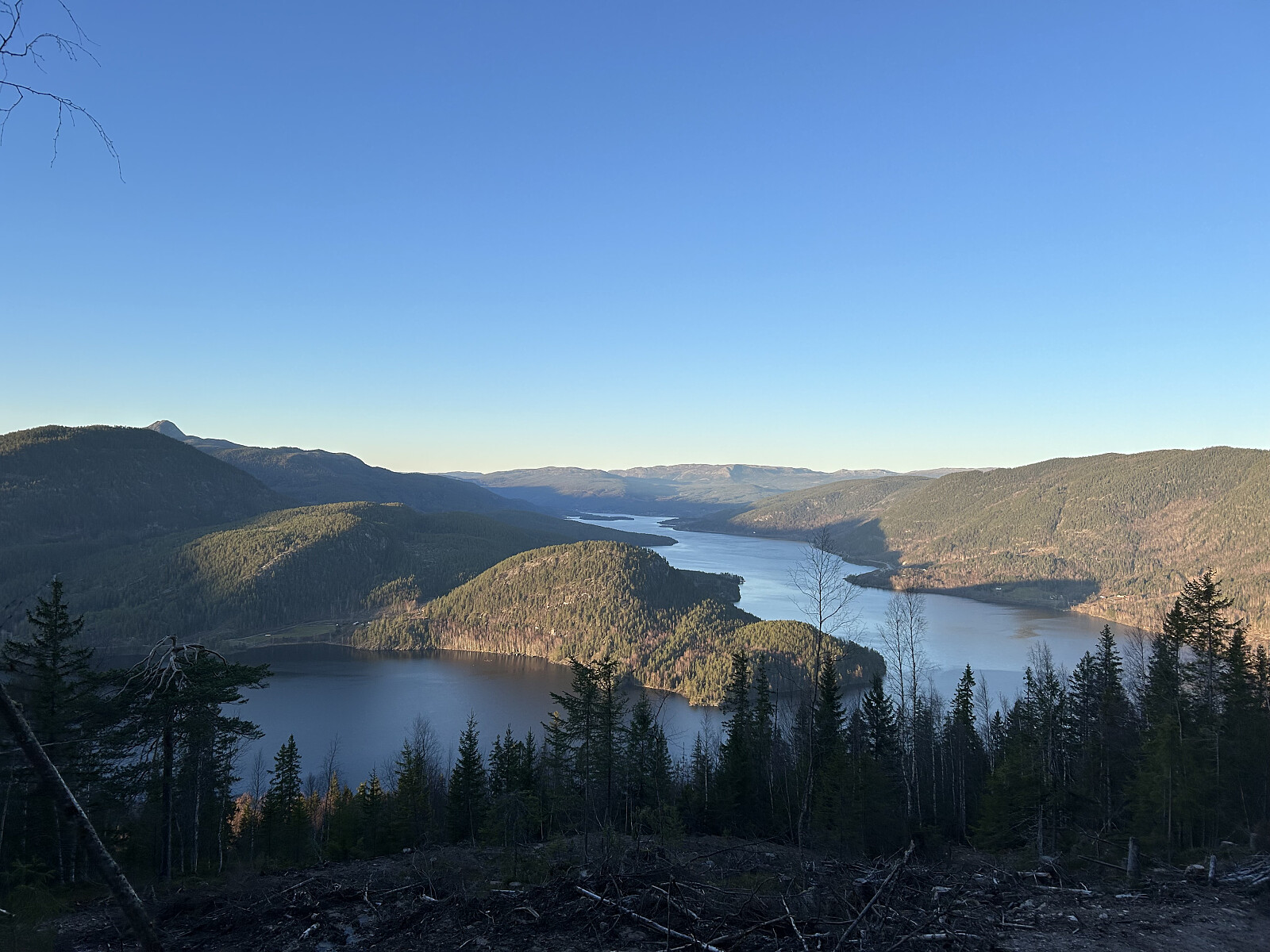
 Turen startet i mørket, planen var å se soloppgangen og gjøre 2 topper ila dagen.
Ikke akkurat det beste utsikt fra den toppen, men ble soloppgang uansett :)
Alltid magisk med soloppgang hver eneste gang.
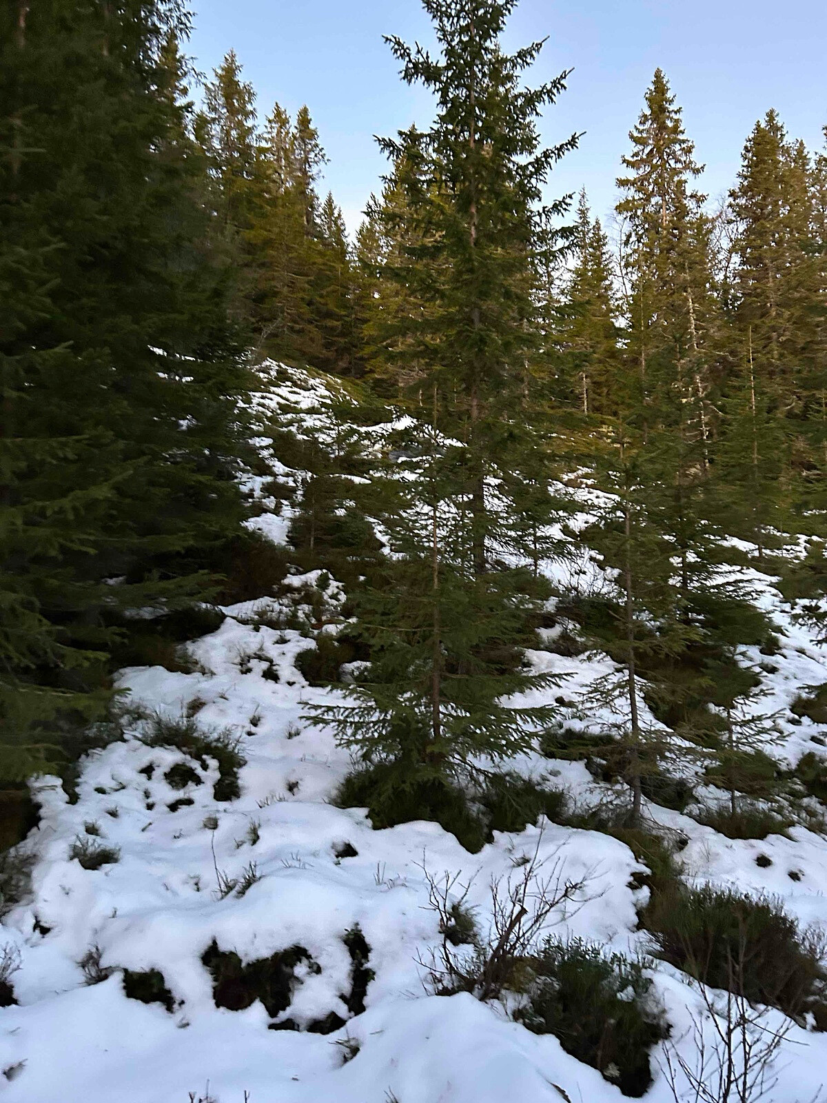
Mye rot rundt skogen og ikke noe spesielt synlig rute, ellers ok.
Turen startet i mørket, planen var å se soloppgangen og gjøre 2 topper ila dagen.
Ikke akkurat det beste utsikt fra den toppen, men ble soloppgang uansett :)
Alltid magisk med soloppgang hver eneste gang.
Mye rot rundt skogen og ikke noe spesielt synlig rute, ellers ok.
LA/BU-105 Åslandåsen 679 moh
- Datum:
- 16.11.2025
- Tourcharakter:
- Expedition
- Entfernung:
- 1,7km
 Etter fredagens krevende topper og en god dag med restitusjon lørdag, var det på tide med en ny fjelltur.
Bestemt meg for å bestige Åslandåsen utenfor Kongsberg.
Dagen var strålende, solfylt og med plussgrader. Vi er virkelig heldige her nede, spesielt når folk i Trøndelag og Troms sliter med dårlig vær.
Jeg kjørte hele veien opp til parkeringsplassen ved Pukkverksløkka, hvor bompenger fortsatt koster 50 kroner, betalt kontant i en tradisjonell bomstasjon – en sjeldenhet i Norge i dag.
Fra Pukkverksløkka er det ca. 1,5 km på en buktende traktor- og grusvei. Jeg tok med terrengsykkelen til Sandbekksetra. Derfra er det omtrent 1,5 km gjennom en delvis vakker, gammel skog.
Ingen sti var merket, så dette er neppe en populær topp som mange besøker. Ifølge min radioapp har det vært >>>
Etter fredagens krevende topper og en god dag med restitusjon lørdag, var det på tide med en ny fjelltur.
Bestemt meg for å bestige Åslandåsen utenfor Kongsberg.
Dagen var strålende, solfylt og med plussgrader. Vi er virkelig heldige her nede, spesielt når folk i Trøndelag og Troms sliter med dårlig vær.
Jeg kjørte hele veien opp til parkeringsplassen ved Pukkverksløkka, hvor bompenger fortsatt koster 50 kroner, betalt kontant i en tradisjonell bomstasjon – en sjeldenhet i Norge i dag.
Fra Pukkverksløkka er det ca. 1,5 km på en buktende traktor- og grusvei. Jeg tok med terrengsykkelen til Sandbekksetra. Derfra er det omtrent 1,5 km gjennom en delvis vakker, gammel skog.
Ingen sti var merket, så dette er neppe en populær topp som mange besøker. Ifølge min radioapp har det vært >>>
LA/BU-099 Vesle Blodfjell 747 moh
- Datum:
- 14.11.2025
- Tourcharakter:
- Expedition
- Entfernung:
- 3,0km
 Ryggoperasjonen post trening #2
Dette var den andre toppen for dagen, og jeg burde kanskje ha vært fornøyd med den første, «Flæa syd 684 moh», som jeg hadde besteget tidligere. :)
Etter flere måneder med fjell tørke på grunn av en omfattende ryggskade og operasjon, var jeg endelig tilbake etter mange måneders trening. Planen for helgen var å teste kroppen.
Været var strålende, med temperaturer mellom -3 og -8 grader Celsius, så det var bare å kaste seg ut i fjellturen.
Siden jeg driver med min hobby som radioamatør og gjør SOTA-aktivering på fjell, var torsdagen dedikert til planlegging for å finne ut hvor jeg skulle dra.
Jeg klargjorde camper bilen med nødvendig proviant, tur klær, radio, batterier, antenner og annet utstyr, og kjørte fra Drammen tidlig på fredagen, før >>>
Ryggoperasjonen post trening #2
Dette var den andre toppen for dagen, og jeg burde kanskje ha vært fornøyd med den første, «Flæa syd 684 moh», som jeg hadde besteget tidligere. :)
Etter flere måneder med fjell tørke på grunn av en omfattende ryggskade og operasjon, var jeg endelig tilbake etter mange måneders trening. Planen for helgen var å teste kroppen.
Været var strålende, med temperaturer mellom -3 og -8 grader Celsius, så det var bare å kaste seg ut i fjellturen.
Siden jeg driver med min hobby som radioamatør og gjør SOTA-aktivering på fjell, var torsdagen dedikert til planlegging for å finne ut hvor jeg skulle dra.
Jeg klargjorde camper bilen med nødvendig proviant, tur klær, radio, batterier, antenner og annet utstyr, og kjørte fra Drammen tidlig på fredagen, før >>>
LA/BU-103 Flæa syd 684 moh
- Datum:
- 14.11.2025
- Tourcharakter:
- Expedition
- Entfernung:
- 3,9km
 Ryggoperasjonen post trening #1
Denne dagen viste seg å være en strålende fjelldag og et paradis for stive kropper!
Etter flere måneder med “fjelltørke” som følge av en omfattende ryggskade og operasjon, var jeg endelig tilbake etter mange måneders trening.
Planen for helgen var å teste hvordan kroppen min taklet belastningen.
Været var helt fantastisk, med temperaturer mellom -3 og -8 grader Celsius, så det var bare å kaste seg ut i fjellturen.
Siden jeg er radioamatør og aktiverer SOTA på fjell, dedikerte jeg torsdagen til planlegging for å finne ut hvor jeg skulle dra.
Jeg pakket campingbilen med nødvendig proviant, turklær, radio, batterier, antenner og annet utstyr, og kjørte fra Drammen tidlig på fredagen, før hyttefolket begynte å ankomme.
Jeg kjørte opp til bommen, >>>
Ryggoperasjonen post trening #1
Denne dagen viste seg å være en strålende fjelldag og et paradis for stive kropper!
Etter flere måneder med “fjelltørke” som følge av en omfattende ryggskade og operasjon, var jeg endelig tilbake etter mange måneders trening.
Planen for helgen var å teste hvordan kroppen min taklet belastningen.
Været var helt fantastisk, med temperaturer mellom -3 og -8 grader Celsius, så det var bare å kaste seg ut i fjellturen.
Siden jeg er radioamatør og aktiverer SOTA på fjell, dedikerte jeg torsdagen til planlegging for å finne ut hvor jeg skulle dra.
Jeg pakket campingbilen med nødvendig proviant, turklær, radio, batterier, antenner og annet utstyr, og kjørte fra Drammen tidlig på fredagen, før hyttefolket begynte å ankomme.
Jeg kjørte opp til bommen, >>>
LA/OL-046 Svarttjernshøgda 717 moh
- Datum:
- 10.11.2025
- Tourcharakter:
- Expedition
- Entfernung:
- 2,0km
 Ryggoperasjonen post trening �️♂️
LA/HM-087 Rafjellet 576 moh
- Datum:
- 26.09.2025
- Tourcharakter:
- Expedition
- Entfernung:
- 1,8km
 Fantastikk fint sted å være, behagelig rute og anbefales.
Distance: abt 3.6 km t/r
Start: Svarttjern p-plass (parking).
Summer: Bike / Walk -> Hike up to summit.
Winter: Skiis / Snowshoes -> Yes snowshoes and boots with crampons when is a lot of ice.
Tollroad/Bom: 40 kr i 2024/2025
Equipment: KX3 15w & 1/4~wave Vertical (APRS LA9PJA-7/LA9PJA-9)
Apps / Resources: SOTA Goat, SOTLAS, PeakBook, APRS.FI, QTHnow / POTA, POTA-MAP.fr, AllTrails
- - - -
Photos & Track: Courtesy of LA9PJA :)
Fantastikk fint sted å være, behagelig rute og anbefales.
Distance: abt 3.6 km t/r
Start: Svarttjern p-plass (parking).
Summer: Bike / Walk -> Hike up to summit.
Winter: Skiis / Snowshoes -> Yes snowshoes and boots with crampons when is a lot of ice.
Tollroad/Bom: 40 kr i 2024/2025
Equipment: KX3 15w & 1/4~wave Vertical (APRS LA9PJA-7/LA9PJA-9)
Apps / Resources: SOTA Goat, SOTLAS, PeakBook, APRS.FI, QTHnow / POTA, POTA-MAP.fr, AllTrails
- - - -
Photos & Track: Courtesy of LA9PJA :)
LA/HM-094 Engerfjellet 567moh
- Datum:
- 26.08.2025
- Tourcharakter:
- Expedition
- Entfernung:
- 1,6km
 Summer route, easy and nice view from the summit.
