Archiv - Nach Datum
Archiv - Nach Aktivität
-
Andere Tour (1)
- Kayaking (1)
-
Andere Wintertour (4)
- Schneeschuhtour (4)
-
Fahrradtour (137)
- Fahrradtour Straße (9)
- Fahrradtour gemischt (51)
-
Fußtour (740)
- Bergtour (363)
- Jogging (18)
- Spaziergang (89)
- Wanderung (270)
-
Skitour (4)
- Tourenskilauf (4)
Archiv - Nach Geografie
Peakbookfreunde


Gesammelte Listen
-
Bergen ≥ 50m pf. og ≥ 100 m.o.h.
(87/89)
 97%
97% -
Most dominating tops of the Bergen peninsula
(68/75)
90%
-
Utvalgte topper og turmål i Bergen
(316/350)
90%
-
Alle topper i Bergen
(357/398)
89%
-
Opptur Bergen
(100/113)
88%
-
De syv fjell rundt Bergen
(6/7)
85%
-
Sund ≥ 50m pf.
(14/18)
77%
-
Os ≥ 50m pf.
(25/34)
73%
-
Søyler (fastmerker) i Bergen
(68/100)
68%
-
Fjell ≥ 50m pf.
(21/32)
65%

Tysnessåta from Myrdal
- Datum:
- 11.04.2026
- Tourcharakter:
- Wanderung
- Tourlänge:
- 3:45h
- Entfernung:
- 6,9km
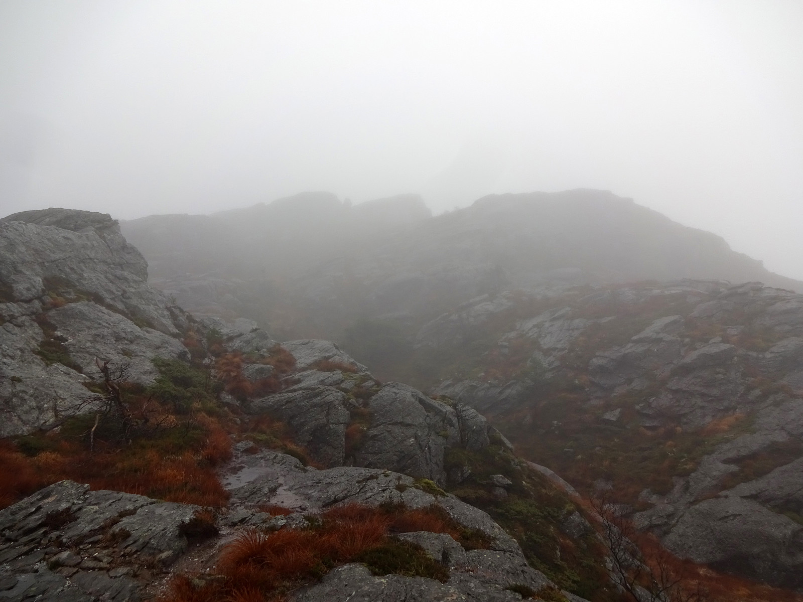
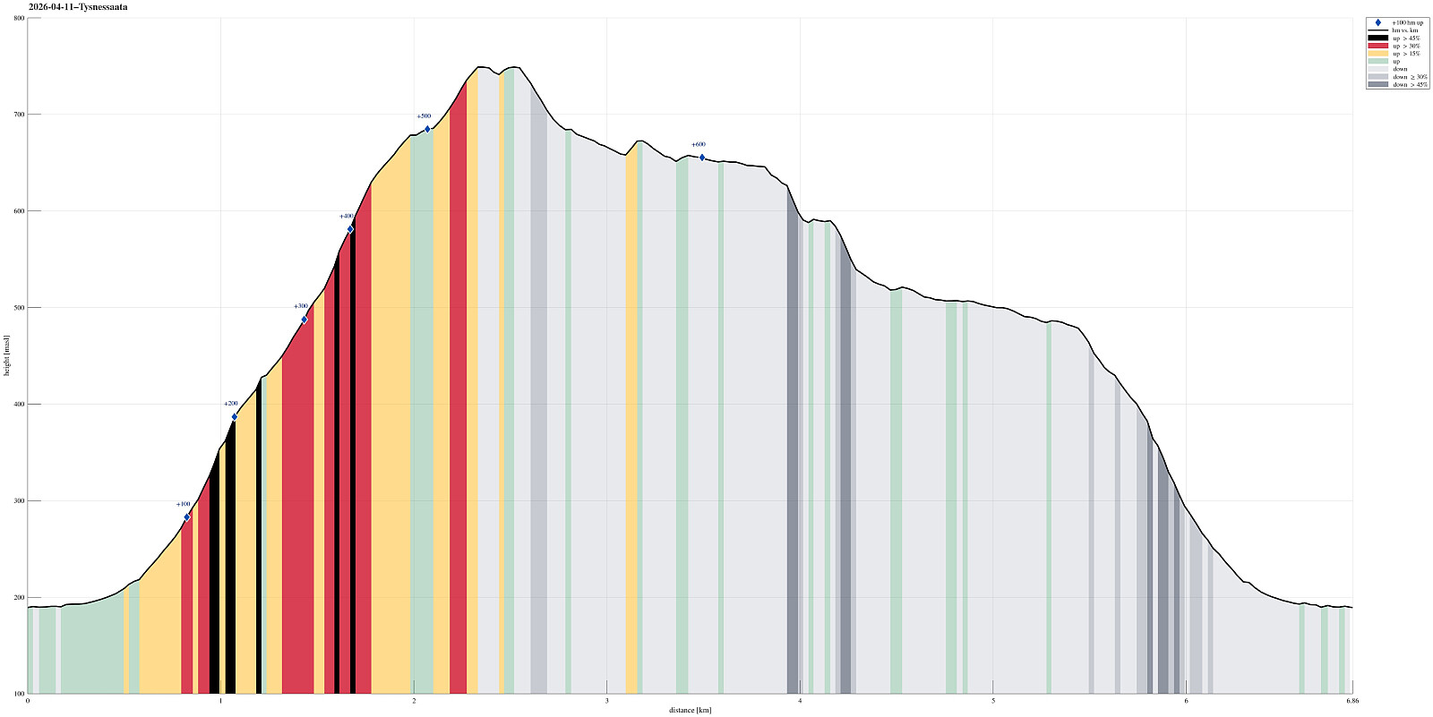 The idea was to make a nice hike on a nice day, which would (1) bring us up to enjoy some nice views and (2) avoid significant amounts of snow, if possible (well, well). We took the ferry from Halhjem to Våge and then drove around and up to Myrdal (already at about 195masl). After parking near Storåkerhølen, a bit north of Myrdal, we started our hike first on a tractor road across Myrdal, before getting into the real hike from the "second" parking place south of Myrdal. From there, one can now (since 2024) find a "Sherpasti" with numerous impressive rock steps that are laid down for large stretches of the ascent along Steinelva. This way, one can "simply" step up these stone steps and reach the heights of Tysnessåta quickly (one still needs to make about >>>
Melderskin from Grønestølen (via Store Laurdalen)
- Datum:
- 17.05.2025
- Tourcharakter:
- Wanderung
- Tourlänge:
- 12:00h
- Entfernung:
- 11,4km
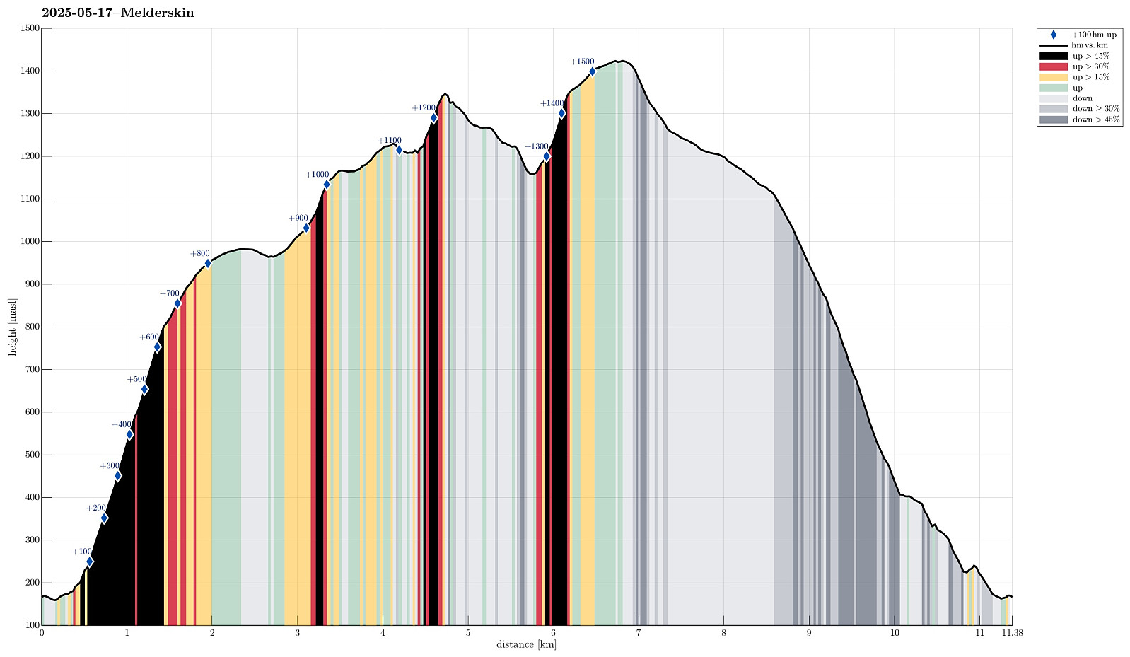 For quite a while we had talked about hiking Melderskin one day. Would we have guessed that our window of opportunity to do so would open up exactly on May 17? With an excellent weather forecast in our hands, we decided on rather short notice that we would leave Bergen after work on May 16, taking the fast ferry to Rosendal. We then stayed at Grønestølen over night -- what a nice place?! From there, we then started our hike to Melderskin in the morning of May 17. Our plan was (first) to try getting up to Store Laurdalen in the northwest of Laurdalselva (without a trail). We had studied the map in quite some detail to support our assessment that this should be possible (even though the terrain is certainly very steep there in places). From there, we had (first) in mind to continue the >>>
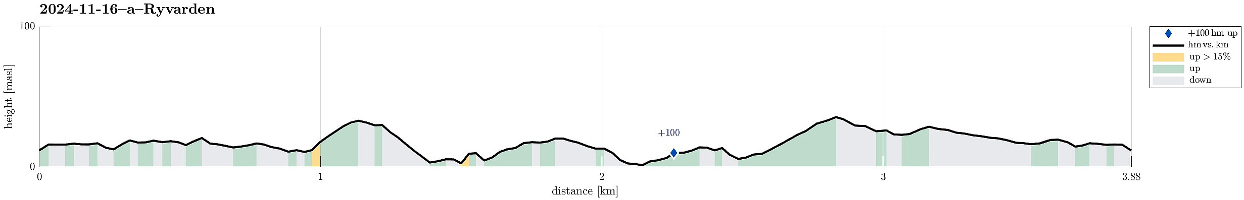
From Lyngholm to Ryvarden
- Datum:
- 16.11.2024
- Tourcharakter:
- Bergtour
- Tourlänge:
- 3:00h
- Entfernung:
- 6,7km
 We left one car at the parking lot for Ryvarden in Mølstrevåg, while driving with the other one to Lyngholm a bit further north. There, we found a place, where we could leave the car for 20 NOK. There, we started our hike, following the well-marked North Sea Trail (Nordsjøløypa). Right in the beginning, the weather was a bit rough (strong wind, a bit of rain) -- a bit later, though, it improved and approaching Landsåt, we even got to imagine the sun for some moments! :-) The rather wild weather, however, made walking this trail an interesting experience. Especially the hail showers, which hit us with quite some force due to the strong wind, made sure that we experienced a special kind of presence. :-) Even though the first roughly three kilometers not really are right at the sea, >>>
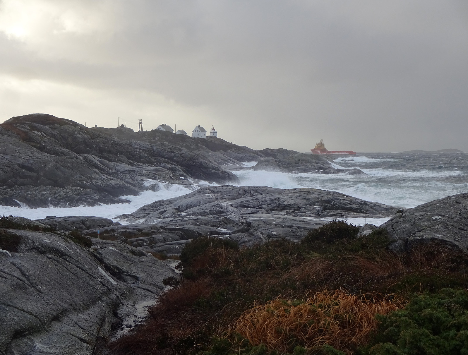
Morning round on Ryvardsneset
- Datum:
- 16.11.2024
- Tourcharakter:
- Bergtour
- Tourlänge:
- 1:30h
- Entfernung:
- 3,9km
 We were staying in one of Flokehyttene on Ryvardsneset and given the rather strong winds the circumstances for easily sleeping into the Saturday were not ideal anyway -- instead, it was much better to get out into the wind and make an attempt to use a rain-free period for a stroll around Ryvardsneset. First, we took the few steps out to the light house at Ryvarden. With all the rather strong winds, it was clearly an impressive experience (and walking down to Huldrahola was by no means a viable option). Next, we visited the commemoration monument for the Sleipner tragedy a bit north of Ryvarden in 1999. Even though breakfast was tempting a real lot, already, there still seemed to be a good opportunity for including a short trail along the southern coast of Ryvardsneset. This trail, when >>>
Valesåta, Trollevassnibba, Monsvarden, Målefjellet
- Datum:
- 15.11.2024
- Tourcharakter:
- Wanderung
- Tourlänge:
- 4:00h
- Entfernung:
- 8,9km
 We had left Bergen early on this Friday to still use some daylight time for a hike on Sveio. Right after using the under sea tunnel from Stord, we turned onto Tittelsnesvegen (in a way to head "back" north, but now above the tunnel). Near Valevåg Camping (on the left side of the street) we found a spot to park (on the right side of the street) and started our hike from there. We first continued along Tittelsnesvegen northwards, passing by Valevåg Camping on the left, until we came to the place, where Tittelsnesvegen forks off to the right. Following now this part of Tittelsnesvegen for about two thirds of a kilometer, we got to the trail head on the right of the road. From there, we used a well-marked trail relatively steeply upwards to get up to a ridge in the south of Valesåta. >>>
From Stovegolvet to Sagvåg on Stord
- Datum:
- 11.05.2024
- Tourcharakter:
- Wanderung
- Tourlänge:
- 5:00h
- Entfernung:
- 13,2km
 As part 2 of a two-days hike across Stord, we started from Stovegolvet, where we had stayed over night. We first descended (steeply) towards Tysevatnet, following a nice trail down from Stovegolvet. Instead of walking around Eldhushøgda, as prepared for by the trails, we crossed over this little hill, enjoying some nice views from above. Even though a bit steep on its southwestern side, descending back down to the trail was still no issue. We then followed the trail, which leads (also across the one or other dam) along Tysevatnet in its south, to get to the other side and, eventually, further southwards to Ravatnet, crossing over a little saddle in the west of Ramnaskolten. After walking between Ravasslia (in the northwest) and Ravatnet (in the southeast), we arrived at another small saddle >>>
From Vistvik to Stovegolvet on Stord
- Datum:
- 10.05.2024
- Tourcharakter:
- Wanderung
- Tourlänge:
- 7:00h
- Entfernung:
- 16,5km
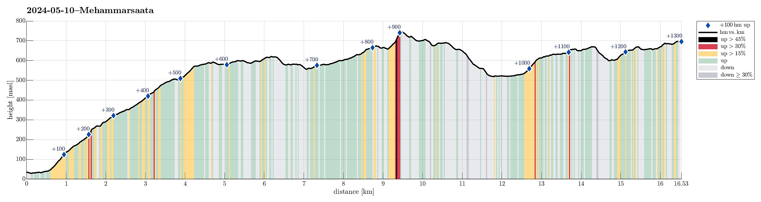 As part 1 of a two-days hike across Stord, we first took an early bus from Bergen southwards. The bus dropped us off near Vistvik (Vestvik?) quite a bit north on Stord. From Grønestølen, we then started our ascent into Hovlandsdalen, where Vistvikelva comes down. At almost 200 masl, we then followed a sign towards Tindane (turning left to get up the northern ridge of Tindane). We then followed the trail further up to Tindane (this trail is not used a lot, as it seems, but still easy to find -- at times, howover, the terrain is quite wet). Near Tindane, we then arrived at Tindaslottet (a small cabin, firmly protected by stones all-around). After a short break (it was not really warm enough for any longer break, and also we could not really enjoy a lot of great views due to low-hanging >>>
Hovlandsnuten and Etlådnefjellet
- Datum:
- 31.05.2020
- Tourcharakter:
- Wanderung
- Tourlänge:
- 5:15h
- Entfernung:
- 11,8km
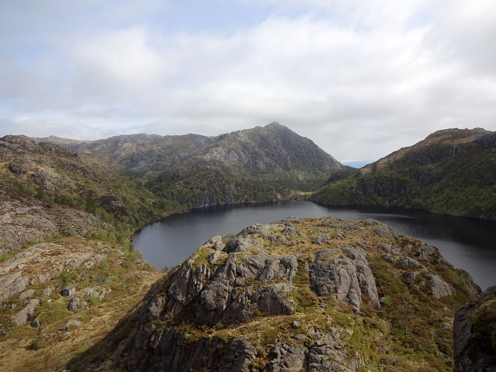
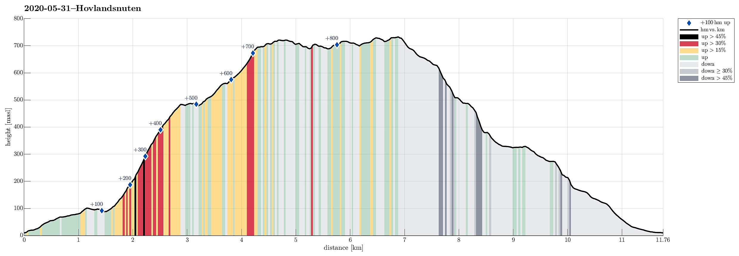 For years, we had talked about "one day" visiting Tysnes and doing some nice hike there. This weekend, with warm and sunny weather, seemed to be perfect to actually do it! :-) We drove from Bergen to Halhjem (southwest of Osøyro) and took the ferry to Vågen from there. Already this crossing of Bjørnafjorden was nice, with nice views towards south and east! Once on Tysnes, we drove first east (towards Lundegrend). There, we turned right (and south) and crossed over to the southeastern side of Tysnes (Hovland & Tveit). Our plan was to go a nice round over Hovlandsnuten, maybe the most spectacular mountain on Tysnes (not the hightest though). We parked near Tveitneset and started to hike along a forest road that extends southwards (parallel to the steep mountain side there, >>>
Malmangersnuten
- Datum:
- 15.05.2014
- Tourcharakter:
- Bergtour
- Tourlänge:
- 3:00h
- Entfernung:
- 7,4km
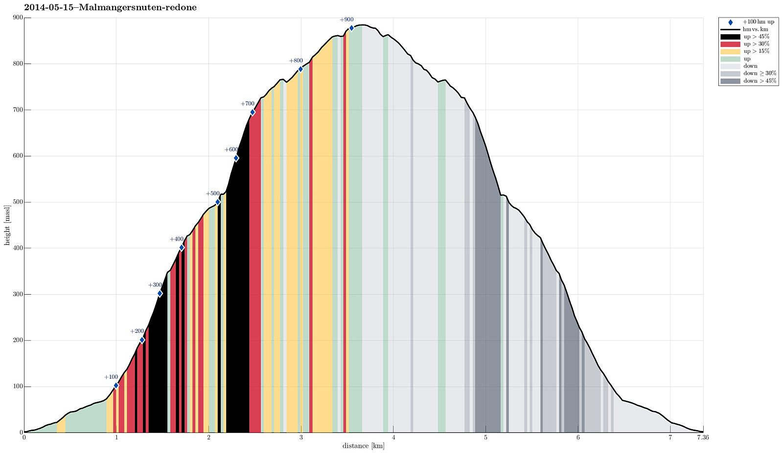 Good hike from Rosendal on a very wet day! :-)
Web page WestCoastPeaks.com provides useful information about Malmangersnuten
and also Petter Bjørstad has a useful page about Malmangersnuten .
Good hike from Rosendal on a very wet day! :-)
Web page WestCoastPeaks.com provides useful information about Malmangersnuten
and also Petter Bjørstad has a useful page about Malmangersnuten .
Siggjo
- Datum:
- 20.05.2013
- Tourcharakter:
- Bergtour
- Tourlänge:
- 2:00h
- Entfernung:
- 5,1km
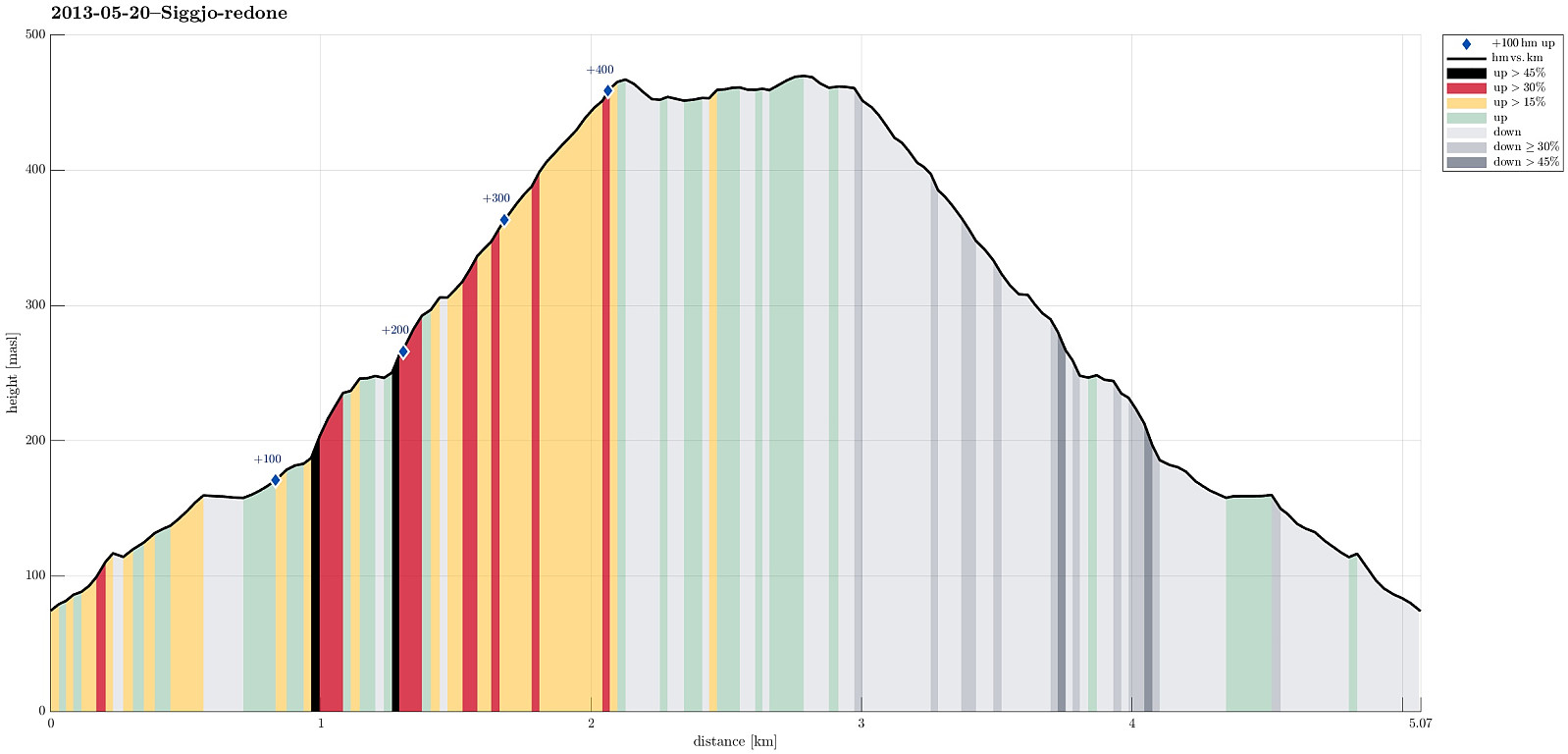 Very nice morning hike (from Idlestigen up Siggjo and down again) -- really a nice mountain (standing quite alone and prominent)!
