Archiv - Nach Datum
Archiv - Nach Aktivität
-
Andere Tour (1)
- Kayaking (1)
-
Andere Wintertour (4)
- Schneeschuhtour (4)
-
Fahrradtour (123)
- Fahrradtour Straße (5)
- Fahrradtour gemischt (41)
-
Fußtour (736)
- Bergtour (363)
- Jogging (18)
- Spaziergang (88)
- Wanderung (267)
-
Skitour (4)
- Tourenskilauf (4)
Archiv - Nach Geografie
Peakbookfreunde


Gesammelte Listen
-
Bergen ≥ 50m pf. og ≥ 100 m.o.h.
(87/89)
 97%
97% -
Most dominating tops of the Bergen peninsula
(68/75)
90%
-
Utvalgte topper og turmål i Bergen
(313/347)
90%
-
Alle topper i Bergen
(356/398)
89%
-
Opptur Bergen
(100/113)
88%
-
De syv fjell rundt Bergen
(6/7)
85%
-
Sund ≥ 50m pf.
(14/18)
77%
-
Os ≥ 50m pf.
(25/34)
73%
-
Søyler (fastmerker) i Bergen
(68/100)
68%
-
Fjell ≥ 50m pf.
(21/32)
65%

Fedje
- Datum:
- 12.07.2014
- Tourcharakter:
- Wanderung
- Tourlänge:
- 4:00h
- Entfernung:
- 12,7km
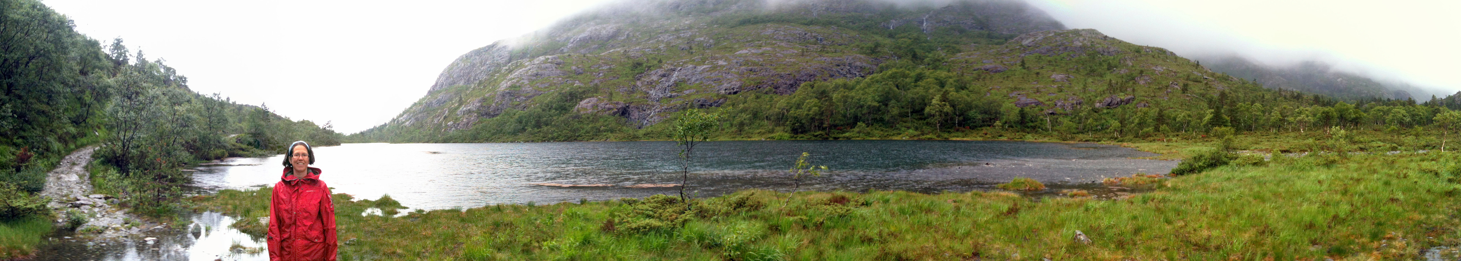
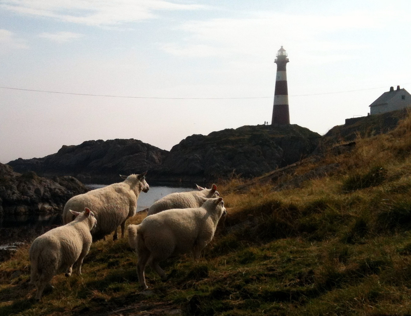 Nice summer hike around Fedje. The historic site (in the northwest of Fedje) is also quite interesting -- telling from hard times, not too long ago...
Selected photos are available as Google photo album .
Nice summer hike around Fedje. The historic site (in the northwest of Fedje) is also quite interesting -- telling from hard times, not too long ago...
Selected photos are available as Google photo album .
Skogsøytua
- Datum:
- 21.06.2014
- Tourcharakter:
- Wanderung
- Tourlänge:
- 2:00h
- Entfernung:
- 4,8km
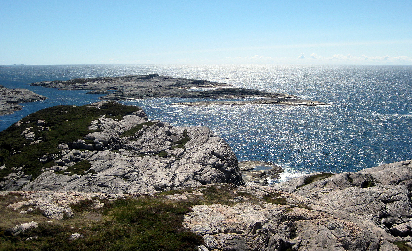 Again and again a nice little hike to the outermost rocks of Øygarden!
Bildøybakken
- Datum:
- 18.04.2014
- Tourcharakter:
- Wanderung
- Tourlänge:
- 3:00h
- Entfernung:
- 7,6km
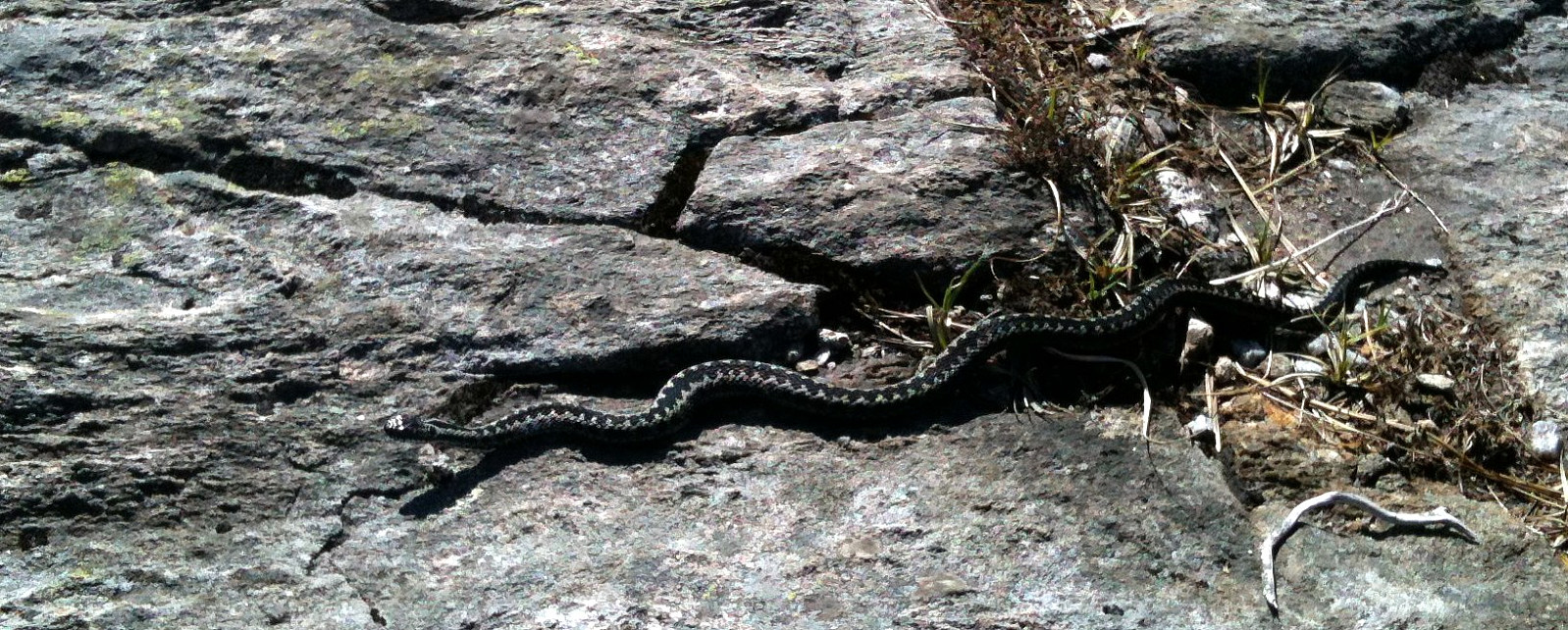 Nice and easy tour -- not much up, actually, but great views over the North Sea! One could also connect further to Pyttane and/or Liatårnet -- really a great hiking area! Note that parts of this tour (between km 3.6 and km 4.5) were without path, while still easy to go.
Web page WestCoastPeaks.com provides useful information about Liatårnet
and also Petter Bjørstad has a useful page about Liatårnet .
Nice and easy tour -- not much up, actually, but great views over the North Sea! One could also connect further to Pyttane and/or Liatårnet -- really a great hiking area! Note that parts of this tour (between km 3.6 and km 4.5) were without path, while still easy to go.
Web page WestCoastPeaks.com provides useful information about Liatårnet
and also Petter Bjørstad has a useful page about Liatårnet .
Ruine Falkenstein
- Datum:
- 26.12.2013
- Tourcharakter:
- Wanderung
- Tourlänge:
- 2:30h
- Entfernung:
- 6,2km
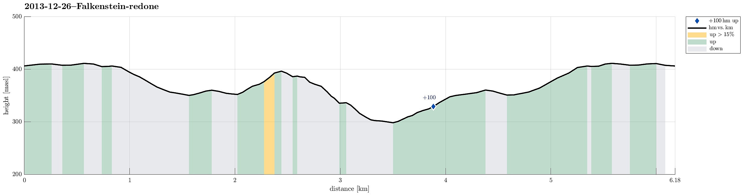 Falkenstein, and the old ruin high above it, is definitely worth a visit!
Brekkedalen
- Datum:
- 19.07.2013
- Tourcharakter:
- Wanderung
 Training walk (after my knee operation) up and down Brekkedalen (turning around at Stora Brekkevatnet) -- not really a hillwalk, this hike, but good for a first training (Brekkedalen is really a nice place to visit, so or so)!
Kanadaskogen Walk
- Datum:
- 08.01.2012
- Tourcharakter:
- Wanderung
- Tourlänge:
- 1:30h
- Entfernung:
- 5,9km
 Nice walk in Kanadaskogen! :-)
Tour around Tennebekktjørna
- Datum:
- 17.04.2010
- Tourcharakter:
- Wanderung
- Tourlänge:
- 0:45h
- Entfernung:
- 4,0km
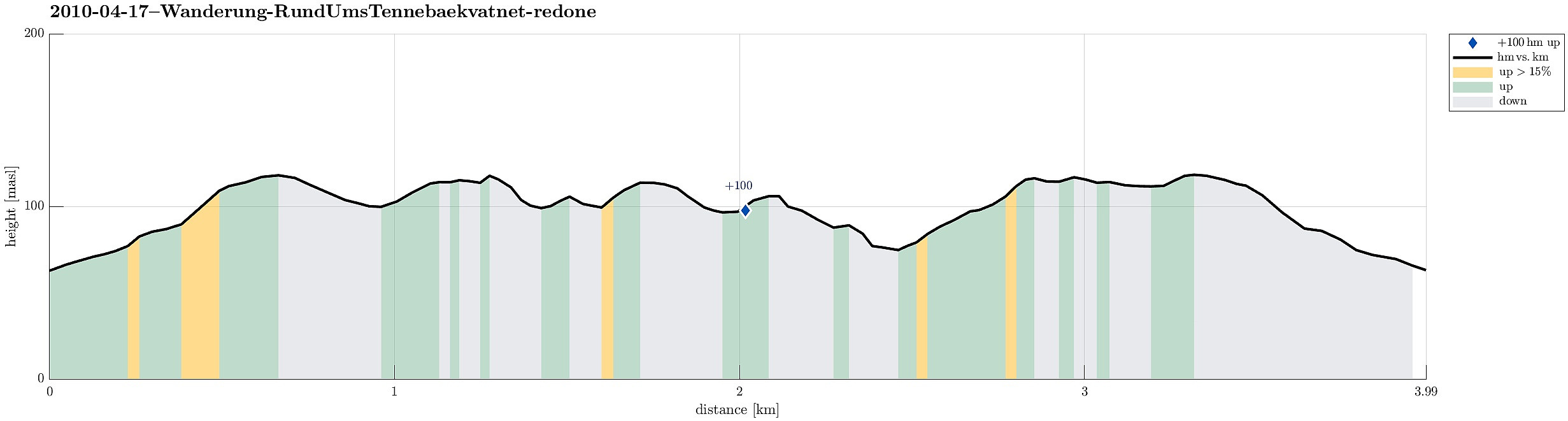 One (short) round around Tennebekktjørna.

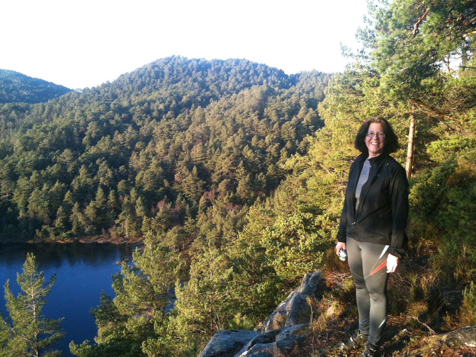
Hike around Dyrdalsvatnet
- Datum:
- 11.08.2007
- Tourcharakter:
- Wanderung
- Tourlänge:
- 2:00h
- Entfernung:
- 4,6km
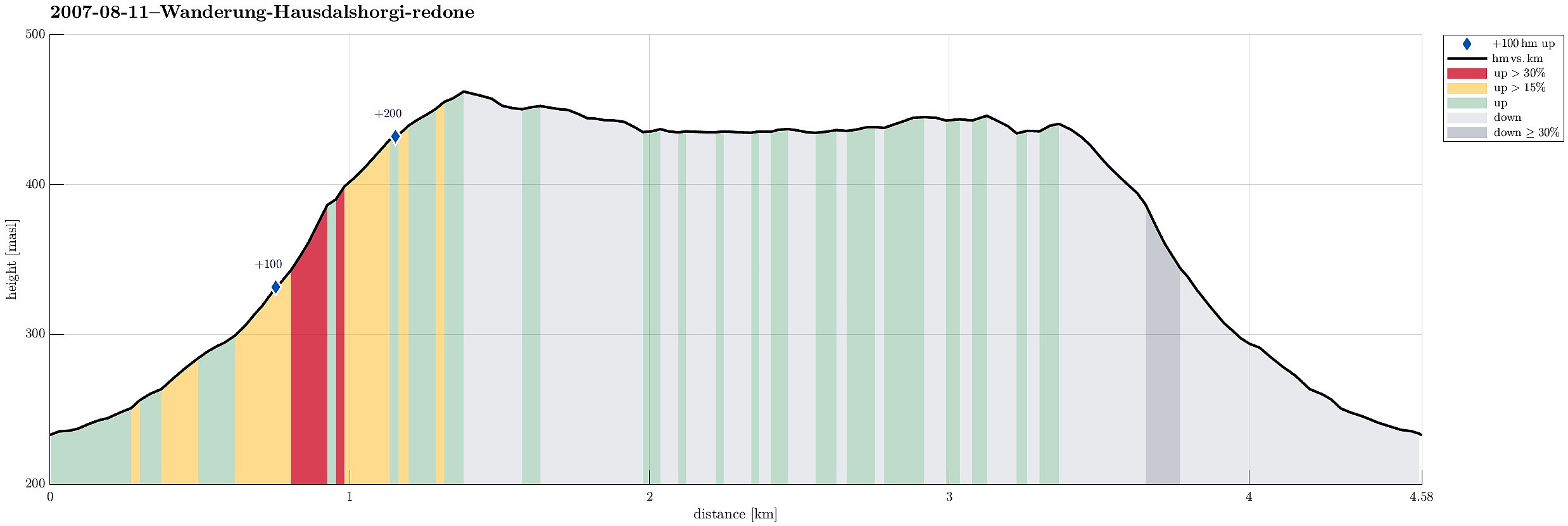 Very nice hike around Dyrdalsvatnet! :-)
Hike into Fyllingsdalen
- Datum:
- 24.06.2007
- Tourcharakter:
- Wanderung
- Tourlänge:
- 2:00h
- Entfernung:
- 6,1km
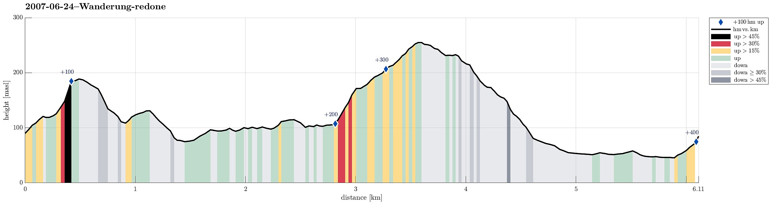 Hike into Fyllingsdalen.
