Archiv - Nach Datum
Archiv - Nach Aktivität
-
Andere Tour (1)
- Kayaking (1)
-
Andere Wintertour (4)
- Schneeschuhtour (4)
-
Fahrradtour (120)
- Fahrradtour Straße (5)
- Fahrradtour gemischt (38)
-
Fußtour (732)
- Bergtour (362)
- Jogging (18)
- Spaziergang (88)
- Wanderung (264)
-
Skitour (4)
- Tourenskilauf (4)
Archiv - Nach Geografie
Peakbookfreunde
Around Gåssandvatnet
- Datum:
- 28.12.2016
- Tourcharakter:
- Wanderung
- Tourlänge:
- 3:00h
- Entfernung:
- 10,1km
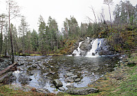 After first visiting a shop in Søfteland (along E39 from Bergen to Os), we wanted to make a hike around Gåssandvatnet. We parked our car right next to the Søfteland school and started to walk from there. First, we followed a little path, which leads southwards (parallel to E39, but not right at it, fortunately).
Our plan was to cross Storestraumen across a little bridge, which we had seen before on the map. Once we got there, however, we met an unexpected challenge: The bridge belongs to the private place on the other side of Storestraumen and it is locked with a door that is also secured by an alarm. Since we were motivated to not give up at once, we organized the telephone number of the owner of the bridge from a friendly neighbor and then called. Luckily we were then enabled to cross >>>
Evening hike on Algrøyna
- Datum:
- 23.06.2016
- Tourcharakter:
- Wanderung
- Tourlänge:
- 3:00h
- Entfernung:
- 5,6km
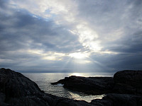 We drove to Algrøyna (out on Sotra) and parked along Vestavegen. From there, we walked a little along the small roads, following Kongvikvegen---basically straight to the west. Near Kongvikvegen 51 (on the left side of the road), we descended towards a path that leads around this building and then southwards towards Kungvika. There, we crossed over to the south of Kungvika, in order to walk out towards Barmaneset. Following the path, we quickly reached the western end of this peninsula, called Langtrotten. There, we had a nice break, before returning. On the way back, we chose a different path, walking along Storavatnet (in the north of it). Walking this way, one ends up in a narrow valley that connects to Storvegen. From there, it's just a few steps back to Vestavegen.
Selected photos >>>
Golta
- Datum:
- 03.01.2016
- Tourcharakter:
- Wanderung
- Tourlänge:
- 2:30h
- Entfernung:
- 4,1km
 We drove to Sotra and then southwards into the direction Klokkarvik. At Eide, we turned right, into the direction of Glesvær. Relatively near to Glesvær, we turned right, again---this time into the direction of Golta. We drove over the bridge to Golta and parked the car along the road, a short bit before reaching Nedre/Øvre Golta. We weren't 100% sure were "the path to Sandvika" would leave the road and searched for a short while, before we decided to follow something that looked in the beginning like a track (maybe sheep!). We passed through a couple of trees, before finding a suitable spot to cross a simple fence. We then followed a "height ridge" towards northwest, right next to a significant depression, called Trolldalen. Halfway out, we came to another fence---this >>>
Storhovden in Kanadaskogen
- Datum:
- 12.12.2015
- Tourcharakter:
- Wanderung
- Tourlänge:
- 1:30h
- Entfernung:
- 7,1km
 We started from Varden, entering Kanadaskogen near Hesjaholten. From there, we mostly followed small paths---if paths at all---approaching and ascending to Storhovden. Back, we first descended a little wilder from Storhovden than what would have been necessary---not recommended, actually. We then connected back to Syningen and from there we reached Stora Krokatjørna on a nice path. From there, we connected back to Hesjaholten, passing by Litla Krokatjørna, also.
Selected photos are available as Google+ photo album .
Barmaneset on Algrøyna
- Datum:
- 14.08.2015
- Tourcharakter:
- Wanderung
- Tourlänge:
- 2:30h
- Entfernung:
- 7,0km
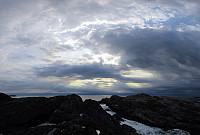 We parked on Nordre Øyavegen, right before getting close to the few houses on northern Algrøyna. From there, we first followed the road further (and down and upwards, again), before continuing on Kongvikvegen (to the west). After maybe 200m, a barn is on the left side with some signs that hiking tracks are leaving the road from there (down between the road and the barn through a narrow passage). Once this entry point is found, the rest of the tour is quite straight forward (or more in a round, actually). We walked out Barmaneset to the west, approaching Rognkallen and Langtrotten at the end of this peninsula (and Kungvika on our right). Once we came close to Krabbakeila, right between Rognkallen and Langtrotten, where the ocean waters get wild, even on a very calm day, we first approached >>>
Grindaflethytta
- Datum:
- 23.07.2014
- Tourcharakter:
- Wanderung
- Tourlänge:
- 15:00h
- Entfernung:
- 43,7km
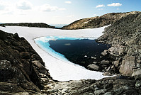 Two days tour from Ljosanbotn (arrival with the train from Bergen) -- first day to Grindflethytta (via a really well marked trail, including three summer bridges); then, next day, first along the marked trail towards Fyre (up to the pass near Stangahøgdi, where the trail starts to descend into Øvsthusdalen), before then following the ridge up to Kaldanuten (no trail along this part) and then down (via Bjørndalsvatnet) into Bjørndalen and out to Brandset. An intense hike, alltogether: about 42km and about 15h out in the beautiful nature.
Selected photos are available as Google photo album .
Hillefjellet
- Datum:
- 13.07.2014
- Tourcharakter:
- Wanderung
- Tourlänge:
- 4:00h
- Entfernung:
- 10,1km
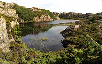 Someone (Leif Algerøy?) has put really a lot of effort into preparing nice hiking choices on Algrøyna -- wow! :-) The tour to Sandeie is really worth the lengthy approach (driving to Algrøyna)!
Selected photos are available as Google photo album .
Fedje
- Datum:
- 12.07.2014
- Tourcharakter:
- Wanderung
- Tourlänge:
- 4:00h
- Entfernung:
- 12,7km
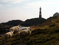 Nice summer hike around Fedje. The historic site (in the northwest of Fedje) is also quite interesting -- telling from hard times, not too long ago...
Selected photos are available as Google photo album .
Skogsøytua
- Datum:
- 21.06.2014
- Tourcharakter:
- Wanderung
- Tourlänge:
- 2:00h
- Entfernung:
- 4,8km
 Again and again a nice little hike to the outermost rocks of Øygarden!
Bildøybakken
- Datum:
- 18.04.2014
- Tourcharakter:
- Wanderung
- Tourlänge:
- 3:00h
- Entfernung:
- 7,6km
 Nice and easy tour -- not much up, actually, but great views over the North Sea! One could also connect further to Pyttane and/or Liatårnet -- really a great hiking area! Note that parts of this tour (between km 3.6 and km 4.5) were without path, while still easy to go.
Web page WestCoastPeaks.com provides useful information about Liatårnet
and also Petter Bjørstad has a useful page about Liatårnet .


