Archiv - Nach Datum
Archiv - Nach Aktivität
-
Andere Tour (1)
- Kayaking (1)
-
Andere Wintertour (4)
- Schneeschuhtour (4)
-
Fahrradtour (137)
- Fahrradtour Straße (9)
- Fahrradtour gemischt (51)
-
Fußtour (740)
- Bergtour (363)
- Jogging (18)
- Spaziergang (89)
- Wanderung (270)
-
Skitour (4)
- Tourenskilauf (4)
Archiv - Nach Geografie
Peakbookfreunde


Gesammelte Listen
-
Bergen ≥ 50m pf. og ≥ 100 m.o.h.
(87/89)
 97%
97% -
Most dominating tops of the Bergen peninsula
(68/75)
90%
-
Utvalgte topper og turmål i Bergen
(316/350)
90%
-
Alle topper i Bergen
(357/398)
89%
-
Opptur Bergen
(100/113)
88%
-
De syv fjell rundt Bergen
(6/7)
85%
-
Sund ≥ 50m pf.
(14/18)
77%
-
Os ≥ 50m pf.
(25/34)
73%
-
Søyler (fastmerker) i Bergen
(68/100)
68%
-
Fjell ≥ 50m pf.
(21/32)
65%

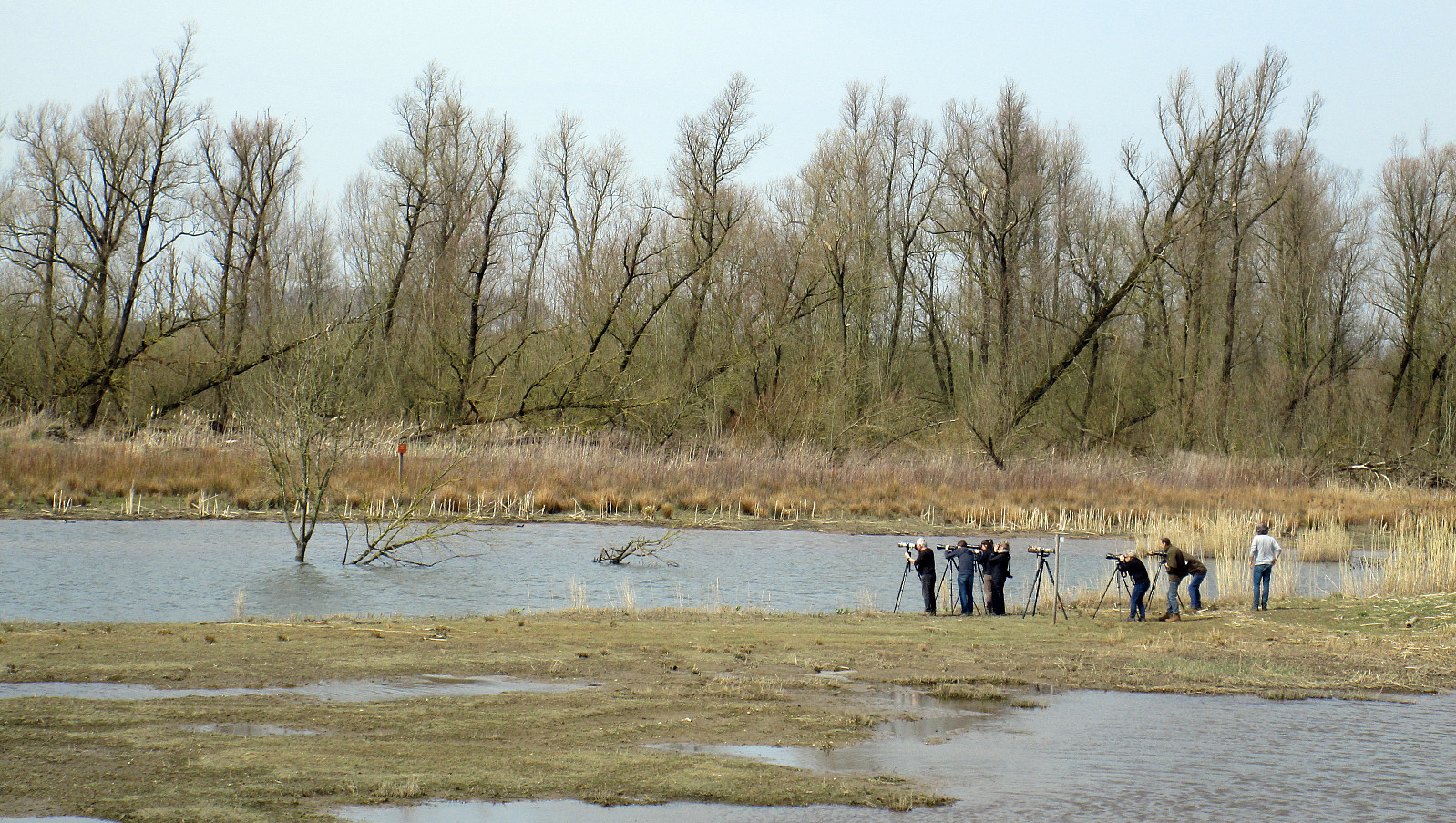
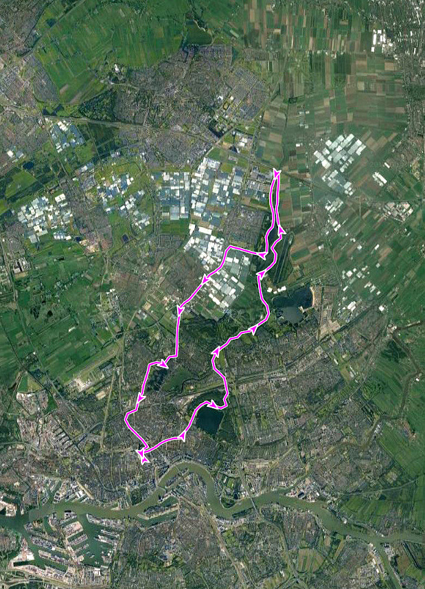
Cycle round from Rotterdam, including park Bergse Bos
- Datum:
- 14.04.2018
- Tourcharakter:
- Fahrradtour
- Tourlänge:
- 2:00h
- Entfernung:
- 29,1km
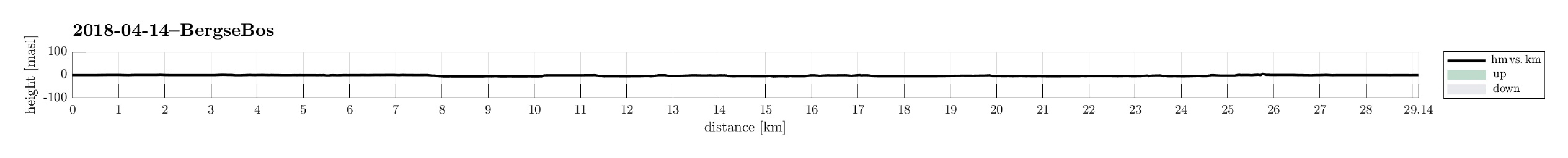 We started to cycle from the Cool district in Rotterdam, heading for the nice biking paths along the Rotte river (i.e., towards the northeast). After passing by the lake Bergse Voorplas and Prinsenmolen, we continued on the northwestern side of river Rotte (in northeastern direction) in order to get to the park Bergse Bos. Cycling through the park, we got to know it a little. We then continued to Bergschenhoek first (in northern direction), before crossing over (then in northwestern direction) to Berkel en Rodenrijs. Crossing through the settlement, we met the train line at station Berkel-Westpolder. From there, we turned back, i.e., continued in southern direction, towards Rotterdam. Close to the airport of Rotterdam, however, we included a small detour across the fields north of the >>>
Cycling to, in, and from De Biesbosch
- Datum:
- 07.04.2018
- Tourcharakter:
- Fahrradtour
- Tourlänge:
- 4:00h
- Entfernung:
- 45,0km
 After taking the river boat (Waterbus) from Rotterdam to Dordrecht, we cycled (more or less) directly to Kop van Het Land, where we (after a short break) took the ferry over the river Nieuwe Merwede to the national park Biesbosch (the Brabant part of it). Once on the other side, we first took a turn to the left (north) in order to do a clockwise entry arch into the heart of the national park. Our plan was then to cycle longer through the national park and then take another ferry (over the river Amer) to Lage Zwaluwe. When arriving at the very southwestern end of the national park, however, we had to learn that the ferry was not yet put in service for this summer and we had to change our plans. We thus cycled back along the river Nieuwe Merwede and took the ferry to Kop van Het Land, from >>>
From Rotterdam to Kinderdijk, and back
- Datum:
- 06.04.2018
- Tourcharakter:
- Fahrradtour
- Tourlänge:
- 3:00h
- Entfernung:
- 41,8km
 We took the bikes from Rotterdam downtown and headed first east, then southeast, to get to Kinderdijk, a cultural heritage site (with quite a few traditional windmills). To get back, we changed to the other side of the Noord (and with that to the southern side of the Nieuwe Maas), where we then headed back to Rotterdam. All in all, a very enjoyable bike trip!
Selected photos are available as Google photo album .
See also the related FB-page Hiking around Bergen, Norway .
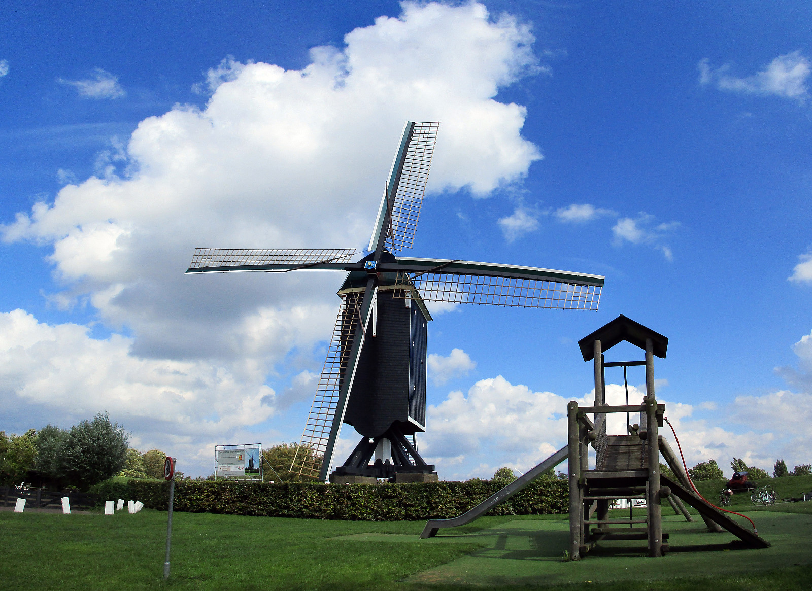
The World Heritage Site Kinderdijk has, of course, it's own home page .
We took the bikes from Rotterdam downtown and headed first east, then southeast, to get to Kinderdijk, a cultural heritage site (with quite a few traditional windmills). To get back, we changed to the other side of the Noord (and with that to the southern side of the Nieuwe Maas), where we then headed back to Rotterdam. All in all, a very enjoyable bike trip!
Selected photos are available as Google photo album .
See also the related FB-page Hiking around Bergen, Norway .
The World Heritage Site Kinderdijk has, of course, it's own home page .
Exploring the dunes north of Den Haag
- Datum:
- 01.04.2018
- Tourcharakter:
- Fahrradtour
- Tourlänge:
- 4:00h
- Entfernung:
- 38,5km
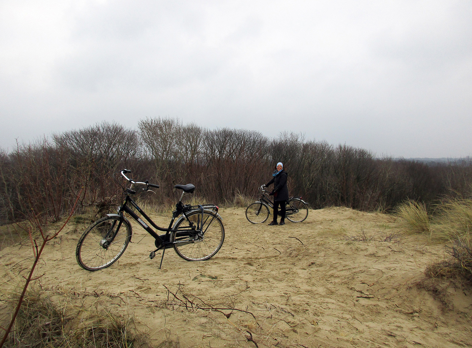 We rented bikes from the train station Den Haag HS and biked first through the nice park Haagsche Bosch. We then cycled around the large park of Clingendael, before we entered the dunes in the north of Den Haad near the International Courthouse. We then enjoyed biking northwards (and "around"), getting to the very nice museum Voorlinden. After visiting the museum, we decided to have more of the dunes, before returning our bikes and taking the train home. Really a nice day!
Selected photos are available as Google photo album .
See also the related FB-page Hiking around Bergen, Norway .
Museum Voorlinden has, of course, it's own home page .
We rented bikes from the train station Den Haag HS and biked first through the nice park Haagsche Bosch. We then cycled around the large park of Clingendael, before we entered the dunes in the north of Den Haad near the International Courthouse. We then enjoyed biking northwards (and "around"), getting to the very nice museum Voorlinden. After visiting the museum, we decided to have more of the dunes, before returning our bikes and taking the train home. Really a nice day!
Selected photos are available as Google photo album .
See also the related FB-page Hiking around Bergen, Norway .
Museum Voorlinden has, of course, it's own home page .
Middendelfland
- Datum:
- 12.02.2018
- Tourcharakter:
- Fahrradtour Straße
- Tourlänge:
- 4:00h
- Entfernung:
- 43,4km
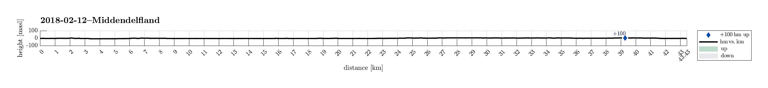 We started from nearby the main train station in Rotterdam, where we rented a bike. We then headed into northwestern direction in order to get outside of the city. We passed by Vroesenpark and continued further towards the airport of Rotterdam. We crossed through the Park de Buitenplaats and passed by the airport on its southwestern side. Once we arrived at Doenkade, we used the bridge to get over both the highway A13 and the canal Delftsche Schie. On the other (western) side, we got down from the bridge, then following the canal Delftsche Schie northwards in its western side. Near Kandelaar we turned towards the west, heading into Middendelfland. We then surrounded the more urban area in its north, following some very nice little roads through a nice rural area. Shortly, after crossing >>>
Kinderdijk
- Datum:
- 23.09.2017
- Tourcharakter:
- Fahrradtour
- Tourlänge:
- 3:00h
- Entfernung:
- 35,8km
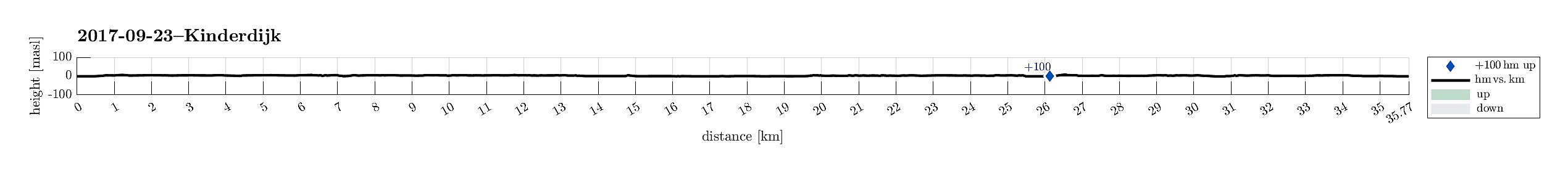 We started from the center of Rotterdam and cycled first into southeastern direction, crossing the new Maas via Erasmusbrug. We then passed by the stadion of Feyenoord, continuing into southeastern direction, in the south of the new Maas. East of the stadion, we turned into eastern direction. After having come to the eastern side of the highway A16, we got onto the dam in the south of the Maas and followed it until the point, where the three rivers Lek, Noord, and Nieuwe Maas come together. There, we took a little ferry to get over to Kinderdijk on the southern side of the Lek. We then explored the cultural heritage site Kinderdijk with its historic wind mills, before we got back to the river, crossing over it with the car ferry to the north. Once there, we basically cycled back into >>>
Rotterdam-exploration 08: To Brielle and back
- Datum:
- 10.09.2017
- Tourcharakter:
- Fahrradtour
- Tourlänge:
- 5:00h
- Entfernung:
- 69,8km
 We started from the center of Rotterdam and cycled first northwards, into the direction of the airport of Rotterdam. Near the airport we turned left, then mostly in western direction, and soon reached the Old Overschie at the knee of the Delftsche Schie. We then crossed over to another city part, Kethel en Spaland. Crossing the highway A4, next, we came through city part Holy, continuing further to the large recreation area Broekpolder. Circling this area in its east and south, we ended up on Broekpolderweg, cycling parallel to highway A20 into western direction and towards Maassluis. In Maassluis, we found our way southwards to Deltaweg from where a ferry took us over the Maas to the southern side. There, we crossed Rozenburg to get onto large bridges, which led us over Calandkanaal, >>>
Rotterdam-exploration 07: Via Kralingse Plas to Rottemeren
- Datum:
- 03.09.2017
- Tourcharakter:
- Fahrradtour
- Tourlänge:
- 3:00h
- Entfernung:
- 37,2km
 We started from the center of Rotterdam, cycling eastwards to get to Kralingse Plas, i.e., a really nice recreational area quite near to the city center. From its northeastern "corner", we then continued northwards in order to connect to the Rotte and the nice dams alongside it. Once there, we cycled along the Rotte in northwards direction and arrived at Rottemeren (on its eastern side) soon. We cycled all the way northwards to the point, where the highway A12 is crossing the Rotte. There we switched to the other side (the western side) and started our return to Rotterdam from there. We started to cycle along the Rotte, again (now on its western side) until we took a turn to the right in the southeast of Bleiswijk. Leaving the Rotte behind us, we followed Merenweg in the south >>>
Rotterdam-exploration 06: to Gouda and back
- Datum:
- 27.08.2017
- Tourcharakter:
- Fahrradtour
- Tourlänge:
- 4:00h
- Entfernung:
- 71,1km
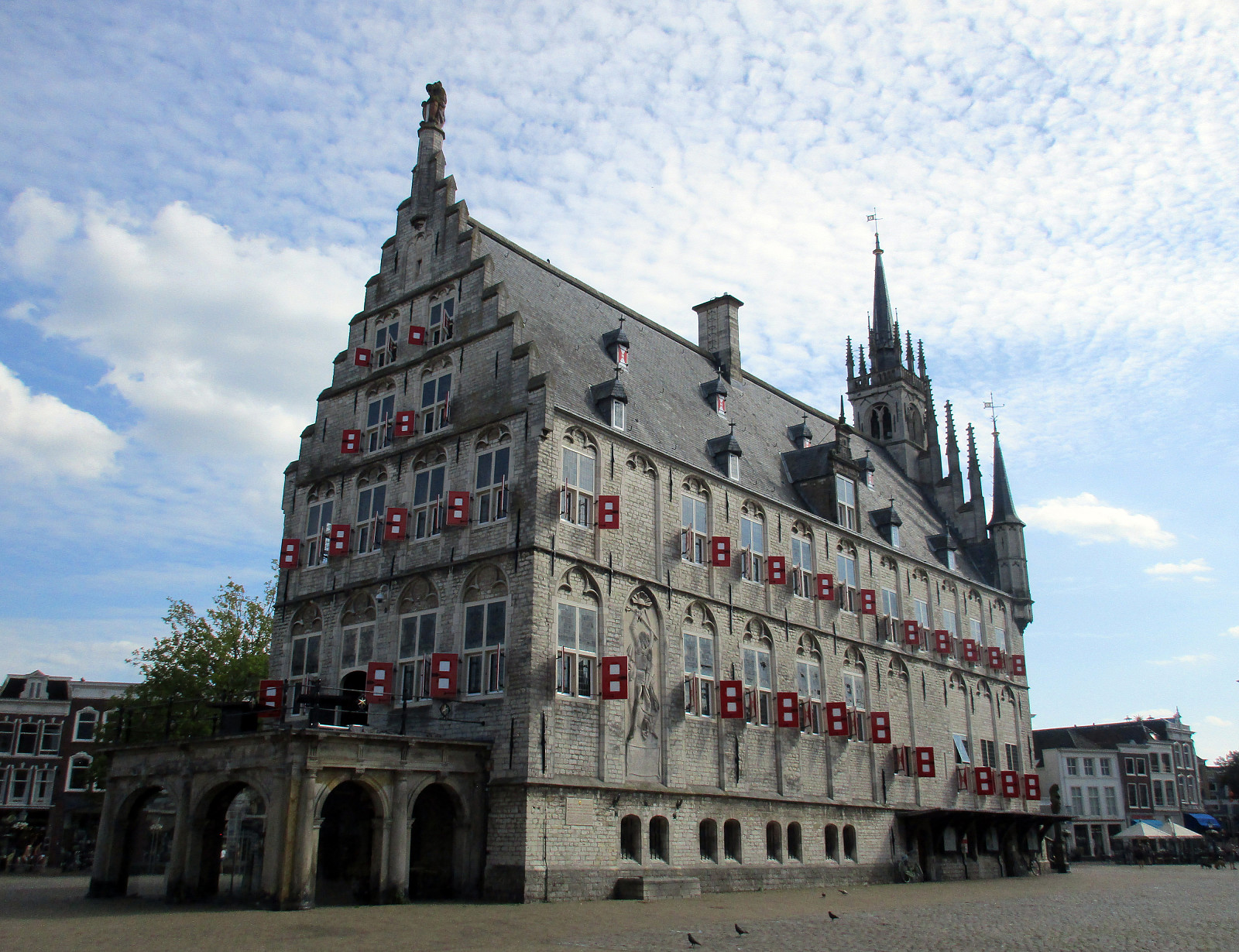 This sixth exploration of Rotterdam by bike brought me to the northeast of Rotterdam, in particular to Gouda. I cycled first towards the east (into the direction of Kralingse Plas), but turned left once I had crossed the Rotte. Then, I was basically following the Rotte into northeastern direction all the way to Rottemere, where I departed from the main cycling route (which leads further north) and crossed over to Zevenhuizen. From there, I continued into northeastern direction, crossing the highway A12, also, until I came to Waddinxveen. There, I changed into eastern direction, which brought me to Reeuwijk, right next to the lakes north of Gouda. I then circled 's-Gravenbroek in the north, before I crossed between Elfhoeven and Kleine Elfhoeven towards the south and Gouda. The old center >>>
Rotterdam-exploration 05: along the Oude Maas to Dordrecht
- Datum:
- 26.08.2017
- Tourcharakter:
- Fahrradtour
- Tourlänge:
- 5:00h
- Entfernung:
- 72,6km
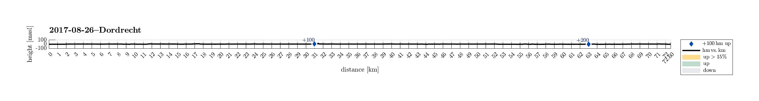 This fifth exploration of Rotterdam by bike brought me to the southeast of Rotterdam. I cycled first towards Schiedam in the west of Rotterdam. At Vijfsluizen, I turned left (into southern direction) and headed towards the Benelux-tunnel that connects to the south underneath the Nieuwe Maas. It's really cool that cyclists have their own tunnel, in fact! On the souther side, I biked by Pernis, before I came to the enormous traffic line, which leads out to Europoort in the west (train tracks plus two highways next to each other). I followed this traffic line a bit towards the west so that I could circle Hoogvliet on its western side. After all, this also brought me towards the Oude Maas, along which I had planned to cycle towards Dordrecht. Doing so, I enjoyed the nice biking paths along >>>
