Archiv - Nach Datum
Archiv - Nach Aktivität
-
Andere Tour (1)
- Kayaking (1)
-
Andere Wintertour (4)
- Schneeschuhtour (4)
-
Fahrradtour (137)
- Fahrradtour Straße (9)
- Fahrradtour gemischt (51)
-
Fußtour (740)
- Bergtour (363)
- Jogging (18)
- Spaziergang (89)
- Wanderung (270)
-
Skitour (4)
- Tourenskilauf (4)
Archiv - Nach Geografie
Peakbookfreunde


Gesammelte Listen
-
Bergen ≥ 50m pf. og ≥ 100 m.o.h.
(87/89)
 97%
97% -
Most dominating tops of the Bergen peninsula
(68/75)
90%
-
Utvalgte topper og turmål i Bergen
(316/350)
90%
-
Alle topper i Bergen
(357/398)
89%
-
Opptur Bergen
(100/113)
88%
-
De syv fjell rundt Bergen
(6/7)
85%
-
Sund ≥ 50m pf.
(14/18)
77%
-
Os ≥ 50m pf.
(25/34)
73%
-
Søyler (fastmerker) i Bergen
(68/100)
68%
-
Fjell ≥ 50m pf.
(21/32)
65%

Rax from Preiner Gscheid
- Datum:
- 15.07.2024
- Tourcharakter:
- Wanderung
- Tourlänge:
- 6:30h
- Entfernung:
- 13,9km
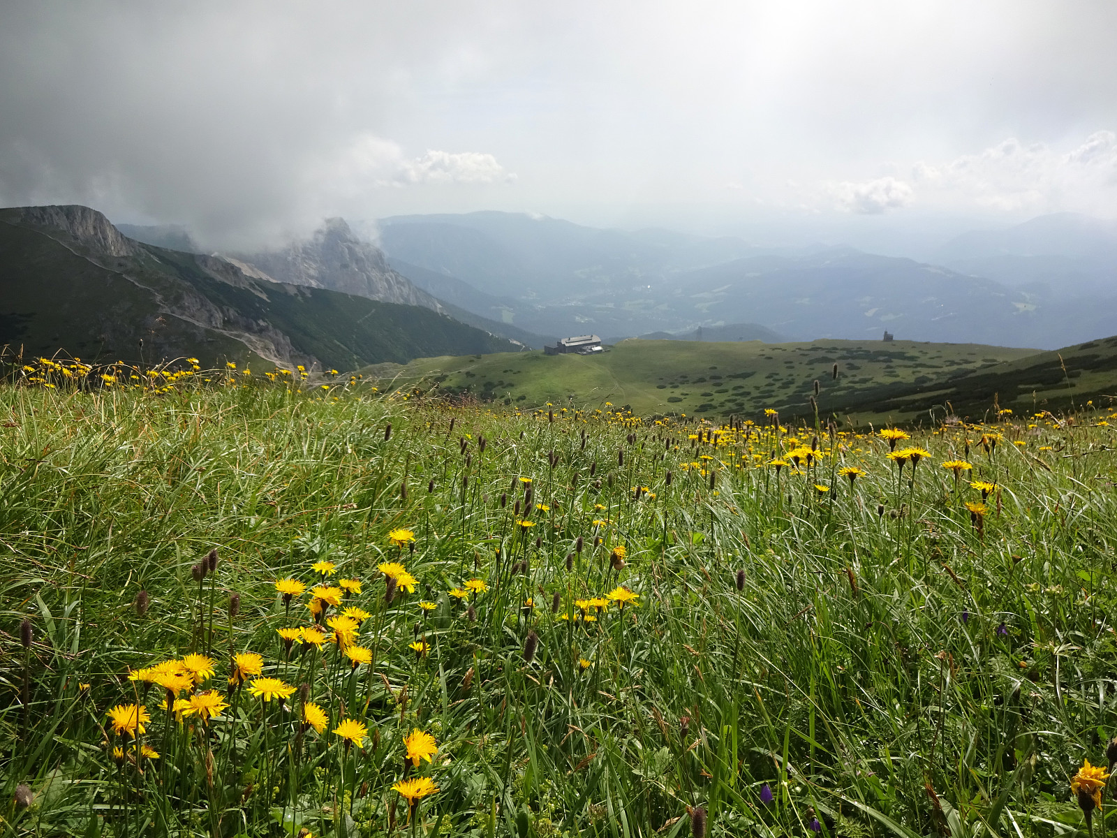 The weather looked promising (fine enough) to attempt the Rax, south of Wien. Starting early, we arrived at Preiner Gscheid (about 1070 masl) at about 8h30 in the morning. To make height meters quickly, we ascended (mostly northwards) along the skiing track that comes down in parallel to Rettenbach (in the northeast). At about 1340 masl (just a short distance from Waxrieglhaus in the east), we then entered Karlgraben in order to ascend (steeply) to Karl-Ludwig-Haus. We arrived at the Rax-heights at Thörl, before then walking over to Karl-Ludwig-Haus. From there, it's an easy stroll to Raxkircherl at Wetterkogel. Further upwards, we continued to Heukuppe via Schneegrubensattel. From there, we then returned to Karl-Ludwig-Haus, where we enjoyed a nice break with something to eat and drink. >>>
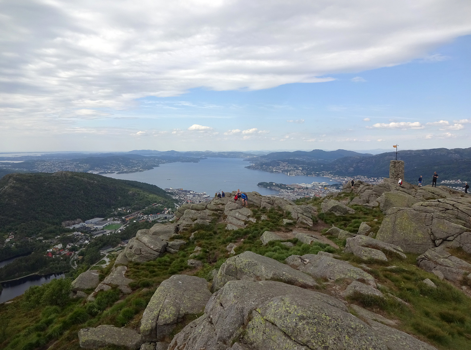
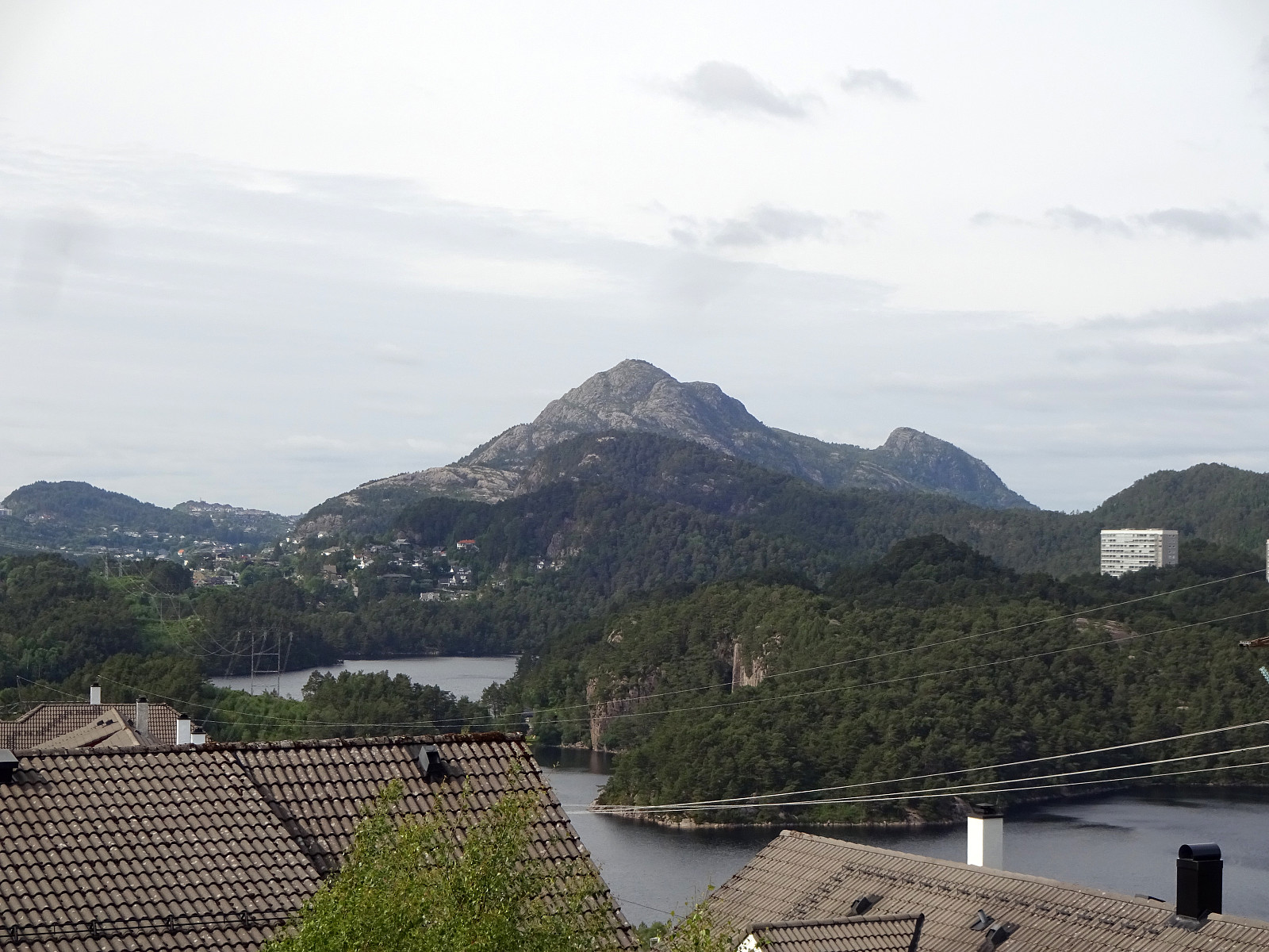
Prozor from Arapovac
- Datum:
- 10.07.2024
- Tourcharakter:
- Bergtour
- Tourlänge:
- 2:00h
- Entfernung:
- 2,4km
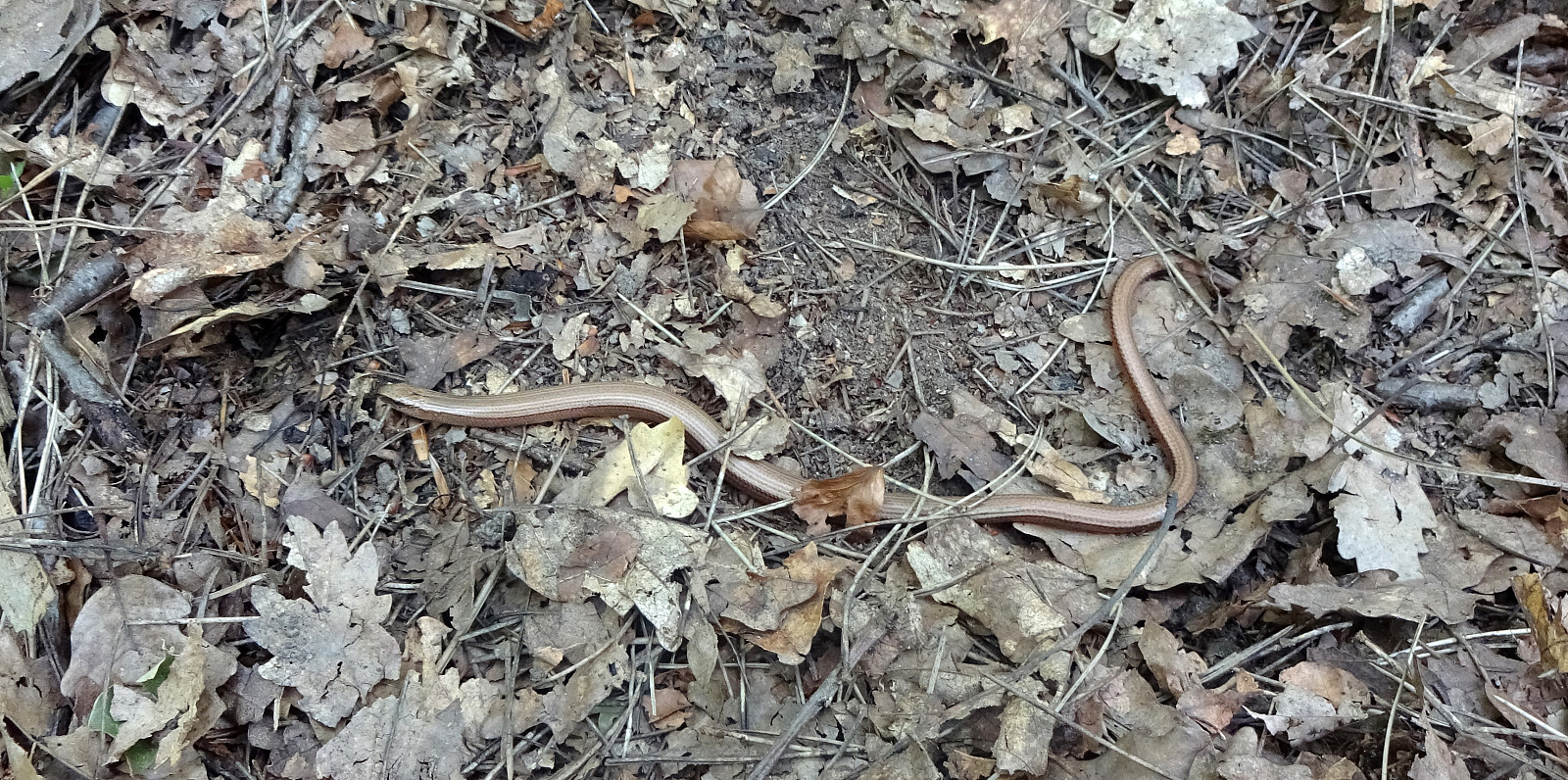 We were up for a short hike, given the quite hot weather. From Arapovac, we made our way up to Prozor, mostly without any trail. To get back to Arapovac, we chose another route, also (partly) without any (proper) trail. Hiking in those parts, which are covered by some older forest, was nice and without challenges; hiking through newer forest, however, was challenging due to the extra-dense vegetation! :-)
Selected photos are available as Google photo album .
See also the related FB-page Hiking around Bergen, Norway .
We were up for a short hike, given the quite hot weather. From Arapovac, we made our way up to Prozor, mostly without any trail. To get back to Arapovac, we chose another route, also (partly) without any (proper) trail. Hiking in those parts, which are covered by some older forest, was nice and without challenges; hiking through newer forest, however, was challenging due to the extra-dense vegetation! :-)
Selected photos are available as Google photo album .
See also the related FB-page Hiking around Bergen, Norway .
Visiting the caves of Barać
- Datum:
- 09.07.2024
- Tourcharakter:
- Spaziergang
- Tourlänge:
- 2:00h
- Entfernung:
- 1,0km
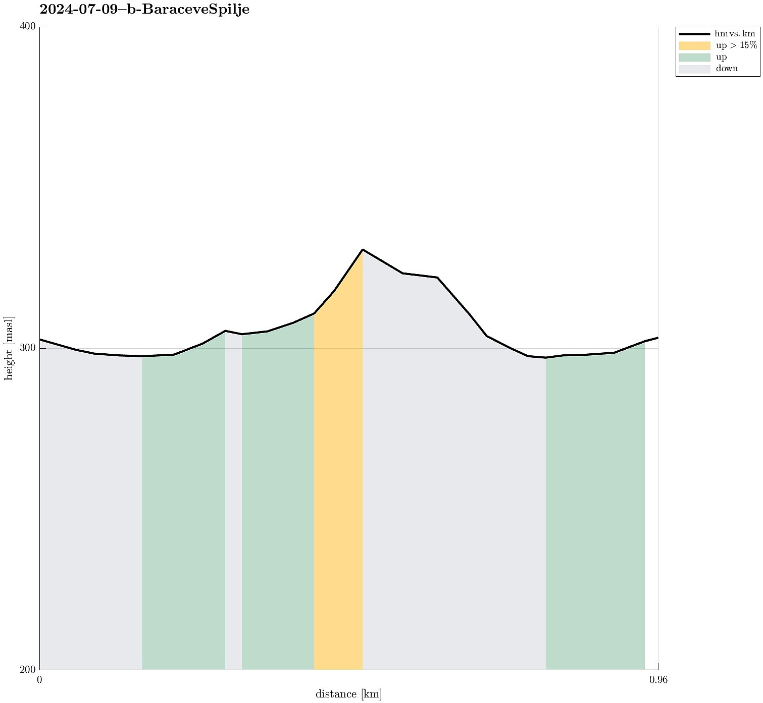 As a nice early evening program, we made a detour to see the caves of Barać. After parking at the parking lot, we walked into the "cave area" and got thoroughly impressed by the amount of effort that someone had put into setting up everything and making the whole area nice! :-) Since none else was about to take a tour, we eventually, after a bit of waiting, got a tour of the upper cave just for the four of us -- that was nice (we were told that at other times, some groups would be as large as 50, which clearly sounded too large for this cave). Our tour guide showed us around in the cave and gave us ample time to shoot our photos (since photographing was only allowed without flash, it usually took a few tries before one photo came out reasonably). After visiting the cave, we returned >>>
Visiting Kotlac near Slunj
- Datum:
- 09.07.2024
- Tourcharakter:
- Spaziergang
- Tourlänge:
- 1:00h
- Entfernung:
- 0,7km
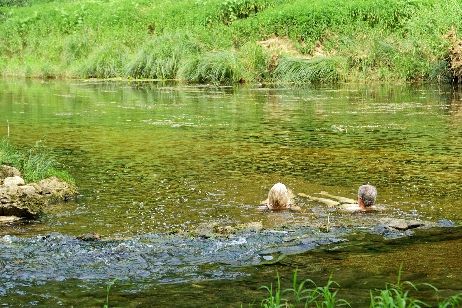 Given the warm day, we made a short excursion to Kotlac near Slunj to cool down (a little) in the lovely Korana river.
Selected photos are available as Google photo album .
See also the related FB-page Hiking around Bergen, Norway .
Given the warm day, we made a short excursion to Kotlac near Slunj to cool down (a little) in the lovely Korana river.
Selected photos are available as Google photo album .
See also the related FB-page Hiking around Bergen, Norway .
Exploring the city center of Sopron
- Datum:
- 05.07.2024
- Tourcharakter:
- Spaziergang
- Tourlänge:
- 1:00h
- Entfernung:
- 2,7km
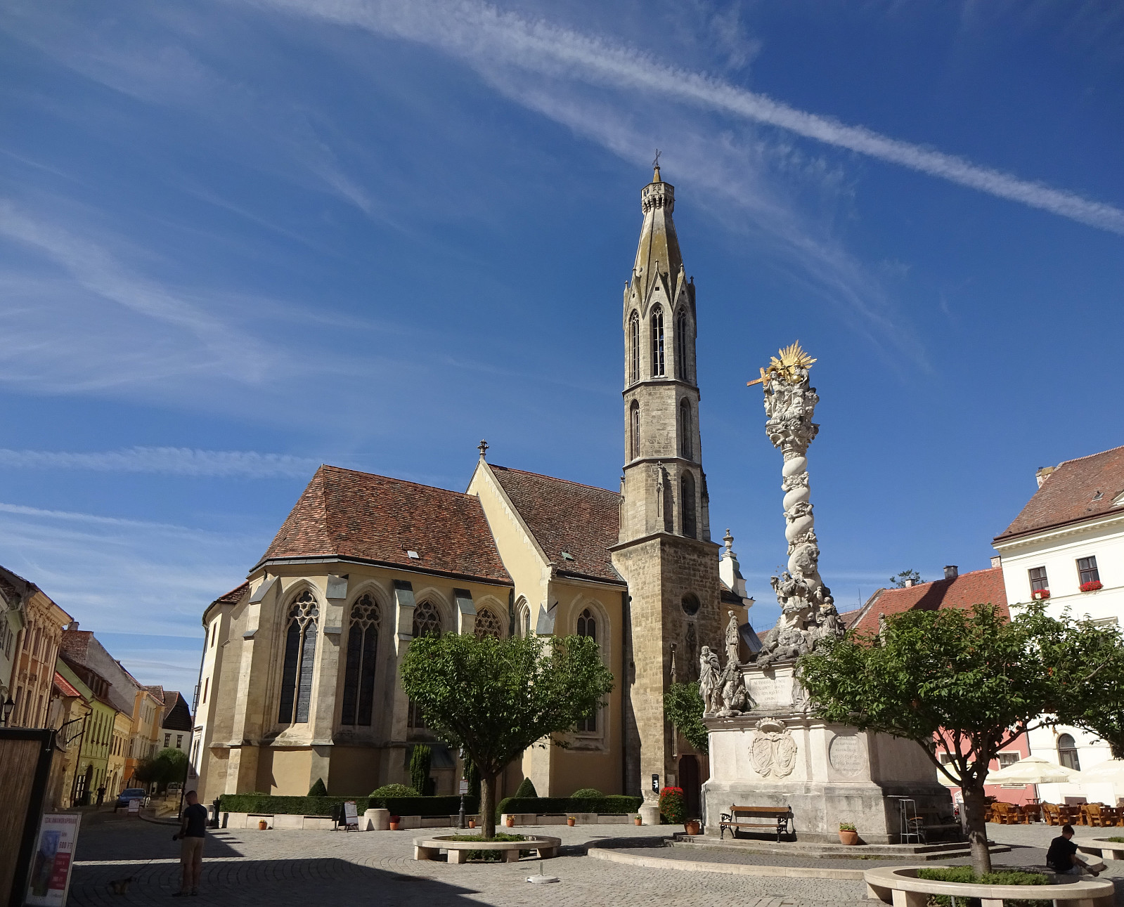 We had some spare time in Sopron, Hungary, which we used to walk around the historic center of the town. This brought us by mighty city walls, long out of their original use, the central square, as well as some unexpected sights (such as Fekete Elefánt cégér). Visiting Sopron can be recommended, even though making many height meters is difficult there! :-)
Selected photos are available as Google photo album .
See also the related FB-page Hiking around Bergen, Norway .
We had some spare time in Sopron, Hungary, which we used to walk around the historic center of the town. This brought us by mighty city walls, long out of their original use, the central square, as well as some unexpected sights (such as Fekete Elefánt cégér). Visiting Sopron can be recommended, even though making many height meters is difficult there! :-)
Selected photos are available as Google photo album .
See also the related FB-page Hiking around Bergen, Norway .
Fuglenosi from Gravalen and Hjelle via Avdal gard
- Datum:
- 30.06.2024
- Tourcharakter:
- Wanderung
- Tourlänge:
- 5:30h
- Entfernung:
- 10,1km
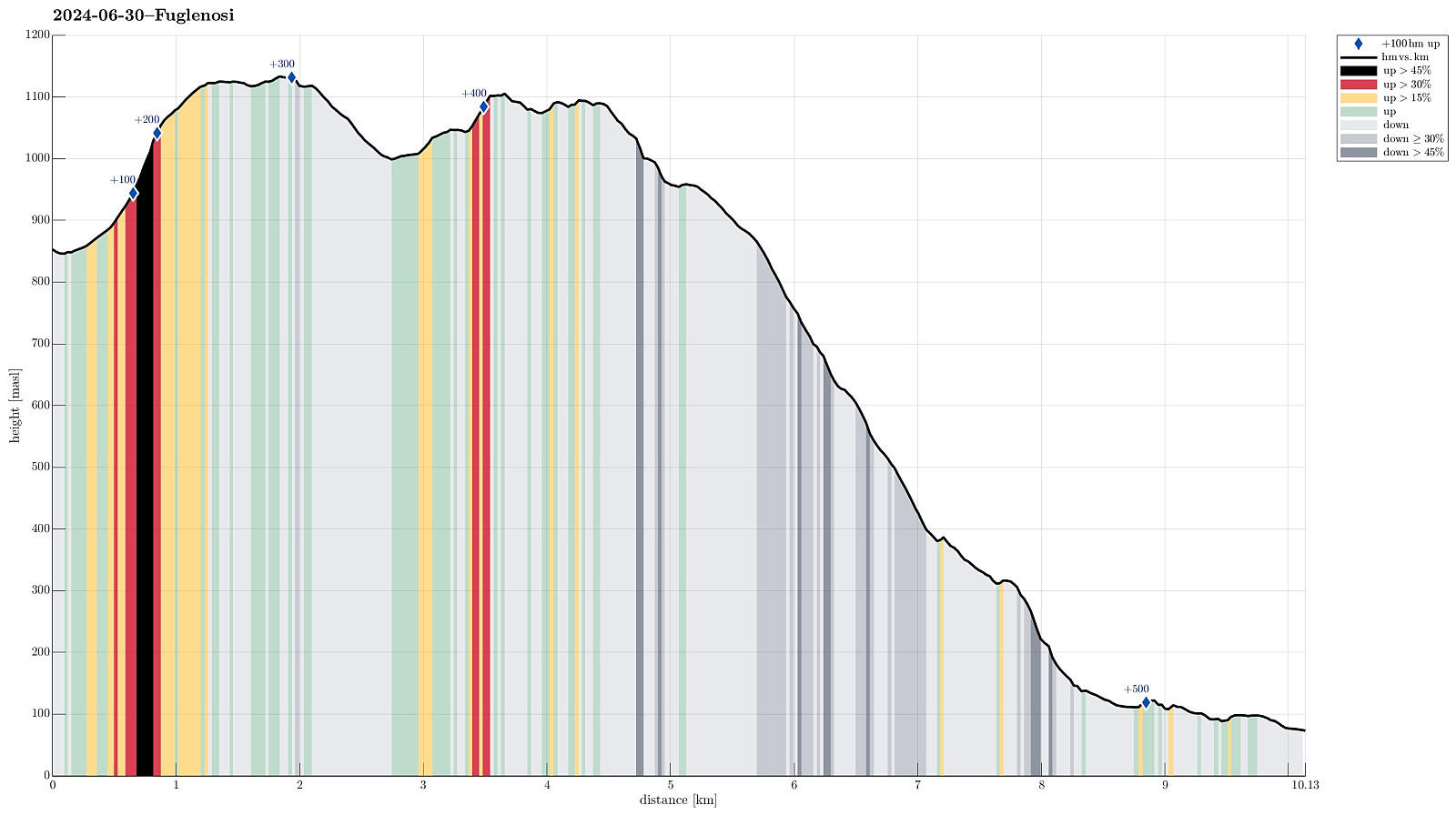 With many days in advance, we originally had thought to hike up to Stølsmaradalstinden from Gravdalen on this day. Given the weather (medium-high clouds, well engulving the highest tops, with some precipitation every now and then) and the rather wet walk through Gravdalen on the day before, we decided to drop our Stølsmaradalstinden plan and instead do something below the clouds. Still recalling the map that had suggested that one could find a trail, crossing over at Åsetvatnet and then continuing further along the heights to Stølsmaradalen, and also having read that the trail between Avdal gard and Stølsmaradalen should be nice and well-marked, we decided to hike first to Fuglenosi and then to find a way down to the trail between Avdal gard and Stølsmaradalen (in order to walk this trail then down to Avdal gard). >>>
Gravdalen via Botnanosi from Øvre Årdal
- Datum:
- 29.06.2024
- Tourcharakter:
- Wanderung
- Tourlänge:
- 7:00h
- Entfernung:
- 13,4km
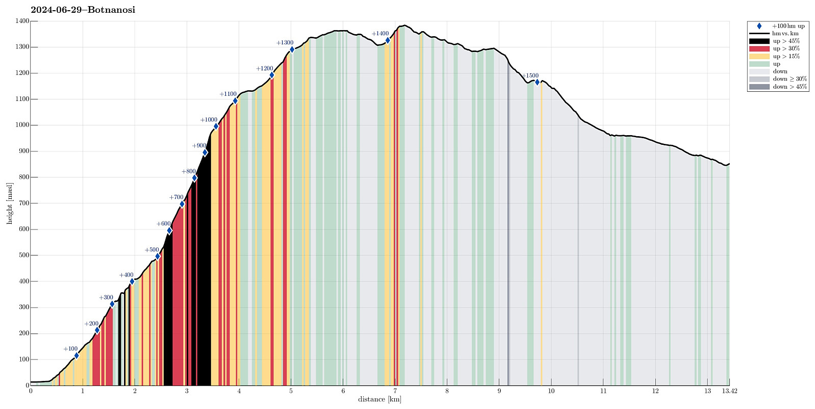 Our original plan was to first go up to Gravdalen and then, on the next day, further up to Stølsmaradalstinden. The weather forecast, however, did not look all too promising until only shortly before we left for Øvre Årdal. On the day before we wanted to start our two-days hike, however, the forecast became better (not really good, though) and so we decided to at least begin with the first planned leg (from Øvre Årdal to Gravdalen via Botnanosi). After finding a suitable place in Øvre Årdal, where we could leave our car for the night, also, we started the hike following a well-marked trail up to Ramnaberget, i.e., the impressive cliff directly north of Øvre Årdal. After enjoying the views from Ramnaberget (and a nice little chat with two hikers from England), we continued along >>>
Molden from Marifjøra (up via Svåi)
- Datum:
- 28.06.2024
- Tourcharakter:
- Wanderung
- Tourlänge:
- 5:30h
- Entfernung:
- 15,7km
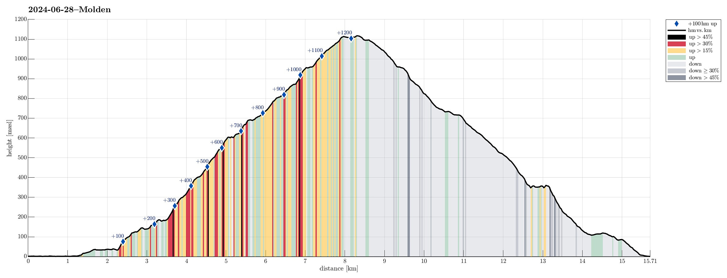 We left Bergen early in the morning with a plan to start hiking around noon-time. The plan was to hike up to Molden. After searching a little here on Peakbook , we got inspired by Jørn Håvard Ask , who wrote in his trip report " trip report " that hiking Molden from the north was really good! :-) We thus drove to Marifjøra, where road #55 (Lustravegen) comes down to meet Gaupnefjorden (only a few kilometers before reaching Gaupne). The idea was to leave the car there, ready to be picked up after coming down from Molden in Marifjøra, and then first walk Eikjastrondsvegen (along Gaupnefjorden) to the southeast and the start our ascent near Svåi. After about 2km on Eikjastrondsvegen, we found a trail-head for Molden, just meters before reaching Svåi. The original plan had been to first walk up to the highest house >>>
Around Løvstakken (and up to it, too)
- Datum:
- 15.06.2024
- Tourcharakter:
- Fahrradtour gemischt
- Tourlänge:
- 4:00h
- Entfernung:
- 22,9km
 We combined two ideas: Cycle along Løvstien and visit Løvstakken. We started at Varden and biked around Sælevatnet, continuing then along Straumeveien until we came to Bøneset. There we crossed under the main road to then ascend towards Storahugen and further to Kråkenes. Following road Øvre Kråkenes, we got to the start point of Løvstien (on its southern end). We then biked along Løvstien, passing by Lerkhaugen and Lisahaugen, until we were close to Grønnestølen. At about (5.3307E/60.3549) we then parked our bikes at the side of Løvstien, where also a trail from Grønnestølstunet comes up. From there, we then started our ascent towards Løvstakken, starting in southwestern direction (up towards a small saddle that would bring us over and into "Dalen"). While one >>>
Knappen
- Datum:
- 02.06.2024
- Tourcharakter:
- Bergtour
- Tourlänge:
- 0:45h
- Entfernung:
- 4,8km
 To get some fresh air, we decided to do a quick round over Knappen, approaching it via Sandeidbrotet (up to Eldtona, first). After crossing over to Såta on Knappen, we then descended furthre southwards (via Hesthaugen). Before stepping out on Knappenveien, we saw some (new?) signs near the sports area, suggesting a trail through the forest to Knappentunet. Following this trail, we first made quick progress into the right direction. After a while, however, the trail seemed to cross over some wet area at Hesthaugen, becoming less visible (or not at all, actually). Following our basic sense of orientation, we crossed through the forest into the right direction, connecting to Knappenveien at Knappentunet in the south of Knappatjørna. From there, it was then straight-forward (mostly) to >>>
