Archiv - Nach Datum
Archiv - Nach Aktivität
-
Andere Tour (1)
- Kayaking (1)
-
Andere Wintertour (4)
- Schneeschuhtour (4)
-
Fahrradtour (137)
- Fahrradtour Straße (9)
- Fahrradtour gemischt (51)
-
Fußtour (740)
- Bergtour (363)
- Jogging (18)
- Spaziergang (89)
- Wanderung (270)
-
Skitour (4)
- Tourenskilauf (4)
Archiv - Nach Geografie
Peakbookfreunde


Gesammelte Listen
-
Bergen ≥ 50m pf. og ≥ 100 m.o.h.
(87/89)
 97%
97% -
Most dominating tops of the Bergen peninsula
(68/75)
90%
-
Utvalgte topper og turmål i Bergen
(316/350)
90%
-
Alle topper i Bergen
(357/398)
89%
-
Opptur Bergen
(100/113)
88%
-
De syv fjell rundt Bergen
(6/7)
85%
-
Sund ≥ 50m pf.
(14/18)
77%
-
Os ≥ 50m pf.
(25/34)
73%
-
Søyler (fastmerker) i Bergen
(68/100)
68%
-
Fjell ≥ 50m pf.
(21/32)
65%

Bike-hiking Skavdalsfjellet (and some additional hills)
- Datum:
- 23.07.2023
- Tourcharakter:
- Fahrradtour gemischt
- Tourlänge:
- 6:00h
- Entfernung:
- 43,6km
 Due to some unfortunate illness, this excursion was without the usual company. The idea was to first ride my eBike to a suitable starting point and then do a hike from there. Also, I thought to make a hike, which we quite likely would not do together (parts of the planned hike were predicted to be more like a bush war than anything else*), ending up at the area in the northeast of Myrdalsvatnet with its smaller (and honestly speaking also not terribly exciting) hills (Kattuglehaugane, Barkahaugane, Kattuglefjellet, and Preståsen). I also thought to visit two small hills in Skjold (Skjoldhøgda and Storåsen), since they were along my route to Myrdalsvatnet (and since I thought that I'd never visit them otherwise anyway).
Biking around Søråsen, I made my way to Skjold. Finding a good route >>>
Due to some unfortunate illness, this excursion was without the usual company. The idea was to first ride my eBike to a suitable starting point and then do a hike from there. Also, I thought to make a hike, which we quite likely would not do together (parts of the planned hike were predicted to be more like a bush war than anything else*), ending up at the area in the northeast of Myrdalsvatnet with its smaller (and honestly speaking also not terribly exciting) hills (Kattuglehaugane, Barkahaugane, Kattuglefjellet, and Preståsen). I also thought to visit two small hills in Skjold (Skjoldhøgda and Storåsen), since they were along my route to Myrdalsvatnet (and since I thought that I'd never visit them otherwise anyway).
Biking around Søråsen, I made my way to Skjold. Finding a good route >>>
Exploring several grottos in Dumdalen
- Datum:
- 12.07.2023
- Tourcharakter:
- Spaziergang
- Tourlänge:
- 2:00h
- Entfernung:
- 2,8km
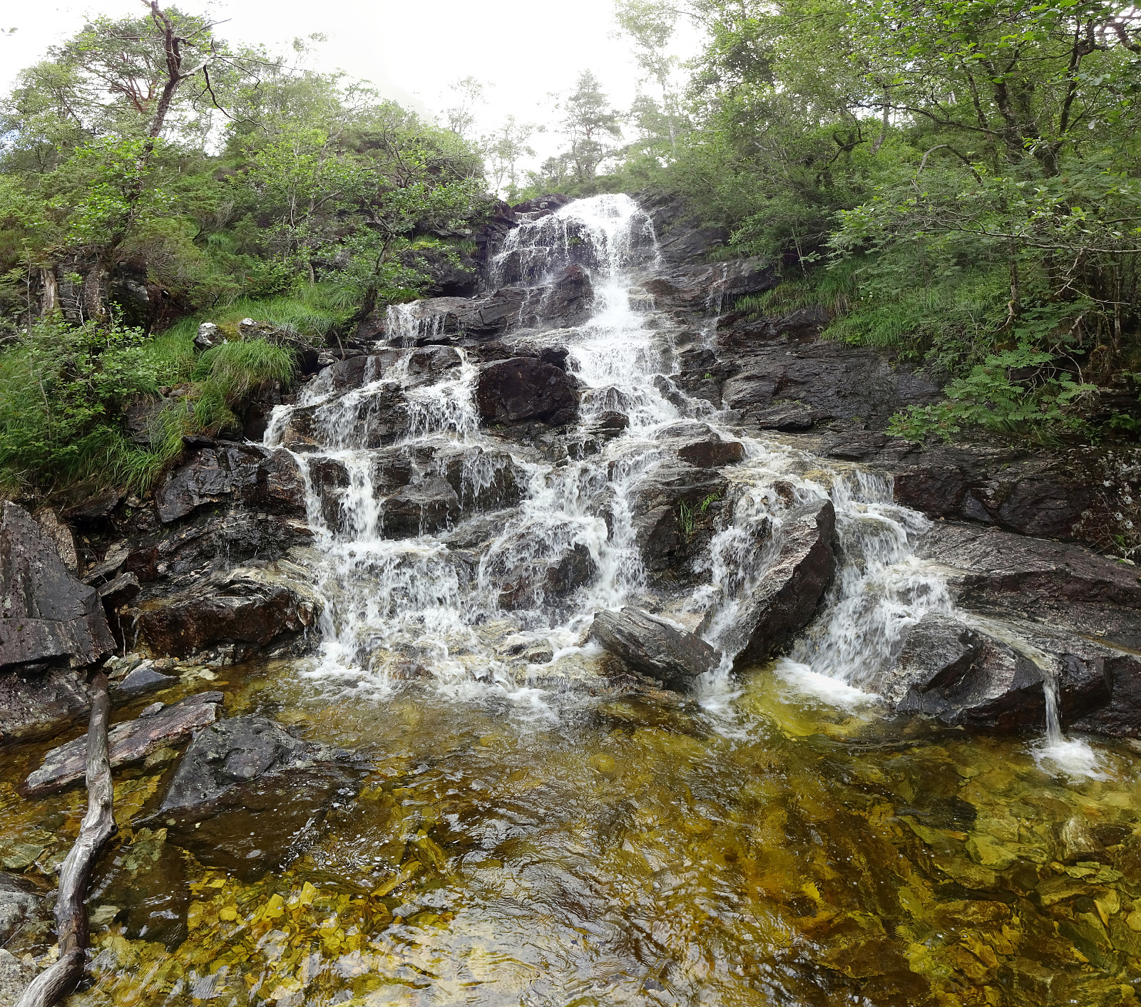
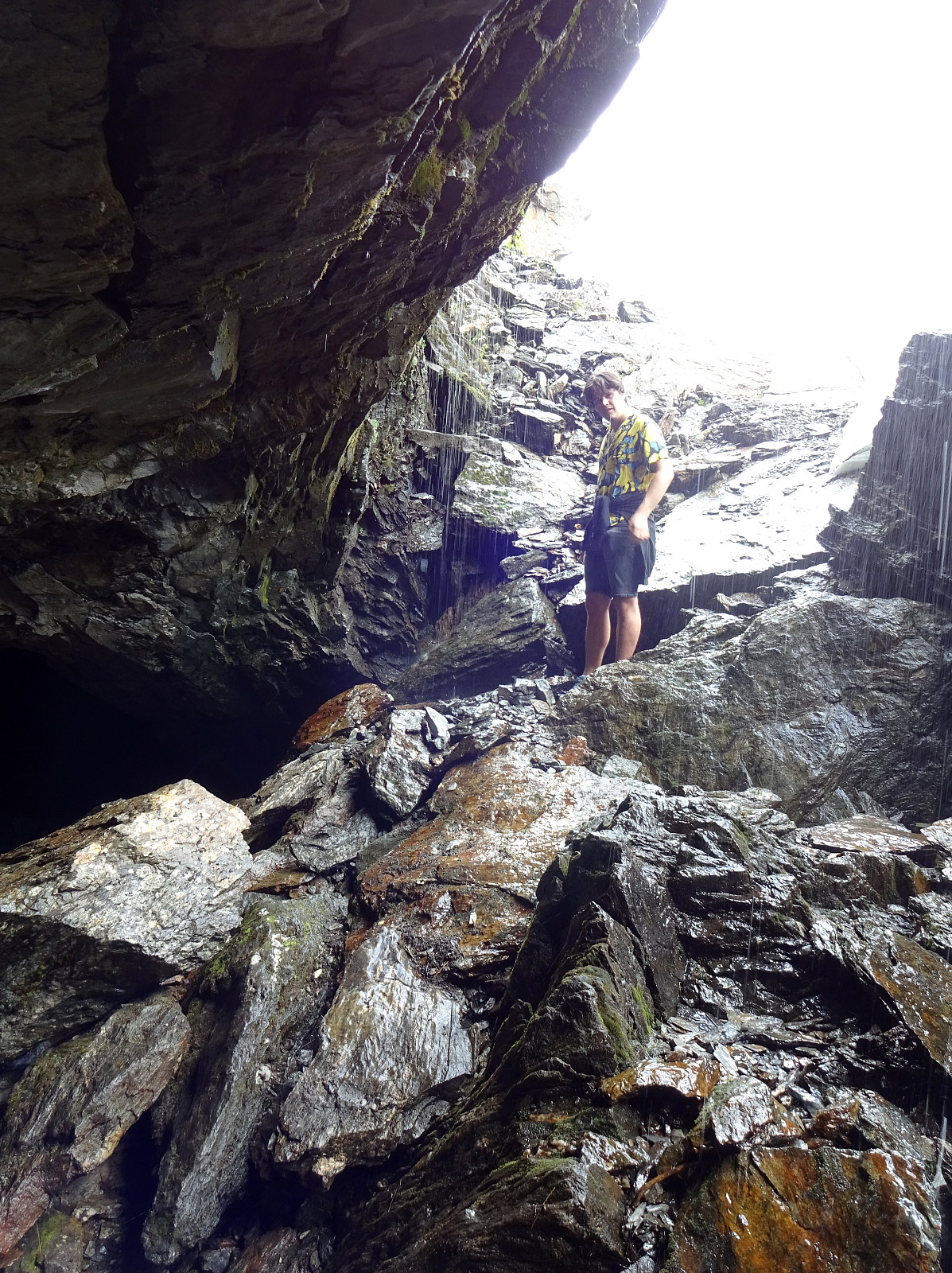 After a night at Jotunheimen Fjellstue, we decided to explore Dumdalen and (some of) the caves there. Parking right next to the road that leads further up to Sognefjellet, we used trails on both sides of Dumma to get up and down Dumdalen. While we certainly did not see all of the caves, we easily found several of them. Next to some of them, we also identified the markers (like "G3", "G10", etc.). The first aspect of this grottos that impressed us was the matter of fact that not so small Dumma disappears several times entirely in them. So it's not just interesting caves, but also an energetic mountain stream that rushes through several of them! While we mostly looked at these caves from the outside, we could not resist and also entered two (or three) of them. Especially >>>
Sagasøylen at Elvesæter
- Datum:
- 11.07.2023
- Tourcharakter:
- Spaziergang
- Tourlänge:
- 0:15h
- Entfernung:
- 0,1km
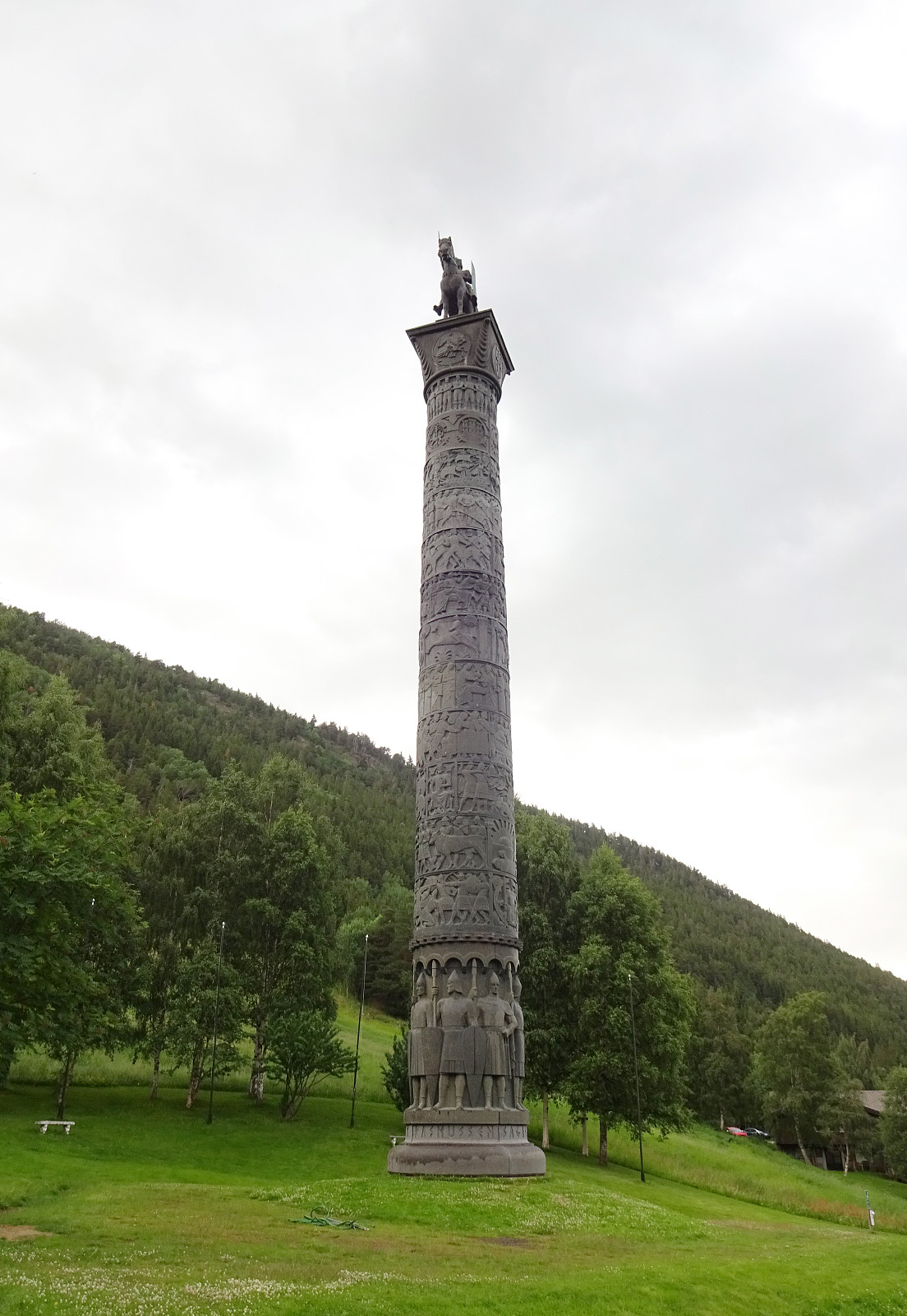 While driving up to Sognefjellet from Lom, we came by Elvesæter in Leirdalen. Spotting Sagasøylen (or Eidvollsmonumentet) by Wilhelm Rasmussen right next to the road, we made a short stop to have a look. This over 30 meters high column -- in "the middle of nowhere" -- is definitely a sight, also with its interesting history (originally planned as a monument to be erected in Oslo in front of Stortinget, it eventually survived due to the private initiative of Elvesæter hotel).
Selected photos are available as Google photo album .
See also the related FB-page Hiking around Bergen, Norway .
While driving up to Sognefjellet from Lom, we came by Elvesæter in Leirdalen. Spotting Sagasøylen (or Eidvollsmonumentet) by Wilhelm Rasmussen right next to the road, we made a short stop to have a look. This over 30 meters high column -- in "the middle of nowhere" -- is definitely a sight, also with its interesting history (originally planned as a monument to be erected in Oslo in front of Stortinget, it eventually survived due to the private initiative of Elvesæter hotel).
Selected photos are available as Google photo album .
See also the related FB-page Hiking around Bergen, Norway .
Round on Runde
- Datum:
- 11.07.2023
- Tourcharakter:
- Wanderung
- Tourlänge:
- 2:30h
- Entfernung:
- 7,4km
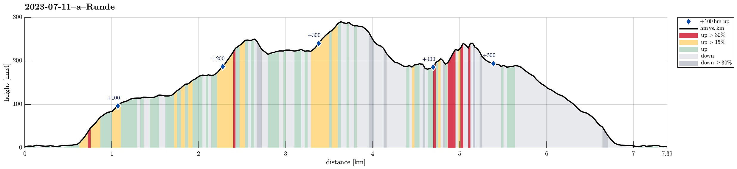 After taking the ferry to Gurskøya, we drove north to Runde to make an excursion to the birds there. Before getting all the way to Goksøyr, we found the last public parking spot. From there, it's then just to follow the marked trails. From Goksøyr upwards to the heights above the bird cliffs (in the northwest of Runde), they even paved the trail for a good stretch -- what a service?! :-) Once up on Myrane, we first headed north (to Raudetinden). There, we got some nice views down to Kvalnes (where also Runde Fyr is). After stepping up to Rongabakkane, we then traversed Storemyr to get to Raudnipa (in the north of Rundabranden). From there, we had our first amazing views down to Hjorthaugsmåla, where a large number of gannets have their nesting spots. For looking down to this gannet >>>
Stålet from Ytre Honningsvåg
- Datum:
- 10.07.2023
- Tourcharakter:
- Wanderung
- Tourlänge:
- 2:00h
- Entfernung:
- 4,0km
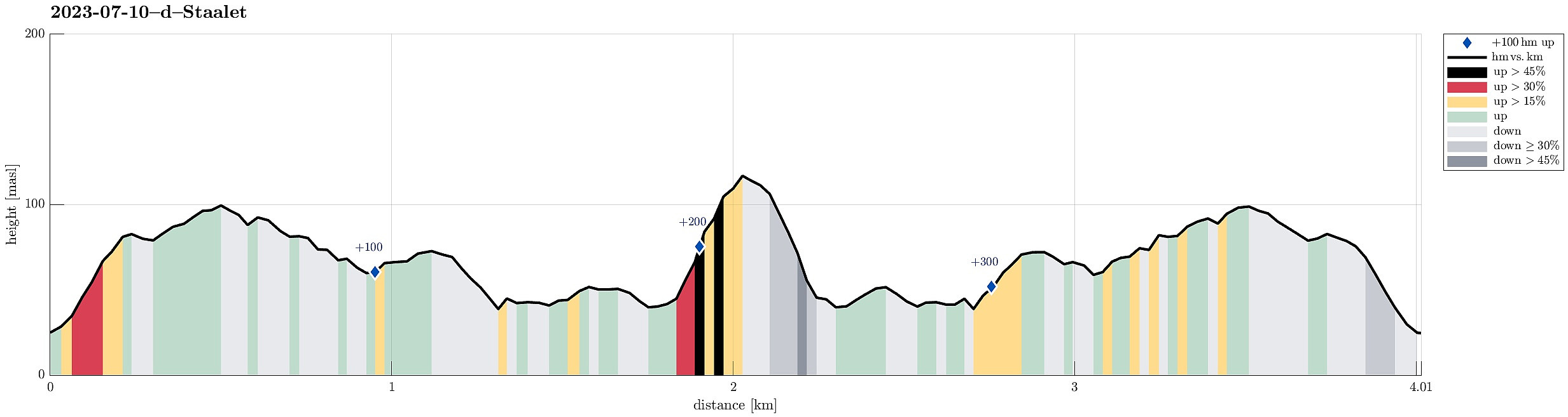 After not seeing much on Vestkapp , we continued to Honningsvågen to make an attempt at Stålet (as far north as you can get on Stadlandet, or so). We found a convenient place to park in Ytre Honningsvåg, right next to the trail head (place for about two cars). From there, we followed a marked trail that extends northwards from Ytre Honningsvåg, traversing the quite steep western slopes of Storebruna, Storeknausen, and Stålsegga at "half height" (or so). While this hike is not long and you also don't have to make many height meters, just the matter of fact that you traverse a relatively steep mountain side (basically all the way out and in), requires a bit of extra care. Also, if the condition should be wet, there may be risks to slip, which could be quite bad in the steepest sections. >>>
Vestkapp on Stadlandet
- Datum:
- 10.07.2023
- Tourcharakter:
- Spaziergang
- Tourlänge:
- 0:30h
- Entfernung:
- 0,6km
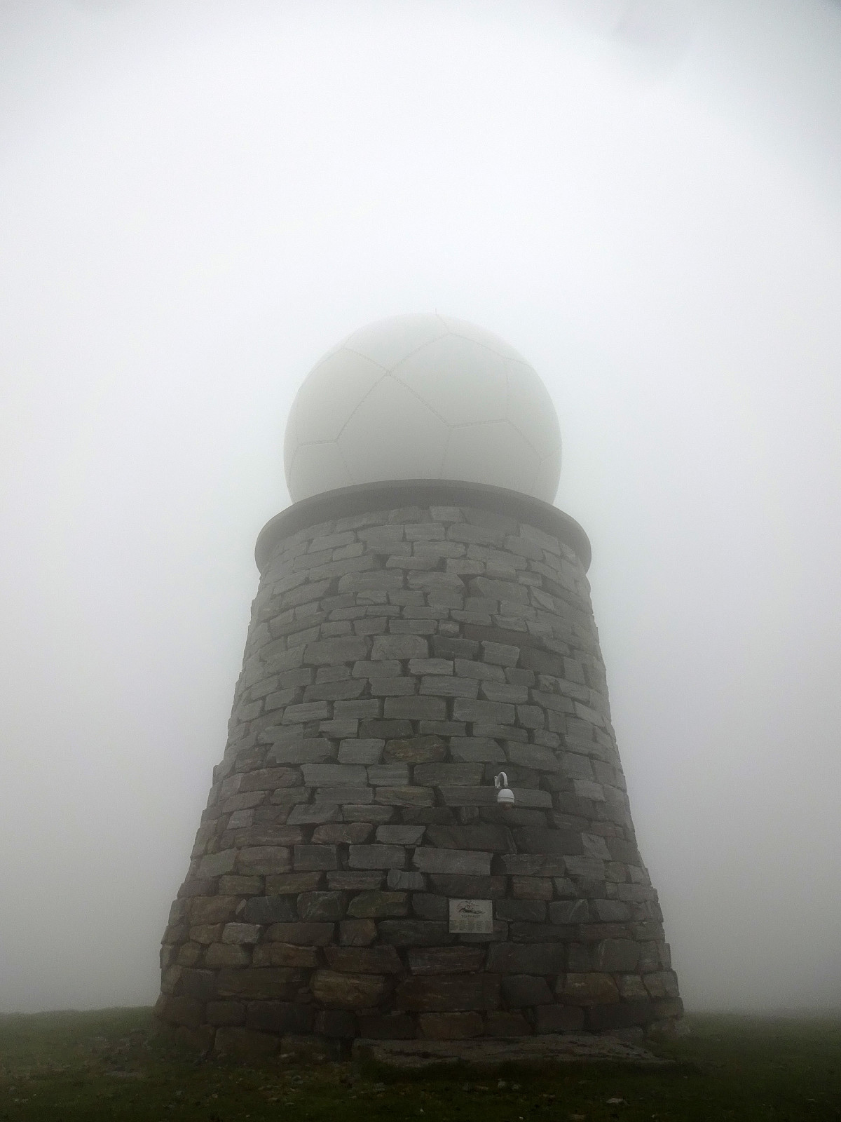 After first paying Vågsøy and Måløy a short visit, we continued to Stadlandet. Our first stop was Vestkapp on Kjerringa in the northwest of Stadlandet. Taking the road up to a parking spot quite close to the actual top, we eventually entered some very thick (and wet) clouds that enshrouded all of the top. Even just a few meters from the massive meteorological radar station on top of Kjerringa we had some difficulties to actually find and see it! :-) Since our views were extremely limited anyway (and it was quite a bit wet, also!), we decided to not stay there for any significant time, but return to our car soon, instead, with our next goal, Stålet , in front of us! :-)
Selected photos are available as Google photo album .
See also the related FB-page Hiking around Bergen, Norway .
After first paying Vågsøy and Måløy a short visit, we continued to Stadlandet. Our first stop was Vestkapp on Kjerringa in the northwest of Stadlandet. Taking the road up to a parking spot quite close to the actual top, we eventually entered some very thick (and wet) clouds that enshrouded all of the top. Even just a few meters from the massive meteorological radar station on top of Kjerringa we had some difficulties to actually find and see it! :-) Since our views were extremely limited anyway (and it was quite a bit wet, also!), we decided to not stay there for any significant time, but return to our car soon, instead, with our next goal, Stålet , in front of us! :-)
Selected photos are available as Google photo album .
See also the related FB-page Hiking around Bergen, Norway .
Short visit to Hendanes Fyret
- Datum:
- 10.07.2023
- Tourcharakter:
- Spaziergang
- Tourlänge:
- 1:00h
- Entfernung:
- 1,4km
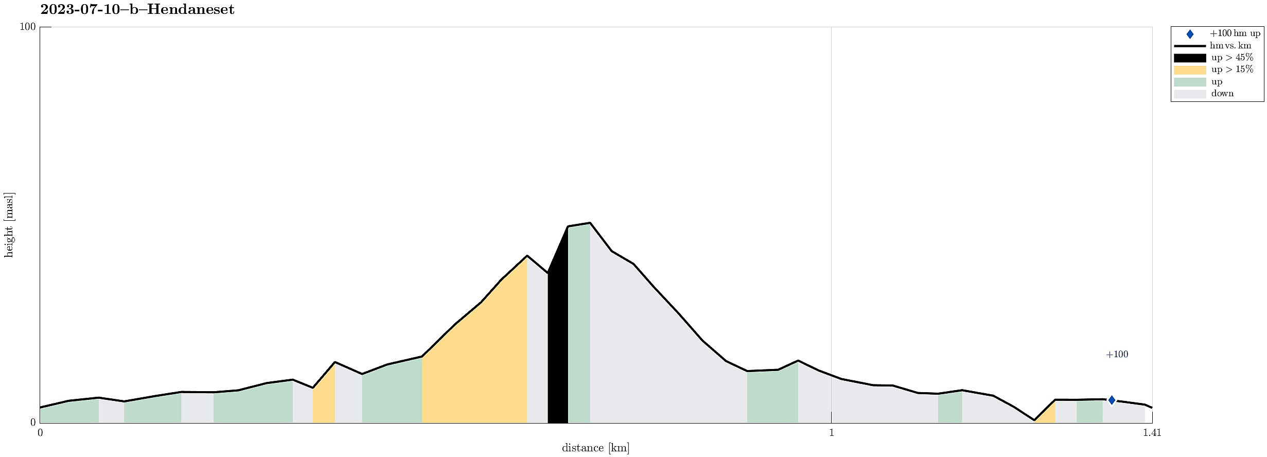 After visiting Kannesteinen , we also wished to see the other side of Torskangerpollen and walking out to the small light house at Hendanes seemed to be a good idea. :-) The path out there is in fact nicely prepared so that this very much is an easy and full uncomplicated walk. Once out at Hendaneset, we enjoyed some great views, not only across Torskangerpollen, but also across Kvalheimsvika to Ytre Kvalheim as well as into the opposite direction (towards Klovningen). Nice walk! :-)
Selected photos are available as Google photo album .
See also the related FB-page Hiking around Bergen, Norway .
After visiting Kannesteinen , we also wished to see the other side of Torskangerpollen and walking out to the small light house at Hendanes seemed to be a good idea. :-) The path out there is in fact nicely prepared so that this very much is an easy and full uncomplicated walk. Once out at Hendaneset, we enjoyed some great views, not only across Torskangerpollen, but also across Kvalheimsvika to Ytre Kvalheim as well as into the opposite direction (towards Klovningen). Nice walk! :-)
Selected photos are available as Google photo album .
See also the related FB-page Hiking around Bergen, Norway .
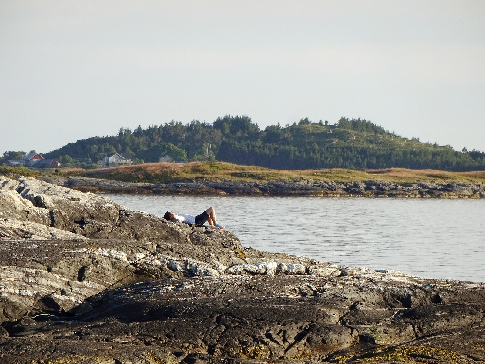
Kannesteinen on Vågsøy
- Datum:
- 10.07.2023
- Tourcharakter:
- Spaziergang
- Tourlänge:
- 0:30h
- Entfernung:
- 0,2km
 On our way to Stadlandet, we also paid Vågsøy and Måløy a visit. On Vågsøy, we then also drove out to Kannesteinen near Nordoppedalen. Not only is this stone impressive with its particular shape, but also the whole scenery around Torskangerpollen is worth seeing! :-)
Selected photos are available as Google photo album .
See also the related FB-page Hiking around Bergen, Norway .
See the Norwegian Wikipedia for a page about Kannesteinen .
On our way to Stadlandet, we also paid Vågsøy and Måløy a visit. On Vågsøy, we then also drove out to Kannesteinen near Nordoppedalen. Not only is this stone impressive with its particular shape, but also the whole scenery around Torskangerpollen is worth seeing! :-)
Selected photos are available as Google photo album .
See also the related FB-page Hiking around Bergen, Norway .
See the Norwegian Wikipedia for a page about Kannesteinen .
Havreneset and Nordnes in Florø
- Datum:
- 09.07.2023
- Tourcharakter:
- Spaziergang
- Tourlänge:
- 1:30h
- Entfernung:
- 3,8km
 After arriving relatively late in Florø, we still wished to get a bit of fresh air. We also liked the idea to visit Nordnes in the northwest of Florø and so we just went onto a short but nice stroll. First, we visited Havreneset, where quite a bit of installation of an (old) radio station (Florø Radio, discontinued after 2018) is still to be seen. We then stepped along the coast to Nordnes and the marina in Håvågen there. Always nice to smell a bit of ocean air; especially after a long drive! :-)
See also the related FB-page Hiking around Bergen, Norway .
After arriving relatively late in Florø, we still wished to get a bit of fresh air. We also liked the idea to visit Nordnes in the northwest of Florø and so we just went onto a short but nice stroll. First, we visited Havreneset, where quite a bit of installation of an (old) radio station (Florø Radio, discontinued after 2018) is still to be seen. We then stepped along the coast to Nordnes and the marina in Håvågen there. Always nice to smell a bit of ocean air; especially after a long drive! :-)
See also the related FB-page Hiking around Bergen, Norway .
Two old stone crosses in Eivindvik
- Datum:
- 09.07.2023
- Tourcharakter:
- Spaziergang
- Tourlänge:
- 0:30h
- Entfernung:
- 0,7km
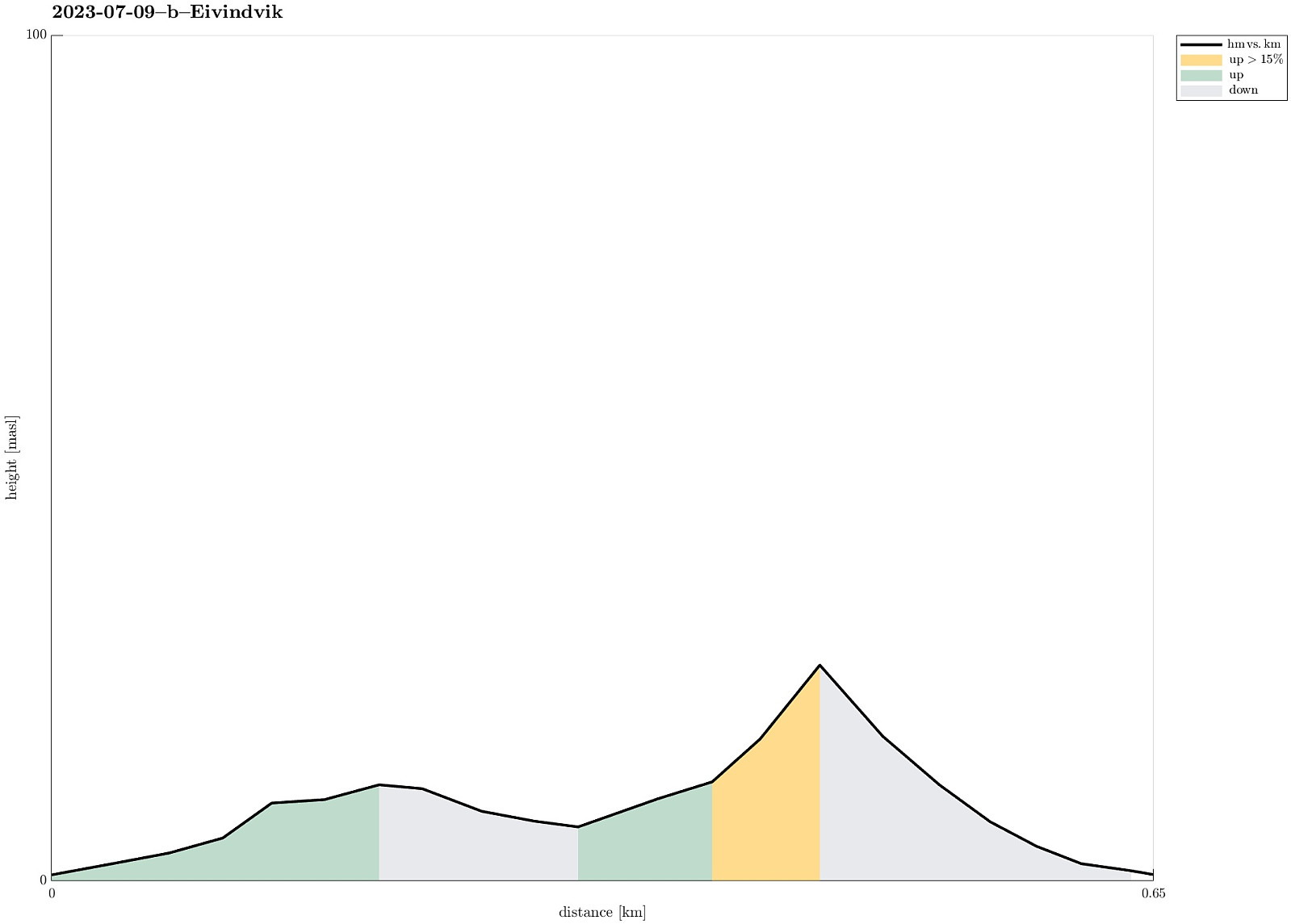 After visiting Gulatinget east of Eivindvik, we continued to Eivindvik to see the two old stone crosses there, also. We parked near the harbor and first walked up to Gulen church (east of the harbor) to see the first cross (Olavskorset). It's standing there with some help now after it broke into two when a nearby tree was cut down in 2012. From there, one can already see the other cross (Korset i Krossteigen), standing a bit up in Krossteigen some (maybe) 250 meters further north. An accordingly short walk brought us up there then. This second cross is interesting as it seems to show some celtic flair. To compensate for that, maybe, they added a smaller, Latin cross (by embossing it out of the main cross). Clearly worth a close look! :-)
Selected photos are available as Google photo album .
See also the related FB-page >>>
After visiting Gulatinget east of Eivindvik, we continued to Eivindvik to see the two old stone crosses there, also. We parked near the harbor and first walked up to Gulen church (east of the harbor) to see the first cross (Olavskorset). It's standing there with some help now after it broke into two when a nearby tree was cut down in 2012. From there, one can already see the other cross (Korset i Krossteigen), standing a bit up in Krossteigen some (maybe) 250 meters further north. An accordingly short walk brought us up there then. This second cross is interesting as it seems to show some celtic flair. To compensate for that, maybe, they added a smaller, Latin cross (by embossing it out of the main cross). Clearly worth a close look! :-)
Selected photos are available as Google photo album .
See also the related FB-page >>>
