Archiv - Nach Datum
Archiv - Nach Aktivität
-
Andere Tour (1)
- Kayaking (1)
-
Andere Wintertour (4)
- Schneeschuhtour (4)
-
Fahrradtour (137)
- Fahrradtour Straße (9)
- Fahrradtour gemischt (51)
-
Fußtour (740)
- Bergtour (363)
- Jogging (18)
- Spaziergang (89)
- Wanderung (270)
-
Skitour (4)
- Tourenskilauf (4)
Archiv - Nach Geografie
Peakbookfreunde


Gesammelte Listen
-
Bergen ≥ 50m pf. og ≥ 100 m.o.h.
(87/89)
 97%
97% -
Most dominating tops of the Bergen peninsula
(68/75)
90%
-
Utvalgte topper og turmål i Bergen
(316/350)
90%
-
Alle topper i Bergen
(357/398)
89%
-
Opptur Bergen
(100/113)
88%
-
De syv fjell rundt Bergen
(6/7)
85%
-
Sund ≥ 50m pf.
(14/18)
77%
-
Os ≥ 50m pf.
(25/34)
73%
-
Søyler (fastmerker) i Bergen
(68/100)
68%
-
Fjell ≥ 50m pf.
(21/32)
65%

Visiting Montezuma Falls in the jungle
- Datum:
- 03.11.2023
- Tourcharakter:
- Spaziergang
- Tourlänge:
- 2:30h
- Entfernung:
- 9,5km
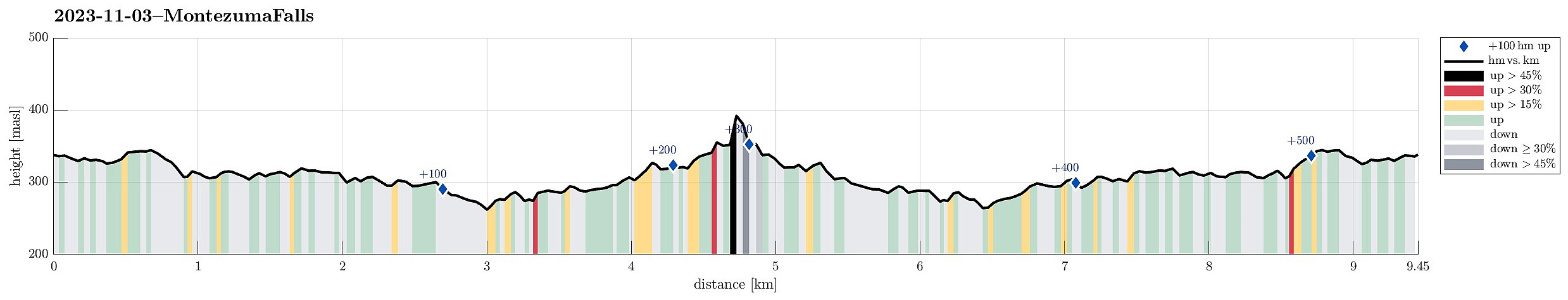 After our very nice hike up to Cradle Mountain on the day before, we headed further towards the west of Tasmania, driving (mostly) in southwestern direction. After first driving through large Eucalyptus forests, we then arrived in an impressive rain forest / jungle. Our main plan for the day, besides driving towards the west coast of Tasmania, was to do a hike into the jungle at Montezuma Falls. Leaving the main highway A10 near Rosebery, we used a minor road to get to the starting point of the Trail (where we also found a good spot to park). The trail to Montezuma Falls comes with an interesting bit of history, actually. It follows the route of an early-day railway that pioneers had built into the jungle to help with some mining activity in this area. Even though the topography of this area is definitely challenging (up >>>
Cradle Mountain in lovely weather
- Datum:
- 02.11.2023
- Tourcharakter:
- Wanderung
- Tourlänge:
- 6:30h
- Entfernung:
- 13,1km
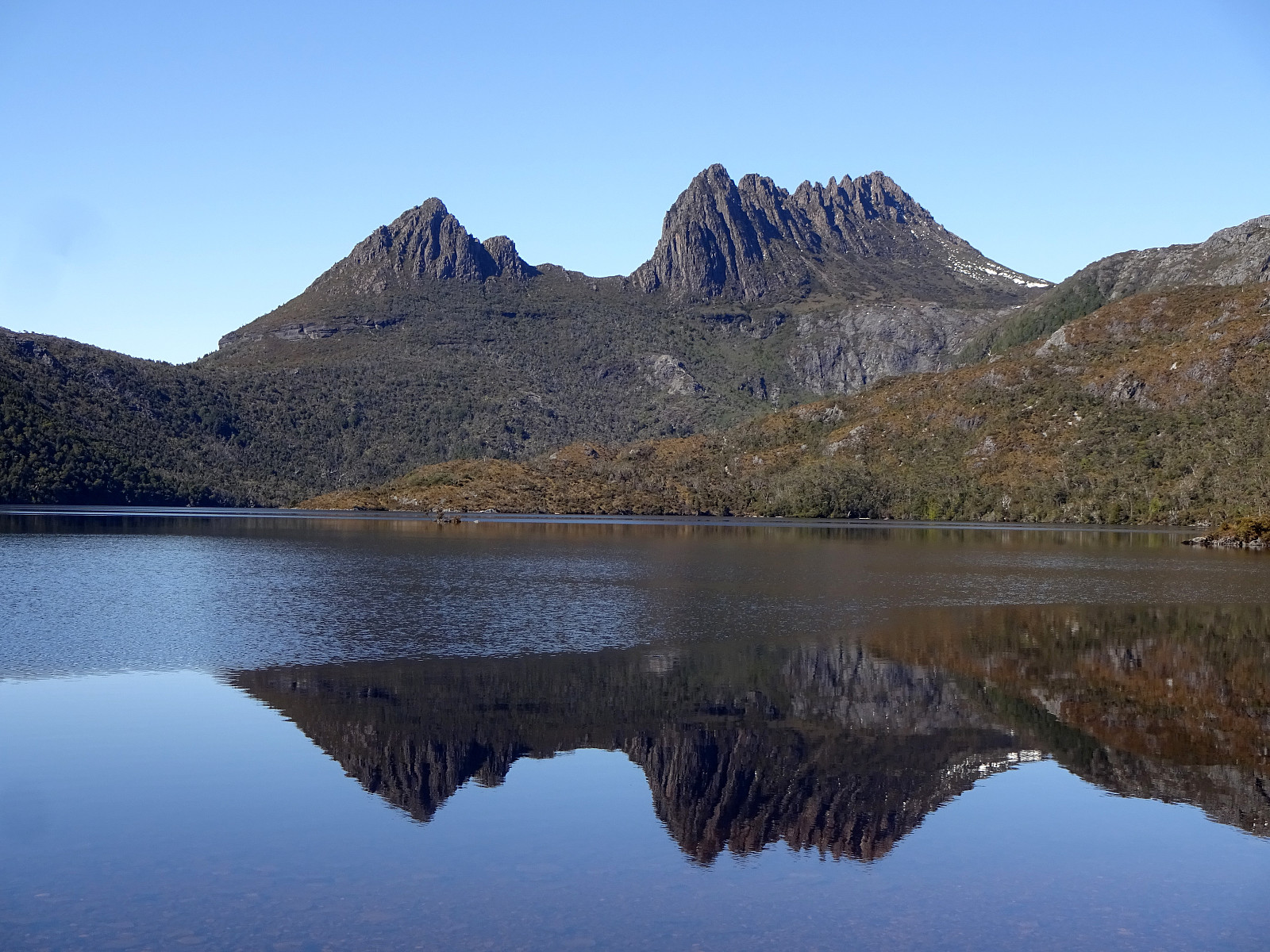 We started the day at the Cradle Mountain Visitor Centre at 4057 Cradle Mountain Road from where we took a shuttle bus up to the end of the road at Dove Lake. There, we first enjoyed beautiful views across the still lake, reflecting Cradle Mountain from behind and its surrounding landscape. We then started our hike on the east-side of Dove Lake, briefly checking out Glacier Rock, before then using the slightly minor trail up to Hansons Peak (Lake Rodway Track). Already this part was very nice, with views both across Dove Lake (to the west) as well as eastwards (once up on the ridge). From Hansons Peak, we then crossed over to the Face Track, which brought us, between Cradle Mountain in the south and Dove Lake in the north, to the west-side of Cradle Mountain. There, we connected to the >>>
Nice round through the Rocky Cape National Park
- Datum:
- 01.11.2023
- Tourcharakter:
- Wanderung
- Tourlänge:
- 6:00h
- Entfernung:
- 17,3km
 After a nice morning in Devonport, we decided to use the beautiful weather for a hike through Rocky Cape National Park. To get there, we followed the Bass Highway along the norther coast (in western, northwestern direction). In the area of Boat Harbour, we turned right and onto road C232 to Sisters Beach. In Sisters Beach, we oriented us towards the Boat Ramp (at the very northwestern end of Sisters Beach). There, we also found a good place to park the car. Since we had planned for a round through the Rocky Cape National Park, starting along the Inland route (over the hills), we aimed at the trailhead a few meters southwest of the parking place. After a few moments of searching this trailhead, we nicely located it along one of the sideroads. From there, it was then easy to follow the >>>
Mersey Bluff in Devonport
- Datum:
- 01.11.2023
- Tourcharakter:
- Spaziergang
- Tourlänge:
- 1:00h
- Entfernung:
- 1,5km
 Devonport had already welcomed us nicely and we decided to give it one more chance to shine! :-) Instead of heading out of town immediately, we first drove to the north of Devonport, where we thought to see the Mersey Bluff Lighthouse. Mersey Bluff and the beach right next to it did not disappoint us -- in fact, this area is really nice and clearly worth a short visit! :-) You can even shower yourself after swimming in the Bass Strait next to Mersey Bluff! Really nice! :-)
Selected photos are available as Google photo album .
See also the related FB-page Hiking around Bergen, Norway .
Devonport had already welcomed us nicely and we decided to give it one more chance to shine! :-) Instead of heading out of town immediately, we first drove to the north of Devonport, where we thought to see the Mersey Bluff Lighthouse. Mersey Bluff and the beach right next to it did not disappoint us -- in fact, this area is really nice and clearly worth a short visit! :-) You can even shower yourself after swimming in the Bass Strait next to Mersey Bluff! Really nice! :-)
Selected photos are available as Google photo album .
See also the related FB-page Hiking around Bergen, Norway .
Downtown Devonport
- Datum:
- 01.11.2023
- Tourcharakter:
- Spaziergang
- Tourlänge:
- 1:00h
- Entfernung:
- 2,3km
 After the whole night at the ferry from Geelong to Devonport, we wished to first get some fresh air (before driving on). We thus changed from East Devonport to West Devonport and made a nice stroll through down town Devonport, also enjoying a nice coffee for a breakfast! :-)
Selected photos are available as Google photo album .
See also the related FB-page Hiking around Bergen, Norway .
After the whole night at the ferry from Geelong to Devonport, we wished to first get some fresh air (before driving on). We thus changed from East Devonport to West Devonport and made a nice stroll through down town Devonport, also enjoying a nice coffee for a breakfast! :-)
Selected photos are available as Google photo album .
See also the related FB-page Hiking around Bergen, Norway .
Organ Pipes National Park
- Datum:
- 31.10.2023
- Tourcharakter:
- Spaziergang
- Tourlänge:
- 1:30h
- Entfernung:
- 3,7km
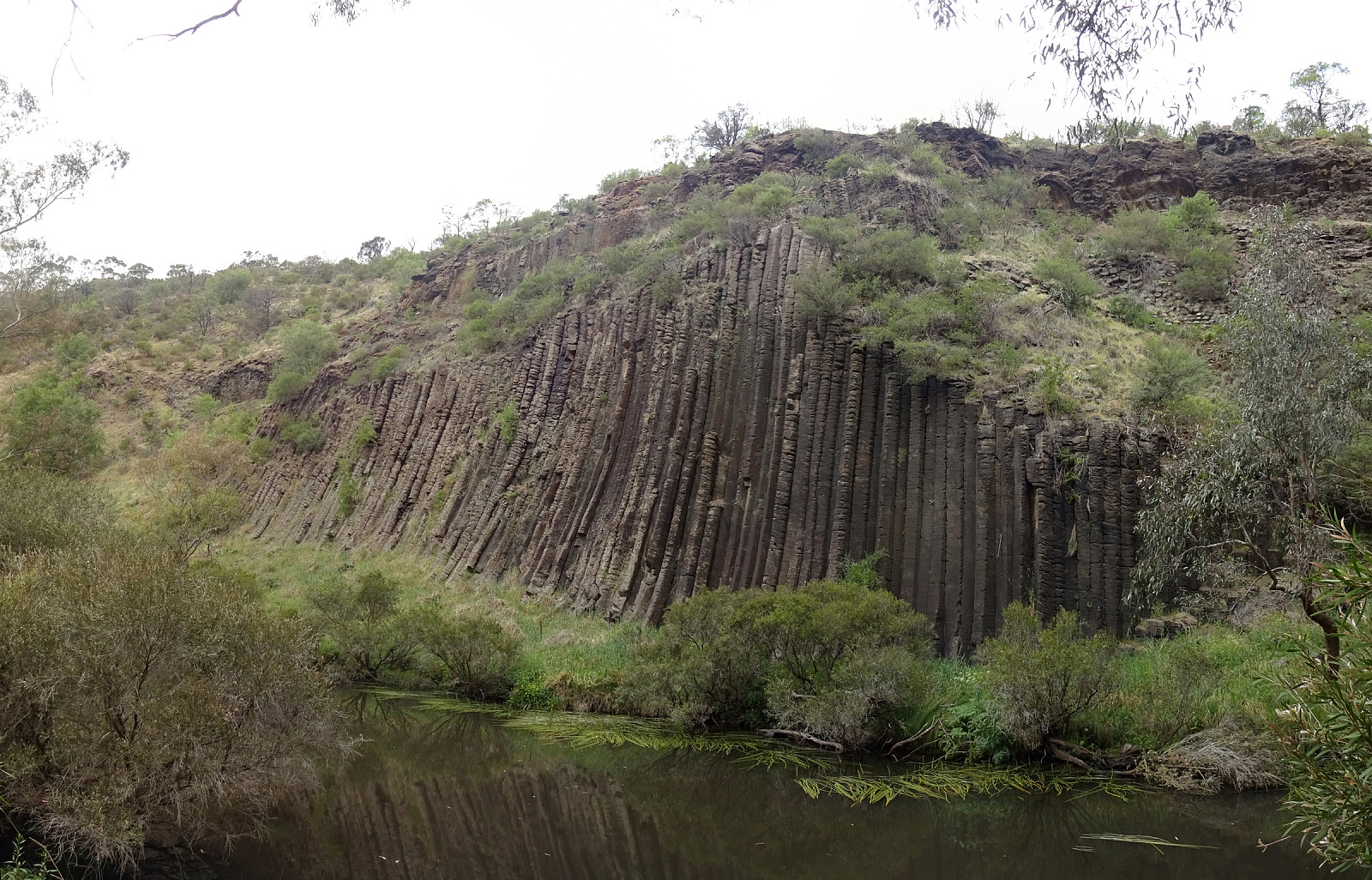 After stopping at the airport of Melbourne and before driving to Geelong in order to catch the ferry to Tasmania, we included a brief visit to the Organ Pipes National Park in the northwest of Melbourne. We found the presented information a little minimal in the sense that it did not become clear up-front that there are multiple place along Jacksons Creek that are worth seeing: Tessellated Pavement, Rosette Rock, and Organ Pipes. Luckily, we were curious enough to walk by them nonetheless! :-)
Selected photos are available as Google photo album .
See also the related FB-page Hiking around Bergen, Norway .
After stopping at the airport of Melbourne and before driving to Geelong in order to catch the ferry to Tasmania, we included a brief visit to the Organ Pipes National Park in the northwest of Melbourne. We found the presented information a little minimal in the sense that it did not become clear up-front that there are multiple place along Jacksons Creek that are worth seeing: Tessellated Pavement, Rosette Rock, and Organ Pipes. Luckily, we were curious enough to walk by them nonetheless! :-)
Selected photos are available as Google photo album .
See also the related FB-page Hiking around Bergen, Norway .
Lilly Pilly Gully
- Datum:
- 28.10.2023
- Tourcharakter:
- Wanderung
- Tourlänge:
- 2:00h
- Entfernung:
- 5,6km
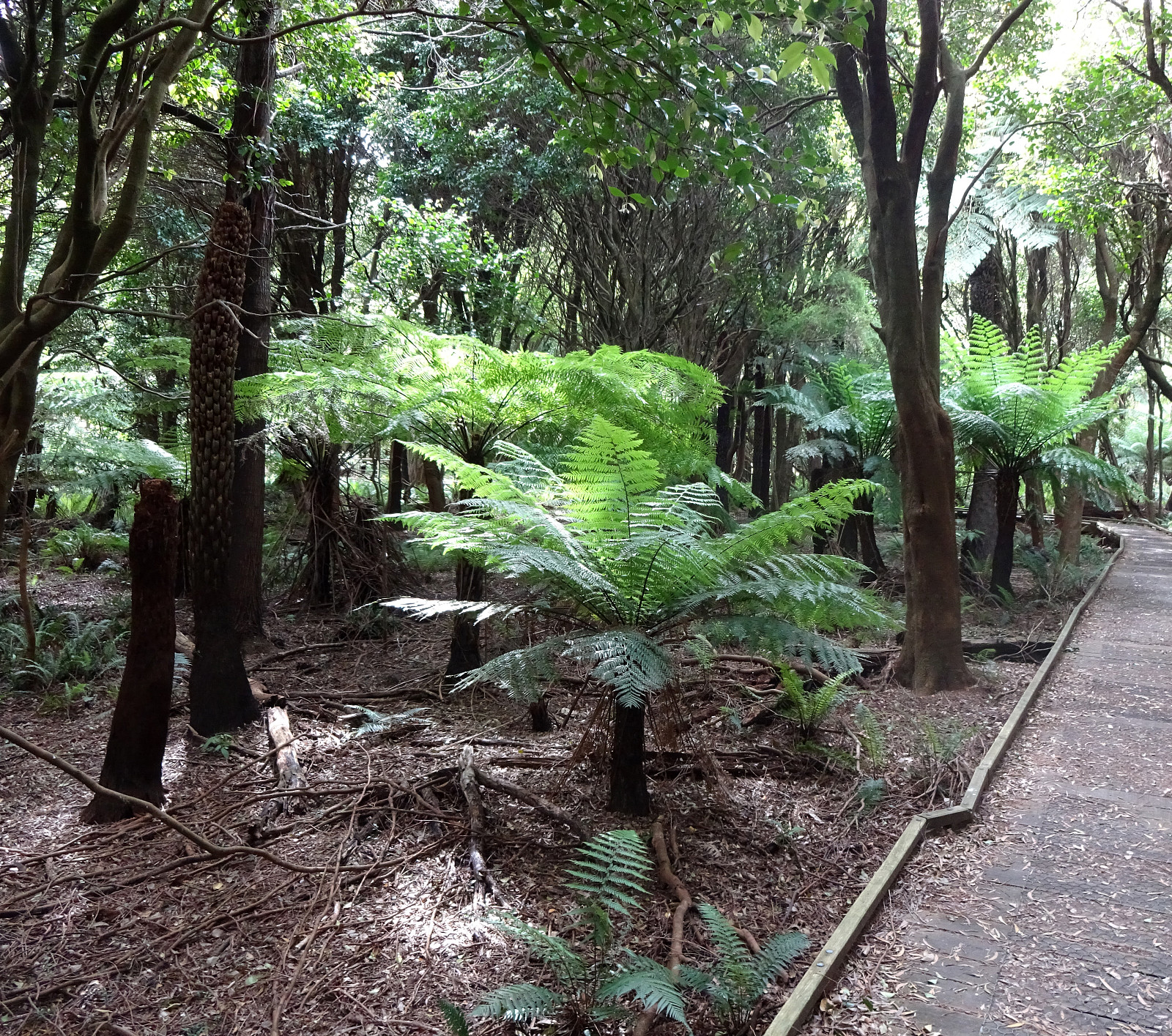 Originally, we also had an idea to hike up to Mount Oberon in Wilsons Prom. Since we were unable to find some reasonable parking near Telegraph Saddle, we made a quick change of plans to also walk into Lilly Pilly Gully, just a little bit back along the road. From the carpark, we first walk almost level into the jungle (along the Lilly Pilly Gully Trail) until we got to the starting point of the Lilly Pilly Gully Boardwalk. This little round, in the middle of a dense jungle, is really impressive. One take-away impresssion from this place is that one would not be surprised, if suddenly a dinosaur walked "around the corner"! :-) After enjoying this little round, we then completed the Lilly Pilly Gully Circuit by taking "the higher route" back (which would also bring one >>>
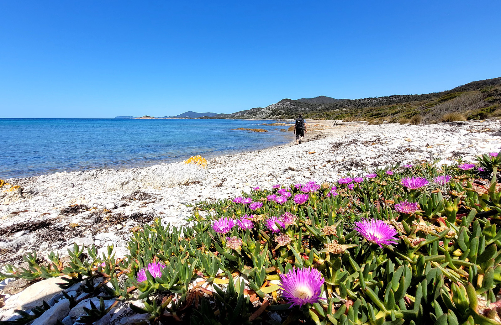
Visiting Whisky Bay
- Datum:
- 28.10.2023
- Tourcharakter:
- Bergtour
- Tourlänge:
- 1:00h
- Entfernung:
- 1,8km
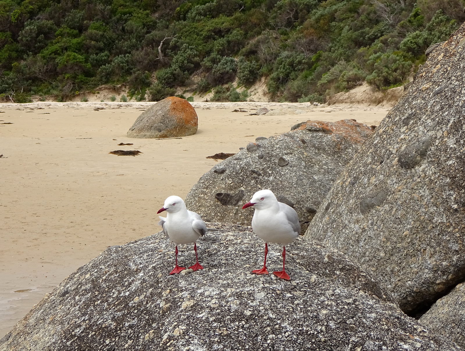 Our third stop in Wilsons Prom (Wilsons Promonotory) was to visit Whisky Bay. We started at the Picnic Bay Carpark, walking down to the Picnic Bay and Whisky Bay Lookout, first. We then continued to Whisky Bay, which impresses with its colored rocks and a nice beach! :-)
Selected photos are available as Google photo album .
See also the related FB-page Hiking around Bergen, Norway .
Our third stop in Wilsons Prom (Wilsons Promonotory) was to visit Whisky Bay. We started at the Picnic Bay Carpark, walking down to the Picnic Bay and Whisky Bay Lookout, first. We then continued to Whisky Bay, which impresses with its colored rocks and a nice beach! :-)
Selected photos are available as Google photo album .
See also the related FB-page Hiking around Bergen, Norway .
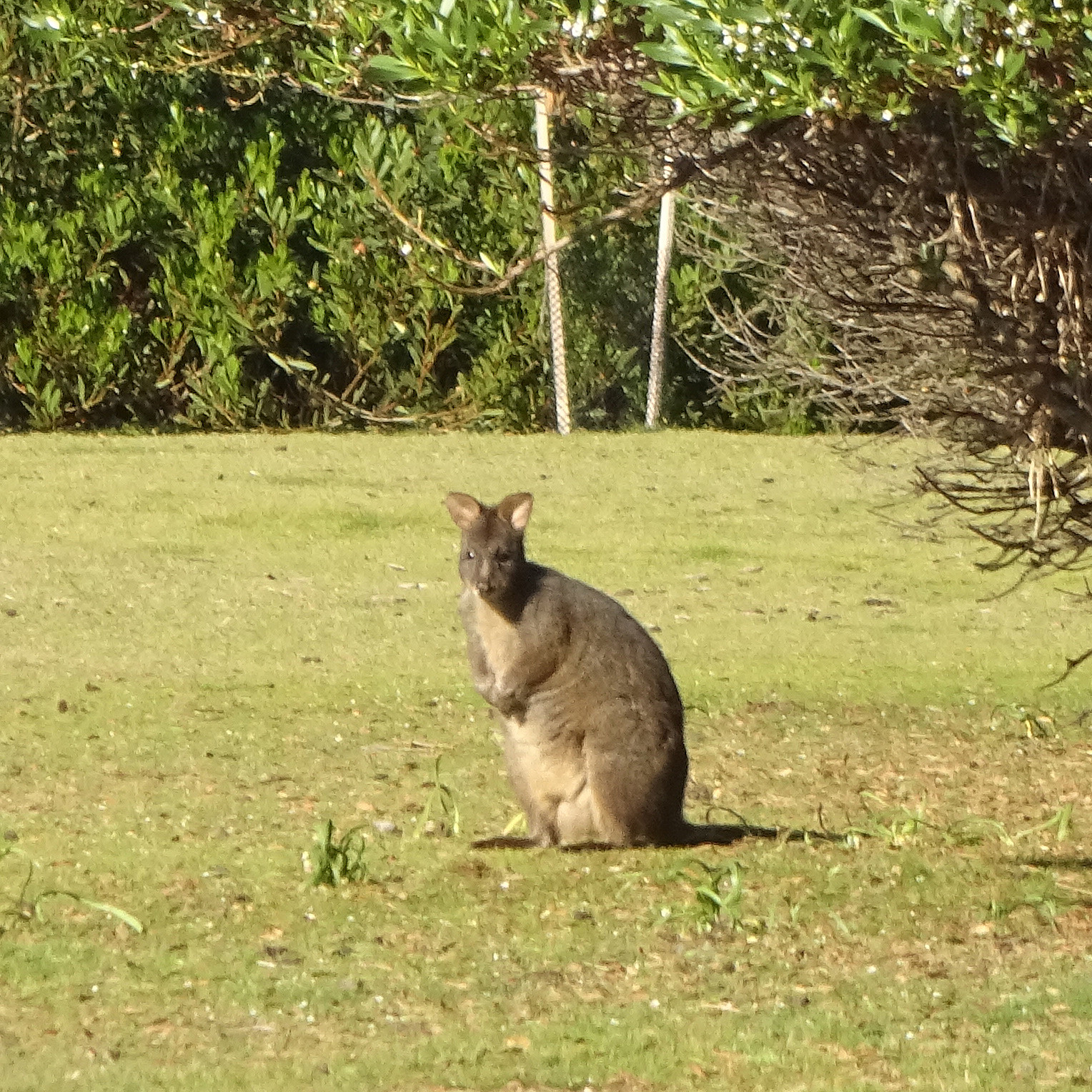
Prom Wildlife Walk
- Datum:
- 28.10.2023
- Tourcharakter:
- Spaziergang
- Tourlänge:
- 0:45h
- Entfernung:
- 2,8km
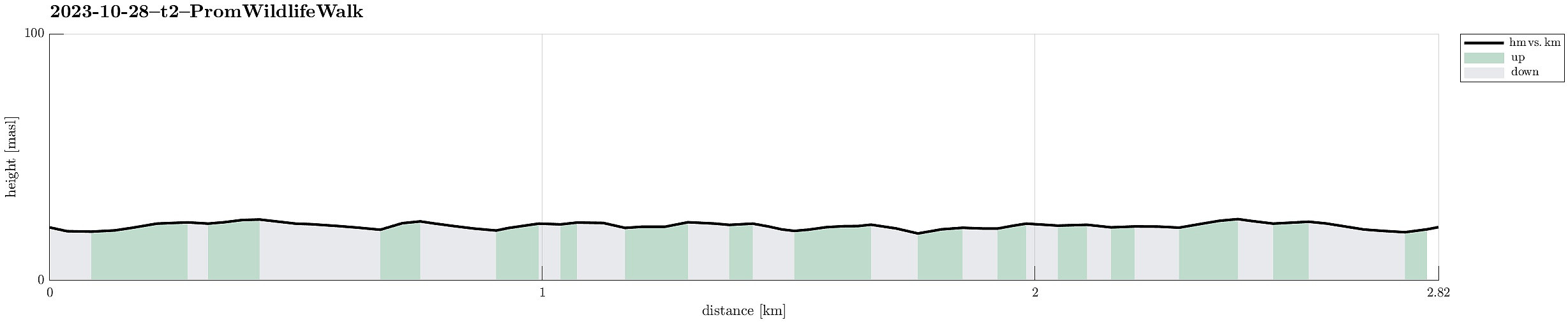 After first walking out to the Dunes of the Big Drift, we did our next stop to walk along the Prom Wildlife Walk (in Wilsons Promonotory) to see some wildlife of the park. While we "only" got to see one Wallaby, we got close to quite a few Emus, which clearly was an impressive and nice experience!
Selected photos are available as Google photo album .
See also the related FB-page Hiking around Bergen, Norway .
After first walking out to the Dunes of the Big Drift, we did our next stop to walk along the Prom Wildlife Walk (in Wilsons Promonotory) to see some wildlife of the park. While we "only" got to see one Wallaby, we got close to quite a few Emus, which clearly was an impressive and nice experience!
Selected photos are available as Google photo album .
See also the related FB-page Hiking around Bergen, Norway .
Exploring the Dunes of the Big Drift
- Datum:
- 28.10.2023
- Tourcharakter:
- Bergtour
- Tourlänge:
- 2:00h
- Entfernung:
- 6,7km
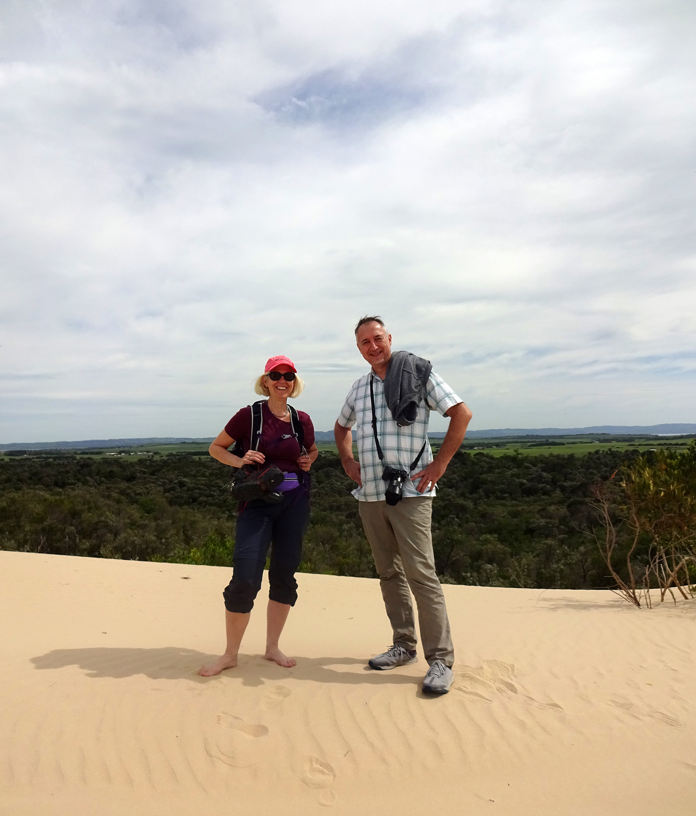 After rounding off the conference in Melbourne, we were ready to explore Victoria a bit. Our first target was Wilsons Prom (Wilsons Promontory) in the southeast of Melbourne. Before driving "all the way" into Wilsons Prom, we started with an exploration of the Dunes of the Big Drift. Following a well-marked trail from the road, we easily connected to the dunes. All this rather large area of sand dunes, surrounded by green nature (and the sea in the west), is a bit surreal and really an interesting spot to visit. Definitely worth the short walk! :-)
Selected photos are available as Google photo album .
See also the related FB-page Hiking around Bergen, Norway .
After rounding off the conference in Melbourne, we were ready to explore Victoria a bit. Our first target was Wilsons Prom (Wilsons Promontory) in the southeast of Melbourne. Before driving "all the way" into Wilsons Prom, we started with an exploration of the Dunes of the Big Drift. Following a well-marked trail from the road, we easily connected to the dunes. All this rather large area of sand dunes, surrounded by green nature (and the sea in the west), is a bit surreal and really an interesting spot to visit. Definitely worth the short walk! :-)
Selected photos are available as Google photo album .
See also the related FB-page Hiking around Bergen, Norway .
