Archiv - Nach Datum
Archiv - Nach Aktivität
-
Andere Tour (1)
- Kayaking (1)
-
Andere Wintertour (4)
- Schneeschuhtour (4)
-
Fahrradtour (137)
- Fahrradtour Straße (9)
- Fahrradtour gemischt (51)
-
Fußtour (740)
- Bergtour (363)
- Jogging (18)
- Spaziergang (89)
- Wanderung (270)
-
Skitour (4)
- Tourenskilauf (4)
Archiv - Nach Geografie
Peakbookfreunde


Gesammelte Listen
-
Bergen ≥ 50m pf. og ≥ 100 m.o.h.
(87/89)
 97%
97% -
Most dominating tops of the Bergen peninsula
(68/75)
90%
-
Utvalgte topper og turmål i Bergen
(316/350)
90%
-
Alle topper i Bergen
(357/398)
89%
-
Opptur Bergen
(100/113)
88%
-
De syv fjell rundt Bergen
(6/7)
85%
-
Sund ≥ 50m pf.
(14/18)
77%
-
Os ≥ 50m pf.
(25/34)
73%
-
Søyler (fastmerker) i Bergen
(68/100)
68%
-
Fjell ≥ 50m pf.
(21/32)
65%

Barmaneset on Algrøyna
- Datum:
- 13.08.2022
- Tourcharakter:
- Wanderung
- Tourlänge:
- 3:00h
- Entfernung:
- 6,8km
 A nice summer day invited us to redo one of our well liked hikes on Algrøyna: to Barmaneset and back. Parking in the east of the little village on Algrøyna, along Nordre Øyavegen, we first followed the street a little further, before turning to the left and onto Kongvikvegen. Once passed Jonsokhaugen, we left the road, rounding a farm house on the way down to the innermost end of Kungvika. There, we "crossed over" to the southern side in order to end up on Barmaneset, not on Smalaneset, north of Barmaneset. Walking out to Barmaneset is then easy, following a proper trail. Once at the western end of the trail, we continued a bit further out towards Langtrotten, which always impresses with its wild nature. On the way back, we then followed "the other trail", a little >>>
Nice summer evening on Skogsøyna
- Datum:
- 01.08.2022
- Tourcharakter:
- Wanderung
- Tourlänge:
- 3:00h
- Entfernung:
- 5,9km
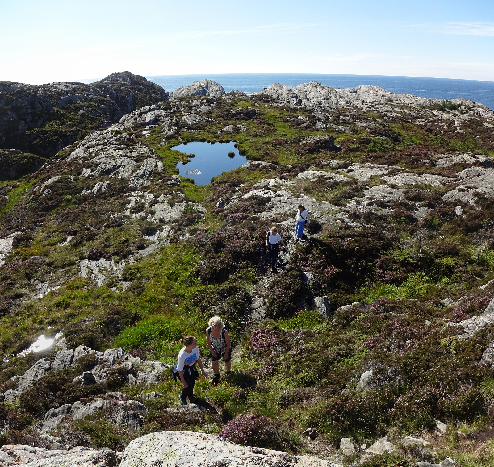
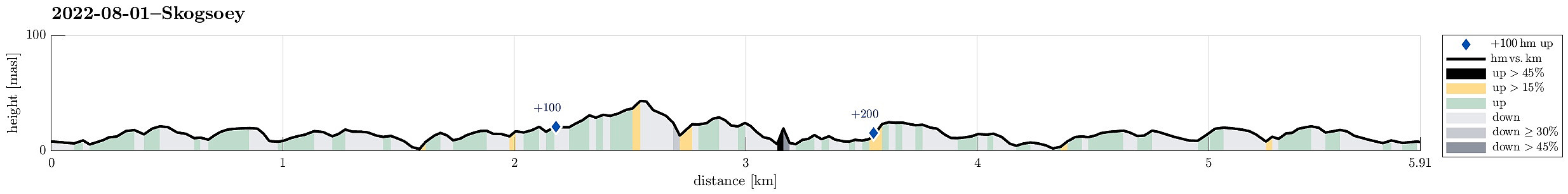 With the prediction of another nice summer day, we headed for Skogsøyna in Øygarden. After driving to Sotra in the west of Bergen, we turn northwards at the roundabout south of Kolltveit and followed road 561 all the way northwards until we turned left (in westward direction) on Ona, then following the minor road 5276 until we crossed the bridge to Skogsøyna. Since all parking places were taken near the trail head, we continued a few meters to Langholmen and parked there next to the road. We then walked the few meters back across the bridge over Langholmsundet to get to the trail head. Following the marked trail out to Skogsøytua is by now really easy (most of the previously wet areas have been covered so that it's now just a nice walk until one gets to the "high point" (at >>>
