Archiv - Nach Datum
Archiv - Nach Aktivität
-
Andere Tour (1)
- Kayaking (1)
-
Andere Wintertour (4)
- Schneeschuhtour (4)
-
Fahrradtour (137)
- Fahrradtour Straße (9)
- Fahrradtour gemischt (51)
-
Fußtour (740)
- Bergtour (363)
- Jogging (18)
- Spaziergang (89)
- Wanderung (270)
-
Skitour (4)
- Tourenskilauf (4)
Archiv - Nach Geografie
Peakbookfreunde


Gesammelte Listen
-
Bergen ≥ 50m pf. og ≥ 100 m.o.h.
(87/89)
 97%
97% -
Most dominating tops of the Bergen peninsula
(68/75)
90%
-
Utvalgte topper og turmål i Bergen
(316/350)
90%
-
Alle topper i Bergen
(357/398)
89%
-
Opptur Bergen
(100/113)
88%
-
De syv fjell rundt Bergen
(6/7)
85%
-
Sund ≥ 50m pf.
(14/18)
77%
-
Os ≥ 50m pf.
(25/34)
73%
-
Søyler (fastmerker) i Bergen
(68/100)
68%
-
Fjell ≥ 50m pf.
(21/32)
65%

Høgafjellet and Haganesfjellet from Buabrekko
- Datum:
- 26.03.2022
- Tourcharakter:
- Wanderung
- Tourlänge:
- 3:00h
- Entfernung:
- 8,6km
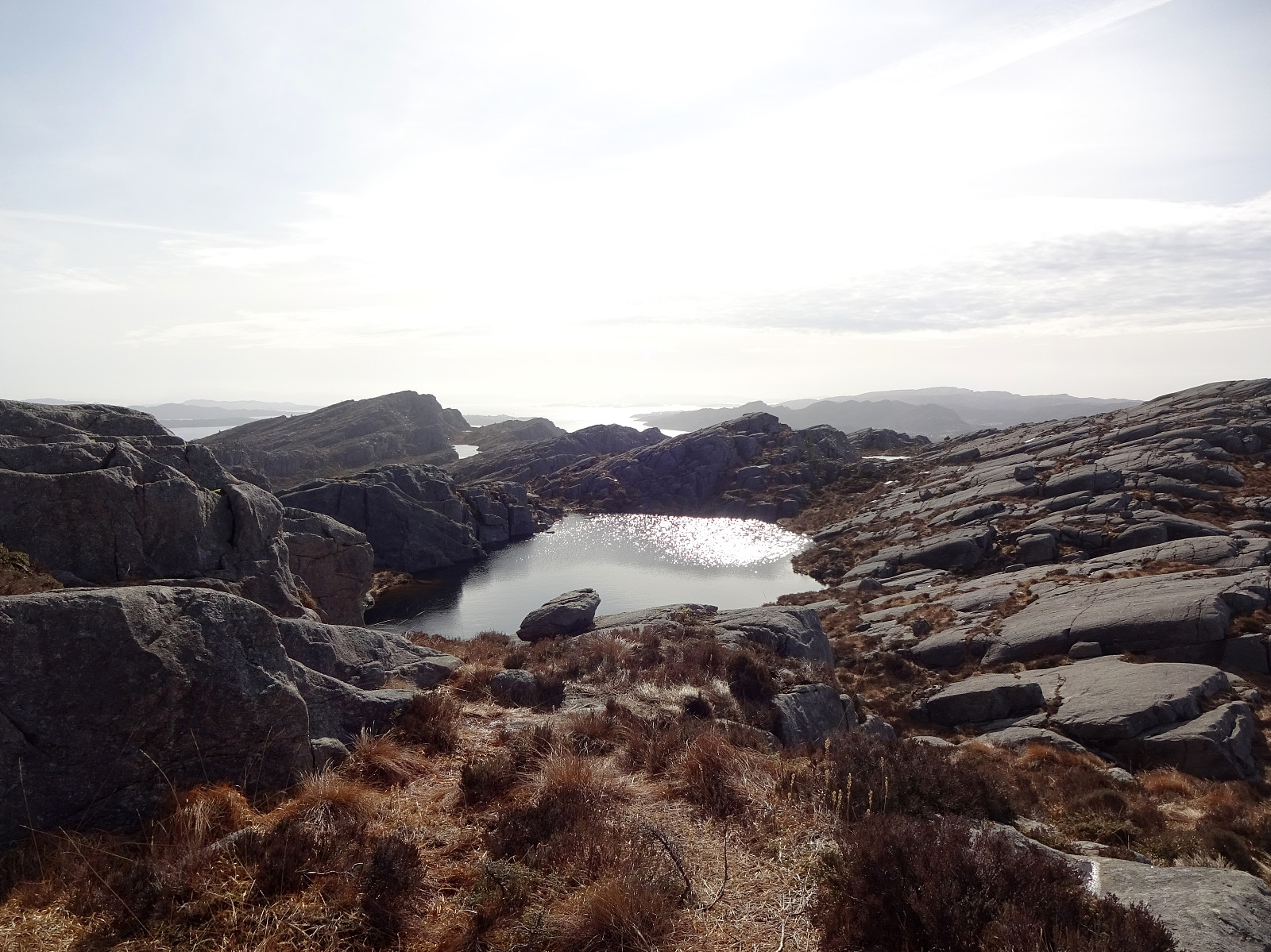 Høgafjellet and Haganesfjellet from Buabrekko. We parked near Tellnesvegen and walked down Buabrekko, crossing over the stream down from Kvernavatnet where it enters Pollen at its very northern end. On the other, eastern side, a trail leads up to the northern end of Ravnafjellet. Originally, we had planned to find a minor trail that should have forked off somewhere half way up in northeastern direction. Since we had not found this trail, we quickly found ourselves at the northern end of Ravnafjellet. There, we left the trail and continued through some relatively wet terrain northwards. Basically right west of Varden, we then found a good spot for ascending to the "next level", north of Vedatåna. There, we then also connected to a trail that circles Varden in its west. After >>>
Førdesveten from Kleppe
- Datum:
- 20.03.2022
- Tourcharakter:
- Wanderung
- Tourlänge:
- 3:00h
- Entfernung:
- 8,4km
 Hike to Førdesveten from Kleppe. We parked near Bjøllhaugen in the east of Kleppe and walked along the road towards Kleppe first. We then turned onto Kleppakslavegen into a northern direction, starting out ascent to Kleppaksla there. A proper trail leads all the way up, just east of Fenadalen. From Kleppaksla we then followed its northern ridge to Ramnaberget, offering some nice views into Kleppadalen in the west and across Trollavatnet in the north east. After passing by Trollavatnet, we crossed the trail leading to Veten from Kleppadalen and ascended to Storevarden in the west of Vetadalen. From there, then without a trail, we continued further north to Middagsberget. Even though Førdesveten has a prominent cliff on its western side, we still had planned to ascend to Veten from >>>
Storsåta and Stangelifjellet from Flaktveit
- Datum:
- 06.03.2022
- Tourcharakter:
- Wanderung
- Tourlänge:
- 4:00h
- Entfernung:
- 11,1km
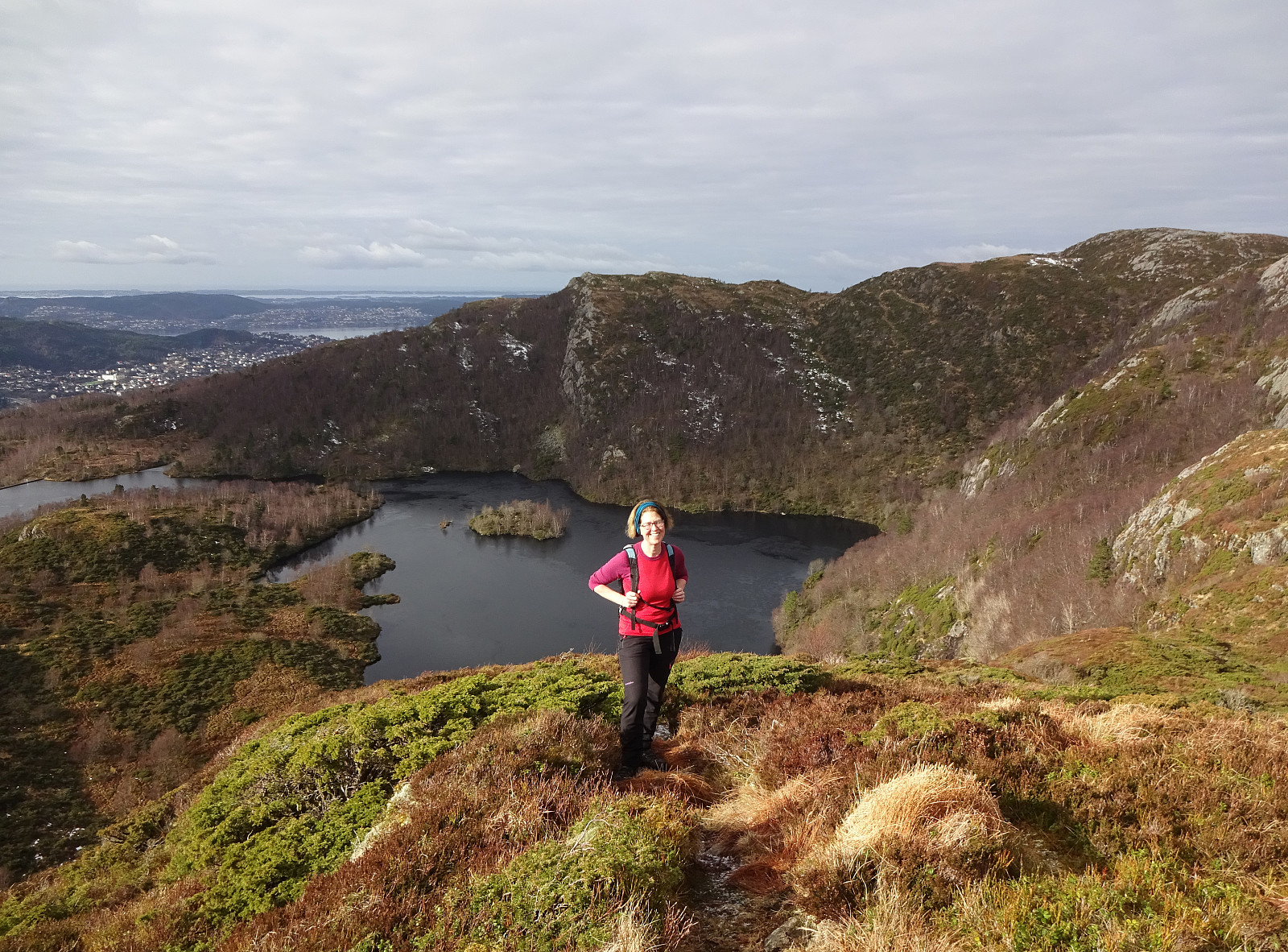 Hike to Storsåta and Vinddalen from Flaktveit. We parked where Hjortlandsvegen forks off Flaktveitsvingane and walked a little along Hjortlandsvegen, also crossing over the stream running down there in parallel to the path, until we found the trail that leads up to Storsåta at the lower end of Gjelet. This trail leads all the way up to the saddle at the upper end of Gjelet, right above Øvstebotn, on the western side of Gjelet. Instead of going directly to the saddle and then over and further to Storsåta, we first include a short excursion to Nukane right in the west of the saddle. From Nukane, it was then right over the saddle and up to Storsåta. Further, we then walked along the high ridge in the southeast of Storsåta until we came to Stangelifjellet, separating Setervatnet in the >>>
