Archiv - Nach Datum
Archiv - Nach Aktivität
-
Andere Tour (1)
- Kayaking (1)
-
Andere Wintertour (4)
- Schneeschuhtour (4)
-
Fahrradtour (120)
- Fahrradtour Straße (5)
- Fahrradtour gemischt (38)
-
Fußtour (732)
- Bergtour (362)
- Jogging (18)
- Spaziergang (88)
- Wanderung (264)
-
Skitour (4)
- Tourenskilauf (4)
Archiv - Nach Geografie
Peakbookfreunde
Hillefjellet
- Datum:
- 13.07.2014
- Tourcharakter:
- Wanderung
- Tourlänge:
- 4:00h
- Entfernung:
- 10,1km
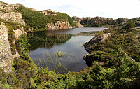 Someone (Leif Algerøy?) has put really a lot of effort into preparing nice hiking choices on Algrøyna -- wow! :-) The tour to Sandeie is really worth the lengthy approach (driving to Algrøyna)!
Selected photos are available as Google photo album .
Fedje
- Datum:
- 12.07.2014
- Tourcharakter:
- Wanderung
- Tourlänge:
- 4:00h
- Entfernung:
- 12,7km
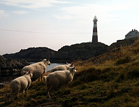 Nice summer hike around Fedje. The historic site (in the northwest of Fedje) is also quite interesting -- telling from hard times, not too long ago...
Selected photos are available as Google photo album .
Kjøttvikvarden
- Datum:
- 02.07.2014
- Tourcharakter:
- Bergtour
- Tourlänge:
- 6:00h
- Entfernung:
- 16,9km
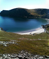 Taking the fast ferry from Hammerfest (check the schedule as this ferry is not going equally every day!) to Akkarfjord and hiking from there -- great experience! :-)
Evening excursion from Hammerfest
- Datum:
- 01.07.2014
- Tourcharakter:
- Bergtour
- Tourlänge:
- 2:00h
- Entfernung:
- 5,4km
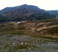 After arriving in Hammerfest quite late this day, I only made a quick and medium-short hike in the hills nearby the city. It was interesting to see, how Hammerfest struggles with all the reindeer around (having built a major fence, not at the least, for example). And, yes, you meet many of them just a "few steps" away from the city...
Note: I found it interesting that I could not find out, whether the tops, which I visited, have any names (and if so, which ones) -- if anyone knows, then please let me know! :-)
Skattørfjellet
- Datum:
- 27.06.2014
- Tourcharakter:
- Bergtour
- Tourlänge:
- 3:00h
- Entfernung:
- 6,3km
 Starting from Skattøra (right after the bridge to Skjervøya), we first read about some interesting history of Skattøra, before we ascend to Skattørfjellet (no path, partially a bit of climbing and some minor bush war). Fantastic view from the top! :-)
Skogsøytua
- Datum:
- 21.06.2014
- Tourcharakter:
- Wanderung
- Tourlänge:
- 2:00h
- Entfernung:
- 4,8km
 Again and again a nice little hike to the outermost rocks of Øygarden!
Livarden
- Datum:
- 19.06.2014
- Tourcharakter:
- Bergtour
- Tourlänge:
- 4:00h
- Entfernung:
- 11,6km
 Livarden is a nice walk ( from Totland ), especially when walking down later the day (into the evening sun -- if there is any, of course)!
Selected photos are available as Google photo album .
Sydpolen
- Datum:
- 24.05.2014
- Tourcharakter:
- Bergtour
- Tourlänge:
- 4:00h
- Entfernung:
- 11,9km
 Sydpolen from Brekkjedalen is again and again a very nice tour!
Web page WestCoastPeaks.com provides useful information about S. Gullfjellstoppen (Sydpolen)
and also Petter Bjørstad has a useful page about Sydpolen .
Hananipa
- Datum:
- 18.05.2014
- Tourcharakter:
- Bergtour
- Tourlänge:
- 4:00h
- Entfernung:
- 11,2km
 Hananipa from Skulestad (and back via Trollabotshaugen) was a nice round tour in beautiful landscape and with fantastic views over the fjord!
Web page WestCoastPeaks.com provides useful information about Hananipa, Raudnipa, Krånipa, and Raudfjell
and also Petter Bjørstad has a useful page about Hananipa .
Web page UT.no from the Norwegian Trekking Association recommends this hike up and down Hananipa (only part of our hike, though).
Malmangersnuten
- Datum:
- 15.05.2014
- Tourcharakter:
- Bergtour
- Tourlänge:
- 3:00h
- Entfernung:
- 7,4km
 Good hike from Rosendal on a very wet day! :-)
Web page WestCoastPeaks.com provides useful information about Malmangersnuten
and also Petter Bjørstad has a useful page about Malmangersnuten .


