Blåmanen (08.02.2014)

| Startpunkt | Svartediksveien (65m) |
|---|---|
| Endpunkt | Svartediksveien (65m) |
| Tourcharakter | Bergtour |
| Tourlänge | 3h 00min |
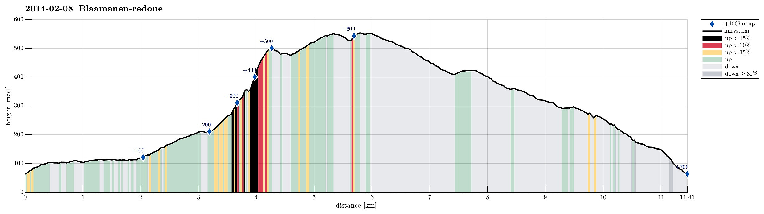
| Entfernung | 11,5km |
| Höhenmeter | 695m |
| GPS |
|
| Besteigungen | Blåmanen Vest (552m) | 08.02.2014 |
|---|---|---|
| Blåmanen SØ (505m) | 08.02.2014 | |
| Besuche anderer PBE | BT-bu (296m) | 08.02.2014 |
| Brushytten (412m) | 08.02.2014 | |
| Kobbeltveit (ruin) (214m) | 08.02.2014 | |
| Lappen søyle (99m) | 08.02.2014 | |
| Lundekvam (tuft) (495m) | 08.02.2014 | |
| Røde Kors Buen (tuft) (415m) | 08.02.2014 | |
| Solhaugen søyle (107m) | 08.02.2014 | |
| Steinhus i Tarlebøveien (176m) | 08.02.2014 |
Note that this track has been created a posteriori, i.e., from memory, not automatically recorded.
Trip Summary
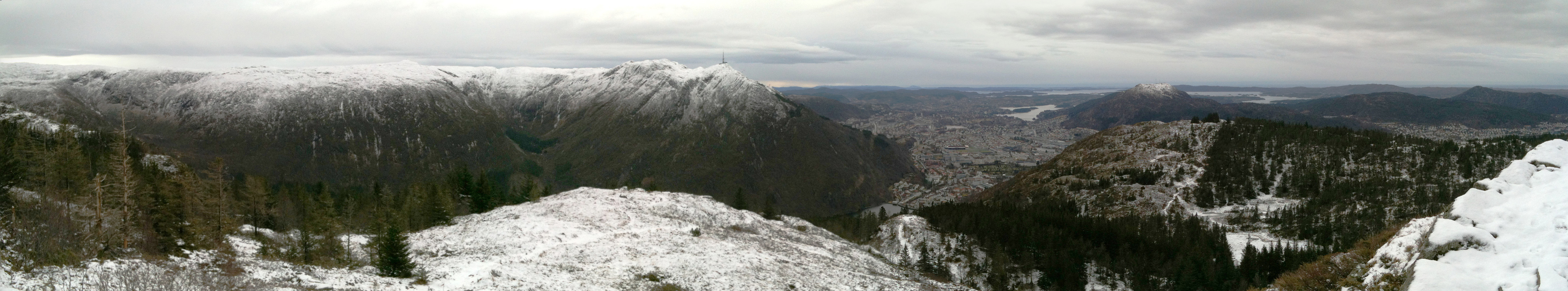
Blåmannen from the back side (first along Svartediket, then Tarlebøveien up until the path leaves to the left and up towards Blåmannen) -- a nice hike! :-)
Photos
Selected photos are available as Google photo album.

Benutzerkommentare