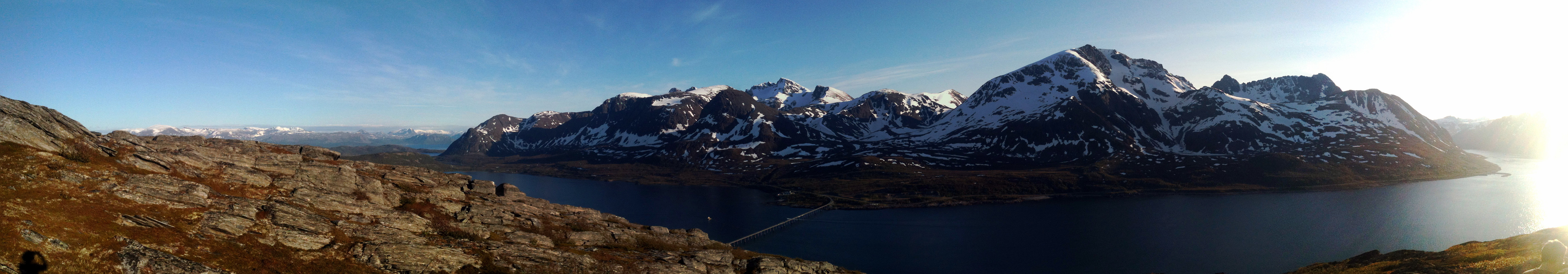
Skattørfjellet (27.06.2014)

| Startpunkt | Skattøra (10m) |
|---|---|
| Endpunkt | Skattøra (10m) |
| Tourcharakter | Bergtour |
| Tourlänge | 3h 00min |
| Entfernung | 6,3km |
| Höhenmeter | 397m |
| GPS |
|
| Besteigungen | Skattørfjellet (347m) | 27.06.2014 |
|---|
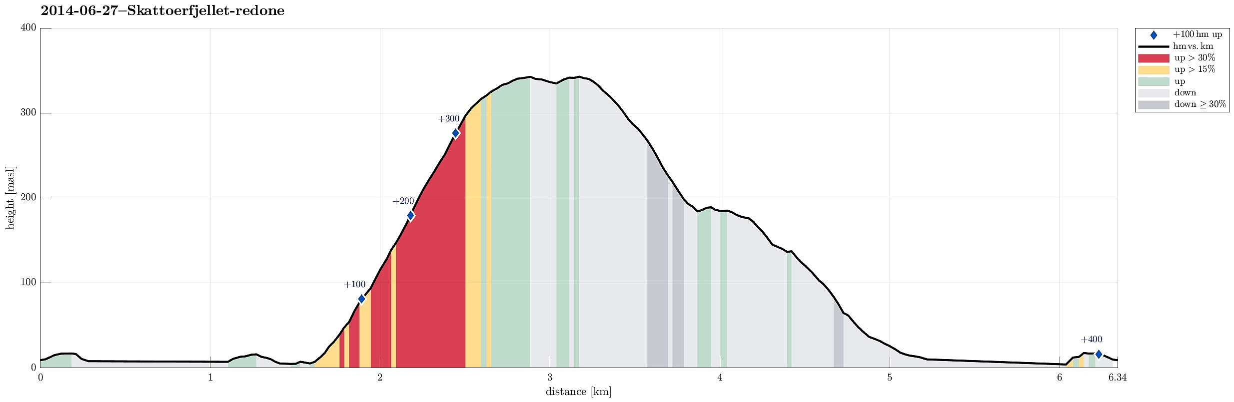
Note that this track has been created a posteriori, i.e., from memory, not automatically recorded.
Trip Summary
Starting from Skattøra (right after the bridge to Skjervøya), we first read about some interesting history of Skattøra, before we ascend to Skattørfjellet (no path, partially a bit of climbing and some minor bush war). Fantastic view from the top! :-)

Benutzerkommentare