Lundåsane from Hausdalen (14.09.2025)

| Startpunkt | Hausdalen (70m) |
|---|---|
| Endpunkt | Hausdalen (70m) |
| Tourcharakter | Wanderung |
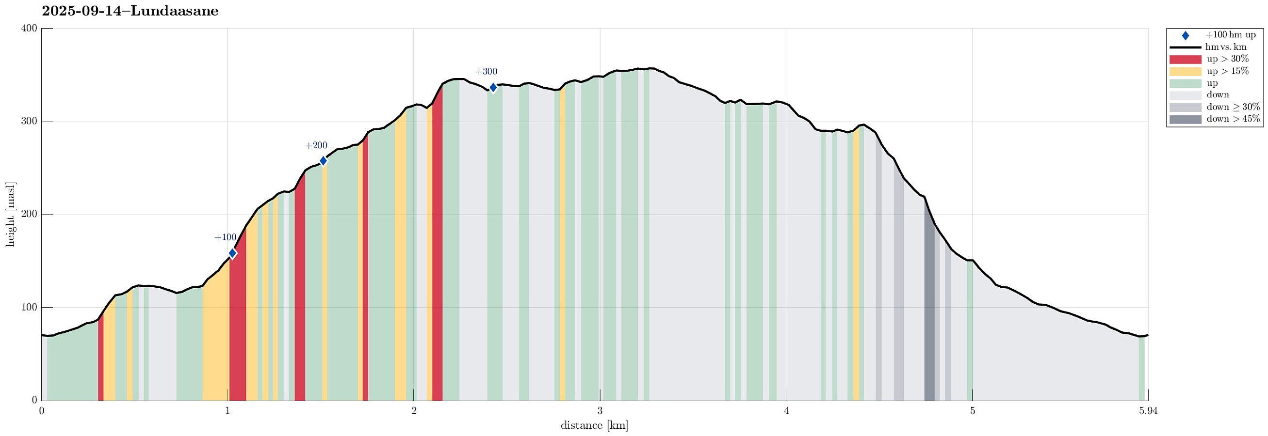
| Tourlänge | 3h 00min |
| Entfernung | 5,9km |
| Höhenmeter | 374m |
| GPS |
|
| Besteigungen | Lundåsane (361m) | 14.09.2025 |
|---|---|---|
| Storerinden (126m) | 14.09.2025 | |
| Besuche anderer PBE | Såta (329m) | 14.09.2025 |
Trip Summary
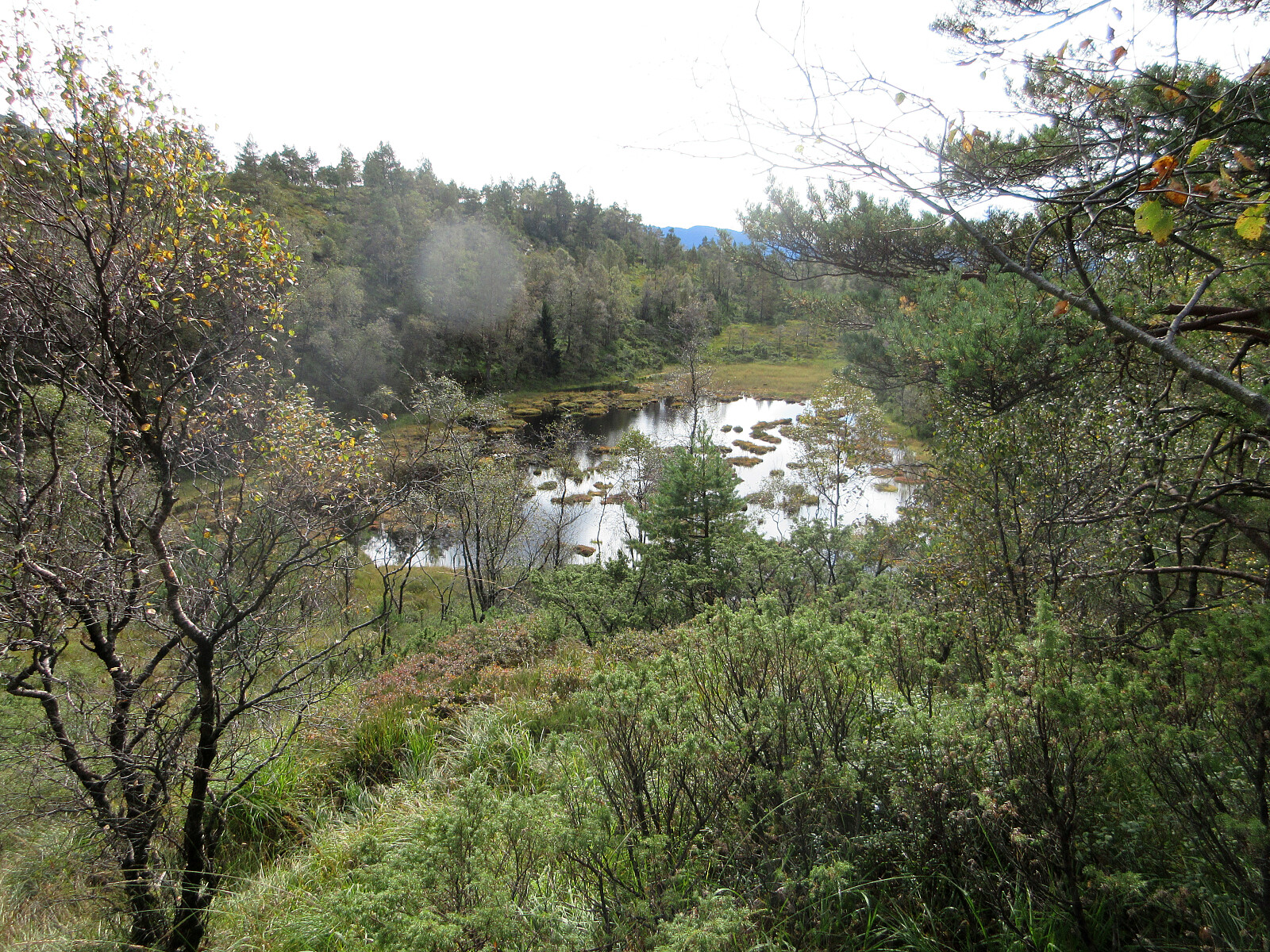
We wished to explore the Hausdalen-side of Lundåsane and thus drove to Hausdalen, where we parked a bit south of Håland. From there, we first walked up a gravel road that extends parallel to Hålandsbekken. About half way up, I decided that I wished to explore Storerinden, in the east of Slokadalen, also. Stepping up to this hill was straight-forward, while not on a trail, though. From Storerinden, while not really a prominent "peak", I still got a nice view towards Hausdalshorgi (it's always nice to see Hausdalshorgi!). I then continued across the ridge to re-connect with the gravel road near the T-junction, where one leg of the gravel road extends a bit further up to Plasset. Instead of following the gravel road any further, though, I used a trail (maybe more a former trail) to get up to Bygrinda, where I was impressed by a massive stone wall that stands there on the ridge in the SE of Svartedalen. I then made my way (without a trail) up this ridge (with Svartedalen on my left). After getting up to about 225 masl, the terrain became more varied with a few "intermediate" hills, interleaved with some pretty wet spots. I still found my way without troubles up to Eikerinden and from there further into the direction of Skredlia. After passing through underneath the power line, which comes up across Skredlia, I then headed mostly northwards to ascend up a hill in the south-east of Orretua. There I enjoyed yet another nice view to Hausdalshorgi :-) before "turning around" for getting across the wet heights to Lundåsane. Once on my way "up" to Lundåsane, I got the (faint) impression of possibly following a "trail" -- at least every now and then (one can see some color applied to some trees, but on the ground there's not much of a trail). I then crossed over the ridge of Lundåsane in southwestern direction. From the "top" of Lundåsane, I also got a glimpse of Frotveitvatnet further in the west. From Lundåsane, I then continued towards Stemmedalshaugane (in the NW of Stemmedalen). For a while, again, I could see me stepping along a "trail". I then descended into Stemmedalen to have a look at Bylitjørna (which indeed is a nice little lake!). Since it then was time for me to get back down to Hausdalen, I decided to try my luck on the northeastern side of Stemmedalen (I first had thought to get to the other side of Stemmedalen and up to Stemmedalshaugane there, but Stemmedalen proved to be too wet for a crossing). I thus found my way towards the northeastern end of Stemmedalen (it's wet there, yes!), before starting my descend via Hålandslia. This descent (without a trail, at least in all of the upper parts) is quite a bit steep and requires careful stepping. I chose a diagonal approach, where it looked slightly less steep, but it was a tiny bit of a challenge to get down there without any accident. From somewhere slightly below 200 masl, then, I connected with a (former?) forest road, not marked on Norgeskart, that then lead me down to Bygrinda very conveniently. Walking the down the gravel road to the car was straight-forward. All in all, it can be reported that southeastern flank of Lundåsane has more to offer than what one possibly thinks when considering the rather smooth (and wet) heights up there! :-)
Photos
Selected photos are available as Google photo album.
Useful Resources
See also the related FB-page Hiking around Bergen, Norway.

Benutzerkommentare