Hiking down from Mt. Hiei (22.06.2025)

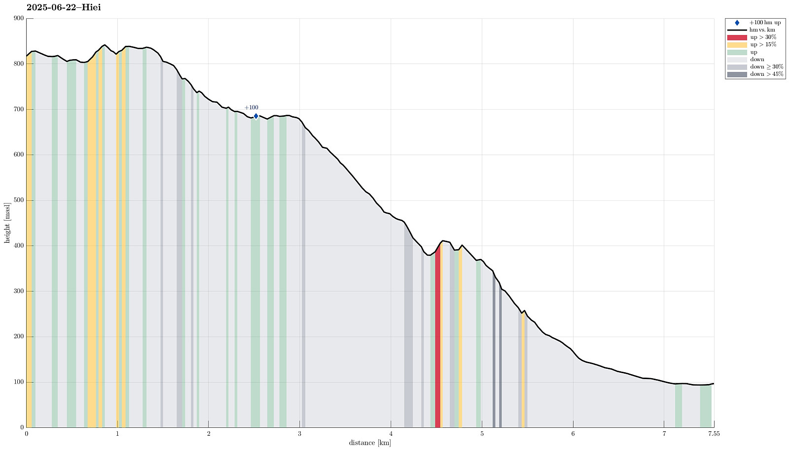
| Startpunkt | Mountain Exit of the Eizan Ropeway (815m) |
|---|---|
| Endpunkt | Hieizan-Sakamoto Station (95m) |
| Tourcharakter | Wanderung |
| Tourlänge | 4h 00min |
| Entfernung | 7,5km |
| Höhenmeter | 175m |
| GPS |
|
| Besteigungen | Mt. Hiei (848m) | 22.06.2025 |
|---|---|---|
| Besuche anderer PBE | Enryaku-ji Temple (685m) | 22.06.2025 |
Trip Summary
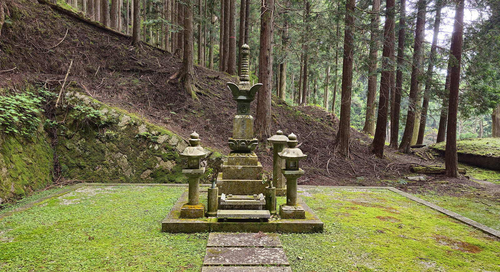
We wished to visit Mt. Hiei in the NE of central Kyoto, but were not ready to hike up to it, given the high summer temperatures. We thus chose to take, first, the Eizan Cable Car and, then, the Eizan Ropeway, up to a place near the top of Mt. Hiei. Walking eastwards from there, we first made it to the actual top of Mt. Hiei, before descending along a hiking trail to the graveyard behind the Enryakuji Temple. Walking through this graveyard in the forest, early in the morning, was a special moment. After visiting the Enryakuji Temple (several of the buildings), we then hiked down the mountain along a hiking trail towards the East (in parallel to the cable car that comes up from Sakamoto). It was impressive to see that quite a few others hiked in the opposite direction, i.e., up the mountain on this very warm day!
Photos
Selected photos are available as Google photo album.
Useful Resources
See also the related FB-page Hiking around Bergen, Norway.

Benutzerkommentare