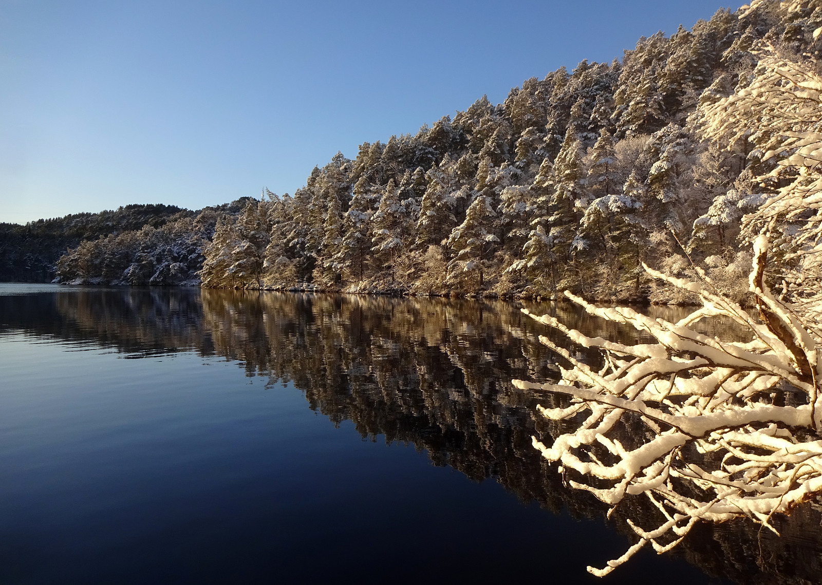
Stroll through snow and sun around Bjørndalsvatnet (01.01.2025)

| Startpunkt | Varden (45m) |
|---|---|
| Endpunkt | Varden (45m) |
| Tourcharakter | Bergtour |
| Tourlänge | 2h 30min |
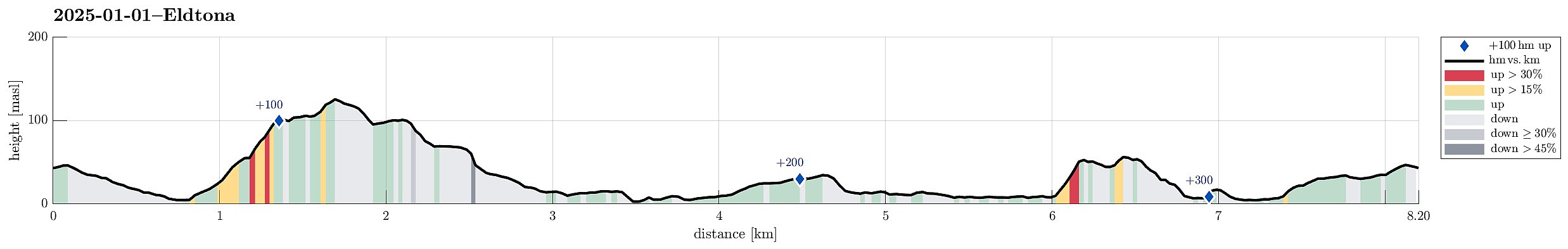
| Entfernung | 8,2km |
| Höhenmeter | 363m |
| GPS |
|
| Besteigungen | Eldtona (128m) | 01.01.2025 |
|---|---|---|
| Besuche anderer PBE | Øst for Elvareidet (60m) | 01.01.2025 |
Note that this track has been created from memory, i.e., it was not recorded automatically.
Trip Summary
A snowy day with nice weather: a good reason for making a stroll in the neighborhood! We started with Eldtona on Knappefjellet before "turning around" and heading northwards to make a round around Bjørndalsvatnet before returning back to Varden. Not a very long hike, but very nice with the snow and some sun, also! :-)
Photos
Selected photos are available as Google photo album.
Useful Resources
See also the related FB-page Hiking around Bergen, Norway.

Benutzerkommentare