Knappen (02.06.2024)

| Startpunkt | Varden (45m) |
|---|---|
| Endpunkt | Varden (45m) |
| Tourcharakter | Bergtour |
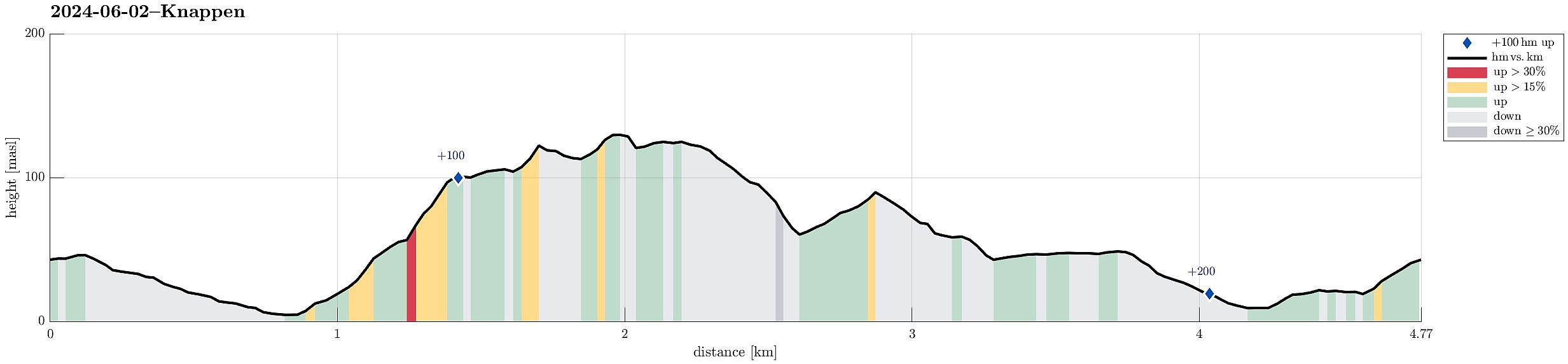
| Tourlänge | 0h 45min |
| Entfernung | 4,8km |
| Höhenmeter | 237m |
| GPS |
|
| Besteigungen | Eldtona (128m) | 02.06.2024 |
|---|---|---|
| Knappen (135m) | 02.06.2024 | |
| Besuche anderer PBE | Knappen søyle (128m) | 02.06.2024 |
Trip Summary
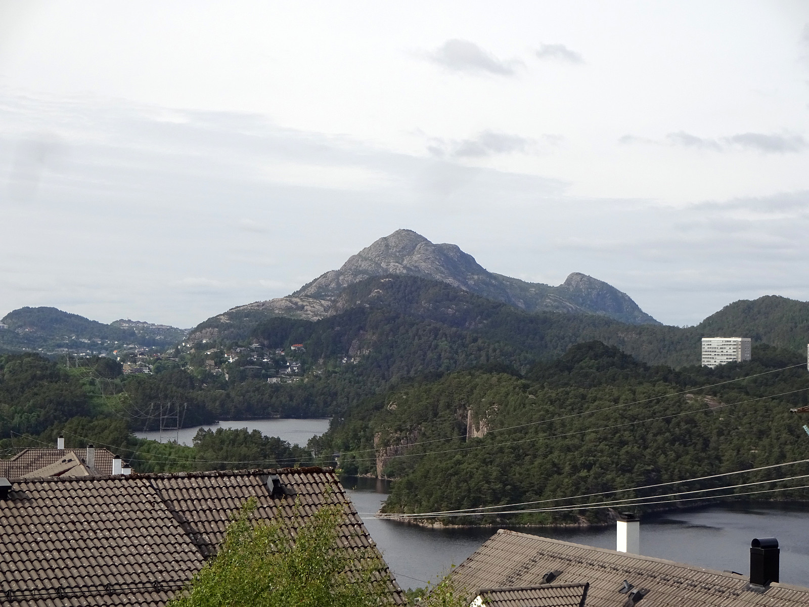
To get some fresh air, we decided to do a quick round over Knappen, approaching it via Sandeidbrotet (up to Eldtona, first). After crossing over to Såta on Knappen, we then descended furthre southwards (via Hesthaugen). Before stepping out on Knappenveien, we saw some (new?) signs near the sports area, suggesting a trail through the forest to Knappentunet. Following this trail, we first made quick progress into the right direction. After a while, however, the trail seemed to cross over some wet area at Hesthaugen, becoming less visible (or not at all, actually). Following our basic sense of orientation, we crossed through the forest into the right direction, connecting to Knappenveien at Knappentunet in the south of Knappatjørna. From there, it was then straight-forward (mostly) to get back to Varden. :-)
Useful Resources
See also the related FB-page Hiking around Bergen, Norway.
Petter Bjørstad has a useful page about Knappen.
Web page UT.no from the Norwegian Trekking Association recommends another hike to Knappen.

Benutzerkommentare