Nice round through the Rocky Cape National Park (01.11.2023)

| Startpunkt | Sisters Beach Boat Ramp Parking (10m) |
|---|---|
| Endpunkt | Sisters Beach Boat Ramp Parking (10m) |
| Tourcharakter | Wanderung |
| Tourlänge | 6h 00min |
| Entfernung | 17,3km |
| Höhenmeter | 834m |
| GPS |
|
| Besteigungen | Broadview Hill (234m) | 01.11.2023 |
|---|---|---|
| Tinkers Lookout (298m) | 01.11.2023 | |
| Besuche anderer PBE | Lee-Archer Cave (25m) | 01.11.2023 |
| Sisters Beach Boat Ramp Parking (10m) | 01.11.2023 | |
| Wet Cave (40m) | 01.11.2023 |

Trip Summary
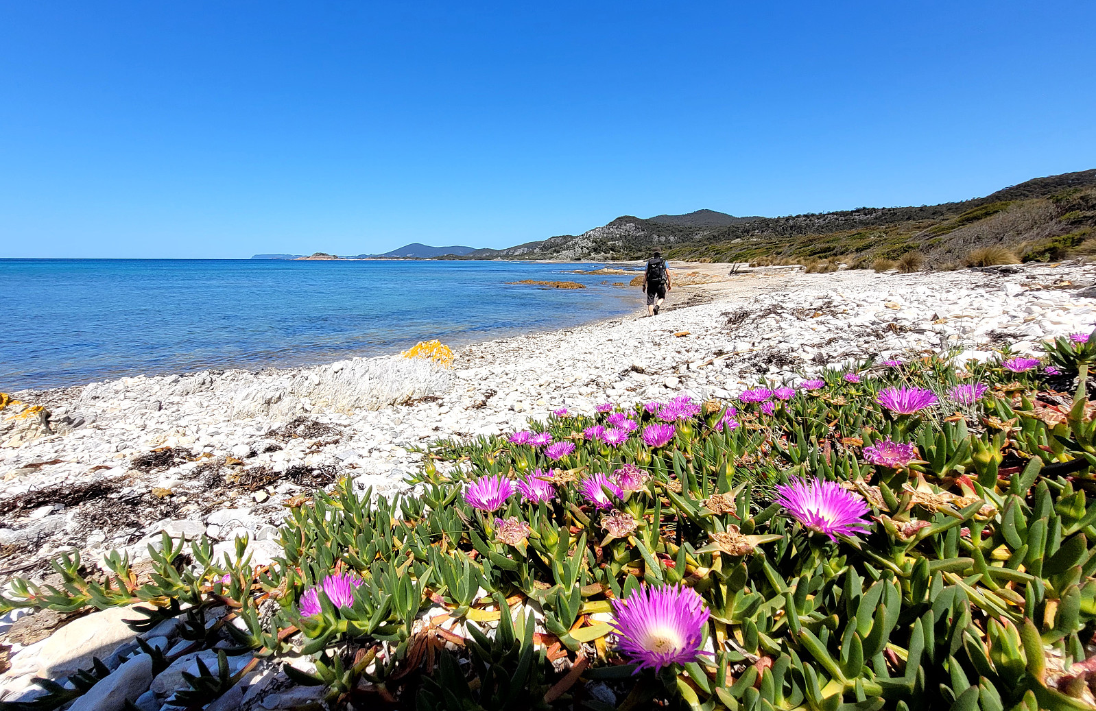
After a nice morning in Devonport, we decided to use the beautiful weather for a hike through Rocky Cape National Park. To get there, we followed the Bass Highway along the norther coast (in western, northwestern direction). In the area of Boat Harbour, we turned right and onto road C232 to Sisters Beach. In Sisters Beach, we oriented us towards the Boat Ramp (at the very northwestern end of Sisters Beach). There, we also found a good place to park the car. Since we had planned for a round through the Rocky Cape National Park, starting along the Inland route (over the hills), we aimed at the trailhead a few meters southwest of the parking place. After a few moments of searching this trailhead, we nicely located it along one of the sideroads. From there, it was then easy to follow the nicely marked trail, leading steadily uphill first (mostly in western direction). After reaching the first heights in the west of Sisters Beach, we found the place, where a minor trail forks off to Broadview Hill (in northern direction). Expecting some nice view from up there, we included also Broadview Hill (all in all, a relatively short detour anyway). While one indeed gets some wider views from Broadview Hill, one could argue that other spots along this hike offered even better views. Back on the main trail, and "down" into the "valley" in the west/southwest of Broadview Hill, came to the junction, where one can "shortcut" to Anniversary Bay (in northern direction). Since we aimed at a longer hike, we continued "straight ahead" (in mostly western direction). Following the Rocky Cape Inland Track, we soon reached the heights near Spicers Lookout. From there, it was then gently above the heights (mostly in northwestern direction) towards Tinkers Lookout. There, we turned around to get back to Sisters Beach via the Coastal Route. We started with the Blandfordia Spur, which lead us down towards the Bay with the Cathedral Rocks. But before hiking all the way down to this bay, we turned right onto the Rocky Cape Coastal Route. There, the trail is/was cut through very thick bush, opening up to the beach only meters from the ocean. Once on the beach, we continued into the direction of Sisters Beach, walking along beach after beach, all very scenic with beatiful colors and extremely clean waters. Walking along the beaches was really nice, but not all the time 100% easy. Also, a few times we had to get "back" into the bush in order to connect to the next beach. We really enjoyed this part of the hike, but one better has enough time to avoid getting stressed (it's quite a few kilometers, all in all, to get back to Sisters Beach). About half-way along all the beaches, one "cuts short" another small peninsula, just to arrive at the next beach (a beautiful, large sand beach in Anniversary Bay. On the other, southern end of this beautiful beach, one can find another "entry point" (into the bush). This leads (along the Anniversary Bay Circuit) up the hill, again, and then around it to a point, where a trail to two caves forks off (Lee-Archers Cave and the Wet Cave). After first walking down to Lee-Archers Cave (which is interesting, but not really spectacular), we continued to the Wet Cave, already very close to Sisters Beach. From there, it was then only a few meters down to the Boat Ramp of Sisters Beach. All in all, this really was a very nice hike with the return leg along all the beaches of the Coastal Route being truly a lovely highlight! :-)
Photos
Selected photos are available as Google photo album.
Useful Resources
See also the related FB-page Hiking around Bergen, Norway.

Benutzerkommentare