Liatårnet from Liaskjeret (11.08.2023)

| Startpunkt | Liaskjærshallen (30m) |
|---|---|
| Endpunkt | Liaskjærshallen (30m) |
| Tourcharakter | Wanderung |
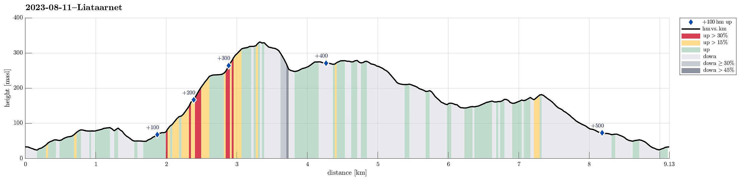
| Tourlänge | 4h 30min |
| Entfernung | 9,1km |
| Höhenmeter | 519m |
| GPS |
|
| Besteigungen | Liatårnet (341m) | 11.08.2023 |
|---|---|---|
| Besuche anderer PBE | Jonsokhaugen parkering (30m) | 11.08.2023 |
Trip Summary
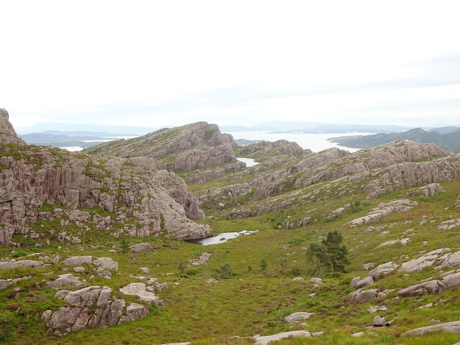
We took the car from Bergen towards the west, crossing over Sotrabrua. In the west of Bildøya, we turned south (onto Døsjevegen), driving to Liaskjeret in the east of Liatårnet. From Liaskjærshallen, we then started our hike with our first goal being the trail that leads up to Liatårnet from Hølo. To get there, we had the choice between walking along Liaskjervegen for a good stretch and the alternative of following a simple trail above (in the west) of the houses. Choosing the latter, we first walked up Elvabakkvegen to get to the nearest trail head near house #11. A few hundred meters further west (and up a little), we then turned right (northwards), aiming for Skoradalen via a simple trail. West of Skogsbrekko, however, we did not really find a good way to continue further to the trail to Liatårnet west and above of the houses. Thus, we instead descended the few meters down to Skogsbrekko, then down to Liaskjervegen, before then stepping up Hølo, again, to get to the targeted trail head. Near house #12 (and near the trail head), we first did not immediately see where the trail starts, but with a bit of help we then found it "hidden" behind a car. Once on the trail, however, the ascent to Liatårnet is straight forward and easy to find. The ascent is a bit steep, but not difficult. From Liatårnet, we then headed southwards (and down), following a trail that brought us into the vicinity of Høgafjellet. This time, we stayed on the trail, which passes by Høgafjellet in its west. Following the trail further, we made it nicely towards the west of Kattatjørna. There, we briefly considered "short-cutting" towards the southeast, but found the area in the southwest of Kattafjellet too wet. We thus connected back to the "mail trail", which brought us quickly to the west of Brattestigvatnet. After surrounding Brattestigvatnet in its south, we then stepped up to the northern ridge of Indrafjellet (Haganesfjellet). Instead of including this top, also, we immediately started our descent towards Liaskjeret, following this northern ridge of Indrafjellet down (in northern direction, passing by Risdalen). After walking around Trollhaugen in its south and east, we connected back to the trail that also was our starting point. Only a few minutes later, we were back to the car -- just in the moment when it started to rain properly! :-) Liatårnet and its southern "flank" is always very nice for a hike!
Photos
Selected photos are available as Google photo album.
Useful Resources
See also the related FB-page Hiking around Bergen, Norway.
Petter Bjørstad has a useful page about Liatårnet and also web page WestCoastPeaks.com provides useful information about Liatårnet.

Benutzerkommentare