Brøknipa from Båtaleitet, back via Borgasærtra (12.05.2023)

| Startpunkt | Båtaleitet parking (350m) |
|---|---|
| Endpunkt | Båtaleitet parking (350m) |
| Tourcharakter | Wanderung |
| Tourlänge | 6h 00min |
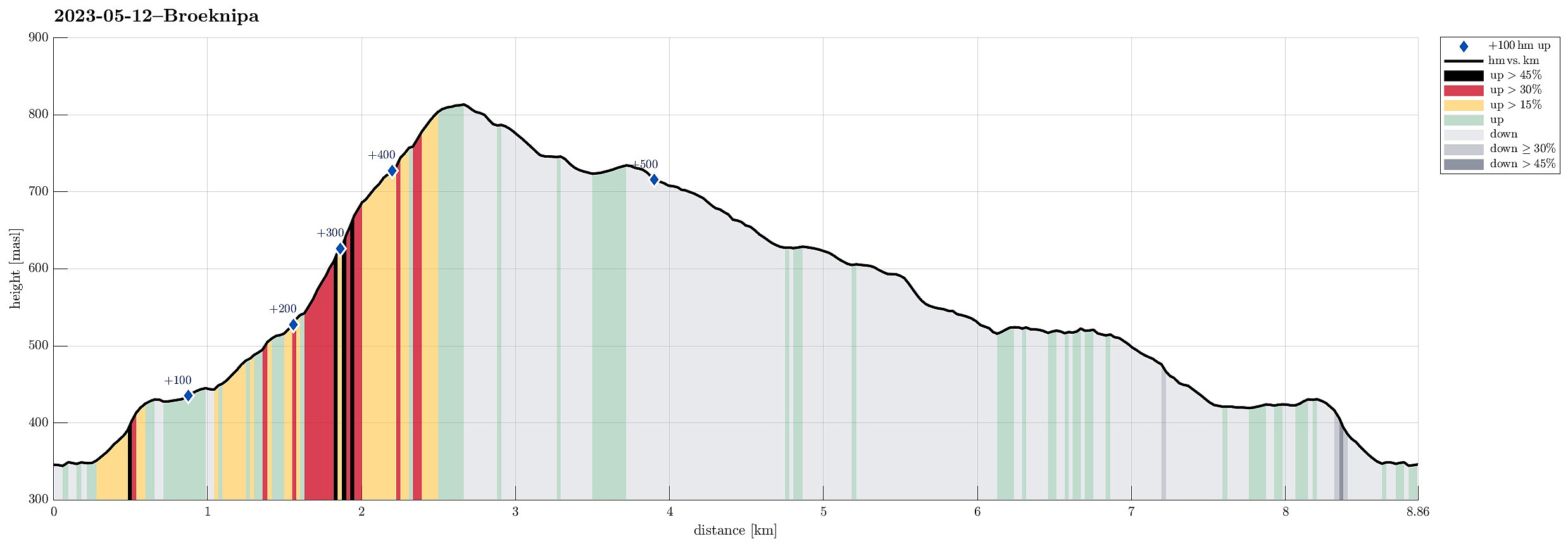
| Entfernung | 8,9km |
| Höhenmeter | 579m |
| GPS |
|
| Besteigungen | Bruviknipa (822m) | 12.05.2023 |
|---|---|---|
| Besuche anderer PBE | Borgasætra (516m) | 12.05.2023 |
| Båtaleitet p-plass (350m) | 12.05.2023 | |
| Ørnatuva (743m) | 12.05.2023 |
Trip Summary
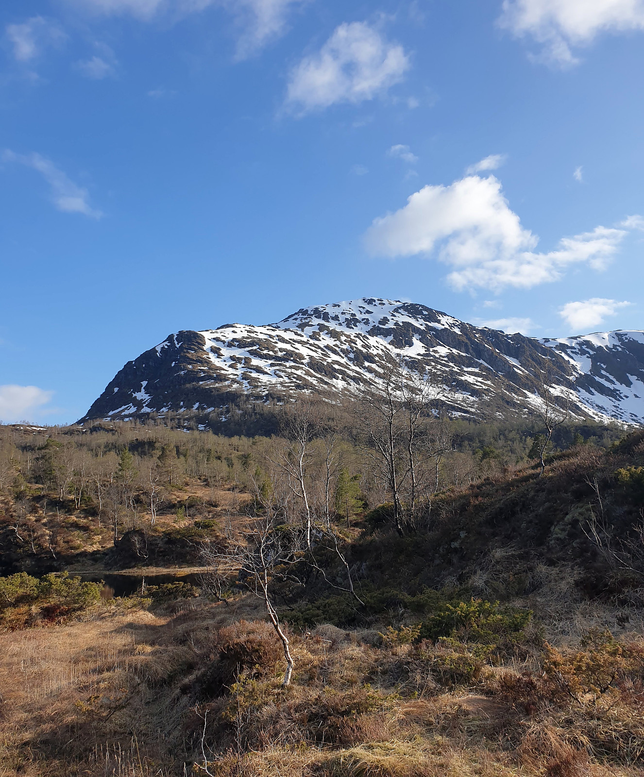
We had the afternoon of this Friday at our disposal and the weather was looking OK. :-) To combine some mountain impressions with such of the fjords, we headed for Brøknipa on Osterøy, starting from Båtaleitet parking at about 350mosl. After driving to Osterøy via the bridge and then continuing further (along Sørfjorden) towards Bruvik, we headed up to the saddle and parked at Båtaleitet parking. Looking up to Brøknipa from there, we recognized that there was still quite a bit of snow left on the northern flank. We agreed to giving it a try, while being ready to turn around whenever anyone of us would feel like it. We followed the main trail that passes by Varmavatnet at about 425mosl. Also the following 100 height meters (in southern direction) were still easy and without much snow. From there, however, we started to encounter more and more snow, partially covering the trail up to Middagshaugen. Once up to about 650mosl, we saw that the only reasonable way to continue would involve us crossing a rather steep (but short) stretch of a snow field. After a short discussion, we decided to continue. The one of us, who had proper hiking boots on, made some steps into the snow and all could follow without real difficulties. The "rest" up (from about 675mosl) was then not that steep and progress was again relatively easy. Once on Middagshaugen, we not only enjoyed the wonderful views across Sørfjorden, but also found it straight-forward and not difficult to continue all the way up to the top of Brøknipa. At Brøknipa, we then had a nice lunch break, before turning back. Instead of descending along the same trail, we decided to "walk around" (via Borgasætra). Surrounding Brøkbotnen on the heights near Ørnatuva was then very nice (and easy). Crossing over Flatafjellet, we made it to Borgasætra without difficulties (crossing the steam there, however, required a bit of creativity). From there, we then followed the trail via Kollhaugane to the lower end of Brøkbotnen. Before reaching Varmavatnet (again), the sun came out (again, also) and we enjoyed a really nice evening atmosphere south / southwest of Botnavatnet. From Varmavatnet, we basically followed the same trail back that we had take up in the beginning. All in all, this hike was a bit more of an adventure than expected (due to the snow) -- still, we all showed us very satisfied in the end! :-)
Photos
Selected photos are available as Google photo album.
Useful Resources
See also the related FB-page Hiking around Bergen, Norway.
Petter Bjørstad has a a useful page about Brøknipa; and also web page WestCoastPeaks.com provides useful information about Brøknipa (he writes "In my personal opinion, Brøknipa is one of Hordaland's finest mountains").
Web page UT.no from the Norwegian Trekking Association recommends a similar hike.

Benutzerkommentare