Biking Grimseidvegen (with Storrinden and Stendafjellet) (05.02.2023)

| Startpunkt | Varden (45m) |
|---|---|
| Endpunkt | Varden (45m) |
| Tourcharakter | Fahrradtour |
| Tourlänge | 2h 30min |
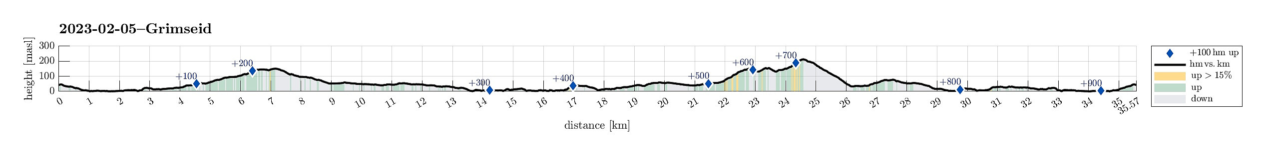
| Entfernung | 35,6km |
| Höhenmeter | 949m |
| GPS |
|
| Besteigungen | Storrinden (153m) | 05.02.2023 |
|---|---|---|
| Besuche anderer PBE | Stendafjellet p-plass (59m) | 05.02.2023 |
| Storgrinden (148m) | 05.02.2023 | |
| Straume bro (5m) | 05.02.2023 |
Trip Summary
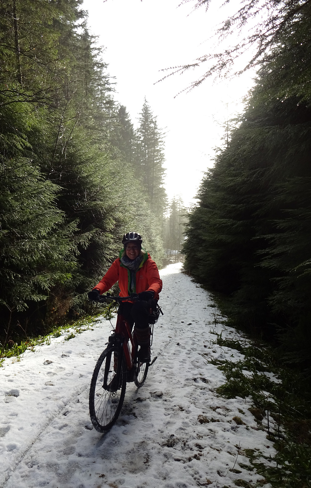
This time, we were in the mood for a bike trip. We headed first south, passing by Sælenvatnet in its southwest, before then crossing over the narrow connection of Nordåsvatnet and Grimstadfjorden. While heading further southwards, we included a detour up to Storrinden (this was quite interesting as substantial sections of the road up and down were covered with ice). Once back on Ytrebygdsvegen, we continued further southwards. We crossed Flypassvegen and continued into the direction of Hjellestad. Before actually getting there, however, we turned left (twice) to get onto Grimseidvegen. This way, we had changed direction and were cycling in about eastern/northeastern direction. Once passed Grimseidvatnet, we turned right to get onto Skeievegen that brought us to the other side of Hordnesskogen near Stend. There, we crossed Fanavegen to start our second uphill section of the day: up to Stendafjellet. When up to about 150masl, however, we did not follow the right road (to get us further up), but continued along the main forest road, descending a bit, again. Turning left then (once too late), we got onto a forest road that leads up to Kandalsskaret. At the saddle, made a short push into the forest (as the gravel road ends there). After briefly considering our situation, we then decided to turn around, cycle the stretch back, which we had taken after missing the left-turn a bit higher up, and then continue on the forst road that we actually had planned to take anyway. This worked then fine, leading us up (almost all the way up) to Stendafjellet and further north from there. The descent towards Lagunen was then, again, intersting due to the extensive stretches with ice on the forest road. Tire with spikes were definitely helpful! :-) From Lagunen it was then "just" back via Steinsvikvegen.
Useful Resources
See also the related FB-page Hiking around Bergen, Norway.

Kommentarer