Rødsfjellet via Kråkedalen (17.05.2022)

| Startpunkt | Øyra (5m) |
|---|---|
| Endpunkt | Øyra (5m) |
| Tourcharakter | Wanderung |
| Tourlänge | 3h 00min |
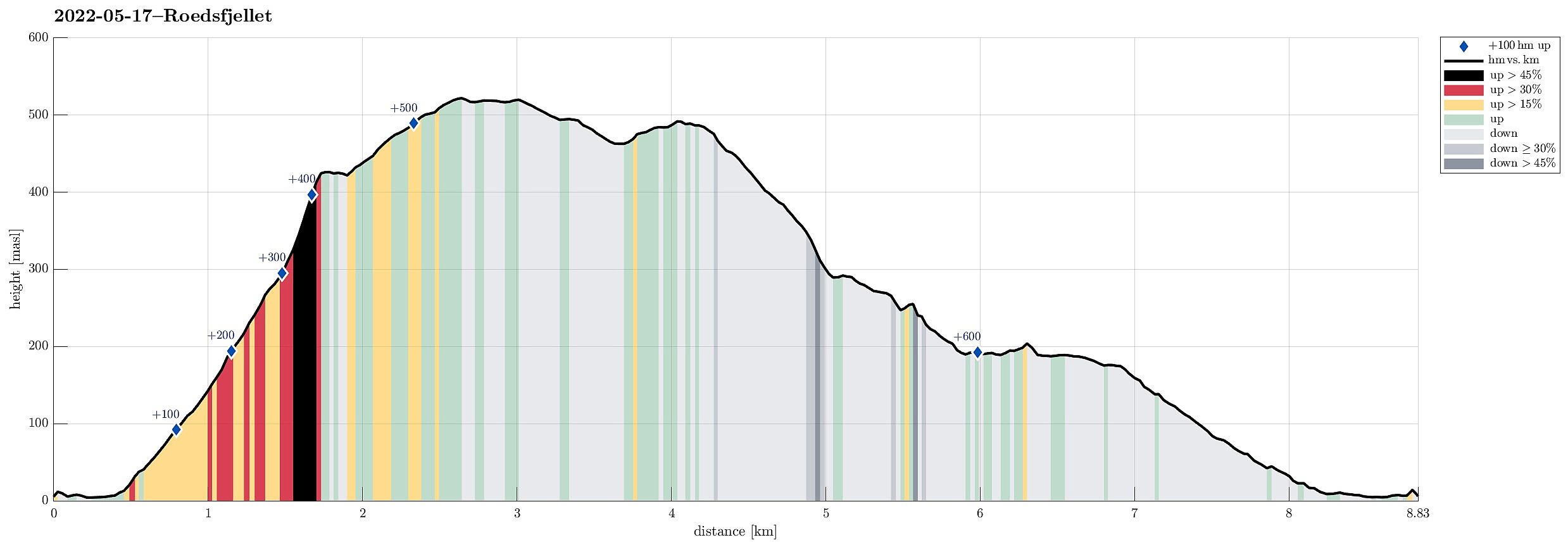
| Entfernung | 8,8km |
| Höhenmeter | 642m |
| GPS |
|
| Besteigungen | Rødsfjellet (525m) | 17.05.2022 |
|---|
Trip Summary
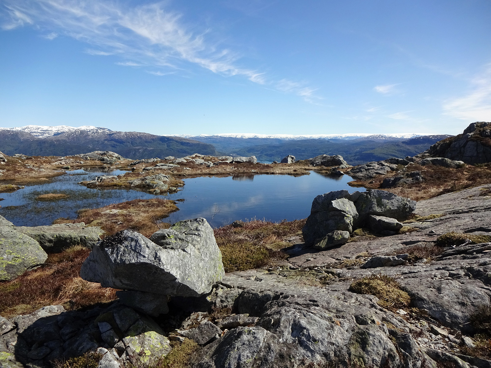
Rødsfjellet from the north/northeast. We drove via Osøyro to connect to Hegglandsdalvegen, which we followed to the small bay in the northeast of Rødsfjellet, where Øvredalsvegen forks off to the north. We parked right there and started our hike with a short walk along Ovredalsvegen until we came to the farm at the lowest end of Kråkedalen. Following first a forest road into Kråkedalen, we started our ascent to Rødsfjellet. Walking up Kråkedalen was straight-forward and easy and soon we had reached the of the forest road in the southeast of Halvardsåsen. There, at about 250mosl, we then deviated from the main valley and headed up and out of the main valley in southeastern direction. Finding a suitable side-valley for this purpose, we managed to reach the northern ridge of Rødsfjellet without any difficulties (it's steep but fine to step up there). From the ridge (it's called Kråka/Kråkefjellet there), we enjoyed some really nice views over the near Samnangerfjord. Completing our ascent to Rødsfjellet from there was easy and very nice, traversing the ridge up to the top. After enjoying some nice views from Rødsfjellet, we started our way back, choosing a different route down than what we had taken up. To start, we first headed in western direction, following one of the two trails that connect with the top of Rødsfjellet, arriving and rounding Stemmetjørna soon after. Our goal for the descent was the rather pronounced ridge in the northwest of Kråkedalen and the idea to continue further down towards Steindalsvatnet from there. Getting up to the ridge in the north of Stemmesvatnet was straight-forward and easy and also traversing the ridge parallel to Kråkedalen in northern direction was nice and easy. Once we got closer to Halvardsåsen, the terrain became steeper and choosing a suitable route became important. In fact, we found descending into the valley in the southwest of Halvardsåsen too steep and decided therefore to cross over towards the northeastern side of Svartatjørna. There, it took us a bit of back and forth to find a suitable place for descending further due to some small cliffs and rather steep terrain. Eventually, however, we made it into the small valley that extends northwards from Svartatjørna without any major issues. Walking down this valley, we reached Steindalsvatnet soon after. We then followed the southern shore of Steindalsvatnet to get around to the other side from where we used a proper trail to get to Midtsætervegen. Once on the road, again, it was just to walk back to the car. While ascending to Rødsfjellet through Kråkedalen proved to be a nice and worthwhile option, the descent to Steindalsvatnet is possibly a little too wild for hikers who prefer trails and so.
Photos
Selected photos are available as Google photo album.
Useful Resources
See also the related FB-page Hiking around Bergen, Norway.
Petter Bjørstad has a useful page about Rødsfjellet and also web page WestCoastPeaks.com provides useful information about Rødsfjellet.
Web page UT.no from the Norwegian Trekking Association recommends another hike up to Rødsfjellet.

Benutzerkommentare