Vossavardane via Innapåeggi and Utapåegga (07.04.2019)

| Startpunkt | Nedre Romslo (65m) |
|---|---|
| Endpunkt | Nedre Romslo (65m) |
| Tourcharakter | Bergtour |
| Tourlänge | 3h 45min |
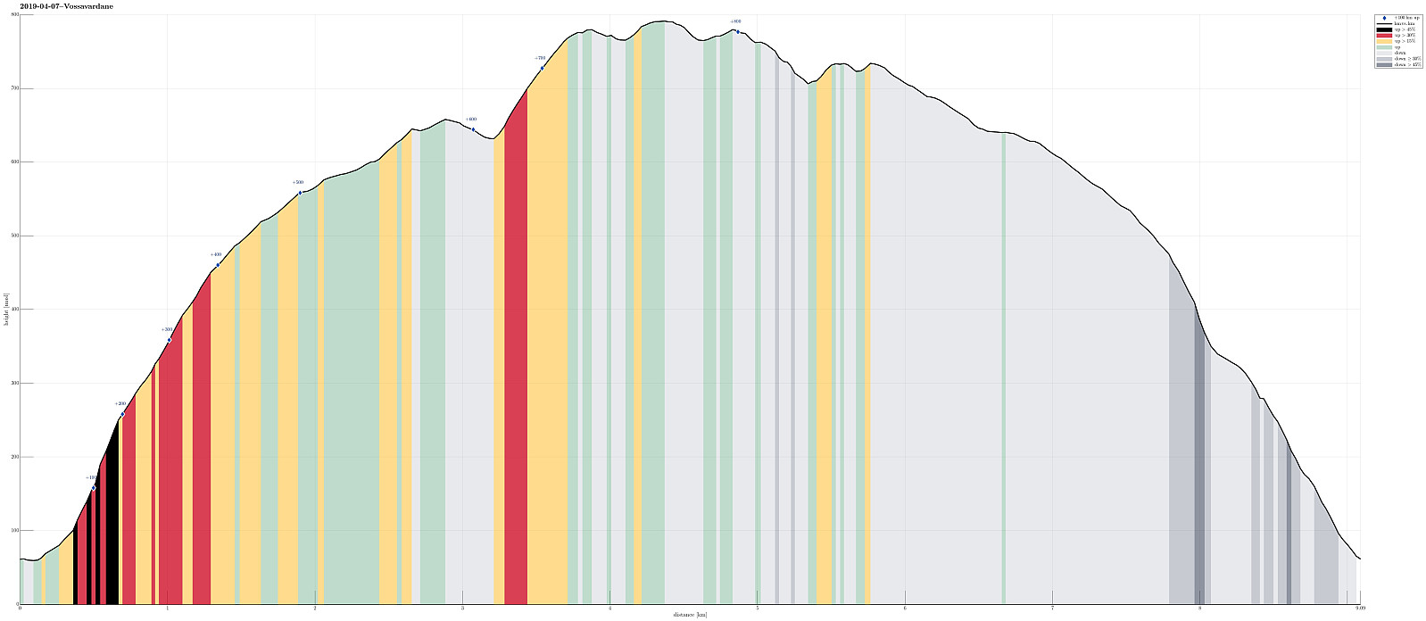
| Entfernung | 9,1km |
| Höhenmeter | 846m |
| GPS |
|
| Besteigungen | Høgevarden (781m) | 07.04.2019 |
|---|---|---|
| Vossavardane NV (736m) | 07.04.2019 | |
| Vossavardane, M (793m) | 07.04.2019 | |
| Vossavardane, S-1 for NV (735m) | 07.04.2019 | |
| Besuche anderer PBE | Skylefonnstølen (641m) | 07.04.2019 |
| Utapåegga p-lomme (61m) | 07.04.2019 |
Consider the track with care; especially the beginning (very steep and no trail)!
Trip Summary
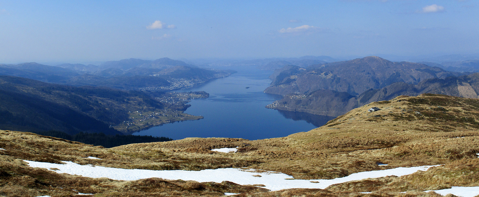
We parked near Nedre Romslo at Romslovegen (very near to the E16). Our goal was to reach the ridge of Innapåeggi and then to follow it upwards into the direction of Gullfjellet. At house 243, shortly before crossing over E16, we left Romslovegen and started to ascend towards the ridge. First, we used a path until we came close to the forest. From there on, it was mostly through the forest and towards the ridge. This part was steep and the underground was partly unstable. It is highly recommended to plan carefully and to not follow this track without having good shoes. Also, it was useful to use our hands every now and then, before reaching the ridge. Clearly, this first part of our hike required a portion of hiking experience! Once on the ridge, however, the hike turned into a wonderful pleasure! Due to perfect conditions (nice hiking temperature and sunny weather!), we really enjoyed this afternoon very much! Even though it would be too much to say that we found a coherent trail on the ridge, the ascent was still easy and enjoyable all the way up. As soon as we had left the tree line below us, we also enjoyed many amazing views down to Sørfjorden and over to Osterøy! Once we were already quite high up on this ridge, we decided to include Vossvardane, also. Even though it was clear from below that quite a bit of snow was still up there, we nonetheless got the impression that it should be straight-forward to hike up. And indeed we could do it without much snow-crossing. Once on Vossavardane, we really enjoyed the beautiful nature and the amazing weather -- what a great day! Also the views over to Gullfjellet are very nice from Vossavardane. To start out descent, we first hiked a bit towards the west, reaching the highest ends of the other ridge: Utapåegga. At Skylefonnstølen, we passed by a hut with outstanding location and views. We then followed the ridge (Utapåegga) down, coming by the remains of a few stone houses. It should be noted that Utapåegga has a nice trail from the top to the bottom and it is definitely straight-forward and without any challenges to use this one for getting up to / down from Vossavardane. All in all, this was a wonderful hike in perfect conditions. Wow! :-)
Photos
Selected photos are available as Google photo album.
Useful Resources
See also the related FB-page Hiking around Bergen, Norway.

Benutzerkommentare