Kanadaskogen (16.12.2018)

| Startpunkt | Varden (40m) |
|---|---|
| Endpunkt | Varden (40m) |
| Tourcharakter | Bergtour |
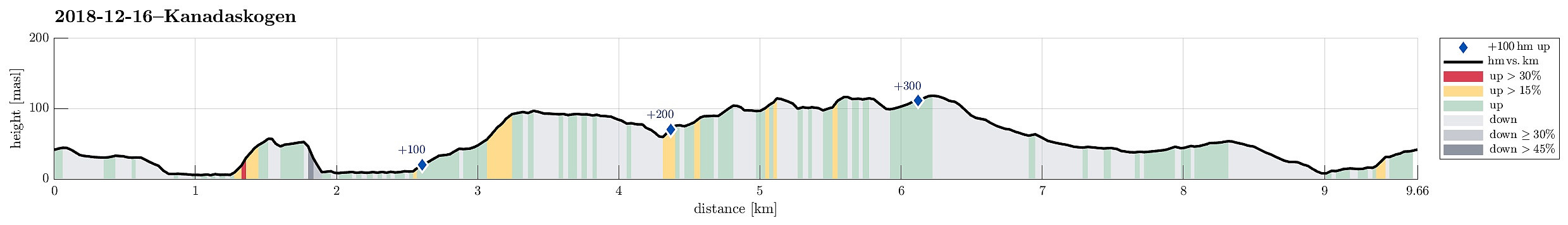
| Tourlänge | 2h 00min |
| Entfernung | 9,7km |
| Höhenmeter | 367m |
| GPS |
|
| Besuche anderer PBE | Lappeleiren (62m) | 16.12.2018 |
|---|---|---|
| Spelhaugen p-plass (60m) | 16.12.2018 | |
| Sælen kirke p-plass (15m) | 16.12.2018 | |
| Tennebekktjernet (95m) | 16.12.2018 | |
| Tennebekktjørna p-plass (100m) | 16.12.2018 | |
| Tjørnagrind (96m) | 16.12.2018 | |
| Øst for Elvareidet (60m) | 16.12.2018 |
Trip Summary
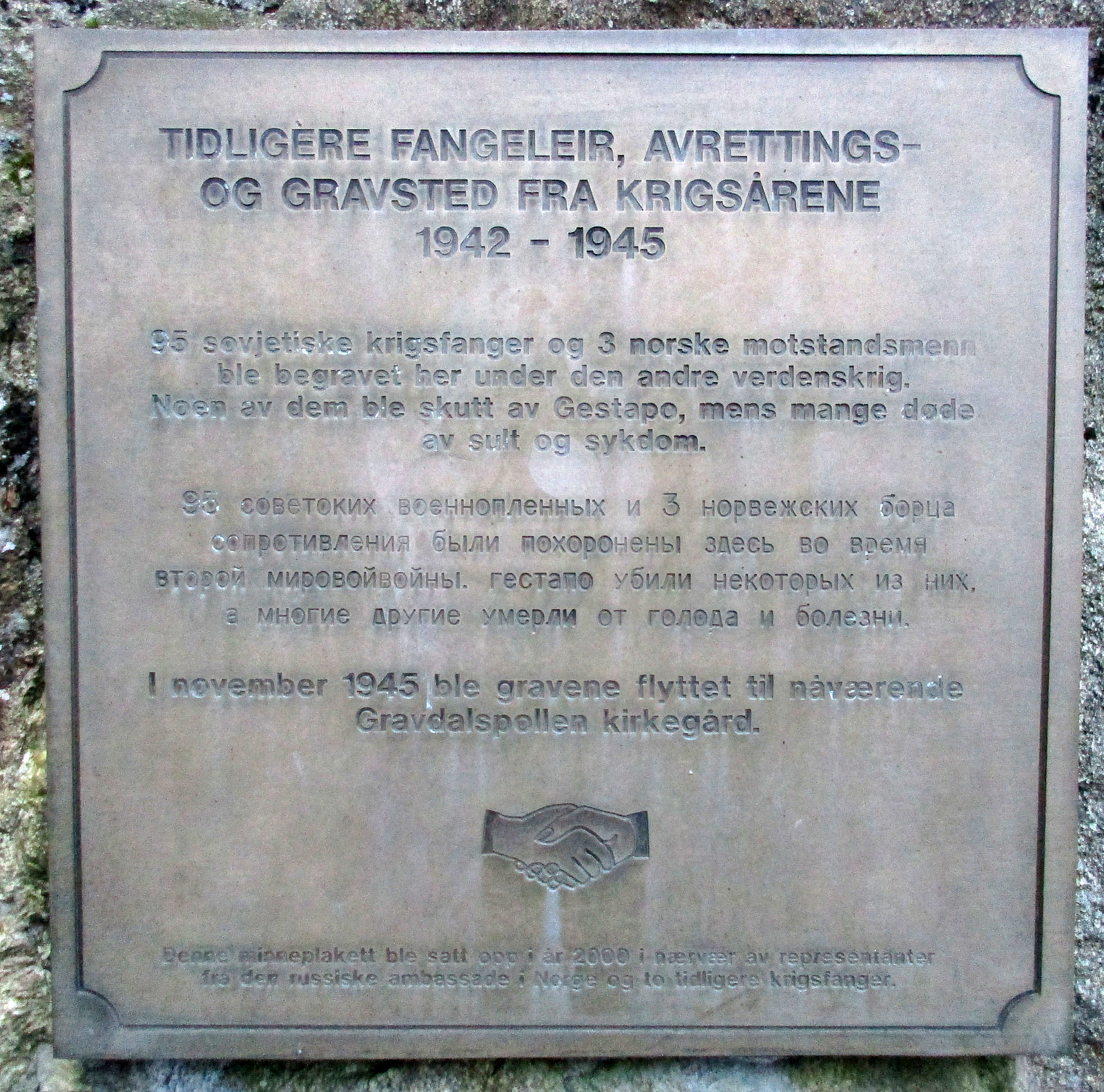
We started from Varden and wished to get some fresh air before dawn time. We first descended to Gjeddevatnet near Myratjørna. We then followed along the lakeside to Gjerdsvika, where we continued along a path that leads upwards in norther direction. Crossing over the "heights" there (between Hesjaholtet on the right / east and the lakes on the left / west), we descended towards Bjørndalsvatnet from there. We then walked along the lake until we came to its northern most bay. From there, we continued along a nice path (in northern direction), getting to Svartatjørna a little later. We passed by Svartatjørna on its western side, continuing along another nice path that connects to Tennebekk. There, we first went to this place, which reminds of some tragic deaths at the end of WWII with a plate, before heading back up to Tennebekktjørna. We then rounded the lake on its northern side, following the major gravel road, which goes all around the lake. After entering Langedalen, we continued towards Spelhaugen. Since it was quite dark already, once we arrived at Spelhaugen, we decided to simply return along the streets.
Useful Resources
See also the related FB-page Hiking around Bergen, Norway.

Benutzerkommentare