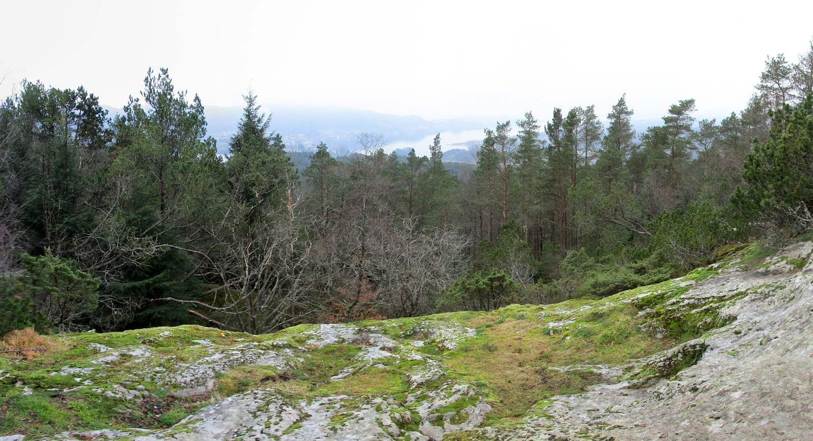
Stendafjellet at about sunset (17.11.2018)

| Startpunkt | Historic train station at Stend (60m) |
|---|---|
| Endpunkt | Historic train station at Stend (60m) |
| Tourcharakter | Bergtour |
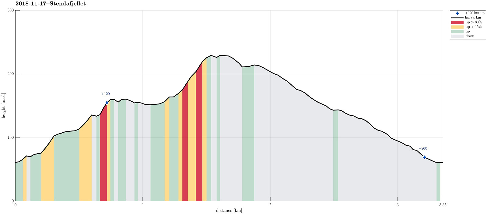
| Tourlänge | 1h 00min |
| Entfernung | 3,4km |
| Höhenmeter | 201m |
| GPS |
|
| Besteigungen | Stendafjellet (232m) | 17.11.2018 |
|---|---|---|
| Besuche anderer PBE | Stendafjellet p-plass (59m) | 17.11.2018 |
Trip Summary
Even though it was already a bit late (for November in Bergen), there still was a chance for a short hike. From the little parking place near the previous train station at Stend (a bit north of Fana), I headed directly into the forest (in northern direction), not following the gravel road that also starts from there (a bit further east). After only a few steps, I got to a little pond (seemingly hold back by a little dam) and chose to surround it on its western side. In order to get further up, I crossed a little saddle north of the pond and ascended through the forest in northeastern direction, following one of apparently several possible routes. Once a bit further up, the terrain flattened out (a bit) and I continued in northern direction, heading towards Stendaåsen. After reaching the "highest" point of Stendaåsen (a bit over 150mosl), I first descended a bit into the wrong direction (to much in eastern direction). After quickly realizing that this was not the direction, which I initially had planned for, I turned back and found the "high route" towards Stendafjellet without any problems. Following a well visible path from there (mostly in northern direction), I got to a point, where I connected with a somewhat more prominent path that came up from the gravel road a bit further south. Also there, I could choose between at least two path upwards. After a few more steps, I ended up at the top of Stendafjellet and was positively surprised of the view towards Fanafjorden from up there! :-) After a short stop at the top, I continued a little further and connected with the gravel road after only a few steps. From there, given the fairly proceeded time, I decided to simply walk down the gravel road to the parking place. Shortly before arriving there, I took a few minutes to look at the historic train station of Stend.
Photos
Selected photos are available as Google photo album.
Useful Resources
See also the related FB-page Hiking around Bergen, Norway.
Web page UT.no from the Norwegian Trekking Association recommends a similar hike.
On Bergentopp 200 there is a page (in Norwegian) about Stendafjellet.

Benutzerkommentare